ATLAS of ANTIENT GEOGRAPHY by SAMUEL BUTLER 1843John McInnis Auctioneers,LLC4.5(505)See Sold PriceFeb 24, 2024
18TH C. ANTIQUE MAP: FRENCH & INDIAN WAR, FRAMEDThomaston Place Auction Galleries4.4(393)See Sold PriceFeb 24, 2024
Rand McNally Railroad Map Cabinet w/ 21 Railroad MapsRail & Road Auctions4.6(165)See Sold PriceMar 08, 2024
Keith Haring - Ink on New York Map, Best Buddies, Inscribed, Signed, and DatedSapphire Auction Gallery4(67)See Sold PriceMar 02, 2024
LATE 17TH C. FRENCH MAP OF THE NEW WORLD BY ALEXIS-HUBERT JAILLOT (1632-1712)Thomaston Place Auction Galleries4.4(393)See Sold PriceFeb 24, 2024
Central Railroad of New Jersey Map of Sandy Hook Route-ca. 1903JM Hobby Supply and Railroad Artifact Auctions4.4(127)See Sold PriceFeb 24, 2024
Lot of Six Mixed Atlas Box Cars-HO Scale-New in BoxJM Hobby Supply and Railroad Artifact Auctions4.4(127)See Sold PriceFeb 25, 2024
Rand McNally/Santa Fe Railroad Map of Iowa-1912JM Hobby Supply and Railroad Artifact Auctions4.4(127)See Sold PriceFeb 24, 2024
NICOLAES VISSCHER (NETHERLANDS, 1618-1709) MAP OF THE NEW WORLDThomaston Place Auction Galleries4.4(393)See Sold PriceFeb 24, 2024
17TH C. WORLD MAP BY NICOLAES VISSCHER (NETHERLANDS, 1618-1709)Thomaston Place Auction Galleries4.4(393)See Sold PriceFeb 24, 2024
Lot of Six Mixed Atlas Cabooses-HO Scale-New in BoxJM Hobby Supply and Railroad Artifact Auctions4.4(127)See Sold PriceFeb 25, 2024
Massachusetts antique state map. Includes BostonTITLE/CONTENT OF MAP: 'Carte géographique, statistique et historique de Massachusetts' The state boundary is drawn to include Boston Corner, now an outlying hamlet of Ancram in Columbia County, New YSee Sold Price
SoldFramed Antique Map Of City & HarborsCities include Boston, New York, Baltimore, Portland, Hudson River, and Philadelphia. Type along top reads ‘Northern Ports & Harbours in the United States, By J. Bartholomew.’ Map is set behind glSee Sold Price
Sold4 Antique Fireman's Fire Fighter Hose NozzlesUNITED STATES, EARLY 20TH CENTURY A collection of four antique fireman's hose nozzles. The lot includes a large red threaded bronze nozzle manufactured by A.J Morse & Son of Boston, Massachusetts. DimSee Sold Price
SoldLot of 19th C. Andover, Massachusetts MapsLot of antique Andover, Massachusetts maps, to include: (4) 1888 maps and (3) 1852 maps.See Sold Price
SoldAN ANTIQUE MAP, "United States," BOSTON, CIRCA 1838,AN ANTIQUE MAP, "United States," BOSTON, CIRCA 1838, hand colored engraving on paper, showing Texas as an independent nation, a page fragment from an atlas, Thomas Gamaliel Bradford (1802-1887) cartogSee Sold Price
Sold4 Maps: Bradford (1838): Mass., CT, NJ, Boston.[United States/Northeast] 4 Maps. ++ MASSACHUSETTS. ++ BOSTON. ++ CONNECTICUT. ++ NEW JERSEY. ++ Maps 10, 11, 13, and 16 from T. G. Bradford, “An Illustrated Atlas, Geographical, Statistical, And HiSee Sold Price
SoldLOT OF 20 VINTAGE & ANTIQUE UNITED STATES MAPSLot includes maps of Fort Thunderbolt, North Florida, Selected Civil War map of Eastern US, Manassas Junction, Charleston Harbor, South Carolina and Georgia, Southeastern Virginia, Richmond Virginia,See Sold Price
SoldLot Antique Maps Of Connecticut State & TownsLot of Antique Maps Of Connecticut State & Towns. Includes 10 maps from 19th century. Largest map measures 23 inches in height by 20 inches in width.See Sold Price
SoldMassachusetts Railroad Scene Postcards (35) [128994]A group of 35 postcards all themed around various railroad scenes in the state of Massachusetts.Scenes include, South Terminal Station (Boston), North Station (Boston), Union Station (Worcester), UnioSee Sold Price
SoldCollection of Antique MapsAntique maps to include, Europe, North America, etc., eight (8) total, 16" x 18". Provenance: Cambridge, Massachusetts collection.See Sold Price
SoldMap of Massachusetts, Connecticut & Rhode Island, 1868Original engraving from Johnson's Atlas of the World, 1868. Map includes vignette of Boston & details cities, towns and territories. Dimensions: 18" x 26". This item ships from Ocean View, DE.See Sold Price
Map of Massachusetts, Connecticut & Rhode Island, 1868Original engraving from Johnson's Atlas of the World, 1868. Map includes vignette of Boston & details cities, towns and territories. Dimensions: 18" x 26". This item ships from Ocean View, DE.See Sold Price
Sold3 Tompkins ANTIQUE NEW YORK STATE MAPS AdirondackThis auction lot includes the following group of antique New York State color maps: - Adirondack Survey Sketch - 12"x15" - Schuyler Tompkins Cortland Chemung and Tioga Counties - 36"x25"- Madison CSee Sold Price
SoldMap, State of Massachusetts, 1796Antique Map. "The State of Massachusetts, 1796". Published by J. Reid, New York. [Framed]. 15"h x 18 1/4"w=image; 20 1/2"h x 23 1/2"w=frame. Condition: Vertical fold as issued; light toning throughoutSee Sold Price
SoldPortfolio Containing 21 Topographic MapsDESCRIPTION: Portfolio containing twenty-one topographic maps. Includes seventeen maps by the United States Department of the Interior Geological Survey of the State of Massachusetts and five of the SSee Sold Price
Sold1930s-50s JAMES MICHAEL CURLEY COLLECTIONCarton loaded with signed & unsigned items related to this former Mayor of Boston, Governor of Massachusetts & United States Congressman. Includes inscribed & signed copies of his biography (by DinneeSee Sold Price
Bellin: Antique French Map Plan of Boston, 1757Title/Content of Map: Antique French Map and Plan of Boston, Massachusetts. Plan de la Ville de Boston et ses Environs Date Printed: 1757 Cartographer: Bellin, Jacques Nicolas Size (inches): 10 x 6 OnSee Sold Price
SoldThomas & Andrews: Antique Map of Massachusetts, 1796Map: Massachusetts Date: 1796 Medium: Original copperplate engraving From Morse's Universal Geography by Thomas & Andrews, Boston, 1796 Dimensions: 15" x 12.5" Unframed. Please note that this lot hasSee Sold Price
SoldTanner: Antique Map of Massachusetts & Rhode IslandTitle/Content of Map: Massachusetts & Rhode Island with insert of Boston by Tanner Date Printed: 1843 Cartographer: H.C. Tanner Material/Medium: Paper Size: 17" x 14" Hand colored engraved Map based oSee Sold Price
Sold1875 Ma of Massachusetts, 1838 Boston NewspaperMassachusetts related ephemera: (1) Antique map, "Railway & Township Map of Massachusetts", published by Comstock & Cline. Detailed hand colored map. Excellent condition with age tone, measures: 14" HSee Sold Price
1841 UNITED STATES, Antique Roll Map. Own an impr1841 UNITED STATES, Antique Roll Map. Own an impressive piece of history. This 1841 Phelps & Ensign’s Traveller’s Guide and Map of the United States (and territories) includes the Republic of TexaSee Sold Price
Tallis/Rapkin: Antique Map of Asia, 1849Title/Content of Map: 'Asia' States marked on the map include Siberia, Cochin China, China, Hindoostan, Cabool (Kabul), Turkey, Arabia, Persia, Beloochistan, Birmah, Siam, Malaya, Independent Tartary,See Sold Price
Tallis / Rapkin: Antique Map of Asia, 1849'Asia' States marked on the map include Siberia, Cochin China, China, Hindoostan, Cabool (Kabul), Turkey, Arabia, Persia, Beloochistan, Birmah, Siam, Malaya, Independent Tartary, Japan, Dutch East IndSee Sold Price
SoldTallis/Rapkin: Antique Map of Asia, 1849TITLE/CONTENT OF MAP: 'Asia' States marked on the map include Siberia, Cochin China, China, Hindoostan, Cabool (Kabul), Turkey, Arabia, Persia, Beloochistan, Birmah, Siam, Malaya, Independent Tartary,See Sold Price
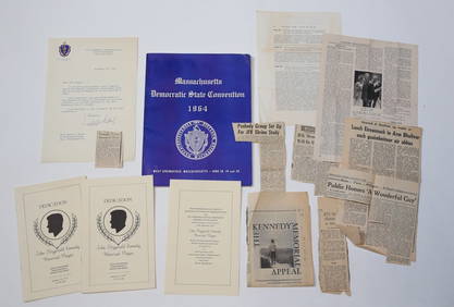
1952 J.F.K for US SENATE CAMPAIGN MATERIALSJohn McInnis Auctioneers,LLC4.5(505)See Sold PriceFeb 25, 2024
1963 J.F.K. for US PRESIDENT RE-ELECTION MATERIALJohn McInnis Auctioneers,LLC4.5(505)See Sold PriceFeb 25, 2024
1964 J.F.K. MEMORIAL COMMISSION APPOINTMENTJohn McInnis Auctioneers,LLC4.5(505)See Sold PriceFeb 25, 2024
Arrowsmith & Lewis - Map of the United StatesTrillium Antique Prints & Rare Books4.5(32)See Sold PriceFeb 24, 2024
A quantity of World War II / Two military ephemera to include assorted 1940s newspapers pages toClaydon Auctioneers Ltd4.3(125)See Sold PriceFeb 26, 2024
1993 BEAUTIFUL RUSSIAN PALEKH SIGNED HAND PAINTED ALL SIDES LACQUER BOX WEDDINGJasper524.5(9.9k)See Sold PriceFeb 27, 2024
AFRICA. Shows Mountains of Kong/the Moon. Caravan routes. RAPKIN/TALLIS 1851 mapJasper524.5(9.9k)See Sold PriceFeb 28, 2024
Cooke, George 1801 Antique Map. United States of AmericaAlbion Auctions4.6(341)See Sold PriceMar 01, 2024
Robert de Vaugondy - Map of Canada - Mer de l' Ouest or Sea of the West and a Northwest PassageProverde Auctions4.3(3)See Sold PriceFeb 28, 2024


![Massachusetts Railroad Scene Postcards (35) [128994] (1 of 1)](https://p1.liveauctioneers.com/2699/193409/97516315_1_x.jpg?height=282&quality=70&version=1612307874)