ATLAS of ANTIENT GEOGRAPHY by SAMUEL BUTLER 1843John McInnis Auctioneers,LLC4.5(505)See Sold PriceFeb 24, 2024
18TH C. ANTIQUE MAP: FRENCH & INDIAN WAR, FRAMEDThomaston Place Auction Galleries4.4(393)See Sold PriceFeb 24, 2024
Rand McNally Railroad Map Cabinet w/ 21 Railroad MapsRail & Road Auctions4.6(165)See Sold PriceMar 08, 2024
Keith Haring - Ink on New York Map, Best Buddies, Inscribed, Signed, and DatedSapphire Auction Gallery4(67)See Sold PriceMar 02, 2024
LATE 17TH C. FRENCH MAP OF THE NEW WORLD BY ALEXIS-HUBERT JAILLOT (1632-1712)Thomaston Place Auction Galleries4.4(393)See Sold PriceFeb 24, 2024
Central Railroad of New Jersey Map of Sandy Hook Route-ca. 1903JM Hobby Supply and Railroad Artifact Auctions4.4(127)See Sold PriceFeb 24, 2024
Lot of Six Mixed Atlas Box Cars-HO Scale-New in BoxJM Hobby Supply and Railroad Artifact Auctions4.4(127)See Sold PriceFeb 25, 2024
Rand McNally/Santa Fe Railroad Map of Iowa-1912JM Hobby Supply and Railroad Artifact Auctions4.4(127)See Sold PriceFeb 24, 2024
NICOLAES VISSCHER (NETHERLANDS, 1618-1709) MAP OF THE NEW WORLDThomaston Place Auction Galleries4.4(393)See Sold PriceFeb 24, 2024
17TH C. WORLD MAP BY NICOLAES VISSCHER (NETHERLANDS, 1618-1709)Thomaston Place Auction Galleries4.4(393)See Sold PriceFeb 24, 2024
Lot of Six Mixed Atlas Cabooses-HO Scale-New in BoxJM Hobby Supply and Railroad Artifact Auctions4.4(127)See Sold PriceFeb 25, 2024
SoldMARIS PACIFICI quod vulgo MAR del SUDMARIS PACIFICI quod vulgo MAR del SUD Map Maker: Abraham Ortelius Date: 1603 Place: Antwerp Color: Colored 17” x 21” (43 cm x 53 cm) WRITE UP: The First Printed Map of the Pacific OSee Sold Price
SoldMaris Pacifici (quod vulgo Mar delZur) by Abrahamus Ortelius, Antwerp, 1589, an early full color example of Ortelius' Maris Pacifici from the 1589 Latin edition of Theatrum Orbis Terrarum, widely regarded as the first modern atlas, alSee Sold Price
SoldAbraham Ortelius map of Pacific OceanCartographer: Abraham Ortelius Title: Maris Pacifici, (quod vulgo Mar del Zur) cum Regionibus Circumiacentibus, Insulisque in Codem Passim Sparsis, Novissima Descriptio Subject: Pacific Ocean PublisheSee Sold Price
SoldMAP, Western Hemisphere, OrteliusPacific Ocean, Western Hemisphere. Abraham Ortelius, Maris Pacifici, (quod Vulgo Mar del Zur), cum Regionibus Circumiacentibus, Insulisque in Eodem Passim Sparsis, Novissima Descriptio, 1589 (dated).See Sold Price
SoldPacific Ocean.- Ortelius (Abraham) Maris Pacifici,Pacific Ocean.- Ortelius (Abraham) Maris Pacifici, (quod vulgo Mar del Zur), the first printed map devoted to the Pacific and the first to label the Americas separately as North and South subsequent tSee Sold Price
Ortelius Map of Pacific OceanORTELIUS, Abraham (1527-1598) Maris Pacifici, (quod vulgo Mar del Zur) cum regionaribus circumiacentibus, insulisque in eodem passim sparsis, novissima descripto. Engraved map with original hand colorSee Sold Price
SoldFIRST MAP OF THE PACIFIC - ABRAHAM ORTELIUS (Flemish,FIRST MAP OF THE PACIFIC - ABRAHAM ORTELIUS (Flemish, 1527-1598); "Maris Pacifici (quod vulgo Mar del Zur) cum regionibus circumiacentibus, insusisque in eodem passim sparsis, novissima descriptio"; aSee Sold Price
Pacific Ocean.- Ortelius (Abraham) Maris Pacifici,Pacific Ocean.- Ortelius (Abraham) Maris Pacifici, (quod vulgo Mar del Zur), the first printed map devoted to the Pacific and the first to label the Americas separately as North and South subsequent tSee Sold Price
SoldOrtelius Map of Pacific, 1602ORTELIUS, Abraham (1527-1598). Maris Pacifici, (quod vulgo Mar del Zur) cum regionaribus circumiacentibus, insulisque in eodem passim sparsis, novissima descripto. Engraved map with original hand coloSee Sold Price
SoldOrtelius Map of the Pacific OceanORTELIUS, Abraham (1527-1598). Maris Pacifici, (quod vulgo Mar del Zur) cum regionaribus circumiacentibus, insulisque in eodem passim sparsis, novissima descripto. Engraved map with original hand coloSee Sold Price
Sold[Maps]. Abraham Ortelius. Maris Pacifici, (quod[Maps]. Abraham Ortelius. Maris Pacifici<See Sold Price
SoldAbraham OrteliusAntwerp, 1589 Maris Pacifi (Quod Vulgo Mar del Zud) 34 x 50 cm (13 1/3 x 19 3/5 in) The first published map devoted to the Pacific Ocean. The map is adorned by 2 decorative cartouches and magellan's sSee Sold Price
SoldCoronelli, Mare PacificoVINCENZO CORONELLI (Italian 1650-1718) Mar del Sud detto altrimenti Mare Pacifico Hand colored map Plate:18 x 23.50 inches/ 45.7 X 59.7 centimeters In good condition. UnframedSee Sold Price
[MAP]. ORTELIUS, Abraham. Maris Pacifici. 1589“First Printed Map to be Devoted to the Pacific Ocean” (Burden) A Peninsular California—1589 347. &nbSee Sold Price
Terreni, Giovanni Maria Pianta del porto d'AcapulcoTerreni, Giovanni Maria Pianta del porto d'Acapulco sopra la Costa de Messico nel Mar del Sud. Kupferstichkarte. G.M.T. sculpsit, Livorno 1777. 22,5 x 17,5 (32 x 24,5 cm). Eine seltene Karte von der ASee Sold Price
PASSATOIA LENKORAN, AZERBAIJAN, MAR CASPIO, DATATA 1911CM 286X130 Nel sud dell'attuale Azerbaijan, dove si innalzano i Monti Talish, venivano annodati tappeti con un caratteristico disegno che sembra derivare dalle tartarughe palustri del Caspio: la MaureSee Sold Price
Sauerbrey: Maris Pacifici Map, 1753Map: Tabula geographica partis septentrionalis Maris Pacifici cum adiacentibus regionibus. Nicolaus Sauerbrey's superbly detailed Northwest Passage map from Euler's Atlas is a reduced version of the lSee Sold Price
SoldItalian Modern Vivai del Sud Wicker TablesItalian Modern Vivai del Sud Wicker & Bamboo Tables ++ Including two star form and cross form tables on casters ++ Marked on bottom of one "Vivai del Sud Made in Italy" ++ 17" tallSee Sold Price
SoldVIVAI DEL SUD Un paravento, anniVIVAI DEL SUD Un paravento, anni '70. Cristallo argentato, canna d'India. Altezza cm 170, lunghezza 200, profondità 5. A screen by VIVAI DEL SUD, 1970's. Mirrored crystal, woven cane. 66.9in. (h),See Sold Price
SoldVIVAI DEL SUD 2Coppia di panchetti. Canna d'India, ottone, tessuto imbottito. Italia anni '70. cm 30x47x47 A PAIR OF STOOLS BY VIVAI DEL SUD Buone condizioni generali, leggeri segni di usura, piccole mancanze e lievSee Sold Price
SoldCHARLESTON CAPITALE DELLA CAROLINA DEL SUDBeautiful view of Charleston of 1870 circa Atlas: Emporio pittoresco Author: Cioffi Date: 1870 circa Technique: Steel etching Leaf Dimension: 21x28,5 cm (8.3x11.2 inches) Print Dimension: 17x24 cm (6.See Sold Price
SoldMaris Pacifici , 19th C map of the Pacific region ,Maris Pacifici , 19th C map of the Pacific region , after Ortelius Abrahamus. PROVENANCE: Francis de Sales McHugh Collection. 13 x 19in. (33 x 48cm)See Sold Price
SoldNuove Scoperte... Mare del Sud. Venice: 1776.[Australia/Indonesia/New Zealand]. Nuove Scoperte Fatte el 1765, 67, e 69 nel Mare del Sud. Venice: Antonio Zatta, 1776. [Ca. late 1770's - mid-1780's]. 11 7/8” x 15 7/8”. Right side of upper edgeSee Sold Price
SoldVIVAI DEL SUD attributed. Pair of 1970s table lamps.attributed. Pair of 1970s table lamps. Wood, brass and cutted crystal.. Cm 39,00 x 39,00 x 39,00.See Sold Price
Scuola del Sud della Russia Centrale "Il transitoAste di Antiquariato Boetto4.3(47)See Sold PriceMar 07, 2024
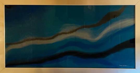
Paulina Del Mar Azul Brillante Hand Signed Mixed Media Resin on Wood Original One of a Kind BluePlatinum Auction Group4.4(56)See Sold PriceMar 04, 2024
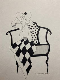
Paulina Del Mar Tarkay Lady 2 Hand Signed Pen and Ink Original One of a Kind Female figurePlatinum Auction Group4.4(56)See Sold PriceMar 04, 2024
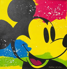
Hot Pink With Purple Heart by Del Mar, PaulinaFederal Assets Auctioneers4.4(412)See Sold PriceFeb 28, 2024
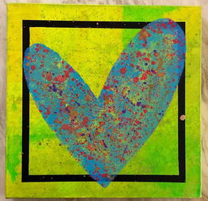
Paulina Del Mar "Purple Goofy (Walt Disney)"Federal Assets Auctioneers4.4(412)See Sold PriceMar 01, 2024


![[Maps]. Abraham Ortelius. Maris Pacifici, (quod (1 of 1)](https://p1.liveauctioneers.com/906/32687/13129987_1_x.jpg?height=282&quality=70&version=1348080146)


![[MAP]. ORTELIUS, Abraham. Maris Pacifici. 1589 (1 of 3)](https://p1.liveauctioneers.com/514/20078/6859797_1_x.jpg?height=282&quality=70)