ATLAS of ANTIENT GEOGRAPHY by SAMUEL BUTLER 1843John McInnis Auctioneers,LLC4.5(505)See Sold PriceFeb 24, 2024
18TH C. ANTIQUE MAP: FRENCH & INDIAN WAR, FRAMEDThomaston Place Auction Galleries4.4(393)See Sold PriceFeb 24, 2024
Rand McNally Railroad Map Cabinet w/ 21 Railroad MapsRail & Road Auctions4.6(165)See Sold PriceMar 08, 2024
Keith Haring - Ink on New York Map, Best Buddies, Inscribed, Signed, and DatedSapphire Auction Gallery4(67)See Sold PriceMar 02, 2024
LATE 17TH C. FRENCH MAP OF THE NEW WORLD BY ALEXIS-HUBERT JAILLOT (1632-1712)Thomaston Place Auction Galleries4.4(393)See Sold PriceFeb 24, 2024
Central Railroad of New Jersey Map of Sandy Hook Route-ca. 1903JM Hobby Supply and Railroad Artifact Auctions4.4(127)See Sold PriceFeb 24, 2024
Lot of Six Mixed Atlas Box Cars-HO Scale-New in BoxJM Hobby Supply and Railroad Artifact Auctions4.4(127)See Sold PriceFeb 25, 2024
Rand McNally/Santa Fe Railroad Map of Iowa-1912JM Hobby Supply and Railroad Artifact Auctions4.4(127)See Sold PriceFeb 24, 2024
NICOLAES VISSCHER (NETHERLANDS, 1618-1709) MAP OF THE NEW WORLDThomaston Place Auction Galleries4.4(393)See Sold PriceFeb 24, 2024
17TH C. WORLD MAP BY NICOLAES VISSCHER (NETHERLANDS, 1618-1709)Thomaston Place Auction Galleries4.4(393)See Sold PriceFeb 24, 2024
Lot of Six Mixed Atlas Cabooses-HO Scale-New in BoxJM Hobby Supply and Railroad Artifact Auctions4.4(127)See Sold PriceFeb 25, 2024
[Maps Showing the Distribution Within the Territory ofTitle: [Maps Showing the Distribution Within the Territory of The United States East of The 100th Meridian Of Certain Foreign Elements Of The Population, I. According to Their Number to The Square MilSee Sold Price
SoldAN ANTIQUE MAP, "Map of Indian Territory ShowingAN ANTIQUE MAP, "Map of Indian Territory Showing Distribution of Woodland," NEW YORK, 1899, color lithograph, published by Julius Bien (1826-1909), "Compiled under the direction of C.H. Fitch by GilbeSee Sold Price
SoldOklahoma, Indian Terr., Indian Res, N.M.T. MapsProposed state of Oklahoma. General Land Office map 1906; Progress of survey and subdivision, Idnian Territory 1896; map showing Indian Reservations within the limits of the US - 1889; and map of theSee Sold Price
WEHRMACHT MINEFIELD MAPWEHRMACHT MINEFIELD MAP Unusual war-date map, 16 1/2"x 12 3/4", a 1:50-scale "Minenplan" ("mine plan") showing the distribution of land mines within a specific sector near the village of Hoignee, BelgSee Sold Price
Sold(2) 1893 MAP U.S. INDIAN TERRITORIES & WATER MAP(lot of 2) Framed "Map of Aboriginal America Showing the Distribution and Territorial Limits of The Indian Nations, In The New World", taken from the "Columbian Atlas of the World We Live In", Hunt &See Sold Price
Map Showing the Location of the Indian ReservationsMap Showing the Location of the Indian Reservations Within The Limits of The United States and Territories. DEPT. OF THE INTERIOR. OFFICE OF INDIAN AFFAIRS, BRODIE, PAUL, 1885, Folio – 21.00 H x 33.See Sold Price
SoldNative American/Western U.S. Expedition Ephemera1st item: "Map Showing the Location of the Indian Reservations Within the Limits of the United States and Territories" compiled from the Official and other Authentic Sources, under the Direction of thSee Sold Price
SoldMap of Predominating Sex Showing the Local Excess ofTitle: Map of Predominating Sex Showing the Local Excess of Males Or Of Females in the Distribution Of Population Over The Territory Of The United States East Of The 100th Meridian. Publication Date:See Sold Price
SoldMap of Indian TerritoryTitle/Content of Map: Map of Indian Territory Date: 1899 Cartographer: U.S. GEOLOGICAL SURVEY Publisher: U.S.G.S. Size: 32.5Height - 29.5Width showing distribution of woodland. Compiled under the direSee Sold Price
SoldAN ANTIQUE RECONSTRUCTION ERA MAP, "County Map of theAN ANTIQUE RECONSTRUCTION ERA MAP, "County Map of the State of Texas, Also showing portions of adjoining States and Territories," PHILADELPHIA, 1873, hand colored engraving on paper, the map within aSee Sold Price
With maps showing distribution of diseasesHeading: Author: Fuchs, Caspar Friedrich Title: Medizinische Geographie Place Published: Berlin Publisher:Verlag von Alexander Duncker Date Published: 1853 Description: xii, 158See Sold Price
With maps showing distribution of diseasesHeading: Author: Fuchs, Caspar Friedrich Title: Medizinische Geographie Place Published: Berlin Publisher:Verlag von Alexander Duncker Date Published: 1853 Description: xiiSee Sold Price
SoldBritish Isles.- Collection of over 45 maps of countiesBritish Isles.- Collection of over 45 maps of counties and regions of England & Wales, including maps by Robert Morden of Cambridge, Oxford, and Hertfordshire, two maps showing distribution of the VolSee Sold Price
SoldNatural Man (a record from Borneo)Artist: Hose, Charles Date: 1926 Media: 284 pp with illustrations and a map showing distribution of tribes Signature: No signedSee Sold Price
SoldMap Showing the Distribution of the Indian Tribes, 1876Title/Content of Map: ... Map Showing the Distribution of the Indian Tribes of Washington Territory Date Printed: 1876 Cartographer: DALL, W. H. Size: 19.75X15.5 Elegant topographical and ethnologic mSee Sold Price
SoldMap Showing The Distribution Of The Genus JuglansMap Showing The Distribution Of The Genus Juglans [the Walnuts] In North America Exclusive Of Mexico. Dept. Of The Interior. 10th Census, Gannett, Henry/harry King, 1883, Folio – 17.40 H X 27.40 W ISee Sold Price
Map Showing the Distribution of Wealth.Title/Content of Map: Map Showing the Distribution of Wealth. Cartographer: WALKER, FRANCIS A. Date: 1874 Publisher: BUREAU OF THE CENSUS Size: 19.75Height - 14.75Width Compiled from the tables of truSee Sold Price
Sold''Map Showing the Territory Originally Assigned to the''Map Showing the Territory Originally Assigned to the Cherokee Nation of Indians...'', C. C. Royce, 1884, from the Fifth Annual Report of the Bureau of Ethnology, published 1887, sheet 21-1/2''h, 30-See Sold Price
SoldWith map showing the distribution of slaves in theHeading: Author: [Lord, Daniel] Title: The Effect of Secession upon the Commercial Relations between the North and South, and upon each Section Place Published: New York Publisher:Office of the New YSee Sold Price
Map Showing the Distribution of Wealth.Title: Map Showing the Distribution of Wealth. Cartographer: WALKER, FRANCIS A. Publisher: BUREAU OF THE CENSUS Size: 19.75 X 14.75 Compiled from the tables of true valuation, Ninth Census 1870. By FrSee Sold Price
Sketch Map Showing the Distribution of the Strata andPublication Date: 1881 Title: Sketch Map Showing the Distribution of the Strata and Eruptive Rocks in The Western Part of The Plateau Province Cartographer: DUTTON, CLARENCE C. Publisher: U.S. GEOLOGISee Sold Price
Distribution Map of Washington Indian Tribes 1876Map: Map Showing the Distribution of the Indian Tribes of Washington Territory Maker: U.S. Geographical and Geological Survey of the Rocky Mountain Region Size: 19.75 inches high x 15.5 inches wide DaSee Sold Price
Sold1850 Petermann Map of the Distribution of Birds andTitle/Content of Map: 1850 Petermann Map of the Distribution of Birds and Reptiles Globally -- Zoological Map Showing the Distribution of Birds and Reptiles (Aves et Reptilia) over the Globe Date: 185See Sold Price
CHARLES ROLLIN c1828 Ceasar Hand Colored Africa Military MapLuis Porretta Fine Arts4.3(10)See Sold PriceMar 02, 2024
Pair of Early Railroad Maps - 1862 Pittsburgh, Ft. Wayne & Chicago Railway and 1873 PennsylvaniaRail & Road Auctions4.6(165)See Sold PriceMar 07, 2024
Collection of Allied Military Silk Printed Maps, WWII Era and LaterMaterial Culture4.6(778)See Sold PriceFeb 29, 2024
Four White Pass & Yukon Route Playing Card DecksRail & Road Auctions4.6(165)See Sold PriceMar 08, 2024
Map of Part of the West Indies, Etc., Showing the Exact Position Of The U.S. War Steamer SanJasper524.5(9.9k)See Sold PriceFeb 27, 2024
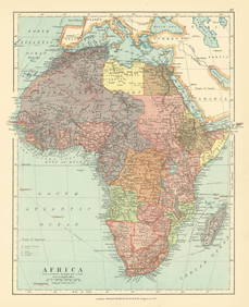
Africa. French West/Equatorial. Tanganyika Belgian Congo. STANFORD c1925 mapJasper524.5(9.9k)See Sold PriceFeb 28, 2024
Central Africa. Map showing great forest traversed by Mr Stanley, 1890Jasper524.5(9.9k)See Sold PriceFeb 28, 2024
Goode, George Brown 1884 Lot of 4 Natural History & Meteorology MapsAlbion Auctions4.6(341)See Sold PriceMar 01, 2024
Late 18th century map of England and Wales sampler and two printsFellows4.3(159)See Sold PriceMar 05, 2024