SoldMAP OF THE WORLD IN THREE SECTIONS 1777With tracks of Lord Mulgrave and Captain Cook, engraved by A. Bell. Matted, 9.5 x 16.75 inch sight size. Not examined outside of wrappings, appears excellent.See Sold Price
SoldA Map of the World in Three SectionsEngraved map marked plate CCXIII, titled "Geography A Map of the World in Three Sections Describing the Polar Regions to The Tropics. In Which Are Traced the Tracts of Lord Mulgrave and Captain Cook.See Sold Price
Sold1782 New Map of the World Navigation Routes“A New Map of the World in Three Sections wherein the several tracks and discoveries of the British Navigators to the present time are distinctly and accurately laid down”, by J. Bayly, printed atSee Sold Price
SoldMap of the World, Bell, 1778Map, double hemisphere, a Map of the World in three Sections, London 1778, Describing the Polar Regions to the tropics which trace the travels of Lord Mulgrave and Captain Cook, the map depicts theirSee Sold Price
SoldColorado Central Railroad Map 1885 (121151)This is a map of three sections of the Colorado Central Railroad depicting the Colorado Central from Denver west; The Georgetown Loop, and Georgetown Breckenridge and Leadville RR. Scales vary on eachSee Sold Price
SoldTWIN HEMISPHERE MAP OF THE WORLD 1777 BY A. BELLEngraved by A. Bell, 1777. Plate CCXIV. Santa Fe is the only N. American city listed, early states of the US southeast are outlined. Professionally matted in archival material, 9 x 14.5 inches.See Sold Price
1777 Section Map of New-York New-Jersey byLotterHandcolored map entitled “A Map of the Provinces of New-York and New-Jersey with a Part of Pennsylvania and the Province of Quebec from the Topgraphical Observations of C.J. Sauthier”, printed atSee Sold Price
SoldSchilder (Günter) Facsimile World MapsSchilder (Günter) The World Map of 1669 by Jodocus Hondius the elder & Nicolaas Visscher; Three World Maps by Francois van den Hoeye of 1661, Willem Janszoon (Blaeu) of 1607, Claes Janszoon VisscherSee Sold Price
SoldHistoire Des Juifs. Amsterdam, 1728. Maps (3)Jewish history. With three maps. Section two of three. Original leather binding. Moderate condition.See Sold Price
Soldde la Tour: Antique Map of World; Twin Hemispheres 1777Title/Content of Map: 'Mappemonde' World twin hemispheres Date Printed: 1777 Image Size: Approx 18.5 x 16.5cm, 7.25 x 6.25 inches (Medium); Please note that this is a folding map. Type: Antique copperSee Sold Price
Soldde la Tour: Antique Map of the Ancient World, 1777Title/Content of Map: 'Le Monde connu des Anciens' Date Printed: 1777 Image Size: Approx 18.5 x 16.5cm, 7.25 x 6.25 inches (Medium); Please note that this is a folding map. Type: Antique copperplate mSee Sold Price
SoldWorld map in three zonesTitle: The world divided into the torrid zone, the temperate & frigid zones, both north & south Author: Johnson, Joseph Description: Three copper-engraved maps on 1 sheet, hand-colored in outline. OnSee Sold Price
SoldA Group of Three Framed World Maps, 20th CenturyA Group of Three Framed World Maps, 20th Century20 x 28 inches (50.8 x 71.1 cm) (image, laSee Sold Price
Sold15-drawer map caseHeading: (Map Case) Author: Title: Fifteen-drawer map case in three stacking sections Place Published: No place Publisher: Date Published: No date Description: Overall 131See Sold Price
Three 18th Century World Mapsincluding Partie du Cours de Fleuve de Saint Laurent and Carte du Cours du Fleuve de Saint Laurent by Jacques Nicholas Bellin, 1761, two-part hand-colored map of the Saint LaurSee Sold Price
de la Tour: Antique Map of the World, Twin HemispheresTitle/Content of Map: 'Mappemonde' World twin hemispheres Date Printed: 1777 Image Size: Approx 18.5 x 16.5cm, 7.25 x 6.25 inches (Medium); Please note that this is a folding map. Type: Antique copperSee Sold Price
Statistique Et Historique De La Jamaique, 1825Map: Carte Geographique, Statistique Et Historique De La Jamaique Maker: Buchon Date: 1825 Size: Folio, 11.3 inches high x 11.8 inches wide Map showing island divided into three sections separately coSee Sold Price
Sold1843 Folding Color German World Maps Europe Americas1843 Folding Color German World Maps Europe Americas Geography Austria RARE Three 19th-century world maps published in Vienna in 1843! Published for use in Austrian high schools, this atlas includes fSee Sold Price
SoldDolland mahogany and brass three section pocketDolland mahogany and brass three section pocket telescope, World War I leather cased field compass and a leather covered brass mounted tape measureSee Sold Price
SoldThree Vintage Framed World & African MapsThree Vintage Framed World & African Maps. One with silver leaf and Latin, one hand colored on parchment type paper, one showing African. Largest measures 23 by 26 inches.See Sold Price
SoldThree Hundred World and Oceanic MapsExtensive Collection of Approximately Three Hundred World and Oceanic Maps, including plate tectonics and oceanic currents, sheet 16" x 21" to 11-1/2" x 8". Unframed. Provenance: Mr. Frank Mapes, TheSee Sold Price
SoldNicolaes Visscher World Map 1657Nicolaes Visscher I (1618-1679), "Orbis Terrarum Typus de Integro in Plurimis Emendatus, Auctus, et Icunculis Illustratus," Amsterdam, 1657. Highly detailed world map in two hemispheres. Three celestiSee Sold Price
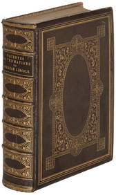
SoldDresser Bureau w World Map Decoupage StyleDresser Bureau w World Map Decoupage Style on Three Sides. 36 inches x 38 inches x 20 inchesSee Sold Price
SoldIsaak Tirion (1705-1765, Dutch), "Grondvlatke van NieuwIsaak Tirion (1705-1765, Dutch), "Grondvlatke van Nieuw Orleans, de Hoofstad van Louisiana...", Amsterdam, 1769, three engraved maps on one sheet, divided into three sections, the first is one of theSee Sold Price
Vintage Full Color World Map LithographThe Benefit Shop Foundation Inc.4.3(2.9k)See Sold PriceFeb 28, 2024
Nova Totius Full Color Geographical World MapThe Benefit Shop Foundation Inc.4.3(2.9k)See Sold PriceFeb 28, 2024
Rand McNally Railroad Map Cabinet w/ 21 Railroad MapsRail & Road Auctions4.6(165)See Sold PriceMar 08, 2024
A Set of Treasure and Discovery Island Brochures.Van Eaton Galleries4.6(99)See Sold PriceMar 02, 2024
Vintage Holy Bible Old & New Testaments Illustrated 1904The Benefit Shop Foundation Inc.4.3(2.9k)See Sold PriceMar 13, 2024