ATLAS of ANTIENT GEOGRAPHY by SAMUEL BUTLER 1843John McInnis Auctioneers,LLC4.6(502)See Sold PriceFeb 24, 2024
18TH C. ANTIQUE MAP: FRENCH & INDIAN WAR, FRAMEDThomaston Place Auction Galleries4.4(386)See Sold PriceFeb 24, 2024
Rand McNally Railroad Map Cabinet w/ 21 Railroad MapsRail & Road Auctions4.6(165)See Sold PriceMar 08, 2024
Keith Haring - Ink on New York Map, Best Buddies, Inscribed, Signed, and DatedSapphire Auction Gallery4(67)See Sold PriceMar 02, 2024
LATE 17TH C. FRENCH MAP OF THE NEW WORLD BY ALEXIS-HUBERT JAILLOT (1632-1712)Thomaston Place Auction Galleries4.4(386)See Sold PriceFeb 24, 2024
Central Railroad of New Jersey Map of Sandy Hook Route-ca. 1903JM Hobby Supply and Railroad Artifact Auctions4.4(126)See Sold PriceFeb 24, 2024
Lot of Six Mixed Atlas Box Cars-HO Scale-New in BoxJM Hobby Supply and Railroad Artifact Auctions4.4(126)See Sold PriceFeb 25, 2024
Rand McNally/Santa Fe Railroad Map of Iowa-1912JM Hobby Supply and Railroad Artifact Auctions4.4(126)See Sold PriceFeb 24, 2024
NICOLAES VISSCHER (NETHERLANDS, 1618-1709) MAP OF THE NEW WORLDThomaston Place Auction Galleries4.4(386)See Sold PriceFeb 24, 2024
17TH C. WORLD MAP BY NICOLAES VISSCHER (NETHERLANDS, 1618-1709)Thomaston Place Auction Galleries4.4(386)See Sold PriceFeb 24, 2024
Lot of Six Mixed Atlas Cabooses-HO Scale-New in BoxJM Hobby Supply and Railroad Artifact Auctions4.4(126)See Sold PriceFeb 25, 2024
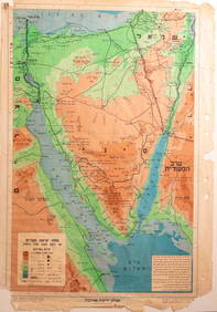
SoldMap of the Kingdoms of David and Solomon. JohannRegni Davidici et Salomonaei Descriptio Geographica cum Vicinis regionibus Syriae et Aegypti. Modern map depicting the kingdoms of David and Solomon with neighborhing countries, Syria and Egypt. The eSee Sold Price
SoldMap of the Kingdoms of David and Solomon, JohannMap of the Kingdoms of David and Solomon, Johann Matthias Haas, Nurnberg, 1739. Regni Davidici et Salomonaei Descriptio Geographica cum Vicinis regionibus Syriae et Aegypti. Colored copper plate engraSee Sold Price
David & Solomon Kingdoms Map, Johann Matthias Haas 1739Map of the Kingdoms of David and Solomon, Johann Matthias Haas, Nurnberg, 1739. Regni Davidici et Salomonaei Descriptio Geographica cum Vicinis regionibus Syriae et Aegypti. Colored copper plate engraSee Sold Price
Johann Matthias Haas (German, 1684-1742) - Map of theJohann Matthias Haas (Germany, 1684-1742) - Map of the Kingdoms of David and Solomon, Nuremberg, 1739. Regni Davidici et Salomonaei Descriptio Geographica cum Vicinis regionibus Syriae et Aegypti. ColSee Sold Price
SoldJohann Matthias Hase - "The Kingdom of David andRegni Davidici Et Salomonaei Descriptio Geographica Et Historica [The Kingdom of David and Solomon, a Geographical and Historical Description], by Johanne Matthia Hasio (Johann Matthias Hase). NurembeSee Sold Price
SoldDetailed Map of Eretz Israel, Syria and Egypt -Regni Davidici et salomonaei descriptio geographica cum vicinis regionibus Syriae et Aegypti / Schema II [geographic description of David and Solomon Kingdoms and the regions of Syria and Egypt/map noSee Sold Price
The Holy Land in its Twelve Tribal Divisions. MiddlePalestinae Seu Terrae Promissionis in duo de cim Tribus Partitae Facies Antiqua. The Holy Land and the Middle East, in its twelve tribal divisions, demarcation of the kingdoms of David and Solomon. ThSee Sold Price
Martier: Antique Map of Ancient Kingdom of Solomon 1705Map: Ancient Holy Land, Kingdom of Solomon Date Printed: 1705-06 Cartographer: Pierre Martier Material/Medium: Paper Size: 23 3/4" x 19 1/4" Condition: Excellent Original hand coloring. Copperplate enSee Sold Price
Sold17th C. Map of Holy Land, Kingdom of Solomon17th Century map of the Holy Land, inscribed "The Kingdom of Solomon in Biblical Times. Framed.See Sold Price
Johann David Schleuen (1711 - 1771) Map of RoyalJohann David Schleuen (1711 - 1771) Map of Royal Prussia, 1742; lithography on paper, 40 x 60 cm, General - Charte der gesamt Königlich Preussischen Länder zu finden bei J.D. Schleuen KupferstecSee Sold Price
SoldJOHANN ADAM DELSENBACH ENGRAVING OF JOSHUA, SAMUEL,JOHANN ADAM DELSENBACH ENGRAVING OF JOSHUA, SAMUEL, DAVID, AND SOLOMON. FIRST KINGS OF ISRAEL. 18 1/4 X 13 1/4 INCH SIGHT SIZE.See Sold Price
SoldKÖHLER Bequemer Schul-Atlas Maps 1719KÖHLER, Johann David (1684-1755) - Bequemer Schul-Und Reisen-Atlas aller zu Erlernung der alten, mittleren und neuen Geographie dienlichen Universal-und Particular-Carten ... angefertigt von ChristopSee Sold Price
SoldKoehler (Johann David) Atlas Manualis 1720Koehler (Johann David) Atlas Manualis,engraved title with contents verso and 30 hand-coloured double-page maps only, some staining or spotting, mostly marginal, original boards, rather worn, bSee Sold Price
SoldC. 1720 Johann David Koehler Atlas of the Ancient WorldJohann David Koehler Atlas of the Ancient World, published by Christoph Weigel, Nuremburg, circa 1720.See Sold Price
SoldKöhler, Johann David Kurtze und gründliche Anleitung zuKöhler, Johann David First part. With engr. frontispiece and 13 fold. col. copper engr. maps. - Contemp. half leather with red edges and gilt-stamped label on spine (rubbed, partly chafed, corners soSee Sold Price
18th Century Map The Kingdom of Denmark Homann HubnerEarly 18th Century Map of The Kingdom of Denmark, Homann and Hubner.Cartography by Johann Hubner and Editing by Johann Baptist Homann ( 1664-1724) Danish/Latin: Regni Daniae in quo sunt Ducatus HolsatSee Sold Price
SoldHarenburg / Homann Heirs: Palestine & Cyprus, 1744Palaestina seu Terra olim Sancta J.C. Harenburg's map of the Holy Land "divided into 12 tribes and extended by Kings David and Solomon," is both highly dramatic and scholarly (Harenburg, clearly had iSee Sold Price
SoldWeigel, NOVI ORBIS SIVE TOTIUS AMERICAE, [1725].[New World]. Weigel. Novi Orbis Sive Totius Americae Cum Adjacentibus Insulis Nova exhibitio. Engraved map of North and South America, from Johann David Koehler, Atlas Manualis Scholasticus Et ItineraSee Sold Price
SoldKoehler Descriptio Orbis antiquiKoehler (Johann David) Descriptio Orbis antiqui in XLIV Tabulis Exhibita,engraved pictorial title, index f. and 44 hand-coloured maps and plans, including a world map and bird's-eye plans of ASee Sold Price
SoldNovi Orbis Sive Totius Americae Cum Adiacentibus InNovi Orbis Sive Totius Americae Cum Adiacentibus Insulis Nova exhibitio, Christoph Weigel and Johann David Koehler, 1724. " A double-page copper-engraved map, with original full coloring, by ChristophSee Sold Price
Sold[ATLAS] -- Nicolas SANSON d'ABBEVILLE. Die gantze[ATLAS] -- Nicolas SANSON d'ABBEVILLE. Die gantze Erd-Kugel.Frankfurt: Johann David Zunner, 1679. 4to (230 x 180 mm). 4 parts in 1. Engraved titled and 62 (of 63 maps). Contemporary velum. ConSee Sold Price
SoldKöhler's Atlas of the Old WorldKöhler, Johann David. Descriptio Orbis Antiqui in XLIV Tabulis Exhibita. Nuremberg: Christoph Wegel, ca 1720. Folio with 44 hand-colored maps plus illustrated title page and index. Pages untrimmed, dSee Sold Price
Map of the Kingdom of Württemberg and the Grand Duchy of Baden, Germany - J. WalchMap of the Kingdom of Württemberg and the Grand Duchy of Baden Title: Charte vom Königreich Würtemberg und dem Grossherzogthum. Baden Artist: Johann Walch ( 1757 in Kempten-Allgäu-See Sold Price
JOHAN HÜBNER Germany 1668-1731JOHAN HÜBNER Germany 1668-1731 JOHANN BAPTISTE HOMANN Germany 1664-1724 Map of the kingdom of Denmark. Nuremberg, 1710 Engraving with burin Signed, dated and titled Size 52.3 x 63.1 cmSee Sold Price
David Y Cameron W/C Coastal Town w/ Sailboats PaintingHeritage Gallery Auctions4.4(56)See Sold PriceMar 10, 2024
Gorgeous 24K Gold Star of David Plate PorcelainArt Antique Auction Gallery4.5(213)See Sold PriceMar 05, 2024
A 1971 Walt Disney World Magic Kingdom Souvenir Map.Van Eaton Galleries4.6(99)See Sold PriceMar 02, 2024
A 1975 Walt Disney World Magic Kingdom Souvenir Map.Van Eaton Galleries4.6(99)See Sold PriceMar 02, 2024
A 1979 Walt Disney World Magic Kingdom Souvenir Map.Van Eaton Galleries4.6(99)See Sold PriceMar 02, 2024
A 1987 Walt Disney World Magic Kingdom Souvenir Map.Van Eaton Galleries4.6(99)See Sold PriceMar 02, 2024
Johann Homann Hand-Colored Map Engraving, c. 1730Auctions at Showplace4.5(726)See Sold PriceMar 17, 2024
David Solomon (Tug Boats) Lithograph Limited EditionMichael's Gallery4.6(89)See Sold PriceFeb 24, 2024
Mitchell - Map of the City of Washington (Washington, DC)Trillium Antique Prints & Rare Books4.5(30)See Sold PriceFeb 24, 2024
ALIEN3 (1992) - Hand-drawn Bait and Chase Five Page Storyboard and MapPropstore4.2(6)See Sold PriceMar 13, 2024
BENIN TOGO GHANA COAST. 'Kingdoms of Koto, Popo, Fida/Whydah & Ardra' 1746 mapJasper524.5(9.8k)See Sold PriceFeb 28, 2024
West Africa. Sahara caravan routes. Tribes Kingdoms Empires. LIZARS 1842 mapJasper524.5(9.8k)See Sold PriceFeb 28, 2024
Georg Bockler Map of Ancient Jerulsaem EtchingAuctions at Showplace4.5(726)See Sold PriceApr 07, 2024
Antique Map of The Kingdom of Spain, 1701 PrintAntiques Online Auctions4.6(407)See Sold PriceMar 14, 2024
The Kingdom of Dalmatia Territories Map, 1700Antiques Online Auctions4.6(407)See Sold PriceMar 14, 2024
David Solomon (Tug Boats) Lithograph Limited EditionMichael's Gallery4.6(89)See Sold PriceMar 02, 2024


![Weigel, NOVI ORBIS SIVE TOTIUS AMERICAE, [1725]. (1 of 1)](https://p1.liveauctioneers.com/179/14187/4432380_1_x.jpg?height=282&quality=70&version=1193335524)


![[ATLAS] -- Nicolas SANSON d'ABBEVILLE. Die gantze (1 of 0)](https://p1.liveauctioneers.com/dist/images/placeholder.jpg?height=282&quality=70)