ATLAS of ANTIENT GEOGRAPHY by SAMUEL BUTLER 1843John McInnis Auctioneers,LLC4.6(502)See Sold PriceFeb 24, 2024
18TH C. ANTIQUE MAP: FRENCH & INDIAN WAR, FRAMEDThomaston Place Auction Galleries4.4(386)See Sold PriceFeb 24, 2024
Rand McNally Railroad Map Cabinet w/ 21 Railroad MapsRail & Road Auctions4.6(165)See Sold PriceMar 08, 2024
Keith Haring - Ink on New York Map, Best Buddies, Inscribed, Signed, and DatedSapphire Auction Gallery4(67)See Sold PriceMar 02, 2024
LATE 17TH C. FRENCH MAP OF THE NEW WORLD BY ALEXIS-HUBERT JAILLOT (1632-1712)Thomaston Place Auction Galleries4.4(386)See Sold PriceFeb 24, 2024
Central Railroad of New Jersey Map of Sandy Hook Route-ca. 1903JM Hobby Supply and Railroad Artifact Auctions4.4(126)See Sold PriceFeb 24, 2024
Lot of Six Mixed Atlas Box Cars-HO Scale-New in BoxJM Hobby Supply and Railroad Artifact Auctions4.4(126)See Sold PriceFeb 25, 2024
Rand McNally/Santa Fe Railroad Map of Iowa-1912JM Hobby Supply and Railroad Artifact Auctions4.4(126)See Sold PriceFeb 24, 2024
NICOLAES VISSCHER (NETHERLANDS, 1618-1709) MAP OF THE NEW WORLDThomaston Place Auction Galleries4.4(386)See Sold PriceFeb 24, 2024
17TH C. WORLD MAP BY NICOLAES VISSCHER (NETHERLANDS, 1618-1709)Thomaston Place Auction Galleries4.4(386)See Sold PriceFeb 24, 2024
Lot of Six Mixed Atlas Cabooses-HO Scale-New in BoxJM Hobby Supply and Railroad Artifact Auctions4.4(126)See Sold PriceFeb 25, 2024
Map of the Great Salt Lake and Adjacent Country in theReserve Reduced! Title: Map of the Great Salt Lake and Adjacent Country in the Territory of Utah. Publication Date: 1852 Cartographer: STANSBURY, H./J. W. GUNNISON/CHAS. PREUSS Publisher: Ackerman LitSee Sold Price
Map of the Great Salt Lake and Adjacent Country in theTitle: Map of the Great Salt Lake and Adjacent Country in the Territory of Utah. Publication Date: 1852 Cartographer: STANSBURY, H./J. W. GUNNISON/CHAS. PREUSS Publisher: Ackerman Lith. Size: 42X29 "SSee Sold Price
Map of the Great Salt Lake and Adjacent Country in thePublication Date: 1852 Title: Map of the Great Salt Lake and Adjacent Country in the Territory of Utah. Cartographer: STANSBURY, H./J. W. GUNNISON/CHAS. PREUSS Publisher: Ackerman Lith. Height: 42 WidSee Sold Price
Map of the Great Salt Lake and Adjacent Country in theTitle/Content of Map: Map of the Great Salt Lake and Adjacent Country in the Territory of Utah. Cartographer: STANSBURY, HOWARD / J.W. GUNNISON / ALBERT CARRINGTON / CHARLES PREUSS Date: 1852 PublisheSee Sold Price
Map of the Great Salt Lake and Adjacent Country in theTitle/Content of Map: Map of the Great Salt Lake and Adjacent Country in the Territory of Utah. Date: 1852 Cartographer: STANSBURY, H./J. W. GUNNISON/CHAS. PREUSS Publisher: Ackerman Lith. Size: 42HeiSee Sold Price
Map of the Great Salt Lake and Adjacent Country in thePublication Date: 1852 Title: Map of the Great Salt Lake and Adjacent Country in the Territory of Utah. Cartographer: STANSBURY, H./J. W. GUNNISON/CHAS. PREUSS Publisher: Ackerman Lith. Height: 42 WidSee Sold Price
Map of the Great Salt Lake and Adjacent Country in theTitle: Map of the Great Salt Lake and Adjacent Country in the Territory of Utah. Publication Date: 1852 Cartographer: STANSBURY, HOWARD / J.W. GUNNISON / ALBERT CARRINGTON / CHARLES PREUSS Dimensions:See Sold Price
SoldMaps of Stanbury's Expedition Utah TerritoryStansbury's Expedition - Map of the Great Salt Lake and Adjacent Country in the Territory of Utah AND Map of a Reconnaissance Between Fort Leavenworth on the Missouri River and the Great Salt Lake inSee Sold Price
SoldTHE GREAT SALT LAKE (MORMON) CITY'. Town plan &TITLE/CONTENT OF MAP: 'The Great Salt Lake (Morman) City and Surrounding Country; Map of the Great Salt Lake and Adjacent Country in the Territory of Utah' DATE PRINTED: 1863 IMAGE SIZE: Approx 44.5 xSee Sold Price
Weller: Antique Map of Great Salt Lake City, 1863Title/Content of Map: 'The Great Salt Lake (Morman) City and Surrounding Country; Map of the Great Salt Lake and Adjacent Country in the Territory of Utah' Date Printed: 1863 Image Size: Approx 44.5 xSee Sold Price
SoldMaps from Stansbury's Report on UtahHeading: (Utah etc.) Author: Stansbury, Howard, J.J. Abert, et al. Title: Map of the Great Salt Lake and Adjacent Country in the Territory of Utah. Surveyed in 1849 and 1850 [and] Map of a ReconnaissaSee Sold Price
Sold'Stansbury's Expedition,'' by Howard Stansbury,''Stansbury's Expedition,'' by Howard Stansbury, 1849-1850, two large folding maps of Utah Territory bound in one volume, including: ''Map of The Great Salt Lake and Adjacent Country in the TerritorySee Sold Price
Weller: Antique Map of Salt Lake (Mormon) City, 1863TITLE/CONTENT OF MAP: 'The Great Salt Lake (Morman) City and Surrounding Country; Map of the Great Salt Lake and Adjacent Country in the Territory of Utah' DATE PRINTED: 1863 IMAGE SIZE: Approx 44.5 xSee Sold Price
SoldWeller: Antique Map of Salt Lake Mormon City, 1863Title/Content of Map: 'The Great Salt Lake (Morman) City and Surrounding Country; Map of the Great Salt Lake and Adjacent Country in the Territory of Utah' Date Printed: 1863 Image Size: Approx 44.5 xSee Sold Price
SoldTwo Maps of Utah Territory, 1850[Two Antique Maps of Utah Territory], "Map of the Great Salt Lake and Adjacent Country in the Territory of Utah..." and "Map of a Reconnaissance between Fort Leavenworth on the Missouri River, and theSee Sold Price
THE GREAT SALT LAKE (MORMON) CITY'. Town plan &Reserve Reduced! TITLE/CONTENT OF MAP: 'The Great Salt Lake (Morman) City and Surrounding Country; Map of the Great Salt Lake and Adjacent Country in the Territory of Utah' The top image on the rightSee Sold Price
SoldMap of the Great Salt Lake StansburyMap of the Great Salt Lake and Adjacent Country Stansbury 1852.See Sold Price
THE GREAT SALT LAKE (MORMON) CITY'. Town plan &TITLE/CONTENT OF MAP: 'The Great Salt Lake (Morman) City and Surrounding Country; Map of the Great Salt Lake and Adjacent Country in the Territory of Utah' The top image on the right hand side shows tSee Sold Price
Sold'Stansbury's Expedition,''''Stansbury's Expedition,'' by Howard Stansbury, 1849-1850, two large folding maps of Utah Territory bound in one volume, including: ''Map of The Great Salt Lake and Adjacent Country in the TerritorySee Sold Price
Weller: Antique Map of Salt Lake (Mormon) City, 1863Title/Content of Map: 'The Great Salt Lake (Morman) City and Surrounding Country; Map of the Great Salt Lake and Adjacent Country in the Territory of Utah' Date Printed: 1863 Image Size: Approx 44.5 xSee Sold Price
SoldStansbury Gunnison Carrington Preuss STANSBURYDetails: STANSBURY, HOWARD; GUNNISON, J. W.; CARRINGTON, A:BERT; PREUSS, CHARLES. Stansbury's Expedition: Maps: Map of the Great Salt Lake And Adjacent Country in the Territory Of Utah. Surveyed in 1See Sold Price
THE GREAT SALT LAKE (MORMON) CITY'. Town plan &TITLE/CONTENT OF MAP: 'The Great Salt Lake (Morman) City and Surrounding Country; Map of the Great Salt Lake and Adjacent Country in the Territory of Utah' DATE PRINTED: 1863 IMAGE SIZE: Approx 44.5 xSee Sold Price
THE GREAT SALT LAKE (MORMON) CITY'. Town plan &TITLE/CONTENT OF MAP: 'The Great Salt Lake (Morman) City and Surrounding Country; Map of the Great Salt Lake and Adjacent Country in the Territory of Utah' DATE PRINTED: 1863 IMAGE SIZE: Approx 44.5 xSee Sold Price
THE GREAT SALT LAKE (MORMON) CITY'. Town plan &TITLE/CONTENT OF MAP: 'The Great Salt Lake (Morman) City and Surrounding Country; Map of the Great Salt Lake and Adjacent Country in the Territory of Utah' The top image on the right hand side shows tSee Sold Price
Rand McNally Railroad Map of Arizona-1909JM Hobby Supply and Railroad Artifact Auctions4.4(126)See Sold PriceFeb 24, 2024
Rand McNally Railroad Map of Washington-1906JM Hobby Supply and Railroad Artifact Auctions4.4(126)See Sold PriceFeb 24, 2024
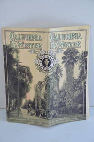
Los Angeles and Salt Lake RR California in Winter Brochure-October 1912JM Hobby Supply and Railroad Artifact Auctions4.4(126)See Sold PriceFeb 24, 2024
Rock Island RR Iowa and Minnesota Lakes Country Brochure-1926JM Hobby Supply and Railroad Artifact Auctions4.4(126)See Sold PriceFeb 24, 2024
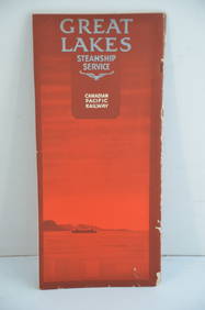
Canadian Pacific RY Great Lakes Steamship 1919 Brochure and TimetableJM Hobby Supply and Railroad Artifact Auctions4.4(126)See Sold PriceFeb 24, 2024
Vintage Sterling Silver Gottan Salt Shaker by SilvercraftMannys Jewelry4.6(331)See Sold PriceMar 03, 2024
Vintage Estate World Maps II Signed & Framed Art PrintMannys Jewelry4.6(331)See Sold PriceMar 03, 2024
LARGE LATE 17TH C. DUTCH CHART OF CANADA, GREAT LAKES, NEW FRANCE, LABRADOR, HUDSON BAY, BY PIERREThomaston Place Auction Galleries4.4(386)See Sold PriceFeb 24, 2024
LATE 17TH C. FRENCH MAP OF THE NEW WORLD BY ALEXIS-HUBERT JAILLOT (1632-1712)Thomaston Place Auction Galleries4.4(386)See Sold PriceFeb 24, 2024
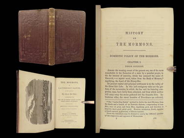
1856 History of Mormons LDS Salt Lake Utah Joseph Smith Polygamy Indian MassacreSchilb Antiquarian Rare Books4.8(421)See Sold PriceMar 31, 2024
[MAP]. [ALBRIZZI, Giambatista, 1698-1777]. Carta Geografica...Potter & Potter Auctions4.6(539)See Sold PriceMar 07, 2024
1738 RUSSIA SIBERIA & GREAT TARTARY Description illustrated ANTIQUE in ENGLISHJasper524.5(9.8k)See Sold PriceFeb 27, 2024
Vintage Estate Hand Painted Porcelain Salt & Pepper Shakers and Cruet SetMannys Jewelry4.6(331)See Sold PriceMar 14, 2024
FIVE ANTIQUE STERLING SILVER SOUVENIR TEASPOONS & FORKMannys Jewelry4.6(331)See Sold PriceMar 14, 2024
NORTH & WEST AFRICA. Sahara Niger river 'Zaara ou le Desert'. MALLET 1683 mapJasper524.5(9.8k)See Sold PriceFeb 28, 2024
Carte de la Guinée, contenant…'. Guinea & Cape Verde islands. BONNE 1771 mapJasper524.5(9.8k)See Sold PriceFeb 28, 2024
Stanford, Edward 1901 Large Map. Burma and Adjacent CountriesAlbion Auctions4.6(336)See Sold PriceMar 01, 2024
Boy Scout Council Shoulder Badges Lot Of 24 CRapid Estate Liquidators and Auction Gallery4.5(1.1k)See Sold PriceFeb 25, 2024


![[MAP]. [ALBRIZZI, Giambatista, 1698-1777]. Carta Geografica... (1 of 1)](https://p1.liveauctioneers.com/928/318880/171361280_1_x.jpg?height=282&quality=70&version=1707501302)


