Turkey in Asia 1829Map: Turkey in Asia Maker: Rees Longman, Orme, Brown & Green Publishing: London 1829 Size: 16 x 20 inches Northern area between Euphrates and Tigris Rivers to just above Tecrit is called “Algezira��See Sold Price
SoldMiddle East.- Münster (Sebastian) Tabula AsiaeMiddle East.- Münster (Sebastian) Tabula Asiae IIII, Ptolemaic map of the Middle East, showing from present-day Iraq and the Tigris & Euphrates Rivers westward to the Mediterranean Sea and the isSee Sold Price
Exploration of the Euphrates Valley, 1850Heading: Author: Chesney, Francis Rawdon Title: The Expedition for the Survey of the Rivers Euphrates and Tigris... in the Years 1835, 1836, and 1837; preceded by geographical and historical noticesSee Sold Price
Exploration of the Euphrates Valley, 1850Heading: Author: Chesney, Francis Rawdon Title: The Expedition for the Survey of the Rivers Euphrates and Tigris... in the Years 1835, 1836, and 1837; preceded by geographical and historical noticesSee Sold Price
SoldChesney.Exped..Survey..Euphrates & TigrisChesney (Francis Rawdon) The Expedition for the Survey of the Rivers Euphrates and Tigris,vol.1 & 2 (all published) but without the slip-case of maps, first edition, half-titles, 49 tinted litSee Sold Price
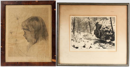
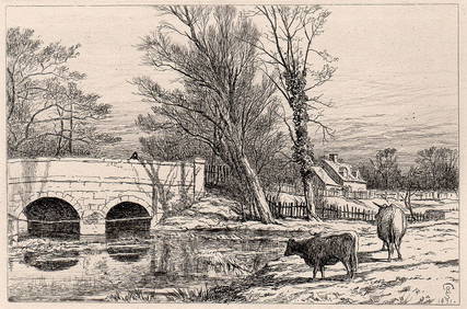
SoldCHARLES CAIN TIGRIS RIVER ETCHINGCAIN, Charles W., (British, 1893-?): ''Tigris'', depicting the Tigris River, Etching, 10 1/4'' x 15 3/4'', pencil signed lower right, titled lower left, edition of 120, plate size 4'' x 8 3/8'', unfraSee Sold Price
SoldCHARLES CAIN TIGRIS RIVER ETCHINGCAIN, Charles W., (British, 1893-?): ''Tigris'', depicting the Tigris River, Etching, 10 1/4'' x 15 3/4'', pencil signed lower right, titled lower left, edition of 120, plate size 4'' x 8 3/8'', unfraSee Sold Price
SoldMap, "The Euphrates & Tigris" - D'Anville's AtlasMap, "The Euphrates & the Tigris" from D'Anville's Atlas - engraved for Jno Harrifon - 16 3/4" x 20 5/8"See Sold Price
Soldca 2200 BC Lagash Bronze Age arrowheadsthree ca 2200 BC Sumerian Bronze Age arrowheads found at Lagash (modern Telloh) between the Tigris & Euphrates rivers, lengths 5 1/2", 3 3/4", 2 1/2", sold with several bronze age objects of unknown oSee Sold Price
SoldMesopotamia Nisibis Philip I 244 -249 AD CoinMesopotamia (Nisibis) Philip I 244 -249 AD Mesopotamia is a historical region of Western Asia situated within the Tigris–Euphrates river system, in the northern part of the Fertile Crescent, in modeSee Sold Price
SoldEtching "Downstream River Tigris"signed in margin with pen " Charles W. Cain" . Numbered 52/77. 9 1/4"X13 5/8.See Sold Price
Tigris and Euphrates Rivers, Iran, Apollo 7, OctobTigris and Euphrates Rivers, Iran, Apollo 7, October 1968 Vintage chromogenic print, 18 x 18cm (7 x 7in), on "A Kodak Paper", numbered AS7-6-1700 £100-150See Sold Price
SoldThe Expedition for the Survey of the Rivers EuphratesChesney, Francis Rawdon. The Expedition for the Survey of the Rivers Euphrates and Tigris…in the Years 1835, 1836, and 1837. London: Longman, Brown, Green, and Longmans, 1850. Two vols., embosseSee Sold Price
SoldThevenot Vera Delineatio Civitatis BassoraeThevenot (Melchisedec) Vera Delineatio Civitatis Bassorae,showing the Tigris and Euphrates rivers in the area surrounding modern-day Basra, 56 locations identified in Arabic within the plate,See Sold Price
SoldCHESNEY, Francis Rawdon. The Expedition for the SurveyCHESNEY, Francis Rawdon. The Expedition for the Survey of the Rivers Euphrates and Tigris. Londra: Longman, Brown, 1850.See Sold Price
SoldLevant.- Chesney (Francis Rawdon) The Expedition forLevant.- Chesney (Francis Rawdon) The Expedition for the Survey of the Rivers Euphrates and Tigris... in the years 1835, 1836, and 1837, 2 vol., first edition, large paper copy, 49 lithographed platesSee Sold Price
World.- Thevenot (Melchisedec) - Relations de Diversvol.1 & 2 only (of 5), vol.1 with folding engraved map of the River Tigris, 4 engraved plates/full-page illustrations (one folding, 2 double-page including one of Hebrew text), 6 engraved illustrationSee Sold Price
Map of Some of the First Inhabited Provinces.Title/Content of Map: Map of Some of the First Inhabited Provinces. Date: 1800 ca. Cartographer: LE KEUX, J. sc. Size: 8.75X7.5 Large scale map of Mt. Ararat, Tigris, Euphrates area. Plate XXX. LargeSee Sold Price
SoldMallet: Antique City Plan of Baghdad, 1683Title/Content of Map: 'Bagdet' Shows the river Tigris. Plan of the walled city & fortifications. Baghdad, Iraq Date Printed: 1683 Image Size: Approx Overall page size 13 x 21cm approximately (5 x 8 inSee Sold Price
BAGHDAD 'Bagdet' Walled city & fortifications plan Iraq MALLET Trimmed 1683 mapTITLE OF THE MAP: 'Bagdet' Shows the river Tigris DATE PRINTED: 1683 IMAGE SIZE: Approx 10.0 x 14.5cm, 4 x 5.5 inches (Small) TYPE: Original 17th century copperplate map CONDITION: Good; suitable forSee Sold Price
BAGHDAD 'Bagdet' Walled city & fortifications plan IraqTITLE OF THE MAP: 'Bagdet' Shows the river Tigris The top image on the right hand side shows the entire map. To view a close up of the map showing the level of printed detail, please click on the bottSee Sold Price
BAGHDAD 'Bagdet' Walled city & fortifications plan IraqTITLE OF THE MAP: 'Bagdet' Shows the river Tigris DATE PRINTED: 1683 IMAGE SIZE: Approx 10.0 x 14.5cm, 4 x 5.5 inches (Small) TYPE: Original 17th century copperplate map CONDITION: Good; suitable forSee Sold Price
Antique Map - The Holy LandMap showing the position of the “Garden of Eden” on the Tigris River and near the Tower of Babel. The story of Eden echoes the Mesopotamian myth of a king, as a primordial man, who is placed iSee Sold Price
Antique German Kampen Town Color Copper EtchingHill Auction Gallery 4.7(1k)See Sold PriceFeb 28, 2024
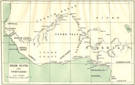
AFRICA. Niger River and Tributaries 1936 old vintage map plan chartJasper524.5(9.9k)See Sold PriceFeb 28, 2024
Georg Bockler Map of Ancient Jerulsaem EtchingAuctions at Showplace4.6(744)See Sold PriceApr 07, 2024
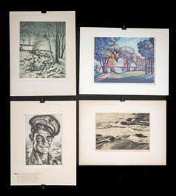
1930s American Etchings, Original Ltd. Editions (4)Artemis Fine Arts4.8(1.4k)See Sold PriceFeb 26, 2024
Richard Samuel Chattock Bridge on the River Blythe 1871 Etching SignedKCM Galleries4.7(164)See Sold PriceFeb 25, 2024
HENRY DAWSON Etching "View of St Paul's from the River" Framed SignedKCM Galleries4.7(164)See Sold PriceFeb 25, 2024
A LARGE ERRATA BOOK INDIAN MAPS AND STUDIES including the provinces of Bengal, Cossimbuzar Island, THannam's Auctioneers Ltd4.3(399)See Sold PriceFeb 27, 2024
A framed lithograph of Fort Victoria , Kow Loon, Hong Kong together with a framed etching of a RiverHannam's Auctioneers Ltd4.3(399)See Sold PriceMar 01, 2024
John Senex Map of Louisiana & Mississippi RiverWillow Auction House4.5(292)See Sold PriceMar 14, 2024
Hudson River Map & North American Postcards, 45Auctions at Showplace4.6(744)See Sold PriceFeb 13, 2025