ATLAS of ANTIENT GEOGRAPHY by SAMUEL BUTLER 1843John McInnis Auctioneers,LLC4.6(502)See Sold PriceFeb 24, 2024
18TH C. ANTIQUE MAP: FRENCH & INDIAN WAR, FRAMEDThomaston Place Auction Galleries4.4(386)See Sold PriceFeb 24, 2024
Rand McNally Railroad Map Cabinet w/ 21 Railroad MapsRail & Road Auctions4.6(165)See Sold PriceMar 08, 2024
Keith Haring - Ink on New York Map, Best Buddies, Inscribed, Signed, and DatedSapphire Auction Gallery4(67)See Sold PriceMar 02, 2024
LATE 17TH C. FRENCH MAP OF THE NEW WORLD BY ALEXIS-HUBERT JAILLOT (1632-1712)Thomaston Place Auction Galleries4.4(386)See Sold PriceFeb 24, 2024
Central Railroad of New Jersey Map of Sandy Hook Route-ca. 1903JM Hobby Supply and Railroad Artifact Auctions4.4(126)See Sold PriceFeb 24, 2024
Lot of Six Mixed Atlas Box Cars-HO Scale-New in BoxJM Hobby Supply and Railroad Artifact Auctions4.4(126)See Sold PriceFeb 25, 2024
Rand McNally/Santa Fe Railroad Map of Iowa-1912JM Hobby Supply and Railroad Artifact Auctions4.4(126)See Sold PriceFeb 24, 2024
NICOLAES VISSCHER (NETHERLANDS, 1618-1709) MAP OF THE NEW WORLDThomaston Place Auction Galleries4.4(386)See Sold PriceFeb 24, 2024
17TH C. WORLD MAP BY NICOLAES VISSCHER (NETHERLANDS, 1618-1709)Thomaston Place Auction Galleries4.4(386)See Sold PriceFeb 24, 2024
Lot of Six Mixed Atlas Cabooses-HO Scale-New in BoxJM Hobby Supply and Railroad Artifact Auctions4.4(126)See Sold PriceFeb 25, 2024
Map of Rome & Roman Territory Italy 1857Engraving, Map featuring Rome & Roman Territory of Long's Classical Atlas by Sherman & published by Blanchard & Lea, circa 1857. Dimensions: 10" x 13.5" Please note that this lot has a confidential reSee Sold Price
SoldNicolas Sanson, 17th c. map of Imperial RomeNicolas Sanson, 17th c. map of Imperial Rome, Nicolas Sanson (French, 1600-1667), "Imperii Romani geographica descriptio ad Herodiani historiam", c. 1650, Roman territory throughout Europe and Asia asSee Sold Price
MAP, Central Italy, Rome, LangenesCentral Italy, Rome. Barent Langenes, Romanum Territorium, 1600 (published). Hand Color. This tiny map focuses on the Territory of Rome and was engraved by Petrus Kaerius (Pieter van den Keere). FrencSee Sold Price
Italy.- Jansson (Jan) Latium, [c. 1652].Italy.- Jansson (Jan) Latium, map of the Lazio province on Italy's central-west coast showing a bird's eye view of Rome with several Roman ruins visible, including the Colosseum, title cartouche withSee Sold Price
Map of Greece and Italy in 1190 - 504. Print in 1850.Print of steel engraving titled „La Grece depuis linvasion des Doriens LItalie la fondation de Rome 1190 a 504.Author A. Houze.Engraved by unknown.From the „Atlas Universel Historique et GeographiSee Sold Price
MAP - Rome, Italy. HalmaRome, Italy. Francois Halma, Rome, 1705 (published). Hand Color. A lovely panoramic view of Rome with the Tiber River flowing at center and St. Peters Basilica prominently depicted at right. This viewSee Sold Price
MAP, Rome, Italy, HomannRome, Italy. Johann Baptist Homann, Urbis Romae Veteris ac Modernae Accurata Delineatio, 1720 (circa). Hand Color. This bird's eye view of Rome presents the city on seven hills in remarkable detail, rSee Sold Price
ROMAN EMPIRE. In the third century. Britannica 9th edition 1898 old mapTITLE/CONTENT OF MAP: 'Rome; Roman empire third century' DATE PRINTED: 1898 IMAGE SIZE: Approx 18.0 x 25.5cm, 7.25 x 10 inches (Medium) TYPE: Antique coloured map CONDITION: Good; suitable for framingSee Sold Price
SoldMercator map of Rome, ItalyMercator, Gerard (1512-1594). Lativm Nunc Campagna Di Roma. Engraved map with full original color. Hondius, c.1607. 14 ½" x 18 ¾" sheet. From a Mercator plate acquired by Jodocus Hondius in 1604See Sold Price
Map of Rome - Italy - Jean Covens - Corneille MortieAmsterdam about 1720. Coven's and Mortier's publication of Giovanni Battista Falda's map published by Giovanni Giacomo de Rossi in 1667. Approx 66x87cm (total 78x104cm). With superb Hand Colouring, guSee Sold Price
SoldFRAMED ANTIQUE MAP OF ROMAN TERRITORIES"Regiones Danubiane, Pannoniae, Dacia, Moesiae, cum Vicino Illyrco. In ufus Collegii Ref. Debrecinensis,oeri' incisae per Franciscum Karacs, pestini MDCCC." Copperplate engraving with hand coloring, dSee Sold Price
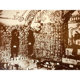
Carpeaux, Neapolitan Fisherman, Rome, C. 1857Plaster Rome, Italy, around 1857 Model: Jean-Baptiste Carpeaux (1827-75) – French sculptor On the plinth inscribed ‘Carpeaux’ Nude, kneeling Neapolitan fisherman with Phrygian Cap, holding a nauSee Sold Price
1830 SDUK Map of Roman Italy's Central to South Portion -- Ancient Italy IITitle: 1830 SDUK Map of Roman Italy's Central to South Portion -- Ancient Italy II Cartographer: SDUK Year / Place: 1830, London Map Dimension (in.): 9.9 X 15.3 in. This is an excellent map of centralSee Sold Price
SoldEntitled “Il Circolo della Bassa Sassonia, Roma 1796”Antique Italian Map of Rome Italy Entitled “Il Circolo della Bassa Sassonia, Roma 1796” by Giovanni Maria Cassini (Italian, 1725-1824) | A hand colored engraved map, dated 1796 | Title is translatSee Sold Price
1830 SDUK Map of Roman Italy's Central to South Portion -- Ancient Italy IITitle: 1830 SDUK Map of Roman Italy's Central to South Portion -- Ancient Italy II Cartographer: SDUK Date/Place: 1830, London Dimensions: 9.9 X 15.3 in. Description: This is an excellent map of centrSee Sold Price
SoldColton: Antique Map of Southern Italy, 1857Title: Map of Southern Italy by Colton Date: 1857 Dimensions (inches): 17 x 14 Medium: Hand Colored Lithograph Condition: Small rips along bottom and right side Joseph Hutchins Colton (1800 - 1893), kSee Sold Price
SoldEmpire of Alexander the Great Territory Map 1857Map Empire of Alexander the Great Territory (Egypt, Persia, Syria, Greece) 1857Engraving Long's Classical Atlas by Sherman & published by Blanchard & Lea, circa 1857. Dimensions: 10" x 13.5" Please noSee Sold Price
SoldNat. Encyclo. 1891 Lot of 4 Maps. Italy & Roman EmpireLithograph Map Published 1891-1901 by William Mackenzie, London for "The National Encyclopedia: A dictionary of Universal Knowledge" Centre Fold as issued. Paper Size: 12 x 9.5 inch (31 x 24cm) Good CSee Sold Price
SoldStreet map of Roma (Rome), Italy, 1972, 54x76.Street map of Roma (Rome), Italy, 1972, 54x76.See Sold Price
Sold3 US MILITARY & FASCIST ITALY ROME MAP WWII EUROPELot of three includes: two (2) 43 X 27 inch Verdun-Wissembourg First Edition, sheet 57, Europe map, and one (1) 34 X 22 inch Pianta Panoramica Di Roma color map. Few wrinkles and tears, overall good cSee Sold Price
SoldTardieu: Antique Map of Ancient Roman Northern ItalyTitle/Content of Map: 'Italie Ancienne' A map of the northern part of Ancient Italy, showing Roman place and province names Date Printed: c1798 Image Size: Approx 36.0 x 46.5cm, 14.25 x 18.25 inches (See Sold Price
MAP - Central Italy, Rome. MercatorCentral Italy, Rome. Mercator/Hondius, Latium nunc Campagna di Roma, 1610 (published). Hand Color. Lovely little map of Lazio on Italy's central-west coast with the city of Rome shown near a depictionSee Sold Price
SoldMap of Washington & Oregon Territories, 1857**Originally Listed At $200** Henry Darwin Rogers (American, 1808-1866) & Alexander Keith Johnston (Scottish, 1804-1871), "Territories of Washington and Oregon." London: publisher Edward Stanford (BriSee Sold Price
Ancient Roman Republican Coins - Roman Republican - AES Grave Victorian CopyTimeLine Auctions Ltd.4.5(183)See Sold PriceMar 09, 2024
G. Bernaro (Italian, b 1911) oil on canvas. Label on verso: Bernaro attended the local academy andNeely Auction4.6(224)See Sold PriceFeb 25, 2024
Sculpture Of Female Torso "Venus de Medici" - 44lbsWeatherham Estate Treasures3.9(157)See Sold PriceMar 14, 2024
Casimiro Tomba (Italy,1857-1929) watercolor painting antiqueBroward Auction Gallery4.8(277)See Sold PriceMay 05, 2024
Passeri - 6 Etruscan Vase EngravingsTrillium Antique Prints & Rare Books4.5(30)See Sold PriceFeb 24, 2024
A quantity of World War II / Two military ephemera to include assorted 1940s newspapers pages toClaydon Auctioneers Ltd4.3(125)See Sold PriceFeb 26, 2024
Jan Goeree (1670-1731) - Set of 2 Italian Engravings of Roman ScenesProverde Auctions4.3(3)See Sold PriceFeb 28, 2024
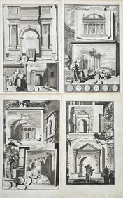
Jan Goeree (1670-1731) - Set av 4 Architecture Engravings - Church of Saint Pudentiana - AProverde Auctions4.3(3)See Sold PriceFeb 28, 2024
Jan Goeree (1670-1731) - Set av 4 Architecture Engravings - A Reconstruction of the Arch of DomitianProverde Auctions4.3(3)See Sold PriceFeb 28, 2024
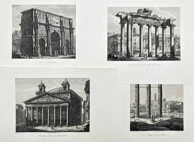
Carl Johan Billmark - Set of 4 Prints depicting Rome, Italy - Church in Sweden - Views of EuropeProverde Auctions4.3(3)See Sold PriceFeb 28, 2024
Domenico Amici - Set of 4 prints - Tempio di Giove Statore - Arco di Costantino in Rome, ItalyProverde Auctions4.3(3)See Sold PriceFeb 28, 2024
Vintage Map of Roman Forum - Vatican City - Versailles parkProverde Auctions4.3(3)See Sold PriceFeb 28, 2024


![Italy.- Jansson (Jan) Latium, [c. 1652]. (1 of 1)](https://p1.liveauctioneers.com/5458/147572/74578975_1_x.jpg?height=282&quality=70&version=1565275641)