ATLAS of ANTIENT GEOGRAPHY by SAMUEL BUTLER 1843John McInnis Auctioneers,LLC4.6(504)See Sold PriceFeb 24, 2024
18TH C. ANTIQUE MAP: FRENCH & INDIAN WAR, FRAMEDThomaston Place Auction Galleries4.4(389)See Sold PriceFeb 24, 2024
Rand McNally Railroad Map Cabinet w/ 21 Railroad MapsRail & Road Auctions4.6(165)See Sold PriceMar 08, 2024
Keith Haring - Ink on New York Map, Best Buddies, Inscribed, Signed, and DatedSapphire Auction Gallery4.1(67)See Sold PriceMar 02, 2024
LATE 17TH C. FRENCH MAP OF THE NEW WORLD BY ALEXIS-HUBERT JAILLOT (1632-1712)Thomaston Place Auction Galleries4.4(389)See Sold PriceFeb 24, 2024
Central Railroad of New Jersey Map of Sandy Hook Route-ca. 1903JM Hobby Supply and Railroad Artifact Auctions4.4(126)See Sold PriceFeb 24, 2024
Lot of Six Mixed Atlas Box Cars-HO Scale-New in BoxJM Hobby Supply and Railroad Artifact Auctions4.4(126)See Sold PriceFeb 25, 2024
Rand McNally/Santa Fe Railroad Map of Iowa-1912JM Hobby Supply and Railroad Artifact Auctions4.4(126)See Sold PriceFeb 24, 2024
NICOLAES VISSCHER (NETHERLANDS, 1618-1709) MAP OF THE NEW WORLDThomaston Place Auction Galleries4.4(389)See Sold PriceFeb 24, 2024
17TH C. WORLD MAP BY NICOLAES VISSCHER (NETHERLANDS, 1618-1709)Thomaston Place Auction Galleries4.4(389)See Sold PriceFeb 24, 2024
Lot of Six Mixed Atlas Cabooses-HO Scale-New in BoxJM Hobby Supply and Railroad Artifact Auctions4.4(126)See Sold PriceFeb 25, 2024
Map of New York & Adjacent Cities 1864Map: Map of New York and the Adjacent Cities Maker: Johnson & Ward, Colton, Joseph Hutchins Publishing: New York 1864 Size: 16 x 26 inches Colton plan reissued by Johnson with a different border PleasSee Sold Price
Johnson's Map of New York and Adjacent CitiesJohnson & Ward, Johnson, A.J., 1863, Double Folio – 15.30 H x 24.70 W Inches, City plan naming streets, squares, parks, railroads etc. Decorative border. Inset: continuation of N.Y.C. north. PleaseSee Sold Price
SoldJohnson's Map of New York and the Adjacent Cities.Title: Johnson's Map of New York and the Adjacent Cities. Publication Date: 1866 Cartographer: JOHNSON, ALVIN JEWETT Publisher: JOHNSON AND WARD Size: 16Height - 26Width 29-30. Original coloring. BrowSee Sold Price
SoldJohnson's Map of New York and the Adjacent Cities.Title: Johnson's Map of New York and the Adjacent Cities. Publication Date: 1864 Cartographer: JOHNSON, ALVIN JEWETT Publisher: JOHNSON AND WARD Size: 16x26 Original coloring. 29-30. Browned, margin sSee Sold Price
SoldMap of New York and the Adjacent Cities.Title: Map of New York and the Adjacent Cities. Date: 1858 Cartographer: COLTON, JOSEPH HUTCHINS Size: 15.75 X 25 Browned. Margin spotted. Centerfold repaired. Please note that this lot has a confidenSee Sold Price
SoldJohnson's Map of New York and the Adjacent Cities.Title/Content of Map: Johnson's Map of New York and the Adjacent Cities. Date: 1866 Cartographer: JOHNSON, ALVIN JEWETT Size: 16X26 Original coloring. Damped with some loosening of sections. 4' X 5'+See Sold Price
SoldGrp: 3 Maps of New York CityGroup of three maps of New York City. Includes Mark Tiddeman, "A Draught of New York from the Hook to New York Town," London: W. Mount & T. Page; "Map of New York and the Adjacent Cities," New York: JSee Sold Price
Johnson’s map of New York and the Adjacent Cities,"c.Johnson’s map of New York and the Adjacent Cities,"c. 1860, by Johnson & Ward, H.- 18 in., W.- 27 in.See Sold Price
SoldTwo hand colored engraved double page large folio mapsTwo hand colored engraved double page large folio maps including The United States of America and Map of New York and the Adjacent Cities. 16 1/2" x 27" and 17 1/2" x 27" Provenance: Property from CSee Sold Price
SoldAntebellum Colton Map of New York CityAntebellum Colton Map of New York CityMap of New York and the Adjacent Cities (New York: J. R. Colton & co., 1855), steel engraving with color from Colton's General Atlas; presented in two-sided woodeSee Sold Price
Map of Upper New York City and adjacent country.Title/Content of Map: Map of Upper New York City and adjacent country. Cartographer: Wm. M. Goldthwaite, 107 Nassau St. Date: 1889 Publisher: N.Y. Country Club and N.Y. Athletic Club / Hyde & Company.See Sold Price
New York & Adjacent Cities J. H. Colton. 1885Item: New York & Adjacent Cities J. H. Colton. 1885 Description: A rare and beautiful example of J. H. Colton map of New York City and vicinity, including Manhattan as well as parts of Brooklyn, JerseSee Sold Price
J.H. Colton: New York & Adjacent Cities 1856Map: Map of New York and the Adjacent Cities Maker: J.H. Colton Publishing: J.H. Colton & Co.: New York Date: 1856 Size: 14.3 x 24.5 inches Map showing wards separately colored, streets, squares, etc.See Sold Price
Sold1891 Framed New York MapBy Caylord & Watson, titles New York and Adjacent Cities, 31 X 21" framed under glass. Hand colored and very clean. Glass may not survive shippingSee Sold Price
Sold1855 Colton Map of New York City and Parts of BrooklynReserve Reduced! Title/Content of Map: 1855 Colton Map of New York City and Parts of Brooklyn -- Map of New York and the Adjacent Cities Date: 1855, New York Cartographer: J Colton Size: 15.5 X 25.1 iSee Sold Price
SoldMiller's New York As It Is With Map 1865Miller's New York As It Is; or Stranger's Guide-Book to the cities of New York, Brooklyn, and adjacent places, first edition 1865, brown cloth with gilt lettering and border, with fold out map, numeroSee Sold Price
SoldBOOKS: (7) Vols Antique Histories of NYC and AreaBOOKS: (7) Vols Antique Histories of NYC and Area, 7 Volumes: 1. Miller's New York As It Is, or Stranger's Guide-Book to the Cities of New York, Brooklyn and Adjacent Places. James Miller, New York. 1See Sold Price
SoldBOOKS: (7) Vols antique histories of NYC and areaBOOKS: (7) Vols antique histories of NYC and area, 7 Volumes: 1. Miller's New York As It Is, or Stranger's Guide-Book to the Cities of New York, Brooklyn and Adjacent Places. James Miller, New York. 1See Sold Price
SoldMAP NEW YORK CITY VALENTINE'S MANUAL 1860 2 SHEET"Map of the five Cities of New York, Brooklyn Jersey City, Hoboken, & Hudson City, 1860." Printed in two sheets with hand coloring. Dimensions: (Paper, each) H 24.75" x W 28.25" Condition: Removed froSee Sold Price
Sold19th c. Map New York City19th c. "Map Of New York And Its Vicinity, New York 1863". Published by S.D. Tildern. 63 1/2" x 63 1/2". Some damage.See Sold Price
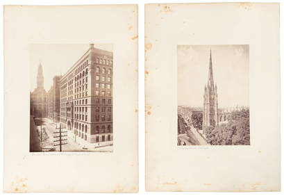
Sold[Map] New York City[Map] New York City , 1846, drawn by D.H. Burr, pub. Homans & Ellis, , linen backed and lacquered, 12 5/8 in. x 10 3/8 in Provenance: Property deaccessioned from the Louisiana State Museum, proceeds tSee Sold Price
SoldLarge framed map, "New York City North of 93rd Street",Large framed map, "New York City North of 93rd Street", Colton's New Map of the City and County of New York Including Extensions North of the Harlem River, published by G.W. and C.B. Colton & Co.'s sSee Sold Price
SoldM. Dripps 1860 Map New York City County & Vacinity By M. DrippsM. Dripps 1860 Map New York City County & Vacinity By M. Dripps 22.5" x 30"See Sold Price
SoldOLD MAP NEW YORK CITY, VALENTINE'S MANUAL 1855"A Plan of the City of New York and Environs...1755" 1855 Dimensions: (Paper) H 25.5" x W 20" Condition: Removed from book, folds, edge damages, toning.See Sold Price
Crams Railroad Map of New York-1881JM Hobby Supply and Railroad Artifact Auctions4.4(126)See Sold PriceFeb 24, 2024
Erie Railway Tourist Book/Magazine-1874JM Hobby Supply and Railroad Artifact Auctions4.4(126)See Sold PriceFeb 24, 2024
George Hayward - Map of the City of New York 1854Dane Fine Art Auctions4.4(496)See Sold PriceMar 07, 2024
Pair of The Gateway to a Continent Books - Grand Central Zone and 1939 World's FairRail & Road Auctions4.6(165)See Sold PriceMar 07, 2024
ANDREW RAYMOND JANSON OIL ON BOARD ADIRONDACKSCharleston Estate Services Ltd.4.5(64)See Sold PriceMar 03, 2024
Johann Homann Hand-Colored Map Engraving, c. 1730Auctions at Showplace4.6(731)See Sold PriceMar 17, 2024
Willem Blaeu, Etc. 17th C. Antiquarian Maps, 2Auctions at Showplace4.6(731)See Sold PriceMar 17, 2024
Alfred Salzman, Etc. JNF Tin Tzedakah Boxes, 3Auctions at Showplace4.6(731)See Sold PriceApr 07, 2024
Georg Bockler Map of Ancient Jerulsaem EtchingAuctions at Showplace4.6(731)See Sold PriceApr 07, 2024
Black and white map of part of New York City (mostly Manhattan)Proverde Auctions4.3(3)See Sold PriceFeb 28, 2024
Laminated Unique Media New York City MapRapid Estate Liquidators and Auction Gallery4.5(1.1k)See Sold PriceFeb 29, 2024
Hudson River Map & North American Postcards, 45Auctions at Showplace4.6(731)See Sold PriceFeb 13, 2025


![[Map] New York City (1 of 1)](https://p1.liveauctioneers.com/268/180010/90586232_1_x.jpg?height=282&quality=70&version=1600794544)