ATLAS of ANTIENT GEOGRAPHY by SAMUEL BUTLER 1843John McInnis Auctioneers,LLC4.6(502)See Sold PriceFeb 24, 2024
18TH C. ANTIQUE MAP: FRENCH & INDIAN WAR, FRAMEDThomaston Place Auction Galleries4.4(386)See Sold PriceFeb 24, 2024
Rand McNally Railroad Map Cabinet w/ 21 Railroad MapsRail & Road Auctions4.6(165)See Sold PriceMar 08, 2024
Keith Haring - Ink on New York Map, Best Buddies, Inscribed, Signed, and DatedSapphire Auction Gallery4(67)See Sold PriceMar 02, 2024
LATE 17TH C. FRENCH MAP OF THE NEW WORLD BY ALEXIS-HUBERT JAILLOT (1632-1712)Thomaston Place Auction Galleries4.4(386)See Sold PriceFeb 24, 2024
Central Railroad of New Jersey Map of Sandy Hook Route-ca. 1903JM Hobby Supply and Railroad Artifact Auctions4.4(126)See Sold PriceFeb 24, 2024
Lot of Six Mixed Atlas Box Cars-HO Scale-New in BoxJM Hobby Supply and Railroad Artifact Auctions4.4(126)See Sold PriceFeb 25, 2024
Rand McNally/Santa Fe Railroad Map of Iowa-1912JM Hobby Supply and Railroad Artifact Auctions4.4(126)See Sold PriceFeb 24, 2024
NICOLAES VISSCHER (NETHERLANDS, 1618-1709) MAP OF THE NEW WORLDThomaston Place Auction Galleries4.4(386)See Sold PriceFeb 24, 2024
17TH C. WORLD MAP BY NICOLAES VISSCHER (NETHERLANDS, 1618-1709)Thomaston Place Auction Galleries4.4(386)See Sold PriceFeb 24, 2024
Lot of Six Mixed Atlas Cabooses-HO Scale-New in BoxJM Hobby Supply and Railroad Artifact Auctions4.4(126)See Sold PriceFeb 25, 2024
Map of China ant Japan. Asia. 1835.Print of hand colored steel engraving titled Chine et Japon“.Author C. V. Monin.Engraved by unknown.From the Atlas Universel de Geography“ by C. V. Monin. Parsi. 1835.China, officially the People'See Sold Price
SoldMaps of China c.1835Heading: (China & Eastern Asia) Author: Chosekisui, Mito Title: Asia shoto yozu (Picture of Eastern Asia in small maps) Place Published: Japan Publisher: Date Published: 1835-1837 DescrSee Sold Price
SoldMap of China and Japan. Asia. 1837.Print of steel engraving titled „Chine et Japon“.Drawn by TH. Duvotenay.Engraved by unknown.From „Chine ou Description Historique, Geographique et Litteraire de ce vaste empire, d‘apres des doSee Sold Price
Antique Map - Asia - China Japan Korea Taiwan Vietnam - Philipp Cluver 1701Title/Artist: Antique Map - Asia - China Japan Korea Taiwan Vietnam - Philipp Cluver 1701 Date/Period: 1701 Material: Paper Dimensions: 15 cm x 13 cm Description: A detailed small map from ”IntrSee Sold Price
Original Antique Map - East & West Indies - China - Japan - Asia - 19th CenturyPolitical map of China, East and West Indies at a scale of 1:20 million, with a continuation of the East Indies archipelago (1:20 million) and an inset map of Japan (1:15 million). On the Japan map, oSee Sold Price
Sold1747 Voyages INDIA MAPS Japan China Asia Africa Ghana1747 Voyages INDIA MAPS Japan China Asia Africa Ghana Geography Prevost 7v RARE The ‘General History of Voyages’ by abbe Prevost is one of the largest and most impressive collections of stories ofSee Sold Price
Sold3 maps: Moll, China, Japan; E. Hemisphere; Asia.[Asia]. 3 engraved maps, each hand-colored, in very good condition overall. ++ Herman Moll. The Empire Of China, And Island of Japan, Agreeable to Modern History. c.1727-1739. 9 7/8 x 9 1/2 in. Wide sSee Sold Price
Original Antique Map - China - Korea - Japan - 19th Century - East Asia - LapieA fine first edition example of M. Lapie's 1832 map of the Chinese empire and Japan. The map covers all of China, Korea, and Japan from Asiatic Russia to India and the Sea of China and from IndependenSee Sold Price
Original Antique Map of Asia - China - Japan - 19th Century - East Asia - LapieA fine first edition example of M. Lapie's 1832 map of the Chinese empire and Japan. The map covers all of China, Korea, and Japan from Asiatic Russia to India and the Sea of China and from IndependenSee Sold Price
Original Antique Map of Asia - China - Japan - 19th Century - Adolf StielerTopographically detailed map of China & Japan, colored by county and province, showing towns, rivers, mtns, lakes, deserts, etc. Table at the bottom, identifying provinces. On the reverse side, thereSee Sold Price
Original Antique Map of Asia - China - Japan - 19th Century - Corea - ThailandDecorative and detaield map of the Chinese empire with Japan, Corea, the isalnd Formosa and partly Thailand. On inset map the area of Macao. History: By the 15th century, Beijing took its current shapSee Sold Price
Sold1752 Voyages INDIA MAPS Atlas JAPAN China Asia1752 Voyages INDIA MAPS Atlas JAPAN China Asia Philippines Geography Prevost The ‘General History of Voyages’ by abbe Prevost is one of the largest and most impressive collections of stories of exSee Sold Price
SoldGeneral Map of Eastern Asia'. China Japan PhilippinesTITLE/CONTENT OF MAP: 'General Map of Eastern Asia' DATE PRINTED: 1913 IMAGE SIZE: Approx 72.0 x 49.0cm, 28.25 x 19.25 inches (Large); Please note that this is a folding map. TYPE: Antique colour mapSee Sold Price
Antique Map of East Asia - China - Japan - 19th Century - Korea - Central AsiaA fine first edition example of M. Lapie's 1832 map of the Chinese empire and Japan. The map covers all of China, Korea, and Japan from Asiatic Russia to India and the Sea of China and from IndependenSee Sold Price
General Map of Eastern Asia'. China Japan Philippines Indonesia 1913 oldTITLE/CONTENT OF MAP: 'General Map of Eastern Asia' DATE PRINTED: 1913 IMAGE SIZE: Approx 72.0 x 49.0cm, 28.25 x 19.25 inches (Large); Please note that this is a folding map. TYPE: Antique colour mapSee Sold Price
General Map of Eastern Asia'. China Japan Philippines Indonesia 1913 oldTITLE/CONTENT OF MAP: 'General Map of Eastern Asia' DATE PRINTED: 1913 IMAGE SIZE: Approx 72.0 x 49.0cm, 28.25 x 19.25 inches (Large); Please note that this is a folding map. TYPE: Antique colour mapSee Sold Price
Sold1752 INDIA Voyages MAPS Atlas Asia JAPAN China1752 INDIA Voyages MAPS Atlas Asia JAPAN China Philippines Geography The ‘General History of Voyages’ by abbe Prevost is one of the largest and most impressive collections of stories of expeditionSee Sold Price
Sold1778 Engraved Vaugondy MAP Diderot Northeast ASIA China1778 Engraved Vaugondy MAP Diderot Northeast ASIA China Japan Alaska FRAMED An incredible, framed engraved map from Denis Diderot’s famous 1778 ‘Encyclopedie’. This large, beautiful piece is a mSee Sold Price
Sold1871 Voyages in ASIA Java Siam CHINA Japan MAP Indones1871 Voyages in ASIA Java Siam CHINA Japan MAP Indonesia Canton Peking Beauvoir “Behind a bend of the Maenam, the entire town of Bangkok appeared in sight. I do not believe that there is a sight inSee Sold Price
Sold1898 Rand McNally Map of Asia from China, Japan toTitle/Content of Map: 1898 Rand McNally Map of Asia from China, Japan to Indonesia -- China, French Indo-China, Siam, Malaysia & Korea Cartographer: Rand McNally Year/Place: 1898, Chicago Size: 18.6 xSee Sold Price
1899 Rand McNally Map of Asia from China, Japan to Indonesia -- China, French Indo-China, Siam,Title: 1899 Rand McNally Map of Asia from China, Japan to Indonesia -- China, French Indo-China, Siam, Malaysia & Korea Cartographer: Rand McNally Year/Place: 1899, Chicago Dimensions: 18.6 x 12.3 in.See Sold Price
Sold3 maps, China/Asia,Japan, 1809-14[China/Japan/Asia]. 3 engraved double-page maps from ''Pinkerton's Modern Atlas'' drawn by I. Hubert and engraved by Neele. 22 x 19 7/8 in. to 20 x 27 3/4 in. Original outline color to Japan and Asia,See Sold Price
Sold1870 Across America & Asia Exploration Silver Mining CH1870 Across America & Asia Exploration Silver Mining CHINA Japan MAPS Pumpelly Raphael Pumpelly was a 19th-century explorer who is notable for his journeys into China, Japan, and northern Asia. He venSee Sold Price
EAST ASIA China Japan Korea Formosa Taiwan JOHNSTON 1901 old antique map chartTITLE/CONTENT OF MAP: 'China and Japan' DATE PRINTED: 1901 IMAGE SIZE: Approx 36.5 x 46.5cm, 14.25 x 18.25 inches (Large); Please note that this is a folding map. TYPE: Antique colour map CONDITION: GSee Sold Price
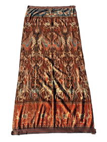
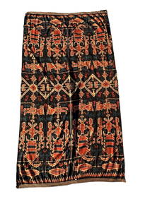
A Fine RARE Antique Woven ikat Pictorial TextilePremier Auction Galleries4.3(329)See Sold PriceMar 09, 2024
Pair of Alpine Black Swallowtail in Framed Showing Its Spring and Summer FormWeatherham Estate Treasures3.9(157)See Sold PriceFeb 29, 2024
Perry, Matthew C. 1856 Large Map. Shah Bay, Lew Chew I. JapanAlbion Auctions4.6(336)See Sold PriceMar 01, 2024
ANTIQUE ILLUSTRATED HANDBOOK OF GEOGRAPHY AND TRAVEL IN ASIA, VOLUME 2, 1896NY Elizabeth 4.3(84)See Sold PriceMar 03, 2024
Henri Plon - Set of 4 topographical prints depicting Asia and JapanProverde Auctions4.3(3)See Sold PriceFeb 28, 2024
Henri Plon - Set of 20 topographical prints depicting Asia - Japan - China - Religious building -Proverde Auctions4.3(3)See Sold PriceFeb 28, 2024
Chinese Clair-de-Lune Censer With Japanese Silver TopLion and Unicorn4.7(1.8k)See Sold PriceMar 12, 2024
L'Art En Chine Et Au Japon, Book by Ernest F. FenellosaLion and Unicorn4.7(1.8k)See Sold PriceMar 12, 2024