ATLAS of ANTIENT GEOGRAPHY by SAMUEL BUTLER 1843John McInnis Auctioneers,LLC4.6(504)See Sold PriceFeb 24, 2024
18TH C. ANTIQUE MAP: FRENCH & INDIAN WAR, FRAMEDThomaston Place Auction Galleries4.4(389)See Sold PriceFeb 24, 2024
Rand McNally Railroad Map Cabinet w/ 21 Railroad MapsRail & Road Auctions4.6(165)See Sold PriceMar 08, 2024
Keith Haring - Ink on New York Map, Best Buddies, Inscribed, Signed, and DatedSapphire Auction Gallery4.1(67)See Sold PriceMar 02, 2024
LATE 17TH C. FRENCH MAP OF THE NEW WORLD BY ALEXIS-HUBERT JAILLOT (1632-1712)Thomaston Place Auction Galleries4.4(389)See Sold PriceFeb 24, 2024
Central Railroad of New Jersey Map of Sandy Hook Route-ca. 1903JM Hobby Supply and Railroad Artifact Auctions4.4(126)See Sold PriceFeb 24, 2024
Lot of Six Mixed Atlas Box Cars-HO Scale-New in BoxJM Hobby Supply and Railroad Artifact Auctions4.4(126)See Sold PriceFeb 25, 2024
Rand McNally/Santa Fe Railroad Map of Iowa-1912JM Hobby Supply and Railroad Artifact Auctions4.4(126)See Sold PriceFeb 24, 2024
NICOLAES VISSCHER (NETHERLANDS, 1618-1709) MAP OF THE NEW WORLDThomaston Place Auction Galleries4.4(389)See Sold PriceFeb 24, 2024
17TH C. WORLD MAP BY NICOLAES VISSCHER (NETHERLANDS, 1618-1709)Thomaston Place Auction Galleries4.4(389)See Sold PriceFeb 24, 2024
Lot of Six Mixed Atlas Cabooses-HO Scale-New in BoxJM Hobby Supply and Railroad Artifact Auctions4.4(126)See Sold PriceFeb 25, 2024
MAP, Netherlands, AllardUtrecht & Amsterdam, Netherlands. Carel Allard, Dominii Ultraiectini Tabula Accuratissima..., 1700 (circa). Hand Color. An attractive map centered on Utrecht and extending to Amsterdam and Amersfoort.See Sold Price
NETHERLANDS & GERMANY - ALLARD, Carel. Foederatum B(Amsterdam, C. Allard, cum pivilegio ordinum Hollandiae & Westfrisiae, ca. 1705). 475 x 820 mm. Engraved map of the Netherlands and a part of Germany, handcoloured, heightened with gold, in two leavesSee Sold Price
MAP, Utrecht & Amsterdam, AllardUtrecht & Amsterdam, Netherlands. Carel Allard, Dominii Ultraiectini Tabula Accuratissima..., 1700 (circa). Hand Color. An attractive map centered on Utrecht and extending to Amsterdam and Amersfoort.See Sold Price
SoldBarclay, James C1835 Pair of Hand Col Maps. NetherlandsHand Colored Copper Engraved Map Published C1835, London for "A Complete and Universal English Dictionary" by the Rev. James Barclay et al. Folds as issued. Paper Size: 11 x 8.5 inch (28 x 22cm) GoodSee Sold Price
SoldGuthrie, William 1790 Antique Map. NetherlandsCopper Engraved Map Published 1790, London for "A New Geographical, Historical and Commercial Grammar..." by William Guthrie. The maps are by John Senex, Thomas Kitchin and others. Folds as issued. EaSee Sold Price
SoldMillar: Antique Map Netherlands Belgium Luxenburg, 1768Title/Content of Map: 1768 Millar Map of Netherlands, Belgium, Luxenburg -- A New and Accurate Map of the Seven United Provinces Imcluding the Dutch Netherlands & e. Date Printed: 1768 Cartographer: GSee Sold Price
SoldLochhead (Pub) 1811 Rare Map. Netherlands Holland"The Severn United Provinces with the Dutch and Austrian Netherlands" Copper Engraved Map Published 1811 by William Lochhead, Berwick for "Modern Geography: And a Compendious General Gazetteer" Rare.See Sold Price
SoldMAP, Netherlands, Van der AaNetherlands. Pieter van der Aa, Le Comte de Hollande, from L'Atlas Soulage, 1714 (circa). Hand Color. Charming map with surprisingly good detail for a small map. Shows roads, cities, and the kavels ofSee Sold Price
SoldEMANUEL BOWEN MAP NETHERLANDSEMANUEL BOWEN British Title: Map of the Netherlands - The Seven United Province Medium: Engraving Size:13 1/2 x 16 3/4 Matted and under glass Frame: 21 x 23 1/2 Estimate 100.00-200.00See Sold Price
SoldBarclay, James 1809 Antique Map. Netherlands & Belgium"The Seven United Provinces, with The Dutch Possessions in Flanders, Brabant and Limburg" Outline Hand Coloured Copper Engraved Map Published 1809, Leeds for "Barclay's Complete and Universal DictionaSee Sold Price
MAP, Netherlands, Braun & HogenbergBrielle, Netherlands. Braun & Hogenberg, Brilium, Holandiae Opp. ob Intestinum Batavicum Bellum, quod Anno Partae Salutis, M.D.LXXII, Calend Aprlis, hic Initium Sumpsit, Famosum, 1575 (circa). Hand CoSee Sold Price
SoldMap, Allard, Kitchin, Lotharingia, Westmoreland(lot of 2) Unframed handcolored engraved map, the larger laid to board: ''Exactissima Lotharingia...,'' after Carel Allard (Dutch, 1648-1709), image: 18.125''w x 21.625''w, overall: 18.25''h x 22.125'See Sold Price
MAP - Netherlands. Braun & HogenbergLeeuwarden & Franeker, Netherlands. Braun & Hogenberg, Lewardum, Occidentalis Frisiae Opp: 1580 [on sheet with] Franicher, Nobiliu Hominum, in Frisia Occidentali, ut Plurimum Saedes, 1581 (circa). HanSee Sold Price
1890s Netherlands map NetherlandsTitle/Content of Map: 1890s Netherlands map Netherlands Date Printed: 1890 Material/Medium: Lithograph Size: 24CM*29CM Provenance: Leipzig Academy of Literature Reserve: $120.00 Shipping: Domestic: FlSee Sold Price
Antique Map : Netherlands - 1802Antique Map : Netherlands - 1802 from Walker's Geography. Size : 10.5" x 8.25"See Sold Price
MAP, Netherlands, Hondius/BertiusSoutheastern Netherlands. Hondius/Bertius, Geldria, from Tabularum Geographicarum Contractarum..., 1616 (published). Hand Color. Lovely miniature map oriented with north to the left and centered approSee Sold Price
Antique Map : Netherlands - 1802Antique Map : Netherlands - 1802 from Walker's Geography. Size : 10.5" x 8.25"See Sold Price
SoldAntique Maps, Netherlands, England, Chinon, EuropeA group of five smaller framed antique maps. Comprised of 1) The United Provinces or Netherlands, H. Moll Geographer, 2) Bowles Post Chase Companion, London to Newmarket, etc. Published 1782, 3) ChinoSee Sold Price
5 Maps: Netherlands, late 1759-60 to [1850.][Netherlands] 5 Maps. ++ Guthrie. THE SEVEN UNITED PROVINCES…FROM THE BEST AUTHORITIES. London: C. Dilly & G. Robinson, 1785. 11 ¾ x 13 7/8 in., hand-colored in outline. Two old tape repairs, foldSee Sold Price
SoldAllard Map of America with California as Island, 1697Map: Allard Map of America with California as Island - Recentissima Novi Orbis sive Americae Septentrionalis et Meridionalis Tabula Cartographer: C. Allard Date: ca. 1697 Size: 19 x 22.5 inches Nice lSee Sold Price
Seutter: Antique Map of the Netherlands, 1740Title/Content of Map: Netherlands (called Belgium on Map) with magnificent cartouche and insert showing posessions Dutch in Eastern Asia Date Printed: c1740 Cartographer: Matthaus Seutter Material/MedSee Sold Price
SoldNetherlands Zealand islandsTitle/Content of Map: Netherlands Zealand islands Date: 1576-1590. Cartographer: By Porcacchi Material/Medium: Copper plate engraved Size: 8x12”. Provenance: Republic of Venice With decorative titleSee Sold Price
Hall: Antique Map of the Netherlands, 1856TITLE/CONTENT OF MAP: 'Netherlands, now divided into Holland and Belgium' Benelux DATE PRINTED: 1856 IMAGE SIZE: Approx 40.0 x 28.5cm, 15.75 x 11.25 inches (Large) TYPE: Antique atlas map with originaSee Sold Price
17TH C. WORLD MAP BY NICOLAES VISSCHER (NETHERLANDS, 1618-1709)Thomaston Place Auction Galleries4.4(389)See Sold PriceFeb 24, 2024
NICOLAES VISSCHER (NETHERLANDS, 1618-1709) MAP OF THE NEW WORLDThomaston Place Auction Galleries4.4(389)See Sold PriceFeb 24, 2024
WILLEM JANSZOON BLAEU (NETHERLANDS, 1571-1638) MAP OF UMBRIAThomaston Place Auction Galleries4.4(389)See Sold PriceFeb 24, 2024
1722 POMPONII MELA De Situ Orbis ARMORIAL VELLUM BINDING antiqueJasper524.5(9.8k)See Sold PriceFeb 27, 2024
1749-59 21 volumes NETHERLANDS HISTORY ILLUSTRATED antique VELLUM BOUNDJasper524.5(9.8k)See Sold PriceFeb 27, 2024
Hubert Kornelisz (1689 - 1733) - Set of 2 Allegorical Copperplate Engravings, NetherlandsProverde Auctions4.3(3)See Sold PriceFeb 28, 2024
Hubert Kornelisz (1689 - 1733) - Set of 2 Allegorical Copperplate Engravings, NetherlandsProverde Auctions4.3(3)See Sold PriceFeb 28, 2024
Jan Goeree (1670-1731) - Set of 2 Italian Engravings of Roman ScenesProverde Auctions4.3(3)See Sold PriceFeb 28, 2024
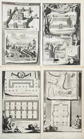
Jan Goeree (1670-1731) - Set av 4 Architecture Engravings - Church of Saint Pudentiana - AProverde Auctions4.3(3)See Sold PriceFeb 28, 2024
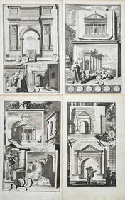
Jan Goeree (1670-1731) - Set av 4 Architecture Engravings - A Reconstruction of the Arch of DomitianProverde Auctions4.3(3)See Sold PriceFeb 28, 2024
Antoine Augustin Calmet (1672-1757) - Set of 6 Architecture Engraving - Temple of Jerusalem -Proverde Auctions4.3(3)See Sold PriceFeb 28, 2024
Set of 4 Maps - Netherlands - Seven United Provinces - Germany - Sweden, Denmark, Norway, FinlandProverde Auctions4.3(3)See Sold PriceFeb 28, 2024
Set of 3 Maps - Netherlands - Belgien - Switzerland - J. BarlowProverde Auctions4.3(3)See Sold PriceFeb 28, 2024
Map of the United Provinces of the Netherlands, 1798 PrintAntiques Online Auctions4.6(410)See Sold PriceMar 14, 2024


![5 Maps: Netherlands, late 1759-60 to [1850.] (1 of 3)](https://p1.liveauctioneers.com/179/85723/44107981_1_x.jpg?height=282&quality=70&version=1456876561)