SoldMAP: Johnsons, Michigan and Wisconsin, c. 1861Maps“Johnson’s Michigan and Wisconsin” Map c. 1861, “Johnson’s Michigan and Wisconsin,” published by Johnson & Browning, Very Fine. From the Johnson’s FamilySee Sold Price
SoldMAP: Johnsons, Michigan and Wisconsin, c. 1861Historic Maps“Johnson’s Michigan and Wisconsin” Map c. 1861, “Johnson’s Michigan and Wisconsin,” published by Johnson & Browning, Very Fine. From the Johnson’See Sold Price
Sold1861 Michigan & Wisconsin By JohnsonTitle: 1861 Michigan & Wisconsin By Johnson Date/Period: 1861 Materials: Steel engraved. Size: 26x18” 1861. By A. J. Johnson & J. H Colton. From "Johnson's New Illustrated Family Atlas' published inSee Sold Price
1861 Michigan & Wisconsin By JohnsonTitle: 1861 Michigan & Wisconsin By Johnson Date/Period: 1861 Materials: Steel engraved. Size: 26x18” 1861. By A. J. Johnson & J. H Colton. From "Johnson's New Illustrated Family Atlas' published inSee Sold Price
1861 Michigan & Wisconsin By JohnsonTitle: 1861 Michigan & Wisconsin By Johnson Date/Period: 1861 Materials: Steel engraved. Size: 26x18” 1861. By A. J. Johnson & J. H Colton. From "Johnson's New Illustrated Family Atlas' published inSee Sold Price
1861 Michigan & Wisconsin By JohnsonTitle: 1861 Michigan & Wisconsin By Johnson Date/Period: 1861 Materials: Steel engraved. Size: 26x18” 1861. By A. J. Johnson & J. H Colton. From "Johnson's New Illustrated Family Atlas' published inSee Sold Price
1861 Michigan & Wisconsin By JohnsonTitle: 1861 Michigan & Wisconsin By Johnson Date/Period: 1861 Materials: Steel engraved. Size: 26x18” 1861. By A. J. Johnson & J. H Colton. From "Johnson's New Illustrated Family Atlas' published inSee Sold Price
1861 Michigan & Wisconsin By JohnsonTitle: 1861 Michigan & Wisconsin By Johnson Date/Period: 1861 Materials: Steel engraved. Size: 26x18” 1861. By A. J. Johnson & J. H Colton. From "Johnson's New Illustrated Family Atlas' published inSee Sold Price
SoldA.J. JOHNSON, YOUNG & DELLEKER MAPS, WI & MIA. J. JOHNSON (19TH C.) AND YOUNG & DELLEKER, ATLAS MAPS, TWO, 17" X 22", WISCONSIN & MICHIGAN:Including 1 Johnson's map of Wisconsin and Michigan, 17 1/2" x 26", and 1 Michigan Territory map by YoungSee Sold Price
Michigan & Wisconsin By JohnsonTitle: Michigan & Wisconsin By Johnson Date/Period: 1861 Materials: Steel engraved. Size: 26x18” 1861. By A. J. Johnson & J. H Colton. From "Johnson's New Illustrated Family Atlas' published in NewSee Sold Price
Michigan & Wisconsin By JohnsonTitle: Michigan & Wisconsin By Johnson Date/Period: 1861 Materials: Steel engraved. Size: 26x18” 1861. By A. J. Johnson & J. H Colton. From "Johnson's New Illustrated Family Atlas' published in NewSee Sold Price
Michigan & Wisconsin By JohnsonTitle: Michigan & Wisconsin By Johnson Date/Period: 1861 Materials: Steel engraved. Size: 26x18” 1861. By A. J. Johnson & J. H Colton. From "Johnson's New Illustrated Family Atlas' published in NewSee Sold Price
SoldMAP: Johnsons, Maine, c. 1861Historic Maps"Johnson's Maine" Published Circa 1861 c. 1861, "Johnson's Maine," published by Johnson and Ward, New York, Choice Extremely Fine. From the Johnson's Family Atlas, measuring 16" x 13.5,"See Sold Price
SoldMAP: Johnsons, Maine, c. 1861Historic Maps"Johnson's Maine" Published Circa 1861 c. 1861, "Johnson's Maine," published by Johnson and Ward, New York, Choice Extremely Fine. From the Johnson's Family AtSee Sold Price
SoldMAP: Johnsons, Maine, c. 1861Historic Maps“Johnson’s Maine” Published Circa 1861 c. 1861, “Johnson’s Maine,” published by Johnson and Ward, New York, Choice Extremely Fine. From the Johnson&rsqSee Sold Price
SoldMAP: Johnsons, Maine, c. 1861Historic Maps"Johnson's Maine" Published Circa 1861 c. 1861, "Johnson's Maine," published by Johnson and Ward, New York, Choice Extremely Fine. From the Johnson's Family AtSee Sold Price
SoldMAP: Johnsons, Maine, c. 1861Maps“Johnson’s Maine” Published Circa 1861 c. 1861, “Johnson’s Maine,” published by Johnson and Ward, New York, Choice Extremely Fine. From the Johnson’s FamiSee Sold Price
SoldMAP: Johnsons Mexico, c. 1861Maps“Johnson’s Mexico” North of Texas is “Indian Territory” c. 1861, “Johnson’s Mexico,” published by Johnson and Ward, New York, Choice Extremely Fine.See Sold Price
SoldMAP: Johnsons, Maine, c. 1861Historic Maps"Johnson's Maine" Published Circa 1861 c. 1861, "Johnson's Maine," published by Johnson and Ward, New York, Choice Extremely Fine. From the Johnson's Family AtSee Sold Price
SoldMAP: Johnsons, Maine, c. 1861Historic Maps"Johnson's Maine" Published Circa 1861 c. 1861, "Johnson's Maine," published by Johnson and Ward, New York, Choice Extremely Fine. From the Johnson's Family AtSee Sold Price
SoldMAP: Johnsons, Maine, c. 1861Historic Maps"Johnson's Maine" Published Circa 1861 c. 1861, "Johnson's Maine," published by Johnson and Ward, New York, Choice Extremely Fine. From the Johnson's Family AtSee Sold Price
SoldMAP: Johnsons New Jersey, c. 1861Maps“Johnson’s New Jersey” c. 1861, “Johnson’s New Jersey,” published by Johnson & Browning, Choice Extremely Fine. From the Johnson’s Family Atlas, measuringSee Sold Price
SoldMAP: Johnsons New Jersey, c. 1861Historic Maps"Johnson's New Jersey" c. 1861, "Johnson's New Jersey," published by Johnson & Browning, Choice Extremely Fine. From the Johnson's Family Atlas, measuring 16" x 12.75," this map is hand-cSee Sold Price
SoldMAP: Johnsons New Jersey, c. 1861Historic Mapsc. 1861 "Johnson's New Jersey" Map c. 1861, "Johnson's New Jersey," published by Johnson & Browning, Choice Extremely Fine. From the Johnson's Family Atlas, meSee Sold Price
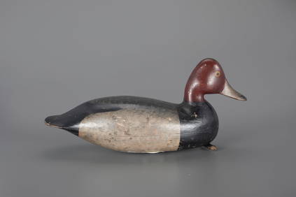
JEB Rig Redhead Drake Decoy by Harry V. Shourds (1861-1920)Copley Fine Art Auctions4.5(40)See Sold PriceFeb 24, 2024
The O'Brien Shourds Winter-Plumage Plover Decoy by Harry V. Shourds (1861-1920)Copley Fine Art Auctions4.5(40)See Sold PriceFeb 24, 2024
LATE 17TH C. FRENCH MAP OF THE NEW WORLD BY ALEXIS-HUBERT JAILLOT (1632-1712)Thomaston Place Auction Galleries4.4(386)See Sold PriceFeb 24, 2024
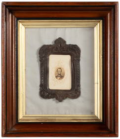
EARLY 18TH C. MAP OF ITALY, FRAMEDThomaston Place Auction Galleries4.4(386)See Sold PriceFeb 24, 2024
LATE 16TH C. MAP OF SCOTLAND BY MERCATOR, FRAMEDThomaston Place Auction Galleries4.4(386)See Sold PriceFeb 24, 2024
17TH C. MAP OF THE BERKSHIRES BY JOHN SPEED, FRAMEDThomaston Place Auction Galleries4.4(386)See Sold PriceFeb 24, 2024
18TH C. ANTIQUE MAP: FRENCH & INDIAN WAR, FRAMEDThomaston Place Auction Galleries4.4(386)See Sold PriceFeb 24, 2024
AN IMPERIAL YELLOW-GROUND GAUZE TWELVE-SYMBOL 'DRAGON' ROBE, JIFU, MOST LIKELY MADE FOR THE EMPRESSGalerie Zacke 4.4(50)See Sold PriceMar 01, 2024
African American History, Civil War Plantation SlavesConnoisseur Auctions4(333)See Sold PriceMar 02, 2024
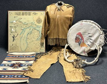
Antique Native American 5 Piece Lot: Deerskin Jacket & Pants, Rug, Drum, Michigan Map & Mule DeerHoller and Hammer4.5(47)See Sold PriceFeb 24, 2024
Johann Homann Hand-Colored Map Engraving, c. 1730Auctions at Showplace4.5(726)See Sold PriceMar 17, 2024
Utagawa Kuniyoshi (Japanese, 1797-1861) Woodblock Print Mid 19th C., "Man Holding Fan"DuMouchelles4.6(825)See Sold PriceMar 15, 2024


![[Ambrotype] Iconic, Published Portrait (1 of 1)](https://p1.liveauctioneers.com/7226/317626/170485470_1_x.jpg?height=282&quality=70&version=1706368022)