ATLAS of ANTIENT GEOGRAPHY by SAMUEL BUTLER 1843John McInnis Auctioneers,LLC4.6(502)See Sold PriceFeb 24, 2024
18TH C. ANTIQUE MAP: FRENCH & INDIAN WAR, FRAMEDThomaston Place Auction Galleries4.4(386)See Sold PriceFeb 24, 2024
Rand McNally Railroad Map Cabinet w/ 21 Railroad MapsRail & Road Auctions4.6(165)See Sold PriceMar 08, 2024
Keith Haring - Ink on New York Map, Best Buddies, Inscribed, Signed, and DatedSapphire Auction Gallery4(67)See Sold PriceMar 02, 2024
LATE 17TH C. FRENCH MAP OF THE NEW WORLD BY ALEXIS-HUBERT JAILLOT (1632-1712)Thomaston Place Auction Galleries4.4(386)See Sold PriceFeb 24, 2024
Central Railroad of New Jersey Map of Sandy Hook Route-ca. 1903JM Hobby Supply and Railroad Artifact Auctions4.4(126)See Sold PriceFeb 24, 2024
Lot of Six Mixed Atlas Box Cars-HO Scale-New in BoxJM Hobby Supply and Railroad Artifact Auctions4.4(126)See Sold PriceFeb 25, 2024
Rand McNally/Santa Fe Railroad Map of Iowa-1912JM Hobby Supply and Railroad Artifact Auctions4.4(126)See Sold PriceFeb 24, 2024
NICOLAES VISSCHER (NETHERLANDS, 1618-1709) MAP OF THE NEW WORLDThomaston Place Auction Galleries4.4(386)See Sold PriceFeb 24, 2024
17TH C. WORLD MAP BY NICOLAES VISSCHER (NETHERLANDS, 1618-1709)Thomaston Place Auction Galleries4.4(386)See Sold PriceFeb 24, 2024
Lot of Six Mixed Atlas Cabooses-HO Scale-New in BoxJM Hobby Supply and Railroad Artifact Auctions4.4(126)See Sold PriceFeb 25, 2024
MAP - Gulf of Mexico & Caribbean. BrueGulf of Mexico & Caribbean. Adrien Hubert Brue, Carte des Iles Antilles ou Indes Occidentales, du Golfe du Mexique et d'une Partie des Pays Adjacents, 1825 (dated). Hand Color. The beautifully engraveSee Sold Price
Robiquet: Antique Map Gulf of Mexico & Caribbean, 1853Title: Carte Generale des Iles Antilles et du Golfe du Mexique Dressee d'Apres les Travaux Anglais et Espagnols. Large French sea chart of the Gulf of Mexico and Caribbean, centered on Cuba Map maker:See Sold Price
Soldmap, Gulf of Mexico, CaribbeanFramed engraved map, ''Carte du Golfe de Mexique et des Isles & Pays Contigus,'' 19th century, sight: 7.5''h x 11.75''w, overall: 19.25''h x 23.25''wSee Sold Price
MAP - Gulf of Mexico & Caribbean. BlaeuGulf of Mexico & Caribbean. Willem Blaeu, Insulae Americanae in Oceano Septentrionali, cum Terris Adiacentibus, 1642 (circa). Hand Color. This fine map centered on the West Indies reflects the firsthaSee Sold Price
MAP - Gulf of Mexico & Caribbean. OttensGulf of Mexico & Caribbean. Reiner and Joshua Ottens, Insulae Americanae Nempe: Cuba, Hispaniola. Jamaica. Pto Rico. Lucania. Antillae Vulgo Caribae. Barlo-Et Sotto-Vento. Etc., 1730 (circa). Hand ColSee Sold Price
SoldMAP, Gulf of Mexico & Caribbean, JanssonGulf of Mexico & Caribbean. Jan Jansson, Insulae Americanae in Oceano Septentrionali, cum Terris Adiacentibus, 1644 (circa). Hand Color. This handsome map focuses on the West Indies and covers the regSee Sold Price
MAP, Gulf of Mexico & Caribbean, VisscherGulf of Mexico & Caribbean. Nicolas Visscher, Insulae Americanae in Oceano Septentrionali ac Regiones Adiacentes, a C. de May usque ad Lineam Aequinoctialem, 1708 (circa). Hand Color. This handsome maSee Sold Price
MAP - Gulf of Mexico & Caribbean. De BryGulf of Mexico & Caribbean. Theodore de Bry, Occidentalis Americae Partis, vel, Earum Regionum quas Christophorus Columbus Primu Detexit Tabula Chorographicae Multorum Auctorum Scriptis..., 1594 (dateSee Sold Price
MAP - Gulf of Mexico & Caribbean. BellinGulf of Mexico & Caribbean. Jacques Nicolas Bellin, Carte Reduite du Golphe du Mexique et des Isles de l'Amerique. Dressee au Depost des Cartes et Plans de la Marine pour le Service des Vaisseaux du RSee Sold Price
SoldMAP, Gulf of Mexico & Caribbean, BellinGulf of Mexico & Caribbean. Jacques Nicolas Bellin, Carte du Golphe du Mexique et des Isles de l'Amerique. Pour Servir a l'Histoire Generale des Voyages, from Prevost's Histoire Generale des Voyages,See Sold Price
SoldMAP, Gulf of Mexico & Caribbean, OrteliusGulf of Mexico & Caribbean. Abraham Ortelius, Culiacanae, Americae Regionis, Descriptio [on sheet with] Hispaniolae, Cubae, Aliarumque Insularum Circumiacientium, Delineatio, from Theatrum Orbis TerraSee Sold Price
SoldElwe: Antique Map of Gulf of Mexico & Caribbean, 1792Map: De Golf van Mexico, de Eilanden en het omleggende Land Cartographer: J. B. Elwe Place & Date: Amsterdam / 1792 Size: 22 3/4" x 19" Condition: Wash and outline color; light overall age toning, minSee Sold Price
SoldBellin: Antique Map of Gulf of Mexico & Caribbean, 1749Map: Carte Reduite du Golphe du Mexique et des Isles de l'Amerique Cartographer: Bellin Place & Date: Paris / 1749 Size: 32 1/4" x 21 1/8" Condition: outline color (cartouche uncolored); water stainsSee Sold Price
de Fer: Antique Map of Gulf of Mexico & Caribbean, 1717Title/Content of Map: "Le Golfe de Mexique, et les Provinces et Isles qui l'Environe comme sont la Floride au Nord, le Mexique ou Nouvelle Espagne a l'Ouest, la Terre-Ferme au Sud, les Is. Antilles, LSee Sold Price
SoldBellin: Antique Map of Gulf of Mexico / Caribbean, 1757Map: Carte du Golphe de Mexique et des Isles de l'Amerique Cartographer: Jacques Bellin Place & Date: Paris / 1757 Size: 15" x 10 3/4" Condition: outline color; washed; some nicks and splits in edgesSee Sold Price
Map of Gulf of Mexico and Caribbean showing Texas, 1874S. Augustus Mitchell map of the southern portion of the United States showing the area from North Carolina and Florida in the east to New Mexico in the West. West Indies, Cuba, Jamaica, Haiti and DomiSee Sold Price
SoldAntique French Buache map of the Carribean and GulfAntique French JN Buache map of the Gulf of Mexico, Caribbean, Antilles and West Indies. Sight size 19 3/4"h x 36 3/4" w Framed size 28"h x 45"wSee Sold Price
SoldM. RIZZI ZANNONI (18TH CENTURY) MAP OF THE GULF OFM. RIZZI ZANNONI (18TH CENTURY) MAP OF THE GULF OF MEXICO, CARIBBEAN, AND PARTS OF CENTRAL AMERICA, hand-colored engraving on paper, titled "Carte Geo-Hydrographique du Golfe de Mexico Et Des Ses IsleSee Sold Price
West Indies.- Goos (Pieter) Pascaerte van Westindien deWest Indies.- Goos (Pieter) Pascaerte van Westindien de Vaste Kusten en de Eylanden, map of the Gulf of Mexico and Caribbean, based on Hessel Gerritsz' map of from 1631, with inset map of the northernSee Sold Price
SoldCarte du Golfe du Mexique et des Isles de l'Amerique'TITLE/CONTENT OF MAP: 'Carte du Golfe du Mexique et des Isles de l'Amerique [Map of the Gulf of Mexico and the Caribbean islands]' DATE PRINTED: 1754 IMAGE SIZE: Approx 28.5 x 39.0cm, 11.25 x 15.5 incSee Sold Price
Carte du Golfe du Mexique et des Isles de l'Amerique'.TITLE/CONTENT OF MAP: 'Carte du Golfe du Mexique et des Isles de l'Amerique [Map of the Gulf of Mexico and the Caribbean islands]' The West Indies, Central America, and the Gulf of Mexico. The routesSee Sold Price
SoldBellin map of Caribbean & Gulf of Mexico 1754Title: Karte von dem Mexicanishen Meerbusen und dem Inseln von America Author: Bellin, Jacques Nicolas Description: Copper-engraved map, hand-colored in outline (later). 27x37.4 cm. (10½x14¾"), mattSee Sold Price
West Indies With The Gulf of Mexico and Caribbean SeaTitle/Content of Map: West Indies With The Gulf of Mexico and Caribbean Sea Date: 1892-06-01 Cartographer: CLOVER, RICHARDSON Publisher: HYDROGRAPHIC OFFICE, BUREAU OF NAVIGATION, NAVY DEPARTMENT SizeSee Sold Price
West Indies With The Gulf of Mexico and Caribbean SeaTitle/Content of Map: West Indies With The Gulf of Mexico and Caribbean Sea Date: 1892-06-01 Cartographer: CLOVER, RICHARDSON Publisher: HYDROGRAPHIC OFFICE, BUREAU OF NAVIGATION, NAVY DEPARTMENT SizeSee Sold Price
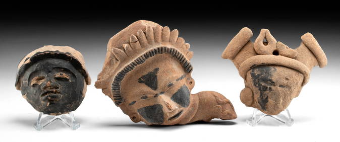
VERACRUZ CULTURE, GULF COAST MEXICO, C. 550-950 AD, FLUTEThomaston Place Auction Galleries4.4(386)See Sold PriceFeb 24, 2024
Map of Mexico, Central America, New Grenada, Venzuela and the West IndiesJasper524.5(9.8k)See Sold PriceFeb 27, 2024
New and Correct Map of North America With the West India Islands,Jasper524.5(9.8k)See Sold PriceFeb 27, 2024
Mexico, Central America and West Indies Physical PoliticalJasper524.5(9.8k)See Sold PriceFeb 27, 2024


![Untitled. [Eastern U.S., Gulf of Mexico and Caribbean] (1 of 5)](https://p1.liveauctioneers.com/5584/319958/171812128_1_x.jpg?height=282&quality=70&version=1708466739)