ATLAS of ANTIENT GEOGRAPHY by SAMUEL BUTLER 1843John McInnis Auctioneers,LLC4.6(502)See Sold PriceFeb 24, 2024
18TH C. ANTIQUE MAP: FRENCH & INDIAN WAR, FRAMEDThomaston Place Auction Galleries4.4(386)See Sold PriceFeb 24, 2024
Rand McNally Railroad Map Cabinet w/ 21 Railroad MapsRail & Road Auctions4.6(165)See Sold PriceMar 08, 2024
Keith Haring - Ink on New York Map, Best Buddies, Inscribed, Signed, and DatedSapphire Auction Gallery4(67)See Sold PriceMar 02, 2024
LATE 17TH C. FRENCH MAP OF THE NEW WORLD BY ALEXIS-HUBERT JAILLOT (1632-1712)Thomaston Place Auction Galleries4.4(386)See Sold PriceFeb 24, 2024
Central Railroad of New Jersey Map of Sandy Hook Route-ca. 1903JM Hobby Supply and Railroad Artifact Auctions4.4(126)See Sold PriceFeb 24, 2024
Lot of Six Mixed Atlas Box Cars-HO Scale-New in BoxJM Hobby Supply and Railroad Artifact Auctions4.4(126)See Sold PriceFeb 25, 2024
Rand McNally/Santa Fe Railroad Map of Iowa-1912JM Hobby Supply and Railroad Artifact Auctions4.4(126)See Sold PriceFeb 24, 2024
NICOLAES VISSCHER (NETHERLANDS, 1618-1709) MAP OF THE NEW WORLDThomaston Place Auction Galleries4.4(386)See Sold PriceFeb 24, 2024
17TH C. WORLD MAP BY NICOLAES VISSCHER (NETHERLANDS, 1618-1709)Thomaston Place Auction Galleries4.4(386)See Sold PriceFeb 24, 2024
Lot of Six Mixed Atlas Cabooses-HO Scale-New in BoxJM Hobby Supply and Railroad Artifact Auctions4.4(126)See Sold PriceFeb 25, 2024
Sold3 pieces. Engraved Maps & Plans - Egypt: [Mercato3 pieces. Engraved Maps & Plans - Egypt: [Mercator/Hondius/Jansson Atlas?] Africae, Egyptum Inferiorem Exhibens." Ca. 1730. Partly hand-colored engraving. 9 3/4 x 14 1/2 inches (247 x 368 mm), wide maSee Sold Price
SoldTwo engraved and hand-colored maps of Egypt1) J. Jansson; "Aegypti Recentior Descriptio …" (Amsterdam: 1666) about 16 X 20 in., p.m.; 2) J. Blaeu, "Nova Aegypti Tabula" circa 1670, about 17 1/4 X 20 1/2 in., p.m.; Property from the Hans GoedSee Sold Price
SoldMAP, Holy Land, Cluver/JanssonHoly Land. Cluver/Jansson, Palaestinae sive Totius Terrae Promissionis, 1661 (circa). Black & White. A charming small map that covers the region from Egypt to Sidon illustrating the Exodus and the wanSee Sold Price
SoldMajorca, Minorca, & Ibiza Islands Map, Jansson, 1650Insulae Balearides et Pytiusae. Jansson's edition of Blaeu's beautiful map of the islands of Majorca, Minorca, and Ibiza, including the coasts of Catalonia and Valencia. As in Blaeu's version, sea monSee Sold Price
SoldTallis, John (Pub) 1852 Map. Egypt and Arabia PetraeaSteel Engraved Map with Original Outline Hand Color Published 1852-56 by John Tallis, London for "The Universal Pronouncing Dictionary" by Thomas Wright. Drawn & Engraved by John Rapkin. Centre fold aSee Sold Price
SoldLochhead (Pub) 1811 Rare Map. EgyptCopper Engraved Map Published 1811 by William Lochhead, Berwick for "Modern Geography: And a Compendious General Gazetteer" Rare. Folds as issued. Paper Size: 11 x 8.5 inch (28 x 22cm) Good ConditionSee Sold Price
Sold(MAP) JANSSON, JAN. Buckingamiae Comitatus cum(MAP) JANSSON, JAN Buckingamiae Comitatus cum Bedfordiensi; vulgo Buckingamshire and Bedfordshire. Amsterdam, ca. 1645. Double-page engraved map hand-colored in outline. With decorative cartouche andSee Sold Price
SoldEarly Map Egypt Nubia AfricaDe l'Egipte. Antique map by Clouet, Paris, 1730. Egypt, Nubia, Abyssinia, Middle East, Asia. . 16" x 24.See Sold Price
Sold(MAP) JANSSON, JAN. Principatus Walliae Pars Borealis(MAP) JANSSON, JAN Principatus Walliae Pars Borealis Vulgo North Wales. Amsterdam, ca. 1650. Double-page engraved map with later hand-coloring. Depicting North and South Wales, decorative cartouches aSee Sold Price
SoldAntique Map : Egypt & Palestine - 1860'sAntique Map : Egypt & Palestine - 1860's by Henrico Kiepert from Atlas Antiquus. Hand-Tinted. Size : 18" x 14.25"See Sold Price
SoldMAP, Egypt, DornEgypt. Sebastian Dorn, Egypten nach dem Zustand der Alten Zeit Vorgestellt, 1746 (circa). Black & White. This uncommon and richly detailed map of Egypt features hundreds of place names along the Nile.See Sold Price
Sold1 piece. Hand Colored Engraved Map. Jansson, Jan1 piece. Hand Colored Engraved Map. Jansson, Jan. "Tabula Italia." Amsterdam, 1640. 18 x 21 1/4 inches; 457 x 540 mm. Margins repaired, small vertical tear at upper right edge. Vignette borders.See Sold Price
SoldAntique map Jansson GermanUnframed antique map, ''Radnoriensis/The Countie of Radnor'', by Johannes (Janssonius) Jansson (German, 1596-1666), sheet: 18.5''h x 23.25''wSee Sold Price
Sold1700's 1800's Map Egypt Mediterranian Nile1700's or 1800's map of Egypt, Mediterranian and Nile. Measures 18" x 24" framed. Excllent condition and hand colored. Plate #TXXi.See Sold Price
Sold1 piece. Hand-Colored Engraved Map. Jansson, Jan.1 piece. Hand-Colored Engraved Map. Jansson, Jan. Mar del Nort." [Amsterdam], [ca. 1650.] 17 1/4 x 22 3/8 inches; 438 x 568 mm, narrow margins. Browned & mounted to bd. Orig. color. Framed. The NorthSee Sold Price
SoldAntique Map Egypt Covens MortierUnframed hand-colored engraved map, L'Egypte de la Nubie, de d'Abissinie, par Guillaume de l'Isle, published by Jean Covens and Corneille Mortier, sheet: 21.5''h x 26.25''wSee Sold Price
SoldMap, Jansson, Jan, Genova, Amsterdam, c.1635MAP. Author: Jansson, Jan, Riviera di Genova di Ponente, Amsterdam, c.1635, Copper-engraved map, hand-colored. 38.2x49 cm. (15x19¼"). The Italian Riviera from Genoa in the west to the Gulf of Spezz iSee Sold Price
Map. Egypt and Palestine. 1829.Print from steel engraving titled „IV. Aegyptus et Palestina“.From Schul-Atlas der alten Welt. Published by Gotha Perthes. 1829.Orbis Terrarum Antiquus. School Atlas of the Ancient World edited bySee Sold Price
SoldUKRAINIAN MAP. JANSSON, JAN. 1588-1664. [after] Typus Generalis Ukrainae, sive Palatinatuum Podo...UKRAINIAN MAP. JANSSON, JAN. 1588-1664. [after] Typus Generalis Ukrainae, sive Palatinatuum Podoliae, Kioviensis et Braczlaviensis terras nova delineationie exhibens. Engraved map, framed. Toning, bucSee Sold Price
SoldAncient World.- Roman road map.- Jansson (Jan) TabulaAncient World.- Roman road map.- Jansson (Jan) Tabula Itineraria ex Illustri Peutingerorum Bibliotheca..., four sheet strip map of the Peutinger Table, or a Roman road map of the world, showing the imSee Sold Price
(MAP) JANSSON, JAN. Hungaria Regnum. Amsterdam, ca.(MAP) JANSSON, JAN Hungaria Regnum. Amsterdam, ca. 1650. Engraved map of Hungary with later hand coloring, vignette title with allegorical figures to lower left. Latin text to verso. Framed and mattedSee Sold Price
Sold(MAP) JANSSON, JOANNES. A group of two maps of(MAP) JANSSON, JOANNES Two maps of Flanders, comprising Flandriae pars Occidentalis [and] Flandria Nova Descriptio. Amsterdam, circa 1680. Framed and matted. 23 x 27 inches each. Property fromSee Sold Price
Sold(MAP) JANSSON, JAN. Regni Daniae Accuratissima delineat(MAP) JANSSON, JAN Regni Daniae accuratissima delineatio. Amsterdam, 1655. Engraved map with hand-coloring, with two engraved cartouches and one armorial. Framed and matted. [Together with:] GlamorganSee Sold Price
Sold[Map] Jansson, "Picardia Vera et Inferior"(Amsterdam: c. 1650) engraving with old outlining and colored cartouches, about 15 1/2 x 21 1/4 in., framedSee Sold Price
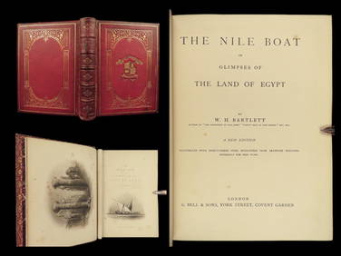
1880 Niles Boat Egypt Voyages Sphinx Pyramids Valley of Kings Illustrated MAPSSchilb Antiquarian Rare Books4.8(421)See Sold PriceMar 31, 2024
NORTH AFRICA OF BABRBARY V Parts of Tripoli & Egypt. Libya Tribes. SDUK 1846 mapJasper524.5(9.8k)See Sold PriceFeb 28, 2024
NORTH AFRICA BARBARY. Parts of Tripoli (Libya) & Egypt. Tribes. SDUK 1844 mapJasper524.5(9.8k)See Sold PriceFeb 28, 2024
NORTH AFRICA BARBARY. Parts of Tripoli (Libya) & Egypt. Tribes. SDUK 1844 mapJasper524.5(9.8k)See Sold PriceFeb 28, 2024
NORTH AFRICA. Morocco Algeria Tunis Tunisia Egypt. Cairo. BARTHOLOMEW 1912 mapJasper524.5(9.8k)See Sold PriceFeb 28, 2024
NORTH AFRICA. Morocco Algeria Tunis Tunisia Egypt. Cairo. BARTHOLOMEW 1901 mapJasper524.5(9.8k)See Sold PriceFeb 28, 2024
NORTH AFRICA. Barbary. Morocco Tunisia Libya Egypt. 'Barbarie'. MALLET 1683 mapJasper524.5(9.8k)See Sold PriceFeb 28, 2024
NORTH AFRICA BARBARY. Parts of Tripoli (Libya) & Egypt. Tribes. SDUK 1848 mapJasper524.5(9.8k)See Sold PriceFeb 28, 2024
NUBIA. 'Nubie'. Nile Valley. Sudan Ethiopia Egypt. MALLET 1683 old antique mapJasper524.5(9.8k)See Sold PriceFeb 28, 2024
Egypte, Nubie et Abissinie. Egypt, Nubia & Abyssinia. Sudan. BONNE 1788 mapJasper524.5(9.8k)See Sold PriceFeb 28, 2024


![UKRAINIAN MAP. JANSSON, JAN. 1588-1664. [after] Typus Generalis Ukrainae, sive Palatinatuum Podo... (1 of 2)](https://p1.liveauctioneers.com/1043/315399/169913859_1_x.jpg?height=282&quality=70&version=1706001851)


![[Map] Jansson, "Picardia Vera et Inferior" (1 of 3)](https://p1.liveauctioneers.com/523/48656/22613832_1_x.jpg?height=282&quality=70&version=1386104939)