ATLAS of ANTIENT GEOGRAPHY by SAMUEL BUTLER 1843John McInnis Auctioneers,LLC4.6(502)See Sold PriceFeb 24, 2024
18TH C. ANTIQUE MAP: FRENCH & INDIAN WAR, FRAMEDThomaston Place Auction Galleries4.4(386)See Sold PriceFeb 24, 2024
Rand McNally Railroad Map Cabinet w/ 21 Railroad MapsRail & Road Auctions4.6(165)See Sold PriceMar 08, 2024
Keith Haring - Ink on New York Map, Best Buddies, Inscribed, Signed, and DatedSapphire Auction GallerySee Sold PriceMar 02, 2024
LATE 17TH C. FRENCH MAP OF THE NEW WORLD BY ALEXIS-HUBERT JAILLOT (1632-1712)Thomaston Place Auction Galleries4.4(386)See Sold PriceFeb 24, 2024
Central Railroad of New Jersey Map of Sandy Hook Route-ca. 1903JM Hobby Supply and Railroad Artifact Auctions4.4(126)See Sold PriceFeb 24, 2024
Lot of Six Mixed Atlas Box Cars-HO Scale-New in BoxJM Hobby Supply and Railroad Artifact Auctions4.4(126)See Sold PriceFeb 25, 2024
Rand McNally/Santa Fe Railroad Map of Iowa-1912JM Hobby Supply and Railroad Artifact Auctions4.4(126)See Sold PriceFeb 24, 2024
NICOLAES VISSCHER (NETHERLANDS, 1618-1709) MAP OF THE NEW WORLDThomaston Place Auction Galleries4.4(386)See Sold PriceFeb 24, 2024
17TH C. WORLD MAP BY NICOLAES VISSCHER (NETHERLANDS, 1618-1709)Thomaston Place Auction Galleries4.4(386)See Sold PriceFeb 24, 2024
Lot of Six Mixed Atlas Cabooses-HO Scale-New in BoxJM Hobby Supply and Railroad Artifact Auctions4.4(126)See Sold PriceFeb 25, 2024
SoldMap, businesses of Westchester, New York, 1860sMap, businesses of Westchester, New York, 1860s, Towns of Harrison and Rye, Westchester County, N.Y., showing also Portchester, marked with names of businesses, no date, but Presbyterian Clergyman ChaSee Sold Price
SoldNEW CENTURY ATLAS STATE OF NEW YORK, 1911 LARGE BONEW CENTURY ATLAS STATE OF NEW YORK, 1911 LARGE BOOK, INCLUDES MAP OF THE STATE AND COUNTIES, ADVERTISEMENTS FROM BUSINESSES IN WESTCHESTER AND ROCKLAND COUNTIES,AND ILLUSTRATIONS, COVER IS TORN AND LSee Sold Price
Vintage Map Print - America - Color Map of Yorktown - Westchester - New YorkColor Map of Yorktown. A well-developed cartoon map, with detailed panoramic cityscapes, wide panoramas from a bird's-eye view. Detailed area and institutions of the city with address. Yorktown is a cSee Sold Price
SoldFramed Antique Map Of Westchester County, NYFramed possibly antique map of Westchester County, New York. Map is mounted and set behind glass in wood style frame. Measures approx 35.75 inches in height by 29.4 inches in width with frame. Some miSee Sold Price
SoldAtlas of Westchester County New York Joseph R BienAtlas of Westchester County New York Joseph R Bien. Two bound folios containing maps of Westchester County New York prepared under the direction of Joseph R Bien, published in 1893. Each folio measureSee Sold Price
SoldSix Westchester County MapsSix maps of Westchester County, New York, circa 1800. Provenance: from a Florida estate.See Sold Price
Six Westchester County MapsSix maps of Westchester County, New York, circa 1800. Provenance: from a Florida estate.See Sold Price
SoldMap of White Plains Print FramedMap of the village of White Plains in Westchester, New York. Map is a print and is framed in mahogany toned framed. Detailed with reference points and measurement scale. Measures approx 26 inches longSee Sold Price
Sold3 New York maps, including "Westchester West Farms3 New York maps, including "Westchester West Farms Morrisania New York, Beers 1867", (17.5" by 14.5"); Map of the State of New York, From the latest Authorities" , 13" by 15.25") & "Plan of New York &See Sold Price
Sold1925 Map of Westchester CountyMap of Westchester County - State of New York. Prepared 1925. E. Belcher Hyde Co. Inc.; 24in. X 20in.(image size)See Sold Price
SoldMap, Business District, Brooklyn, 1904This map depicts the business district of New York, Brooklyn, and Jersey City as it appeared in 1904. It has a scale of 0.4 miles per inch, colored engravings, and notated entrances and stops.See Sold Price
1860's New York City Map - Colored & FramedAntique New York City Map. 28” x 16” New York City map, circa 1860, hand-colored, double matted and framed to 38 ½” x 26”.See Sold Price
SoldRARE WESTCHESTER COUNTY NEW YORK MAP1926 Map of Proposed Parkways for Southwestern Westchester County, between Hudson River and Long Island Sound, including: Yonkers, Mt. Vernon, The Pelhams, New Rochelle, Larchmont, Mamaroneck, HarrisoSee Sold Price
Map of Town of Bedford, Westchester County, New York;Beers, Frederick W. and George E. Warner. Town of Bedford, Westchester County, New York, col. NY: 186716" X 13"Note: From Atlas of New York and Vicinity, plate no. 13.Inv.7See Sold Price
Map of Town of Bedford, Westchester County, New York;Beers, Frederick W. and George E. Warner. Town of Bedford, Westchester County, New York, col. NY: 186716" X 13"Note: From Atlas of New York and Vicinity, plate no. 13.Inv.7See Sold Price
SoldBEERS ELLIS & SOULE 1860s NEW YORK VICINITY LARGE MAP. BEERS ELLIS & SOULE 1860s NEW YORK VICINITY LARGE MAP. NICE OVERALL CONDITION, FEW SMALL TEARS. MEASURES 30" X 27 1/2"See Sold Price
SoldMiniature Map, Bertius Petrus, Amersterdam, 16021602 Malacca, hand coloredEarly miniature map of MalaysiaDimension: Frame 11" x 8"; site 6"x 5"Condition: Very goodProvenance: Westchester, New YorkSee Sold Price
Sold(5) ALVIN J. JOHNSON & WARD ATLAS MAPS, NEW YORK(lot of 5) Unframed maps, Alvin Jewett Johnson (1827-1884) and Benjamin P. Ward, from Johnson’s Illustrated Atlas, c.1860s, including: (1) New York, with inset maps of Albany, Buffalo, Oswego,See Sold Price
SoldLot of 10 New York State Maps and Printslot of 10 New York State maps and prints including 2 prints; Starin's Glen Island, NY and Steinway & Sons Pianoforte Factory, Astoria NY, and 8 maps; county maps, rail maps, business district maps, anSee Sold Price
Sold1853 Westchester County NY WALL MAP Mount VernonTitle: Map of the Southern Part of West-Chester County, New York Draughtsman/Cartographer/Surveyor: R. F. O. Connor Publisher: M. Dripps (New York) Printing Year: 1853 Dimensions: 51 inches x 44See Sold Price
SoldThe Cyclist's Road-book of Connecticut 1890Heading: (Connecticut) Author: Huntington, Charles G. Title: The Cyclist's Road-book of Connecticut: Containing Maps of Each County of Connecticut, And Westchester County, New York, Showing All PublicSee Sold Price
SoldLITHOGRAPHIC MAP - NEWBURGH, NEW YORKLITHOGRAPHIC MAP - NEWBURGH, NEW YORK, LEADING BUSINESS HOUSES PUBLISHED: T.J. HUGHES 1899. 28 X 42" FRAMED/GLAZED. NOTE: WATER STAINSee Sold Price
SoldBolton's Framed Map of Westchester CountyFramed map of Westchester County, NY. Compiled for Bolton's History of Westchester County, from Colton's "Map of Long Island & The Vicinity of New York." 1848 24" x 17" framedSee Sold Price
SoldAntique Hand Colored Maps of Westchester County NYAntique Hand Colored Maps of Westchester County NY. This lot includes four 19th century hand colored maps from the "Atlas of New York and Vicinity" by F.W. Beers. Includes one map of Mamaroneck/Rye NeSee Sold Price
1892 Adams and Bowles New Road Map of the State of New YorkJM Hobby Supply and Railroad Artifact Auctions4.4(126)See Sold PriceFeb 24, 2024
Crams Railroad Map of New York-1881JM Hobby Supply and Railroad Artifact Auctions4.4(126)See Sold PriceFeb 24, 2024
Crams Township and Railroad Map of New York-1890JM Hobby Supply and Railroad Artifact Auctions4.4(126)See Sold PriceFeb 24, 2024
Erie Railway Tourist Book/Magazine-1874JM Hobby Supply and Railroad Artifact Auctions4.4(126)See Sold PriceFeb 24, 2024
George Hayward - Map of the City of New York 1854Dane Fine Art Auctions4.4(494)See Sold PriceMar 07, 2024
Vintage County Map Of NY State Plate EngravingThe Benefit Shop Foundation Inc.4.3(2.9k)See Sold PriceFeb 28, 2024
1855 Map of New York & Erie Railroad and 1917 Trespassing On Railway Property Is A MisdemeanorRail & Road Auctions4.6(165)See Sold PriceMar 07, 2024
Keith Haring - Ink on New York Map, Best Buddies, Inscribed, Signed, and DatedSapphire Auction GallerySee Sold PriceMar 02, 2024
1849 THE NEW-ENGLAND MERCANTILE UNIONNorth American Artifact Auctions4.6(182)See Sold PriceApr 20, 2024
Anchor Line. New York: Nesbitt & Company, [ca. 1860s]. Colo...Potter & Potter Auctions4.6(539)See Sold PriceMar 07, 2024
[THEATRE]. BOOTH, Edwin (1833-1893). CDV...Potter & Potter Auctions4.6(539)See Sold PriceMar 07, 2024
[THEATRE]. [CLOWNS]. FOX, George L. (1825-1...Potter & Potter Auctions4.6(539)See Sold PriceMar 07, 2024
Keith Haring Artwork Signed on a Shell Oil New York Road Map 18 in. x 24 in.Donny Malone Auctions4.5(1.7k)See Sold PriceMar 04, 2024
[ENSLAVEMENT & ABOLITION]. A group of photographs and other items related to abolitionist figuresFreeman's | Hindman4.4(1.6k)See Sold PriceFeb 27, 2024
Supersized 1887- 3 sheets Ledger of New York CityEstate Collection Auctioneer4(117)See Sold PriceMar 02, 2024
Black and white map of part of New York City (mostly Manhattan)Proverde Auctions4.3(3)See Sold PriceFeb 28, 2024
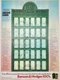
Map Inside Soho - Manhattan - New York Magazine 1974Proverde Auctions4.3(3)See Sold PriceFeb 28, 2024
Rich Dad Poor Dad PaperbackRapid Estate Liquidators and Auction Gallery4.5(1.1k)See Sold PriceFeb 27, 2024
Laminated Unique Media New York City MapRapid Estate Liquidators and Auction Gallery4.5(1.1k)See Sold PriceFeb 29, 2024


![Anchor Line. New York: Nesbitt & Company, [ca. 1860s]. Colo... (1 of 1)](https://p1.liveauctioneers.com/928/318880/171360916_1_x.jpg?height=282&quality=70&version=1707501302)
![[THEATRE]. BOOTH, Edwin (1833-1893). CDV... (1 of 1)](https://p1.liveauctioneers.com/928/318880/171361242_1_x.jpg?height=282&quality=70&version=1707501302)
![[THEATRE]. [CLOWNS]. FOX, George L. (1825-1... (1 of 1)](https://p1.liveauctioneers.com/928/318880/171361244_1_x.jpg?height=282&quality=70&version=1707501302)

![[ENSLAVEMENT & ABOLITION]. A group of photographs and other items related to abolitionist figures (1 of 3)](https://p1.liveauctioneers.com/197/319238/171468086_1_x.jpg?height=282&quality=70&version=1707520367)