ATLAS of ANTIENT GEOGRAPHY by SAMUEL BUTLER 1843John McInnis Auctioneers,LLC4.6(502)See Sold PriceFeb 24, 2024
18TH C. ANTIQUE MAP: FRENCH & INDIAN WAR, FRAMEDThomaston Place Auction Galleries4.4(386)See Sold PriceFeb 24, 2024
Rand McNally Railroad Map Cabinet w/ 21 Railroad MapsRail & Road Auctions4.6(165)See Sold PriceMar 08, 2024
Keith Haring - Ink on New York Map, Best Buddies, Inscribed, Signed, and DatedSapphire Auction Gallery4(67)See Sold PriceMar 02, 2024
LATE 17TH C. FRENCH MAP OF THE NEW WORLD BY ALEXIS-HUBERT JAILLOT (1632-1712)Thomaston Place Auction Galleries4.4(386)See Sold PriceFeb 24, 2024
Central Railroad of New Jersey Map of Sandy Hook Route-ca. 1903JM Hobby Supply and Railroad Artifact Auctions4.4(126)See Sold PriceFeb 24, 2024
Lot of Six Mixed Atlas Box Cars-HO Scale-New in BoxJM Hobby Supply and Railroad Artifact Auctions4.4(126)See Sold PriceFeb 25, 2024
Rand McNally/Santa Fe Railroad Map of Iowa-1912JM Hobby Supply and Railroad Artifact Auctions4.4(126)See Sold PriceFeb 24, 2024
NICOLAES VISSCHER (NETHERLANDS, 1618-1709) MAP OF THE NEW WORLDThomaston Place Auction Galleries4.4(386)See Sold PriceFeb 24, 2024
17TH C. WORLD MAP BY NICOLAES VISSCHER (NETHERLANDS, 1618-1709)Thomaston Place Auction Galleries4.4(386)See Sold PriceFeb 24, 2024
Lot of Six Mixed Atlas Cabooses-HO Scale-New in BoxJM Hobby Supply and Railroad Artifact Auctions4.4(126)See Sold PriceFeb 25, 2024
Mallet: FRANCE. 'Carte Generale'. Towns, rivers &TITLE OF THE MAP: 'Carte Generale de France' DATE PRINTED: 1683 IMAGE SIZE: Approx Overall page size 26 x 21cm approximately (10 x 8 inches); image size 21 x 14.5cm approximately (8 x 5.5 inches) TYPESee Sold Price
FRANCE. 'Carte Generale'. Towns, rivers & provinces. MALLET 1683 old mapTITLE OF THE MAP: 'Carte Generale de France' (De L'Europe) DATE PRINTED: 1683 IMAGE SIZE: Approx Overall page size 26 x 21cm approximately (10 x 8 inches); image size 21 x 14.5cm approximately (8 x 5.See Sold Price
CARTE GENERALE DE FRANCE' showing towns, rivers & provinces. MALLET 1683 mapTITLE OF THE MAP: 'Carte Generale de France' (De L'Europe) DATE PRINTED: 1683 IMAGE SIZE: Approx Overall page size 26 x 21cm approximately (10 x 8 inches); image size 21 x 14.5cm approximately (8 x 5.See Sold Price
CARTE GENERALE DE FRANCE' showing towns, rivers &TITLE OF THE MAP: 'Carte Generale de France' DATE PRINTED: 1683 IMAGE SIZE: Approx Overall page size 26 x 21cm approximately (10 x 8 inches); image size 21 x 14.5cm approximately (8 x 5.5 inches) TYPESee Sold Price
3 European Maps Including France & England3 European Maps, including France and England. 1st item: "Carte D'Angleterre 1754" by Jean Palairet. Colored map of England and Wales with French identifications. Counties, cities, towns, rivers, bodiSee Sold Price
3 European Maps Including France & England3 European Maps, including France and England. 1st item: "Carte D'Angleterre 1754" by Jean Palairet. Colored map of England and Wales with French identifications. Counties, cities, towns, rivers, bodiSee Sold Price
3 European Maps Including France & England3 European Maps, including France and England. 1st item: "Carte D'Angleterre 1754" by Jean Palairet. Colored map of England and Wales with French identifications. Counties, cities, towns, rivers, bodiSee Sold Price
RIGOBERT BONNE - FRANCE, CARTE GENERALE, 1786Rigobert Bonne - France, Carte Generale, 1786 - 30 X 22 3/8 In. - This Giclée Print Is Gallery Stretched And Ready To Hang Or Lean Against A Wall, Or Display On An Easel. - A Giclée Print Is The HigSee Sold Price
RIGOBERT BONNE - FRANCE, CARTE GENERALE, 1786RIGOBERT BONNE - FRANCE, CARTE GENERALE, 1786 - 36 x 26 3/4 in. - Museum Wrapped The Piece Of Art Is Ready To Hang Or Lean Against A Wall, Or Display On An Easel. - A Giclée Print Is The Highest QualSee Sold Price
RIGOBERT BONNE - FRANCE, CARTE GENERALE, 1786Rigobert Bonne - France, Carte Generale, 1786 - Giclée On Canvas - 36 X 26 3/4 In.~~A giclée print falls between serigraph and lithograph in quality. Although they can be made on paper, Giclees on cSee Sold Price
RIGOBERT BONNE - FRANCE, CARTE GENERALE, 1786Rigobert Bonne - France, Carte Generale, 1786 - Giclée On Canvas - 36 X 26 3/4 In.See Sold Price
RIGOBERT BONNE - FRANCE, CARTE GENERALE, 1786Rigobert Bonne - France, Carte Generale, 1786 - 36 X 26 3/4 In. - This Giclée Print Is Gallery Stretched And Ready To Hang Or Lean Against A Wall, Or Display On An Easel. - A Giclée Print Is The HigSee Sold Price
RIGOBERT BONNE - FRANCE, CARTE GENERALE, 1786 - GicléeRIGOBERT BONNE - FRANCE, CARTE GENERALE, 1786 - Giclée on Canvas 36 x 26 3/4 in.See Sold Price
COGNAC BRANDY MAP Crus. Carte Générale. Champagne/Bois &c. Charente. LARMAT 1947Title: COGNAC BRANDY MAP Crus. Carte Générale. Champagne/Bois &c. Charente. LARMAT 1947 Description: "Les Eaux-de-vie de France" - Carte Générale - "Le Cognac"' (Atlas de la FranceSee Sold Price
Map of France, De la Carte Generale de FranceFramed antique map of France, Suite De L'analyse, De la Carte generale de France. Late 18th century. Measures 15" x 21.25". Framed measurement 20.25" x 26.5".See Sold Price
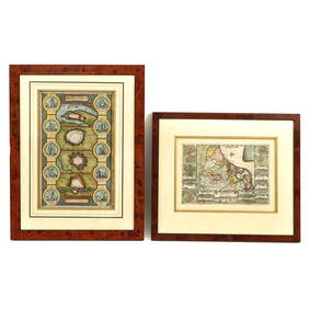
POLISH-LITHUANIAN COMMONWEALTH. Poland Belarus. Towns & rivers. MALLET 1683 mapTITLE OF THE MAP: 'Pologne' (De L'Europe) DATE PRINTED: 1683 IMAGE SIZE: Approx Overall page size 13 x 21cm approximately (5 x 8 inches); image size 10.5 x 14.5cm approximately (4 x 5.5 inches) TYPE:See Sold Price
PERSIA (IRAN). 'Perse Moderne'. Iran. ایران Towns & rivers. MALLETTITLE OF THE MAP: 'Perse Moderne' (De L'Asie) The map includes the Arabian Gulf, Ormus, and extends northwards to Georgia and Armenia. DATE PRINTED: 1683 IMAGE SIZE: Approx Overall page size 13 x 21cmSee Sold Price
POLISH-LITHUANIAN COMMONWEALTH. Poland Belarus. Towns & rivers. MALLET 1683 mapTITLE OF THE MAP: 'Pologne' (De L'Europe) DATE PRINTED: 1683 IMAGE SIZE: Approx Overall page size 13 x 21cm approximately (5 x 8 inches); image size 10.5 x 14.5cm approximately (4 x 5.5 inches) TYPE:See Sold Price
SoldDesnos, Louis Charles 1765 Map of France"Carte Generale de France" Copper Engraved Map Published 1765, Paris for "Coup d'oeil general sur la France" by Louis Charles Desnos & Louis Brion de la Tour. Paper Size: 14 x 11 inch (36 x 28cm) VerySee Sold Price
SoldTwo Maps by Rigobert Bonne (1727-1794, Paris), "CarteTwo Maps by Rigobert Bonne (1727-1794, Paris), "Carte Generale de France deviseepar Gouvernements," 1771; together with "Carte du Gouverements, de Flandre Francoise, d'Artois, de Picardie et du BoulenSee Sold Price
(2) MID 19TH C. MINIATURE WATERCOLORS IN ONE FRAMETwo views of Continental river towns, probably France, unsigned, dated Oct 26, 1844 & Nov 8, in black stick frame, matted and glazed, the two paintings mounted on a single sheet with decorative embossSee Sold Price
(2) MID 19TH C. MINIATURE WATERCOLORS IN ONE FRAMETwo views of Continental river towns, probably France, unsigned, dated Oct 26, 1844 & Nov 8, in black stick frame, matted and glazed, the two paintings mounted on a single sheet with decorative embossSee Sold Price
ENGLAND counties towns rivers. 'Royaume d'Angleterre'. MALLET 1683 old mapTITLE OF THE MAP: 'Royaume d'Angleterre' (De L'Europe) DATE PRINTED: 1683 IMAGE SIZE: Approx Overall page size 13 x 21cm approximately (5 x 8 inches); image size 10.5 x 14.5cm approximately (4 x 5.5 iSee Sold Price
ANCIENT GAUL Gallic tribes Roman towns 'Ancienne Gaule' France. MALLET 1683 mapTITLE OF THE MAP: 'Ancienne Gaule' (De L'Europe) DATE PRINTED: 1683 IMAGE SIZE: Approx Overall page size 26 x 21cm approximately (10 x 8 inches); image size 21 x 14.5cm approximately (8 x 5.5 inches)See Sold Price
Kenyons Pocket Map and Shippers Guide of Wisconsin-1914JM Hobby Supply and Railroad Artifact Auctions4.4(126)See Sold PriceFeb 24, 2024
Rand McNally Railroad Map of Arizona-1909JM Hobby Supply and Railroad Artifact Auctions4.4(126)See Sold PriceFeb 24, 2024
Illegible signed, river festivities, FranceLotus International Auctions, LLC4.6(153)See Sold PriceMar 03, 2024
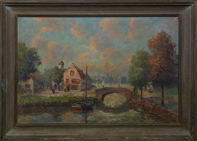
R. Kraft, "River and Town View," 20th c., oil on canvas, signed lower right, presented in a woodCrescent City Auction Gallery4.3(229)See Sold PriceMar 01, 2024
Duval - Pair: Map of Georgia & Map of Moscow, RussiaTrillium Antique Prints & Rare Books4.5(30)See Sold PriceFeb 24, 2024
Duval - Pair: Map of India & Map of MaldivesTrillium Antique Prints & Rare Books4.5(30)See Sold PriceFeb 24, 2024
Railways & Transport.- [Prospectus] The Dorking, Brighton, and Arundel Atmospheric Railway, byForum Auctions4.3(52)See Sold PriceFeb 29, 2024
1683 Sanson Map of the Caribbean -- Les Isles Antilles, &c Entre Lesquelles sont les Lucayes, et lesJasper524.5(9.8k)See Sold PriceFeb 27, 2024
Large French Impressionist Signed Oil Tranquil River Landscape through old TownJasper524.5(9.8k)See Sold PriceFeb 28, 2024
WEST AFRICA Niger/Gambia rivers tribes towns. 'Pays des Negres'. MALLET 1683 mapJasper524.5(9.8k)See Sold PriceFeb 28, 2024
NORTH & WEST AFRICA. Sahara Niger river 'Zaara ou le Desert'. MALLET 1683 mapJasper524.5(9.8k)See Sold PriceFeb 28, 2024


![Railways & Transport.- [Prospectus] The Dorking, Brighton, and Arundel Atmospheric Railway, by (1 of 1)](https://p1.liveauctioneers.com/5458/319736/171654703_1_x.jpg?height=282&quality=70&version=1708010439)


