ATLAS of ANTIENT GEOGRAPHY by SAMUEL BUTLER 1843John McInnis Auctioneers,LLC4.6(504)See Sold PriceFeb 24, 2024
18TH C. ANTIQUE MAP: FRENCH & INDIAN WAR, FRAMEDThomaston Place Auction Galleries4.4(389)See Sold PriceFeb 24, 2024
Rand McNally Railroad Map Cabinet w/ 21 Railroad MapsRail & Road Auctions4.6(165)See Sold PriceMar 08, 2024
Keith Haring - Ink on New York Map, Best Buddies, Inscribed, Signed, and DatedSapphire Auction Gallery4.1(67)See Sold PriceMar 02, 2024
LATE 17TH C. FRENCH MAP OF THE NEW WORLD BY ALEXIS-HUBERT JAILLOT (1632-1712)Thomaston Place Auction Galleries4.4(389)See Sold PriceFeb 24, 2024
Central Railroad of New Jersey Map of Sandy Hook Route-ca. 1903JM Hobby Supply and Railroad Artifact Auctions4.4(126)See Sold PriceFeb 24, 2024
Lot of Six Mixed Atlas Box Cars-HO Scale-New in BoxJM Hobby Supply and Railroad Artifact Auctions4.4(126)See Sold PriceFeb 25, 2024
Rand McNally/Santa Fe Railroad Map of Iowa-1912JM Hobby Supply and Railroad Artifact Auctions4.4(126)See Sold PriceFeb 24, 2024
NICOLAES VISSCHER (NETHERLANDS, 1618-1709) MAP OF THE NEW WORLDThomaston Place Auction Galleries4.4(389)See Sold PriceFeb 24, 2024
17TH C. WORLD MAP BY NICOLAES VISSCHER (NETHERLANDS, 1618-1709)Thomaston Place Auction Galleries4.4(389)See Sold PriceFeb 24, 2024
Lot of Six Mixed Atlas Cabooses-HO Scale-New in BoxJM Hobby Supply and Railroad Artifact Auctions4.4(126)See Sold PriceFeb 25, 2024
Lowry: Antique City Plan of Oxford & Cambridge, 1863Title/Content of Map: 'Cambridge; Oxford' Town/city plan by JW LOWRY for the Dispatch Atlas Date Printed: 1863 Image Size: Approx 44.5 x 31.5cm, 17.5 x 12.5 inches (Large) Type: Antique map with origiSee Sold Price
Antique town city plan of OXFORD by George COLE & JohnTITLE/CONTENT OF MAP: 'Oxford' Date: The map is dated 1808; the atlas from which it was extracted was published in 1810 IMAGE SIZE: Approx 19.5 x 25.0cm, 7.75 x 9.75 inches (Medium) TYPE: Antique engrSee Sold Price
Moule (Thomas) 50 county maps and city plansMoule (Thomas) a group of 50 county maps and city plans,from The English Counties Delineated, including plans of London, Oxford, Cambridge, Bath and elsewhere, most with decorative borders andSee Sold Price
Plan of the University & City of Oxford. Town plan byTITLE/CONTENT OF MAP: 'Plan of the University and City of Oxford' Date: 1837 IMAGE SIZE: Approx 19.5 x 15.0cm, 7.75 x 5.75 inches (Medium) TYPE: Antique steel engraved map CONDITION: Good; suitable foSee Sold Price
SoldCambridge.- Speed (John) Oxfordshire described with ye Citie and the Armes of the Colledges of ytOxford.- Speed (John) Oxfordshire described with ye Citie and the Armes of the Colledges of yt famous University, county map, with inset town plan of Oxford, the vertical margins decorated with the heSee Sold Price
Bishop: Antique City Plan of Brooklyn, 1869Map: 1869 Bishop Map of Brooklyn -- Map of the City of Brooklyn Cartographer: A Brown for W G Bishop Year / Place: 1869, New York City Dimensions: 17.5 x 22.6 in. Condition: Very good. Slight toning,See Sold Price
SoldRand McNally: Antique City Plan of Brooklyn, NY, 1912Title/Content of Map: 'Main Portion Brooklyn ' Brooklyn town city map plan. New York. Date Printed: 1912 Image Size: Approx 27.5 x 33.5cm, 10.75 x 13 inches (Large) Type: Antique colour (color) city pSee Sold Price
SoldMallet: Antique City Plan of Baghdad, 1683Title/Content of Map: 'Bagdet' Shows the river Tigris. Plan of the walled city & fortifications. Baghdad, Iraq Date Printed: 1683 Image Size: Approx Overall page size 13 x 21cm approximately (5 x 8 inSee Sold Price
Plan de la Nouvelle Orléans'. Antique city plan of NewTITLE/CONTENT OF MAP: 'Plan de la Nouvelle Orléans [Map of New Orleans]' The top image on the right hand side shows the entire map. To view a close up of the map showing the level of printed detailSee Sold Price
Plan de la Nouvelle Orléans'. Antique city plan of NewTITLE/CONTENT OF MAP: 'Plan de la Nouvelle Orléans [Map of New Orleans]' The top image on the right hand side shows the entire map. To view a close up of the map showing the level of printed detail,See Sold Price
Antique City Plan & View of Sultzburg, 1574Title: Sultzburg [City Plan and View] Publication: 1574 Authors: BRAUN & HOGENBERG, BRAUN & HOGENBERG Publisher: BRAUN & HOGENBERG Size: Octavo – 5.50 H x 7.00 W Inches Town plan and view on two sheSee Sold Price
Mallet: Antique City Plan Map of Rome, 1683Title of the Map: 'Plan et Porfil de la ville de Rome Moderne' ROME. City plan showing churches Colosseum Vatican St Peter's Date Printed: 1683 Image Size: Approx Overall page size 13 x 21cm approximaSee Sold Price
Basire: Antique City Plan of Ypres & Castle, 1740Title: Ypres a Strong City and Castle in Flanders, Publication Date: 1740 Authors: TINDAL, BASIRE, J. Publisher: TINDAL Size: Folio – 14.00 H x 18.50 W Inches "restor'd to the Emperor by the TreatySee Sold Price
1764 Bellin map of Manhattan by Hayward, 1861Antique city plan of Lower Manhattan, executed by S. Bellin in 1764, redrawn by George Hayward for the Valentine’s Manual of 1861. Includes the Custom House, City Hall, the Fort, the House of the GoSee Sold Price
London in 1897 with street improvements since 1855. 80x105 cm. Edwards 1898 mapTitle: London in 1897 with street improvements since 1855. 80x105 cm. Edwards 1898 map Description: London in 1897' by Percy Edwards (1898). Large antique city plan, 79.5 x 105.0cm, 31.25 x 41.5 incheSee Sold Price
Large map of London in 1855 by Percy Edwards. 71x103 cm 1898 old antiqueTitle: Large map of London in 1855 by Percy Edwards. 71x103 cm 1898 old antique Description: London in 1855' by Percy Edwards (1898). Large antique city plan, 71.5 x 103.5cm, 28 x 40.75 inches; PleaseSee Sold Price
SoldLetts: Calcutta Kolkata Antique City Map Plan, 1889Map: 'Plan of the City of Calcutta' Date Printed: 1889 Image Size: Approx 28.5 x 43.0cm, 11.25 x 16.75 inches (Large) Type: Antique colour atlas map Condition: Good; suitable for framing. Artist/CartoSee Sold Price
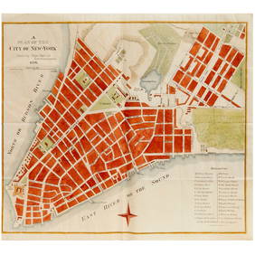
SDUK: Antique Map City Plan of New York City, 1847Title/Content of Map: 'NEW YORK' Antique town city map plan. Manhattan Brooklyn Jersey. Date Printed: 1847 Image Size: Approx 33.0 x 39.0cm, 13 x 15.25 inches (Large) Type: Antique steel engraved mapSee Sold Price
Bellin: Antique Map, City Plan of Buenos Aires, 1743Title/Content of Map: Fascinating antique plan of Buenos Aires, Argentina. "Plan de la Ville de Buenos-Ayres" Date Printed: 1754 Cartographer: Bellin, Jacques Nicolas Size (inches): 10 x 7 Framed antiSee Sold Price
Antique Map, City Plan of Sioux City, 1888Title/Content of Map: Sioux City, Iowa. the Corn Palace City of the World, Publication Date: 1888-07-01 Cartographer: WAKEFIELD/HILL/WINGELAND Publisher: L.H. EVERTS & CO. 1888-07-01 PHILADELPHIA/CHICSee Sold Price
SoldSDUK: Antique City Map Plan of Amsterdam, 1847Title/Content of Map: 'AMSTERDAM.; inset environs of Amsterdam' Date Printed: 1847 Image Size: Approx 34.5 x 40.5cm, 13.5 x 15.75 inches (Large) Type: Antique steel engraved map with original outlineSee Sold Price
SoldPeking'. Beijing antique town city plan. China 1915 oldTITLE/CONTENT OF MAP: 'Peking [Beijing]' DATE PRINTED: 1915 IMAGE SIZE: Approx 33.5 x 30.5cm, 13.25 x 12 inches (Large); Please note that this is a folding map. TYPE: Antique colour town city plan CONSee Sold Price
SoldSDUK: Antique City Map Plan of Lisbon, 1847Title/Content of Map: 'LISBON (LISBOA); inset environs of Lisbon' Antique town city map plan. Panorama. Date Printed: 1847 Image Size: Approx 33.5 x 40.0cm, 13.25 x 15.75 inches (Large) Type: AntiqueSee Sold Price
SoldMallet: Antique Map City Plan of Madrid, 1683Title of the Map: 'Madrid' Decorative plan of the city. Churches. Spain. Date Printed: 1683 Image Size: Approx Overall page size 13 x 21cm approximately (5 x 8 inches); image size 10.5 x 14.5cm approxSee Sold Price
Toys: A quantity of die cast scale model Corgi Toys buses to include Bristol K Utility no. 97857,Claydon Auctioneers Ltd4.3(125)See Sold PriceFeb 26, 2024
COLONIAL TOGO & BENIN (Dahomey). Porto Novo & Lomé city ville plans 1929 mapJasper524.5(9.8k)See Sold PriceFeb 28, 2024
FRENCH COLONIAL GUINEA. Guinee Française. Conakry city town ville plan 1929 mapJasper524.5(9.8k)See Sold PriceFeb 28, 2024
FRENCH SUDAN (Now Mali). Soudan Français. Bamako city plan de la ville 1929 mapJasper524.5(9.8k)See Sold PriceFeb 28, 2024
FRENCH COLONIAL GUINEA. Guinee Française. Conakry city town ville plan 1931 mapJasper524.5(9.8k)See Sold PriceFeb 28, 2024
FRENCH SUDAN (Now Mali). Soudan Français. Bamako city plan de la ville 1938 mapJasper524.5(9.8k)See Sold PriceFeb 28, 2024
FRENCH SUDAN (Now Mali). Soudan Français. Bamako city plan de la ville 1931 mapJasper524.5(9.8k)See Sold PriceFeb 28, 2024
COLONIAL TOGO & BENIN (Dahomey). Porto Novo & Lomé city ville plans 1931 mapJasper524.5(9.8k)See Sold PriceFeb 28, 2024
COLONIAL TOGO & BENIN (Dahomey). Porto Novo & Lomé city ville plans 1938 mapJasper524.5(9.8k)See Sold PriceFeb 28, 2024
[Constructivism]. The general plan of reconstruction of Moscow. - Moscow: Moscow Worker, 1936. -ARTMAXIMUM4.3(4)See Sold PriceMar 14, 2024


![[Constructivism]. The general plan of reconstruction of Moscow. - Moscow: Moscow Worker, 1936. - (1 of 6)](https://p1.liveauctioneers.com/6171/320219/172084257_1_x.jpg?height=282&quality=70&version=1708525949)


