ATLAS of ANTIENT GEOGRAPHY by SAMUEL BUTLER 1843John McInnis Auctioneers,LLC4.6(502)See Sold PriceFeb 24, 2024
18TH C. ANTIQUE MAP: FRENCH & INDIAN WAR, FRAMEDThomaston Place Auction Galleries4.4(386)See Sold PriceFeb 24, 2024
Rand McNally Railroad Map Cabinet w/ 21 Railroad MapsRail & Road Auctions4.6(165)See Sold PriceMar 08, 2024
Keith Haring - Ink on New York Map, Best Buddies, Inscribed, Signed, and DatedSapphire Auction Gallery4(67)See Sold PriceMar 02, 2024
LATE 17TH C. FRENCH MAP OF THE NEW WORLD BY ALEXIS-HUBERT JAILLOT (1632-1712)Thomaston Place Auction Galleries4.4(386)See Sold PriceFeb 24, 2024
Central Railroad of New Jersey Map of Sandy Hook Route-ca. 1903JM Hobby Supply and Railroad Artifact Auctions4.4(126)See Sold PriceFeb 24, 2024
Lot of Six Mixed Atlas Box Cars-HO Scale-New in BoxJM Hobby Supply and Railroad Artifact Auctions4.4(126)See Sold PriceFeb 25, 2024
Rand McNally/Santa Fe Railroad Map of Iowa-1912JM Hobby Supply and Railroad Artifact Auctions4.4(126)See Sold PriceFeb 24, 2024
NICOLAES VISSCHER (NETHERLANDS, 1618-1709) MAP OF THE NEW WORLDThomaston Place Auction Galleries4.4(386)See Sold PriceFeb 24, 2024
17TH C. WORLD MAP BY NICOLAES VISSCHER (NETHERLANDS, 1618-1709)Thomaston Place Auction Galleries4.4(386)See Sold PriceFeb 24, 2024
Lot of Six Mixed Atlas Cabooses-HO Scale-New in BoxJM Hobby Supply and Railroad Artifact Auctions4.4(126)See Sold PriceFeb 25, 2024
Lot of 5 Maps of India, 1606-1821India Orientalis By Jodocus Hondius, Amsterdam, 1606 (1613) In the Mercator-Hondius Latin folio atlas, Atlas sive Cosmographicae Meditationes de Fabrica mundi et fabricati Figura 42 cm x 52 cm WatermaSee Sold Price
SoldBartholomew, John 1922 Lot of 5 Maps. IndiaIncl India & Farther India, India North West, India North East, India South, and The Ganges Valley. Large Lithograph Maps Published 1922 by The Times, London for "The Times Survey Atlas of the World"See Sold Price
SoldBartholomew, John 1922 Lot of 5 Maps of IndiaLarge Lithograph Maps Published 1922 by The Times, London for "The Times Survey Atlas of the World" Maps by John George Bartholomew of the Edinburgh Geographical Institute. Centre fold as issued. PapeSee Sold Price
Lot of 5 Maps of India 1574-1926Tabvla Asiae XI map of Bengal and Burma, “India Extra Gangem” By Giordan Ziletti, Venice, 1574 In La Geographia di Claudio Tolomeo, published by Giralamo Ruscelli 17.5 cm x 23.5 cm WatermaSee Sold Price
SoldBartholomew, John 1922 Lot of 5 LG Maps of IndiaLarge Lithograph Maps Published 1922 by The Times, London for "The Times Survey Atlas of the World" Maps by John George Bartholomew of the Edinburgh Geographical Institute. Centre fold as issued. PapeSee Sold Price
Lot of 5 Maps of Chormandel, India 1754-1765A Map of Coromandel Shewing the Seat of War on that Coast Printed for R. Baldwin, for the London Magazine, London, 1754 23 cm x 16.5 cm Small decorative rococo cartouche with trees and birds. Laid papSee Sold Price
Bartholomew, John 1922 Lot of 5 LG Maps of IndiaLarge Lithograph Maps Published 1922 by The Times, London for "The Times Survey Atlas of the World" Maps by John George Bartholomew of the Edinburgh Geographical Institute. Centre fold as issued. PapeSee Sold Price
Bartholomew, John 1922 Lot of 5 LG Maps of IndiaLarge Lithograph Maps Published 1922 by The Times, London for "The Times Survey Atlas of the World" Maps by John George Bartholomew of the Edinburgh Geographical Institute. Centre fold as issued. PapeSee Sold Price
Lot of 5 Maps of Regions of India 1672-1732Regnum Jafnapatnam; cum Insulis Adjacentibus By Philippus Baldaeus, Amsterdam?, ca. 1672 (Baldaeus Baelde lived ca. 1632-ca. 1672, died in Delft) 29 cm x 36 cm Watermarked paper. Strong, clear print.See Sold Price
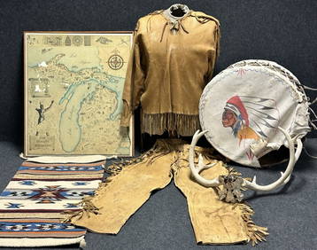
[SANSON - INDIA] A lot of 5 maps[SANSON - INDIA] A lot of 5 maps sold together, including:Sanson, Nicolas. "Thalf Eilandy Van Indiën." [1705]. 19cm x 24cm (7.5" x 9.5"). 2 copies hand coloured differently. ** Sanson, Nicolas. "TrykSee Sold Price
SoldLot of six maps from the mediterraneanKonvolut aus Karten des Mittelmeerraumes. 4 lithogr. Karten auf 5 Bll. (1820, 1821, 1824). 4 lithogr. maps. on 5 leaves. - Partly slightly stained, corners somewhat creased, at the edges little tornedSee Sold Price
Sold20 maps, mostly Africa. 1821 - early 1900's.[Africa, etc.]. 20 Maps. Various sizes, good - very good condition, some coloring. ++ E. Paguenaud. Hindoostan; Or, India...Illustration of Lavoisne's. Atlas. Phila: Carey, 1821. ++ 5 maps of portionsSee Sold Price
SoldGross, Alexander 1920 Lot of 4 Large Maps. IndiaLarge Lithograph Maps Published 1920, London for "The Daily Telegraph Victory Atlas of the World" by Alexander Gross. Centre fold as published. Paper Size: 25 x 19.5 inch (64 x 49cm) Good ConditionSee Sold Price
SoldCram: Map of India, 1887Title: Map of India By Cram Date: 1887 Dimensions: 11.5 x 14.5 Medium: Wax Engraving Please note that this lot has a confidential reserve. When you leave a bid in advance of the auction, submit your mSee Sold Price
SoldThe Times 1895 Lot of 3 Maps of India & AsiaLithograph Maps Published 1895, London for "The Times Atlas" Paper Size: 16 x 10.5 inch (41 x 27cm) and 21 x 16 inch (54 x 41cm) Very minor loss on centre fold of one map. Otherwise fineSee Sold Price
SoldHondius map of India and southeast AsiaHeading: Author: Hondius, Jodocus Title: India Orientalis Place Published: Amsterdam Publisher: Date Published: 1606- Description: Copper-engraved map, hand-colored. 35.5x4See Sold Price
SoldHondius map of India and southeast AsiaHeading: Author: Hondius, Jodocus Title: India Orientalis Place Published: Amsterdam Publisher: Date Published: 1606-[1619] Description: Copper-engraved map, hand-colored.See Sold Price
The Times 1895 Lot of 3 Maps of India & AsiaLithograph Maps Published 1895, London for "The Times Atlas" Paper Size: 16 x 10.5 inch (41 x 27cm) and 21 x 16 inch (54 x 41cm) Very minor loss on centre fold of one map. Otherwise fineSee Sold Price
The Times 1895 Lot of 3 Maps of India & AsiaLithograph Maps Published 1895, London for "The Times Atlas" Paper Size: 16 x 10.5 inch (41 x 27cm) and 21 x 16 inch (54 x 41cm) Very minor loss on centre fold of one map. Otherwise fineSee Sold Price
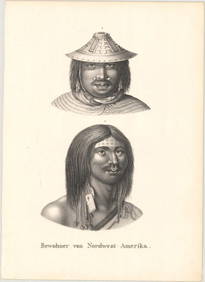
GROUP LOT ANTIQUE MAPS & PRINTSAll unframed. Two maps of southern India (11 x 13" and 19 x 24"). Both with folds and some foxing. Along with three French bookplates- two of battle formations (14 x 9.5" each) and one of ethnic musicSee Sold Price
5 19th C. Hand Colored Engraved MapsLot of five 19th century hand colored engraved maps of Spain and Portugal, England and Wales, India, and Algieria, largest measures 14" h x 17" w (sheet). Provenance: From a FL estate.See Sold Price
SoldMaps 19th Cent. Mixed Lot of 9Incl France, British Isles, Holland/Belgium, North Pole, Chile, Buckinghamshire, India, Africa/Libya, and Switzerland. Paper Size: Up to 23 x 18.5 inch (59 x 47cm) Most with small faultsSee Sold Price
SoldMaps 19th Century Mixed Lot of 6Incl India, France, Turkey in Asia, Guatemala, Paraguay and Venezuela. Examples by Estevanez, Rapkin, and Nolan/Hughes. Paper Size: Up to 18.5 x 13.5 inch (37 x 34cm) Good ConditionSee Sold Price
SoldAsia (Political Divisions & Various Travel Routes) MapAsia (showing it's political divisions and also various travel routes between London, India, China, and Japan), 15.25 x 12.5 in, 1877, S. Augustus Mitchell Please note that this lot has a confidentialSee Sold Price
French Commander Napoleon Bonaparte Bronze SculptureWeatherham Estate Treasures3.9(157)See Sold PriceMar 07, 2024
Handmade French Commander Napoleon Bonaparte Military Bronze StatueWeatherham Estate Treasures3.9(157)See Sold PriceMar 07, 2024
Handmade French Commander Napoleon Bonaparte Military Bronze StatueWeatherham Estate Treasures3.9(157)See Sold PriceMar 07, 2024
5 Dollars - Elizabeth II Map of North AmericaWeatherham Estate Treasures3.9(157)See Sold PriceMar 07, 2024
39.37ct Oval Black With Blue Flek Indian NuummiteWeatherham Estate Treasures3.9(157)See Sold PriceMar 14, 2024
Antique Native American 5 Piece Lot: Deerskin Jacket & Pants, Rug, Drum, Michigan Map & Mule DeerHoller and Hammer4.5(47)See Sold PriceFeb 24, 2024
10k White Gold Ring .54 Ct Blue Sapphire .20ct Diamonds QJ Mark India 6.5Jasper524.5(9.8k)See Sold PriceFeb 28, 2024
1636 MAP of SWITZERLAND DAS WIFISPURGERGOU antique 15 by 19"Jasper524.5(9.8k)See Sold PriceFeb 27, 2024
Geographical, Statistical, and Historical Map of the Leeward Islands.Jasper524.5(9.8k)See Sold PriceFeb 27, 2024
Geographical, Statistical, and Historical Map of the West Indies.Jasper524.5(9.8k)See Sold PriceFeb 27, 2024
Afrique…Nord-Ouest' & 'Inde' by Meissas. N Africa India Singapore 1861 old mapJasper524.5(9.8k)See Sold PriceFeb 28, 2024
Kartic Chandra Pyne (Indian 1931- 2017 ) signed and dated mixed media paintingLatair3.9(20)See Sold PriceMar 20, 2024
Two Vintage Brass Bud VasesRapid Estate Liquidators and Auction Gallery4.5(1.1k)See Sold PriceMar 03, 2024


![[SANSON - INDIA] A lot of 5 maps (1 of 1)](https://p1.liveauctioneers.com/1124/187577/94368888_1_x.jpg?height=282&quality=70&version=1607095126)