ATLAS of ANTIENT GEOGRAPHY by SAMUEL BUTLER 1843John McInnis Auctioneers,LLC4.6(502)See Sold PriceFeb 24, 2024
18TH C. ANTIQUE MAP: FRENCH & INDIAN WAR, FRAMEDThomaston Place Auction Galleries4.4(386)See Sold PriceFeb 24, 2024
Rand McNally Railroad Map Cabinet w/ 21 Railroad MapsRail & Road Auctions4.6(165)See Sold PriceMar 08, 2024
Keith Haring - Ink on New York Map, Best Buddies, Inscribed, Signed, and DatedSapphire Auction Gallery4(67)See Sold PriceMar 02, 2024
LATE 17TH C. FRENCH MAP OF THE NEW WORLD BY ALEXIS-HUBERT JAILLOT (1632-1712)Thomaston Place Auction Galleries4.4(386)See Sold PriceFeb 24, 2024
Central Railroad of New Jersey Map of Sandy Hook Route-ca. 1903JM Hobby Supply and Railroad Artifact Auctions4.4(126)See Sold PriceFeb 24, 2024
Lot of Six Mixed Atlas Box Cars-HO Scale-New in BoxJM Hobby Supply and Railroad Artifact Auctions4.4(126)See Sold PriceFeb 25, 2024
Rand McNally/Santa Fe Railroad Map of Iowa-1912JM Hobby Supply and Railroad Artifact Auctions4.4(126)See Sold PriceFeb 24, 2024
NICOLAES VISSCHER (NETHERLANDS, 1618-1709) MAP OF THE NEW WORLDThomaston Place Auction Galleries4.4(386)See Sold PriceFeb 24, 2024
17TH C. WORLD MAP BY NICOLAES VISSCHER (NETHERLANDS, 1618-1709)Thomaston Place Auction Galleries4.4(386)See Sold PriceFeb 24, 2024
Lot of Six Mixed Atlas Cabooses-HO Scale-New in BoxJM Hobby Supply and Railroad Artifact Auctions4.4(126)See Sold PriceFeb 25, 2024
SoldLattre: Antique Map of The Balkans, 1791Title/Content of Map: The Balkan's Date Printed: 1791 Cartographer: J Lattre Material/Medium: Paper Size: 11" x 8 1/2" Published in Petit Atlas Moderne Ou Collection De Cartes Elementaire. Published iSee Sold Price
SoldLattre: Antique Map of Ancient Egypt, 1791Map: Ancient Egypt by Lattre Date Printed: 1791 Cartographer: J Lattre Material/Medium: Paper Size: 8 1/2" x 12" Hand colored copperplate engraving. Published in Petit Atlas Moderne Ou Collection De CSee Sold Price
SoldLattre: Antique Map of the Barbary Coast, 1791Map: Barbary Coast by Lattre Date Printed: 1791 Cartographer: J Lattre Material/Medium: Paper Size: Approx 11 1/2" x 8 1/2" Hand colored copperplate engraving. Published in Petit Atlas Moderne Ou CollSee Sold Price
Seutter: Antique Map Balkans, Hungary to Greece, 1740Title/Content of Map: Balkan's from Hungary to Greece Date Printed: c1740 Cartographer: Matthaus Seutter Material/Medium: Paper Size: 23 1/2" x 19 3/4" Original hand colored copperplate engraved. PublSee Sold Price
SoldJanvier / Lattre: Antique Map of the Americas, 1772Map: L'Amerique divisee par Grands Etats Cartographer: J. Janvier / J. Lattre Place & Date: Paris / 1772 Size: 17 1/2" x 12" Condition: outline color (wash in cartouche); very light overall age toningSee Sold Price
Tanner: Antique Map of Balkans with Greece, 1843Title/Content of Map: Balkans with Greece by Tanner Date Printed: 1843 Cartographer: H.C. Tanner Material/Medium: Paper Size: 17" x 14" Hand colored engraved Map based on the work of H.C. Tanner fromSee Sold Price
SoldTanner: Antique Map of Balkans with Greece, 1843Title/Content of Map: Balkans with Greece by Tanner Date Printed: 1843 Material/Medium: Paper Provenance: New York Please note that this lot has a confidential reserve. When you leave a bid in advanceSee Sold Price
Seutter: Antique Map of The Balkans, 1740Title/Content of Map: The Balkans or southeastern Europe Date Printed: c1740 Cartographer: Matthuas Seutter Material/Medium: Paper Size: 19" x 23" Original hand colored copperplate engraved. PublishedSee Sold Price
Homann Heirs: Antique Map of Hungary & Balkans, 1750Title/Content of Map: Hvngariae Ampliori Significatu... Carte D'hongrie En General..." Date Printed: 1750 ca. Cartographer: HOMANN HEIRS Publisher/Place: HOMANN HEIRS 1750 ca. NUREMBERG Size: Folio ��See Sold Price
Fries: Antique Map of Greece & Balkans, 1541Map: 1541 Fries Map of Greece and Balkans -- Tabula Nova Graeciae, Sclavoniae, & Bulgariae Cartographer: T Fries Year / Place: 1541, Vienna Map Dimensions: 12.8 x 15.8 in. Condition: Very Good. ClearSee Sold Price
Jaillot/Sanson: Antique Map of the Balkans, 1716Title/Content of Map: LE ROYAUME DE HONGRIE, ET LES ESTATS QUI ONT ESTÉ SUJETS ET DEPENDANS DE SA COURONNE ...’ Date Printed: 1716 Cartographer: Published by Hubert Jaillot from the plate by NicolaSee Sold Price
Antique Colored Map - Europe - Balkans - Hungary - Romania - Bulgaria - HeirsOriginally colored engraved map of the Balkans by Johann Matthias Hase printed by Homann Heirs. Shows Hungary, Romania, Bulgaria, the former Yugoslavia (Croatia, Serbia, Bosnia, Macedonia), Albania anSee Sold Price
Tardieu: Antique Map of North America, 1791Map: Amerique Septentrionale. CIRCA 1791 DEPICTION of FIRST FOURTEEN STATES WITH "TEXAX" [sic] Publication Date: 1791 Authors: TARDIEU, PIERRE FRANCOIS Size: Quarto – 8.30 H x 10.00 W Inches "Pour lSee Sold Price
Homann Heirs: Antique Map of Hungary & North BalkansTitle/Content of Map: Hvngariae Ampliori Significatu... Carte D'hongrie En General..." Date Printed: 1750 ca. Cartographer: HOMANN HEIRS Size (inches): 7.9x6.4 Detailed map of Hungary and the northernSee Sold Price
Mawman: Antique Map of Greece, Boeotia, 1791Map: Greece: Boeotia Date: 1791 Maker: J. Mawman Medium: Original copper engraving Size: 10 1/4" x 15 1/4" From the 1791 "Maps, Plans, Views, and Coins Illustrative of the Travels of Anacharsis the YoSee Sold Price
Mawman: Antique Map of Greece, Sparta, 1791Title/Content of Map: Greece: Sparta & Environs, 1791 Date Printed: 1791 Cartographer: J. Mawman Material/Medium: Engraving Size: 10 1/4" x 15 1/4" Original copper engraving from the 1791 book Maps, PSee Sold Price
Mawman: Antique Map of Greece, Thessaly, 1791Title/Content of Map: Greece: Thessaly, 1791 Date Printed: 1791 Cartographer: J. Mawman Material/Medium: Engraving Size: 10 1/4" x 15 1/4" Original copper engraving from the 1791 book Maps, Plans, VieSee Sold Price
SoldOriginal Antique Map of the Arctic Regions 1791Carte physique de la mer glaciale arctique by Jean Baptiste Nolin. Published in 1791 in Paris, France. From Atlas General, hand colored map. Text in French. Original copper plate engraving printed onSee Sold Price
SoldMawman: Antique Map Plan of Athens, Greece, 1791Original copper engraving from the 1791 "Maps, Plans, Views, and Coins Illustrative of the Travels of Anacharsis the Younger in Greece". by J. Mawman, 1805. Plan of the Academy & Environs for the travSee Sold Price
SoldMawman: Antique Map Plan of Athens, Greece, 1791Original copper engraving from the 1791 "Maps, Plans, Views, and Coins Illustrative of the Travels of Anacharsis the Younger in Greece". by J. Mawman, 1805. Plan of the Athens for the travels of AnachSee Sold Price
Mawman: Antique Map of Aetolia & Acarnania Greece, 1791Title/Content of Map: Greece: Aetolia & Acarnania in Penninsula of Leucadia, 1791 Date Printed: 1791 Cartographer: J. Mawman Material/Medium: Engraving Size: 10 1/4" x 15 1/4" Original copper engravinSee Sold Price
SoldMawman: Antique Map Plan of Athens, Greece, 1791Original copper engraving from the 1791 "Maps, Plans, Views, and Coins Illustrative of the Travels of Anacharsis the Younger in Greece". by J. Mawman, 1805. Plan of the Athens for the travels of AnachSee Sold Price
Mawman: Antique Map of Pass of Thermopyle, 1791Title/Content of Map: Greece: Plan of the pass of Thermopyle, 1791 Date Printed: 1791 Cartographer: J. Mawman Material/Medium: Engraving Size: 10 1/4" x 15 1/4" Original copper engraving from the 1791See Sold Price
Mawman: Antique Map of Greece, The Hellespont, 1791Title/Content of Map: Greece: The Hellespont, Thracian Chersonesus & Troas, 1791 Date Printed: 1791 Cartographer: J. Mawman Material/Medium: Engraving Size: 10 1/4" x 15 1/4" Original copper engravingSee Sold Price
17TH C. ANTIQUE MAP SIEGE OF LA ROCHELLE, FRANCE, FRAMEDThomaston Place Auction Galleries4.4(386)See Sold PriceFeb 24, 2024
18TH C. ANTIQUE MAP: FRENCH & INDIAN WAR, FRAMEDThomaston Place Auction Galleries4.4(386)See Sold PriceFeb 24, 2024
D'Entrecasteaux - Australia: Coasts of Van Diemen's Land (New Holland). 9Trillium Antique Prints & Rare Books4.5(30)See Sold PriceFeb 24, 2024
D'Entrecasteaux - Tasmania, Australia: Map of the Northern Portion of Recherche Bay. 5Trillium Antique Prints & Rare Books4.5(30)See Sold PriceFeb 24, 2024
D'Entrecasteaux - Australia: Chart of Van Diemen's Land (New Holland). 3Trillium Antique Prints & Rare Books4.5(30)See Sold PriceFeb 24, 2024
D'Entrecasteaux - Map of Australia (New Holland), New Zealand, and southern Asia and surroundingTrillium Antique Prints & Rare Books4.5(30)See Sold PriceFeb 24, 2024
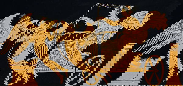
Hamilton - Engraving of a Painting from a Grecian Vase. 1Trillium Antique Prints & Rare Books4.5(30)See Sold PriceFeb 24, 2024
Hamilton - Engraving of a Painting from a Grecian VaseTrillium Antique Prints & Rare Books4.5(30)See Sold PriceFeb 24, 2024
Hamilton - Engraving of a Painting from a Grecian Vase. 2Trillium Antique Prints & Rare Books4.5(30)See Sold PriceFeb 24, 2024
Hamilton - Engraving of a Painting from a Grecian Vase. 32Trillium Antique Prints & Rare Books4.5(30)See Sold PriceFeb 24, 2024
Hamilton - Engraving of a Painting from a Grecian Vase. 114Trillium Antique Prints & Rare Books4.5(30)See Sold PriceFeb 24, 2024
Hamilton - Engraving of a Painting from a Grecian Vase. 5Trillium Antique Prints & Rare Books4.5(30)See Sold PriceFeb 24, 2024
Cooke, George 1801 Antique Map. United States of AmericaAlbion Auctions4.6(336)See Sold PriceMar 01, 2024
1792 OLD INDIA HISTORY ANTIQUE ILLUSTRATED WITH MAPS OF THE EIGHTEENTH CENTURY IN FRENCHNY Elizabeth 4.3(84)See Sold PriceMar 03, 2024
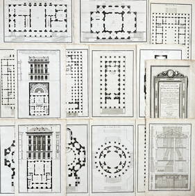
Jean-Francois de Neufforge (1714 - 1791) - Set of 15 Architecture Prints - Development pour unProverde Auctions4.3(3)See Sold PriceFeb 28, 2024
Jean-Francois de Neufforge (1714 - 1791) - Set of 15 Architecture Prints - Plan de l' EdificeProverde Auctions4.3(3)See Sold PriceFeb 28, 2024
Antique Map of Poland, 1700 by Guillaume De Lisle, ParisAntiques Online Auctions4.6(407)See Sold PriceMar 14, 2024