ATLAS of ANTIENT GEOGRAPHY by SAMUEL BUTLER 1843John McInnis Auctioneers,LLC4.6(502)See Sold PriceFeb 24, 2024
18TH C. ANTIQUE MAP: FRENCH & INDIAN WAR, FRAMEDThomaston Place Auction Galleries4.4(386)See Sold PriceFeb 24, 2024
Rand McNally Railroad Map Cabinet w/ 21 Railroad MapsRail & Road Auctions4.6(165)See Sold PriceMar 08, 2024
Keith Haring - Ink on New York Map, Best Buddies, Inscribed, Signed, and DatedSapphire Auction Gallery4(67)See Sold PriceMar 02, 2024
LATE 17TH C. FRENCH MAP OF THE NEW WORLD BY ALEXIS-HUBERT JAILLOT (1632-1712)Thomaston Place Auction Galleries4.4(386)See Sold PriceFeb 24, 2024
Central Railroad of New Jersey Map of Sandy Hook Route-ca. 1903JM Hobby Supply and Railroad Artifact Auctions4.4(126)See Sold PriceFeb 24, 2024
Lot of Six Mixed Atlas Box Cars-HO Scale-New in BoxJM Hobby Supply and Railroad Artifact Auctions4.4(126)See Sold PriceFeb 25, 2024
Rand McNally/Santa Fe Railroad Map of Iowa-1912JM Hobby Supply and Railroad Artifact Auctions4.4(126)See Sold PriceFeb 24, 2024
NICOLAES VISSCHER (NETHERLANDS, 1618-1709) MAP OF THE NEW WORLDThomaston Place Auction Galleries4.4(386)See Sold PriceFeb 24, 2024
17TH C. WORLD MAP BY NICOLAES VISSCHER (NETHERLANDS, 1618-1709)Thomaston Place Auction Galleries4.4(386)See Sold PriceFeb 24, 2024
Lot of Six Mixed Atlas Cabooses-HO Scale-New in BoxJM Hobby Supply and Railroad Artifact Auctions4.4(126)See Sold PriceFeb 25, 2024
Large map of the American West, 1857Heading: Author: Warren, Gouverneur K. Title: Map of the Territory of the United States from the Mississippi to the Pacific Ocean... to accompany the Reports of the Explorations for a Railway Route..See Sold Price
SoldLarge map of the American West, 1859Title: Map of the Territory of the United States from the Mississippi to the Pacific Ocean...to accompany the Reports of the Explorations for a Railway Route... Author:Warren, Gouverneur K. DescriptioSee Sold Price
Jedediah Smith and His Maps of the American WestJedediah Smith and His Maps of the American West. [Smith, Jedediah]. Morgan, Dale L. and WHEAT, Carl I. . San Francisco: California Historical Society, 1954. Illustrated with four large folding maps bSee Sold Price
Jedediah Smith and His Maps of the American West Book[SMITH, Jedediah]. MORGAN, Dale L. and WHEAT, Carl I. Jedediah Smith and His Maps of the American West. San Francisco : California Historical Society, 1954. Illustrated with four large folding maps boSee Sold Price
SoldSix volumes on maps of AmericaTitle: Six volumes on maps of America Author: ** Description: Includes: * Wheat, Carl I. Mapping the American West 1540-1857: A Preliminary Study. pp. 19-194 within: Proceedings of the American AntiquSee Sold Price
CORPS OF TOPOGRAPHICAL ENGINEERS. Map of U.S.“The best general map of the American West published by the Topographical Engineers until the Emory and Warren maps of 1857”—RumseySee Sold Price
SoldC. 1857 LITHOGRAPHIC MAP OF NORTH WEST CANADAA large lithographic map, "Map of the North West Part of Canada, Indian Territories & Hudson's Bay", Thomas Devine Surveyor and Cartographer (b. 1818, Ireland), circa 1857, folding marks and some foxiSee Sold Price
SoldBartholomew, John 1922 Lot of 6 Large Maps. USAIncl North America Political, USA - East, USA - Central, USA - West, North East States, and Sketch Plans of American Cities. Large Lithograph Maps Published 1922 by The Times, London for "The Times SuSee Sold Price
SoldBurgess: Antique Map of the United States & Canada 1853Map of the United States and Canada, Burgess 1853. Great map of the U. S. during the transitional period of the American West. Most of the western lands are shown as large territories: Minnesota, NebrSee Sold Price
SoldSidney Hall: Antique Map of the West Indies, 1856Title/Content of Map: 'West Indies [inset: Panama Railway, Jamaica]' Date Printed: 1856 Image Size: Approx 29.0 x 42.0cm, 11.25 x 16.5 inches (Large) Type: Antique atlas map with original hand colouriSee Sold Price
Johnson: Map of West India Islands/Caribbean, 1850Title/Content of Map: 'West India Islands'. Caribbean Antilles Gulf of Mexico. Date Printed: 1850 Image Size: Approx 28.5 x 36.5cm, 11.25 x 14.25 inches (Large) Type: Antique engraved map with originaSee Sold Price
SoldAmerican Regimental Stein Large Tank FinialAmerican Regimental Stein 1/2 L. Porcelain. 1950's map of West Germany. Large tank finial. Mint.See Sold Price
SoldCHITTENDEN, HIRAM MARTIN The American Fur Trade oCHITTENDEN, HIRAM MARTIN The American Fur Trade of the Far West Plates and folding map in pocket of rear Vol. II. 2 vols. Large 8vo, cloth. Endpapers of Vol. II lightly foxed. New York: Press of theSee Sold Price
SoldMap of the United States 1835Map: Map of the United States Maker: Anonymous Size: Folio - 11.2 inches high x 14.6 inches wide Date: 1835 Map covering U.S. west to Rocky Mtns. Large NW Terr.; huge MO Terr. Texas part of Mexico asSee Sold Price
Thomson: Antique Map of West Indies, Caribbean, 1817Title/Content of Map: 'Grenada. Tobago. Trinidad. Curaçao' West Indies Caribbean Date Printed: 1817 Image Size: Approx 53.0 x 63.5cm, 21 x 25 inches (Large); Please note that this is a folding map. TSee Sold Price
Thomson: Antique Map of West Indies Caribbean, 1817Title/Content of Map: 'Grenada. Tobago. Trinidad. Curaçao' Date Printed: 1817 Image Size: Approx 53.0 x 63.5cm, 21 x 25 inches (Large); Please note that this is a folding map. Type: Antique early 19tSee Sold Price
Thomson: Antique Map of the West Indies Caribbean, 1817Title/Content of Map: 'Grenada. Tobago. Trinidad. Curaçao' West Indies Caribbean Date Printed: 1817 Image Size: Approx 53.0 x 63.5cm, 21 x 25 inches (Large); Please note that this is a folding map. TSee Sold Price
Thomson: Antique Map of West Indies Caribbean, 1817Title/Content of Map: 'Grenada. Tobago. Trinidad. Curaçao' West Indies Caribbean. Date Printed: 1817 Image Size: Approx 53.0 x 63.5cm, 21 x 25 inches (Large); Please note that this is a folding map.See Sold Price
SoldMartenet Map of MarylandMARTENET, Simon J. (1832-1892). Martenet's Map of Maryland and District of Columbia, Including a Sketch of Delaware and Parts of Pennsylvania, Virginia, and West Virginia. Large hand-colored engravedSee Sold Price
SoldIves COLORADO RIVER OF THE WEST Maps Plates 1861We at CNY Book Auctions are pleased to offer a large selection of works on early United States History and Explorations, Civil War History, Slavery, Native Americans, Theology, Latin American History,See Sold Price
SoldLorenzo Ghiglieri, Signed Bronze Figural SculptureLorenzo E. Ghiglieri (American, b. 1931- ), "The Need for Buffalo", patinated bronze sculpture, signed on base and limited edition noted "6/36". Large American West bronze figural sculpture depictingSee Sold Price
SoldLarge map of West Africa c.1700Heading: (Africa) Author: De l'Isle, Guillaume Title: Carte de la Barbarie de la Nigritie et de la Guinée Place Published: Paris Publisher: Date Published: c.1700 Description:See Sold Price
SoldLarge map of West Indies 1740Heading: (Caribbean) Author: Moll, Herman & Robert Morden Title: A New Mapp of the West-Indies or the Islands of America in the North Sea; Together with the adjacent Dominions; Explaining what belongsSee Sold Price
Second State Coronelli Map of American's West CoastLe Nouveau Mexique appele‚ aussi Nouvelle Grenade et Marata, Avec Partie de Californie, Selon les Memoires les plus Nouveaux. Vincenzo Maria Coronelli (1650-1718). Engraved Map with Original hand coSee Sold Price
Arrowsmith & Lewis - Map of North AmericaTrillium Antique Prints & Rare Books4.5(30)See Sold PriceFeb 24, 2024
Arrowsmith & Lewis - Map of the World on Mercator's ProjectionTrillium Antique Prints & Rare Books4.5(30)See Sold PriceFeb 24, 2024
Arrowsmith & Lewis - Map of LouisianaTrillium Antique Prints & Rare Books4.5(30)See Sold PriceFeb 24, 2024
Arrowsmith & Lewis - Map of the United StatesTrillium Antique Prints & Rare Books4.5(30)See Sold PriceFeb 24, 2024
WEST AFRICA Explorers' routes Senegal Ashanti. Mountains of Kong. SDUK 1857 mapJasper524.5(9.8k)See Sold PriceFeb 28, 2024
Côte occidentale de l'Afrique. W Africa.Senegal Gambia rivers.D’ANVILLE 1751 mapJasper524.5(9.8k)See Sold PriceFeb 28, 2024
L'Afrique Françoise ou du Senegal'. French West Africa. DE L’ISLE 1727 mapJasper524.5(9.8k)See Sold PriceFeb 28, 2024
Perry, Matthew C. 1856 Large Map. Shah Bay, Lew Chew I. JapanAlbion Auctions4.6(336)See Sold PriceMar 01, 2024
Michel Bayne (b. 1959), A large Folk Art pottery jug, late 20th/21st centuryJohn Moran Auctioneers, Inc.4.7(453)See Sold PriceMar 12, 2024
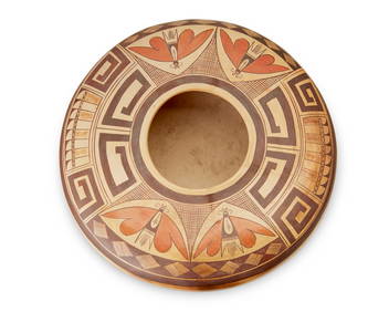
Priscilla Namingha Nampeyo (1924-2008, Hopi-Tewa), A large yellowware polychrome pottery seed pot,John Moran Auctioneers, Inc.4.7(453)See Sold PriceMar 12, 2024
A Hopi Nampeyo-style large flat-shouldered seed potJohn Moran Auctioneers, Inc.4.7(453)See Sold PriceMar 12, 2024
Florence Aragon (1929-2010, Acoma Pueblo), A large Tularosa swirl polychrome pottery olla, late 20thJohn Moran Auctioneers, Inc.4.7(453)See Sold PriceMar 12, 2024
Ruby Shroulate (b. 20th century, Acoma Pueblo), A large Anasazi Revival pottery jar, late 20thJohn Moran Auctioneers, Inc.4.7(453)See Sold PriceMar 12, 2024
Lois Medina (1959-2003, Zia Pueblo), A large polychrome pottery jar, late 20th centuryJohn Moran Auctioneers, Inc.4.7(453)See Sold PriceMar 12, 2024
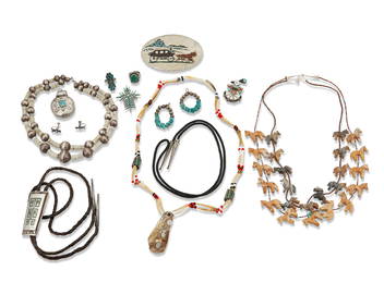
A large group of Santo Domingo/Kewa-style stone inlay jewelryJohn Moran Auctioneers, Inc.4.7(453)See Sold PriceMar 12, 2024
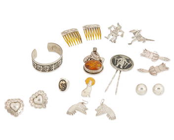
A large group of Southwest style silver jewelryJohn Moran Auctioneers, Inc.4.7(453)See Sold PriceMar 12, 2024
A large group of Southwest-style stone bead necklacesJohn Moran Auctioneers, Inc.4.7(453)See Sold PriceMar 12, 2024