Sold[Kitchin (Thomas)] British Isles[Kitchin (Thomas)] A Compleat Map of the British Isles, or Great Britain and Ireland with their respective Roads and Divisions,engraved map with original hand-colouring in outline, 610 x 475mmSee Sold Price
Sold[Kitchin (T)] A Compleat Map of the British Isles[Kitchin (Thomas)] A Compleat Map of the British Isles, or Great Britain and Ireland with their respective Roads and Divisions,engraved map with original hand-colouring in outline, 610 x 475mmSee Sold Price
Kitchin (Thomas) Map of EuropeKitchin (Thomas) A New and Accurate Map of Europe,from the British Isles and Scandinavia to the Mediterranean, North African coast and the Black Sea, with inset map of Iceland and large decoraSee Sold Price
THOMAS KITCHIN - A COMPLETE MAP OF THE BRITISH ISLES,Thomas Kitchin - A Complete Map Of The British Isles, 1788 - 30 3/4 X 36 In. - Giclée Print - Gallery Stretched - Ready to hang.See Sold Price
Kitchin (Thomas) Map of EuropeKitchin (Thomas) A New and Accurate Map of Europe, 2 engraved maps, each comprising 2 sheets joined to form a large map of Europe from the British Isles and Scandinavia to the Mediterranean, NSee Sold Price
THOMAS KITCHIN - A COMPLETE MAP OF THE BRITISH ISLES,Thomas Kitchin - A Complete Map Of The British Isles, 1788 - 37 5/8 X 44 In. This is a Giclée on Canvas. Very Large Piece!See Sold Price
THOMAS KITCHIN - A COMPLETE MAP OF THE BRITISH ISLES,Thomas Kitchin - A Complete Map Of The British Isles, 1788 - 30 3/4 X 36 In. - Giclée Print - Gallery Stretched - Ready to hang.See Sold Price
Thomas Kitchin - A Complete Map Of The British Isles,Thomas Kitchin - A Complete Map Of The British Isles, 1788 Size: 37 5/8 X 44 In. - This Is A Gallery Stretched Giclee Print On Canvas. The Piece Was Printed On High Quality Artist Grade 350 Gsm, Acid-See Sold Price
Thomas Kitchin - A Complete Map Of The British Isles,Thomas Kitchin - A Complete Map Of The British Isles, 1788 - Tea Stained Size: 27 X 36 In. - This Is A Gallery Stretched Giclee Print On Canvas. The Piece Was Printed On High Quality Artist Grade 350See Sold Price
Thomas Kitchin - A Complete Map Of The British Isles,Thomas Kitchin - A Complete Map Of The British Isles, 1788 Size: 30 3/4 X 36 In. - This Is A Gallery Stretched Giclee Print On Canvas. The Piece Was Printed On High Quality Artist Grade 350 Gsm, Acid-See Sold Price
Thomas Kitchin - A Complete Map Of The British Isles,Thomas Kitchin - A Complete Map Of The British Isles, 1788 Size: 37 5/8 X 44 In. - This Is A Gallery Stretched Giclee Print On Canvas. The Piece Was Printed On High Quality Artist Grade 350 Gsm, Acid-See Sold Price
THOMAS KITCHIN - A COMPLETE MAP OF THE BRITISH ISLES,Thomas Kitchin - A Complete Map Of The British Isles, 1788 - 37 5/8 X 44 In. - Giclée Print - Gallery Stretched - Ready to hang.See Sold Price
THOMAS KITCHIN - A COMPLETE MAP OF THE BRITISH ISLES,Thomas Kitchin - A Complete Map Of The British Isles, 1788 - 30 3/4 X 36 In. - This Giclée Print Is Gallery Stretched And Ready To Hang Or Lean Against A Wall, Or Display On An Easel. - A Giclée PriSee Sold Price
THOMAS KITCHIN - A COMPLETE MAP OF THE BRITISH ISLES,Thomas Kitchin - A Complete Map Of The British Isles, 1788 - 30 3/4 X 36 In. - This Giclée Print Is Gallery Stretched And Ready To Hang Or Lean Against A Wall, Or Display On An Easel. - A Giclée PriSee Sold Price
THOMAS KITCHIN - A COMPLETE MAP OF THE BRITISH ISLES,Thomas Kitchin - A Complete Map Of The British Isles, 1788 - 37 5/8 X 44 In. - This Giclée Print Is Gallery Stretched And Ready To Hang Or Lean Against A Wall, Or Display On An Easel. - A Giclée PriSee Sold Price
THOMAS KITCHIN - A COMPLETE MAP OF THE BRITISH ISLES,Thomas Kitchin - A Complete Map Of The British Isles, 1788 - 30 X 40 In. - Gallery Stretched The Piece Of Art Is Ready To Hang Or Lean Against A Wall, Or Display On An Easel. - A Giclée Print Is TheSee Sold Price
THOMAS KITCHIN - A COMPLETE MAP OF THE BRITISH ISLES,Thomas Kitchin - A Complete Map Of The British Isles, 1788 - 30 X 40 In. - Gallery Stretched The Piece Of Art Is Ready To Hang Or Lean Against A Wall, Or Display On An Easel. - A Giclée Print Is TheSee Sold Price
THOMAS KITCHIN -A COMPLETE MAP OF THE BRITISH ISLES,Thomas Kitchin -a Complete Map Of The British Isles, 1788 - Giclée On Canvas -37 5/8 X 44 In. - A Giclée Print Is The Highest Quality Print Available Today. Because There Is No Visible Dot Screen PaSee Sold Price
THOMAS KITCHIN - A COMPLETE MAP OF THE BRITISH ISThomas Kitchin - A Complete Map Of The British Isles, 1788 - Giclée On Canvas - 30 X 40 In. A Giclée Print Is The Highest Quality Print Available Today. Because There Is No Visible Dot Screen PatterSee Sold Price
A COMPLETE MAP OF THE BRITISH ISLES, 1788…THOMASThomas Kitchin - A Complete Map Of The British Isles, 1788 - 30 X 40 In. - This Giclée Print Is Gallery Stretched And Ready To HangSee Sold Price
A COMPLETE MAP OF THE BRITISH ISLES, 1788…THOMASThomas Kitchin - A Complete Map Of The British Isles, 1788 - 30 X 40 In. - This Gicle On Canvas Is Gallery Stretched And Ready To HangSee Sold Price
SoldGrp: 11 Maps of the British Isles w/ 1 Map ParmaGroup of ten maps of various regions of the British Isles, primarily dating from the 19th century. Includes one Thomas Kitchin (1718–1784) map of Leith, Ireland; one map of the rivers and canalSee Sold Price
THOMAS KITCHIN"A COMPLETE MAP OF THE BRITISH ISLESThis Is A THOMAS KITCHIN Giclee on CANVAS Titled "A COMPLETE MAP OF THE BRITISH ISLES, 1788"Measuring - 25 5/8 x 30 in.This Giclée is high-resolution and of the highest quality, has a color permanencSee Sold Price
Sold[Eastern America]. Kitchin, Thomas. British Domin[Eastern America]. Kitchin, Thomas. British Dominions In America, Drawn From The Latest And Best Authorities. (Engrav'd for Guthrie's new Geographical Grammar. Lon: c.1771). 14 x 15.5 inches. Neatly tSee Sold Price
LATE 17TH C. FRENCH MAP OF THE NEW WORLD BY ALEXIS-HUBERT JAILLOT (1632-1712)Thomaston Place Auction Galleries4.4(386)See Sold PriceFeb 24, 2024
Thomas Fairland (British 1804-1852) After Benjamin West (British/American 1738-1820)Nadeau's Auction Gallery4.7(401)See Sold PriceFeb 24, 2024
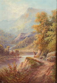
John Thomas Serres (British 1759 - 1825) Oil Painting on canvas Landscape c1870Global Auctions Company4.3(36)See Sold PriceMar 03, 2024
ATTR TO LIBERTY COMPANY ARTS CRAFTS COPPER MIRRORAntique Arena Inc.4.5(852)See Sold PriceFeb 24, 2024
ARTS AND CRAFTS HAMMERED LAMP BY FREDRICK FIFIELDAntique Arena Inc.4.5(852)See Sold PriceFeb 24, 2024
AN ANTIQUE FOLDING MAP OF THE BRITISH ISLES DATED 1873Hutchinson Scott Auctioneers4.4(39)See Sold PriceFeb 28, 2024
Chatelain - 3 Maps of the British Isles (England, Ireland, Scotland)Trillium Antique Prints & Rare Books4.5(30)See Sold PriceFeb 24, 2024
De Jode, Rare, pub. 1593 - Map of the British Isles [England, Scotland, Ireland] (Angliae Scotiae etTrillium Antique Prints & Rare Books4.5(30)See Sold PriceFeb 24, 2024
Map: A 17thC engraved map of the British Isles titled A Generall Mapp of the Isles of GreatClaydon Auctioneers Ltd4.3(125)See Sold PriceFeb 26, 2024
Map: An 18thC engraved map titled A New and Improved Map of Oxfordshire.. after Thomas Kitchin.Claydon Auctioneers Ltd4.3(125)See Sold PriceFeb 26, 2024
Stanford, Edward 1901 Large Map. Geological Map of the British IslesAlbion Auctions4.6(336)See Sold PriceMar 01, 2024
Stanford, Edward 1901 Large Map. Hydrographical Map of the British IslesAlbion Auctions4.6(336)See Sold PriceMar 01, 2024
Stanford, Edward 1901 Large Map. Stereographical Map of The British IslesAlbion Auctions4.6(336)See Sold PriceMar 01, 2024


![[Kitchin (Thomas)] British Isles First Image](https://p1.liveauctioneers.com/dist/images/placeholder.jpg?height=282&quality=95&width=282)
![[Kitchin (Thomas)] British Isles (1 of 0)](https://p1.liveauctioneers.com/dist/images/placeholder.jpg?height=282&quality=70)
![[Kitchin (Thomas)] British Isles First Image](https://p1.liveauctioneers.com/dist/images/placeholder.jpg?height=282&quality=1&width=282)
![[Kitchin (T)] A Compleat Map of the British Isles (1 of 1)](https://p1.liveauctioneers.com/410/14124/4342544_1_x.jpg?height=282&quality=70&version=1192724045)


![De Jode, Rare, pub. 1593 - Map of the British Isles [England, Scotland, Ireland] (Angliae Scotiae et (1 of 2)](https://p1.liveauctioneers.com/6581/319571/171593327_1_x.jpg?height=282&quality=70&version=1707853304)


![[Eastern America]. Kitchin, Thomas. British Domin (1 of 1)](https://p1.liveauctioneers.com/179/2417/1045238_1_x.jpg?height=282&quality=70)