ATLAS of ANTIENT GEOGRAPHY by SAMUEL BUTLER 1843John McInnis Auctioneers,LLC4.6(502)See Sold PriceFeb 24, 2024
18TH C. ANTIQUE MAP: FRENCH & INDIAN WAR, FRAMEDThomaston Place Auction Galleries4.4(386)See Sold PriceFeb 24, 2024
Rand McNally Railroad Map Cabinet w/ 21 Railroad MapsRail & Road Auctions4.6(165)See Sold PriceMar 08, 2024
Keith Haring - Ink on New York Map, Best Buddies, Inscribed, Signed, and DatedSapphire Auction Gallery4(67)See Sold PriceMar 02, 2024
LATE 17TH C. FRENCH MAP OF THE NEW WORLD BY ALEXIS-HUBERT JAILLOT (1632-1712)Thomaston Place Auction Galleries4.4(386)See Sold PriceFeb 24, 2024
Central Railroad of New Jersey Map of Sandy Hook Route-ca. 1903JM Hobby Supply and Railroad Artifact Auctions4.4(126)See Sold PriceFeb 24, 2024
Lot of Six Mixed Atlas Box Cars-HO Scale-New in BoxJM Hobby Supply and Railroad Artifact Auctions4.4(126)See Sold PriceFeb 25, 2024
Rand McNally/Santa Fe Railroad Map of Iowa-1912JM Hobby Supply and Railroad Artifact Auctions4.4(126)See Sold PriceFeb 24, 2024
NICOLAES VISSCHER (NETHERLANDS, 1618-1709) MAP OF THE NEW WORLDThomaston Place Auction Galleries4.4(386)See Sold PriceFeb 24, 2024
17TH C. WORLD MAP BY NICOLAES VISSCHER (NETHERLANDS, 1618-1709)Thomaston Place Auction Galleries4.4(386)See Sold PriceFeb 24, 2024
Lot of Six Mixed Atlas Cabooses-HO Scale-New in BoxJM Hobby Supply and Railroad Artifact Auctions4.4(126)See Sold PriceFeb 25, 2024
SoldJ.T. Lloyd Wall Map of U.S. & Canada"Lloyds New Map of the United States, the Canadas and New Brunswick" dated 1863. 39" high, 57 1/2" wide. Toned throughout, scattered edge losses and small tears, tear with old tape repair upper left,See Sold Price
SoldWall map of U.S. and Canada 1863Heading: (United States & Canada) Author: Lloyd, J.T. Title: Lloyd's New Map of the United States The Canadas And New Brunswick From the latest Surveys Showing Every Railroad & Station Finished to JunSee Sold Price
SoldRolled Map & P.R.R. CalendarsRolled Map & P.R.R. Calendars including: 1863, Lloyd's Railroad, Telegraph & Express Map of the Eastern States (to accompany Lloyd's map of the U.S. and Canada's), 27" across, plus three PennsylvaniaSee Sold Price
SoldLloyds New Map JT LLOYD 1862 Full Original ColorDetails: LLOYD, J.T. Lloyd's New Map of the United States the Canadas and New Brunswick from the latest surveys showing every railroad & station finished to June 1862. New York: J.T. Lloyd, 1863. FolSee Sold Price
Sold[Two-Sided United States Wall Map] 1867[Two-Sided United States Wall Map], "Lloyd's Topographical Railway Map of North America, or the United States Continent", 1867, J.T. Lloyd, publisher, New York, London, and en verso, "Lloyd's New MapSee Sold Price
Very Early Civil War Wall Map of the U.S.Ettling, Theodor (1823-Late 19th Century). United States of North America, Upper & Lower Canada... Photozincography map. Illustrated London News, 1861. 36" x 30 ½" sheet. "Supplement to the IllustrSee Sold Price
SoldLLOYD pocket map of the U.S.LLOYD, J. T. Lloyd's New Map of the United States the Canadas and New Brunswick From the latest Surveys showing every railroad & station finished to June 1863.New York: J. T. Lloyd, 1864. MSee Sold Price
Detailed Wall Map of United States during the Civil WarLloyd, J. T. (fl. c. 1852 - 1865). Lloyd's New Map of the United States the Canadas and New Brunswick... Lithographed Map. New York: J. T. Lloyd, 1863. 37" x 49 ½" sheet. Incredibly detailed map esSee Sold Price
SoldLLOYD, J. T. Lloyd's Map of the Lower MississiLLOYD, J. T. Lloyd's Map of the Lower Mississippi River from St. Louis to the Gulf of Mexico. With--Lloyd's New Map of the United States, the Canadas and New Brunswick. Together, 2 lithographed wall mSee Sold Price
Map of Eastern Canada New Brunswick, Newfoundland, 1911Map: Untitled. [Eastern Canada, New Brunswick, Newfoundland] Publication Date: 1911 Author: U.S. Geologic Survey, ANONYMOUS Publisher: U.S. Geologic Survey Size: Wall – 37.00 H x 28.50 W Inches ColoSee Sold Price
Sold1845 MITCHELL'S REFERENCE & DISTANCE WALL MAP U.S.SHOWING MITCHELL'S 1845 REFERENCE AND DISTANCE WALL MAP OF THE UNITED STATES WITH GENERAL MAP OF THE US WITH CONTIGUOUS BRITISH AND MEXICAN POSSESSIONS.PHILADELPHIA : S. AUGUSTUS MITCHELL COPPER-ENGRASee Sold Price
SoldDated 1861 J.T. Lloyd Map of Virginia.Stated "only map to plan campaigns in Virginia by General McClellan" 1828 & 1859. Some tears w/ wear consistent w/ age of document. Sze: 48 1/2" x 31 1/2"See Sold Price
MAPS - US & Canada. Trans-Canada Air LinesUnited States & Canada. Trans-Canada Air Lines, [Lot of 3] TCA Air Route Maps [and] Trans-Canada Air Lines Air Canada [and] Route Map Vancouver to Amsterdam, 1950-60 (circa). Printed Color. This lot iSee Sold Price
SoldC.W.Era Map U.S. & Canada R. de Tournon/Jules RenouardU.S., East Coast, New York, Canada; R. de Tournon / Jules Renouard - Etats-Unies de L'Amérique du Nord - 1851-1860 Object Map(More lots) Country (current geographical location): U.S. | Geographical sSee Sold Price
SoldMAP, US & Canada, Arctic, Robert de VaugondyColonial United States & Canada, Arctic. Didier Robert de Vaugondy, Partie de la Carte du Capitaine Cluny Auteur d'un Ouvrage Anglois Intitule American Traveller Publie a Londres en 1769, 1773 (circa)See Sold Price
Rand McNally New Official Railroad Map US & CanadaDESCRIPTION: Rand McNally New Official Railroad Map of the United States and Southern Canada including railroads, cities, towns, villages, post offices, lakes, rivers, etc. Brown paper covers over larSee Sold Price
SoldWall map of U.S. 1833Title: Map of the United States Author: Phelps, Humphrey Description: Engraved wall map, hand-colored. 52x74 cm. (20½x29"), backed with linen, 1 wooden roller present but loose.The United States streSee Sold Price
SoldWall map of U.S. titled "Mitchell's New National MapWall map of U.S. titled "Mitchell's New National Map Exhibiting the US with the North American British Provenances......." dated 1856 - Poor condition with some losses, paper peeling from canvas, wearSee Sold Price
SoldRare wall map of U.S. & Central America, 1859Heading: Author: Johnson & Browning Title: The Union with the adjacent islands & countries from authentic sources Place Published: New York Publisher:Johnson & Browning Date Published: 1859<See Sold Price
SoldWall Map of U.S. 1845Title: Ensign's Traveller's Guide and Map of the United States, Containing the Roads, Distances, Steam Boat and Canal Routes, &c. Author: Ensign, T. & E.H. Description: Engraved map, hand-colored. 65xSee Sold Price
Sold1850 RAILROAD MAP OF U.S. & CANADAFull title being: “Map of the European and North American Railway, Showing Connections with the Railways of the United States & Canada” Chief Engineer A. Morton, lithographed by Bowen & Co., PhilaSee Sold Price
SoldWall Map of U.S. 1847Heading: (United States) Author: Munson, S. Bishop Title: A Map of the United States Place Published: Cincinnati, Ohio Publisher:S. Bishop Munson Date Published: 1847 Description: <See Sold Price
SoldWall map of U.S. 1849 with Gold RegionTitle: Pictorial Map of the United States 1849 Author: Ensign & Thayer Description: Lithographed wall map, hand-colored, surrounded by pictures of historical events. 47x73 cm. (18½x28¾") plus the enSee Sold Price
SoldRare Civil War Wall Map of U.S.Heading: (United States) Author: Smith, J. Calvin Title: The New Naval And Military Map Of The United States... 1863 Place Published: Philadelphia Publisher:J. Baker Date Published: 1863 <See Sold Price
1875 Rand Avery and Co. Map of Express Companies and Railroads of the USA and CanadaJM Hobby Supply and Railroad Artifact Auctions4.4(126)See Sold PriceFeb 24, 2024
FLYING A TOURING SERVICE U.S. ROAD MAPS TIN WALL DISPLAY.Dan Morphy Auctions4.2(1.3k)See Sold PriceFeb 25, 2024
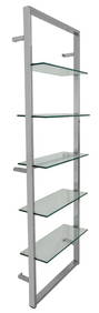
Streamline Moderne Chrome Wall Mounted EtagereAuctions at Showplace4.5(726)See Sold PriceMar 03, 2024
Crystal Wall Lancaster (Canada,20/21C) acrylic paintingBroward Auction Gallery4.8(277)See Sold PriceApr 14, 2024
Vintage County Map Of NY State Plate EngravingThe Benefit Shop Foundation Inc.4.3(2.9k)See Sold PriceFeb 28, 2024
Mostly U.S., Some Canada Maps etc (40 Pcs)Grant Zahajko Auctions, LLC4.8(1k)See Sold PriceMar 06, 2024


![[Two-Sided United States Wall Map] 1867 (1 of 6)](https://p1.liveauctioneers.com/268/66576/33774606_1_x.jpg?height=282&quality=70&version=1421356640)