SoldJEFFERYS / BOWLES. Bowles's New Pocket Map ofJEFFERYS / BOWLES. Bowles's New Pocket Map of the Most Inhabited Part of New England. Double-page engraved map, 650x530 mm, side margins ample, others wide, hand-colored in outline; scattered foxing oSee Sold Price
Sold2 Maps incl: BOWLES’S NEW POCKET MAP... [ca. 1780][Atlantic/Maryland] 2 Maps. ++ BOWLES’S NEW POCKET MAP OF THE ATLANTIC OR WESTERN OCEAN, Laid down from the latest Discoveries, and Regulated by Numerous Astronomical Observations. Lon: Carington BoSee Sold Price
BOWLES, John. Bowles's New Pocket Map of the DiscoBOWLES, John. Bowles's New Pocket Map of the Discoveries of the Russians on the West Coast of North America.London: Bowles & Carver, [c.1795]. Double-page engraved map, hand-colored in outlinSee Sold Price
SoldBOWLES / EVANS. Bowles's New Pocket Map of theBOWLES / EVANS. Bowles's New Pocket Map of the Middle British Colonies. Double-page engraved map, 515x685 mm, ample margins; hand-colored in outline; few closed tears at edges, several just reaching iSee Sold Price
SoldBOWLES, CARINGTON. Bowles's New Pocket Map ofBOWLES, CARINGTON. Bowles's New Pocket Map of Jamaica. Double-page engraved map, 495x570 mm, wide margins; hand-colored in outline; minor foxing; linen-backed, staining in top margin at edges (not neaSee Sold Price
SoldBOWLES, CARINGTON. Bowles's New Pocket Map ofBOWLES, CARINGTON. Bowles's New Pocket Map of America. Double-page engraved map, 515x565 mm, ample margins; hand-colored in outline; some scattered foxing, some staining at sheet edges (not near imageSee Sold Price
SoldBowles's New Pocket Map of England & Wales with theBowles's New Pocket Map of England & Wales with the Addition of New Roads and other Improvements by Daniel Paterson Esq., published Bowles & Carver, circa 1780, engraved map with contemporary hand colSee Sold Price
SoldBOWLES, CARINGTON. Bowles's New Pocket Map ofBOWLES, CARINGTON. Bowles's New Pocket Map of the World. Double-page engraved double-hemispheric world map, 410x740 mm, top and bottom margins wide, side margins trimmed to platemark; hand-colored inSee Sold Price
SoldBOWLES’S Map of New England Offset LithographBOWLES’S Map of New England Offset Lithograph, inscription reads ‘BOWLES’s New Pocket Map of the most inhabited part of New England comprehending the provinces of Massachusetts Bay and Nee HampsSee Sold Price
SoldNorth America in 1784 with XIII United StatesHeading: (North America) Author: Delarochette, Louis Title: Bowles's New Pocket Map of North America Divided into its Provinces, Colonies, States, etc., by J. Palairet, Geographer, Lately Revised andSee Sold Price
SoldRare re-issue of map of Russian discoveries inHeading: Author: Bowles, Carrington Title: Bowles's New Pocket Map of the Discoveries of the Russians on the West Coast of North America Published by the Royal Academy of Sciences at Petersburg PlaceSee Sold Price
SoldLater edition of Lewis Evan's Milestone Map of the EastBowles's New Pocket Map of the Following Independent States… Lewis Evans (1700-1756). Engraved map with original hand color in part. London, 1780. 21 1/4 x 27 1/2 inches. Evans’ map became the staSee Sold Price
SoldMAP OF NEW ENGLAND, Bowle's New Pocket Map of theMAP OF NEW ENGLAND, Bowle's New Pocket Map of the Most Inhabited Part. Reproduction - 23 1/2 x 18 1/4, overall.See Sold Price
SoldBowles Map of the East CoastAfter Lewis Evans (c. 1700-1756). Bowle's New Pocket Map of the Following Independent States... Engraved map with original hand color in part. London, 1780. 21 1/4" x 27 1/2" sheet. Evans’ mapSee Sold Price
SoldLondon.- Bowles (Carington) Bowles's New Pocket Plan ofLondon.- Bowles (Carington) Bowles's New Pocket Plan of the Cities of London & Westminster; with the Borough of Southwark; Comprehending the New Buildings and other Alterations to the year 1783, showiSee Sold Price
SoldBowles (Carington) - Bowles's New Pocket Plan offrom Angel to Newington Butts, and from Stepney to Knightsbridge, title panel upper left, compass rose lower right, engraved plan with original hand-colouring, on 2 sheets, joined, 455 x 915mm., disseSee Sold Price
Sold12 pcs Antique Vintage Paper Book Pages. Mostly m12 pcs Antique Vintage Paper Book Pages. Mostly maps. "Die Statt Strakburg" book page. Bowle's New Pocket Map NORTH AMERICA. "Veduta Scenographica a Ponente Della Citta di Napoli in Campagna Felice. (See Sold Price
SoldBowles (Carington) - Bowles's Reduced New Pocket Planwith the Borough of Southwark, exhibiting the New Buildings to the Year 1792, from Angel to Newington Butts, and from Stepney to Hyde Park, title above and key panel below, compass rose lower right, eSee Sold Price
SoldJigsaw. Bowles (Carington) - Bowles's New One-sheet Mapinset map of Orkney and Shetland Islands, upper right, oval title cartouche lower left, engraved map with original hand-colouring in outline, mounted on wood and dissected as a jigsaw, 550 x 510mm., sSee Sold Price
Sold'Bowles's New Medium Map of Surrey', 18th Century'Bowles's New Medium Map of Surrey', 18th Century Hand-Coloured. 9" x 13", along with Hawkin's 'Mother Ludlam's Hole near Farnham, Surrey', 6" x 9".See Sold Price
SoldBowles & Carver. Bowles's New One-Sheet Map of IreBowles & Carver. Bowles's New One-Sheet Map of Ireland, Divided into its Provinces, Counties & Baronies,engraved map with full original hand-colouring, oval title cartouche at upper left, 635See Sold Price
SoldBowles's New Travelling Map of EnglandBowles's New Travelling Map of England and Wales,with decorative vignette title cartouche, engraved map with full original hand-colouring, 610 x 530mm., dissected and linen-backed, some splitSee Sold Price
SoldBOWLES and CARVER. Bowles's New One-Sheet MapBOWLES and CARVER. Bowles's New One-Sheet Map of America. Engraved folding map of North and South America, 600x600 mm, wide margins; hand-colored. London: Bowles & Carver, circa 1796 All items are ofSee Sold Price
SoldBowles (Carington) Bowles's Reduced New Pocket PlaBowles (Carington) Bowles's Reduced New Pocket Plan of the Cities of London and Westminster,showing from Islington down to Lambeth, and Hyde Park across to Mile End, with reference table belowSee Sold Price
1892 Adams and Bowles New Road Map of the State of New YorkJM Hobby Supply and Railroad Artifact Auctions4.4(127)See Sold PriceFeb 24, 2024
Central Railroad of New Jersey Map of Sandy Hook Route-ca. 1903JM Hobby Supply and Railroad Artifact Auctions4.4(127)See Sold PriceFeb 24, 2024
Kenyons Pocket Map and Shippers Guide of Wisconsin-1914JM Hobby Supply and Railroad Artifact Auctions4.4(127)See Sold PriceFeb 24, 2024
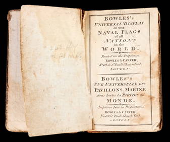
BOWLES'S UNIVERSAL DISPLAY of NAVAL FLAGS c1790John McInnis Auctioneers,LLC4.5(505)See Sold PriceFeb 24, 2024
Portfolio of 15 County Maps by Robert Morden (English 1650-1703)Nadeau's Auction Gallery4.7(410)See Sold PriceFeb 24, 2024
Thirty Pieces of Lackawanna Railroad Ephemera - Chief Engineer Timebook, Map, Public Timetables,Rail & Road Auctions4.6(165)See Sold PriceMar 07, 2024
Keith Haring - Ink on New York Map, Best Buddies, Inscribed, Signed, and DatedSapphire Auction Gallery4.1(67)See Sold PriceMar 02, 2024
1849 THE NEW-ENGLAND MERCANTILE UNIONNorth American Artifact Auctions4.7(201)See Sold PriceApr 20, 2024
[ARCTIC]. BOWEN, Emanuel. A New & Accurate Map of the North...Potter & Potter Auctions4.6(550)See Sold PriceMar 07, 2024
Map: A 19thC engraved and hand coloured map of Buckingham titled A New Map of BuckinghamshireClaydon Auctioneers Ltd4.3(125)See Sold PriceFeb 26, 2024
1750 Bowen Map of Bermuda and St. Kitts -- A New & Accurate Map of Bermudas or Sommer's Islands...Jasper524.5(9.9k)See Sold PriceFeb 27, 2024
Herman Moll A New Map of Ye North Parts of AmericaWillow Auction House4.5(292)See Sold PriceMar 14, 2024


![2 Maps incl: BOWLES’S NEW POCKET MAP... [ca. 1780] (1 of 8)](https://p1.liveauctioneers.com/179/72471/37352403_1_x.jpg?height=282&quality=70&version=1432244280)


![[ARCTIC]. BOWEN, Emanuel. A New & Accurate Map of the North... (1 of 1)](https://p1.liveauctioneers.com/928/318880/171360917_1_x.jpg?height=282&quality=70&version=1707501302)


