ATLAS of ANTIENT GEOGRAPHY by SAMUEL BUTLER 1843John McInnis Auctioneers,LLC4.5(505)See Sold PriceFeb 24, 2024
18TH C. ANTIQUE MAP: FRENCH & INDIAN WAR, FRAMEDThomaston Place Auction Galleries4.4(393)See Sold PriceFeb 24, 2024
Rand McNally Railroad Map Cabinet w/ 21 Railroad MapsRail & Road Auctions4.6(165)See Sold PriceMar 08, 2024
Keith Haring - Ink on New York Map, Best Buddies, Inscribed, Signed, and DatedSapphire Auction Gallery4(67)See Sold PriceMar 02, 2024
LATE 17TH C. FRENCH MAP OF THE NEW WORLD BY ALEXIS-HUBERT JAILLOT (1632-1712)Thomaston Place Auction Galleries4.4(393)See Sold PriceFeb 24, 2024
Central Railroad of New Jersey Map of Sandy Hook Route-ca. 1903JM Hobby Supply and Railroad Artifact Auctions4.4(127)See Sold PriceFeb 24, 2024
Lot of Six Mixed Atlas Box Cars-HO Scale-New in BoxJM Hobby Supply and Railroad Artifact Auctions4.4(127)See Sold PriceFeb 25, 2024
Rand McNally/Santa Fe Railroad Map of Iowa-1912JM Hobby Supply and Railroad Artifact Auctions4.4(127)See Sold PriceFeb 24, 2024
NICOLAES VISSCHER (NETHERLANDS, 1618-1709) MAP OF THE NEW WORLDThomaston Place Auction Galleries4.4(393)See Sold PriceFeb 24, 2024
17TH C. WORLD MAP BY NICOLAES VISSCHER (NETHERLANDS, 1618-1709)Thomaston Place Auction Galleries4.4(393)See Sold PriceFeb 24, 2024
Lot of Six Mixed Atlas Cabooses-HO Scale-New in BoxJM Hobby Supply and Railroad Artifact Auctions4.4(127)See Sold PriceFeb 25, 2024
Japanese Map, 1942, WWII: China, Manchuria, East RussiaJapanese map 1942 of Chinese Manchuria, Mongolia & East Russia. Published during World War II in July 1942 (Showa 17). 43 x 31 in (109 x 78 cm) Depicts the East China, Siberia, Mongolia, North JapanSee Sold Price
Japanese Map, 1942: China, Manchuria, East RussiaJapanese map 1972 of Chinese Manchuria, Mongolia & East Russia. Published during World War II in July 1942 (Showa 17). 43 x 31 in (109 x 78 cm) Depicts the East China, Siberia, Mongolia, North JapanSee Sold Price
Japanese Map, 1942: China, Manchuria, East RussiaJapanese map 1972 of Chinese Manchuria, Mongolia & East Russia. Published during World War II in July 1942 (Showa 17). 43 x 31 in (109 x 78 cm) Depicts the East China, Siberia, Mongolia, North JapanSee Sold Price
SECOND WORLD WAR. Russia & Japanese-occupied Manchuria. China 1942 old mapTITLE/CONTENT OF MAP: 'East Asiatic Russia' DATE PRINTED: 1942 IMAGE SIZE: Approx 22.5 x 27.5cm, 8.75 x 10.75 inches (Large) TYPE: Vintage colour map CONDITION: Good; suitable for framing. However, plSee Sold Price
SECOND WORLD WAR. Russia & Japanese-occupied Manchuria. China 1942 old mapTITLE/CONTENT OF MAP: 'East Asiatic Russia' DATE PRINTED: 1942 IMAGE SIZE: Approx 22.5 x 27.5cm, 8.75 x 10.75 inches (Large) TYPE: Vintage colour map CONDITION: Good; suitable for framing. However, plSee Sold Price
Japanese 1942 Wartime Map: China, Manchukuo, RussiaTitle/Content of Map:Japanese 1942 Wartime Map: China, Manchukuo, Russia Date: July, 1942 (Showa 17) Cartographer: Issued by the Economy Research Bureau of Manchuria Railway Corporation, 1942. MateriaSee Sold Price
MANCHURIA & SOUTH EAST SIBERIA Mongolia China Russia East Asia JOHNSTON 1913 mapCAPTION PRINTED BELOW PICTURE: 'Manchuria and South East Siberia' DATE PRINTED: 1913 IMAGE SIZE: Approx 34.5 x 43.5cm, 13.5 x 17.25 inches (Large); Please note that this is a folding map. TYPE: AntiquSee Sold Price
MANCHURIA & SOUTH EAST SIBERIA Mongolia China Russia East Asia JOHNSTON 1915 mapTITLE/CONTENT OF MAP: 'Manchuria and South East Siberia' DATE PRINTED: 1915 IMAGE SIZE: Approx 35.0 x 45.0cm, 13.75 x 17.75 inches (Large); Please note that this is a folding map. TYPE: Antique colourSee Sold Price
MANCHURIA & SOUTH EAST SIBERIA Mongolia China Russia East Asia JOHNSTON 1912 mapCAPTION PRINTED BELOW PICTURE: 'Manchuria and South East Siberia' DATE PRINTED: 1912 IMAGE SIZE: Approx 34.5 x 43.5cm, 13.5 x 17.25 inches (Large); Please note that this is a folding map. TYPE: AntiquSee Sold Price
MANCHURIA & SOUTH EAST SIBERIA Mongolia China Russia East Asia JOHNSTON 1915 mapTITLE/CONTENT OF MAP: 'Manchuria and South East Siberia' DATE PRINTED: 1915 IMAGE SIZE: Approx 35.0 x 45.0cm, 13.75 x 17.75 inches (Large); Please note that this is a folding map. TYPE: Antique colourSee Sold Price
MONGOLIA MANCHURIA RUSSIAN FAR EAST. Korea China Amur Baikal. LETTS 1884 mapTITLE/CONTENT OF MAP: 'Russia in Asia, Chinese Empire, &c No 3' DATE PRINTED: 1884 IMAGE SIZE: Approx 36.0 x 42.5cm, 14 x 16.75 inches (Large) TYPE: Antique colour atlas map CONDITION: Good; suitableSee Sold Price
MONGOLIA MANCHURIA RUSSIAN FAR EAST. Korea China Amur Baikal. LETTS 1883 mapTITLE/CONTENT OF MAP: 'Russia in Asia, Chinese Empire, &c No 3' DATE PRINTED: 1883 IMAGE SIZE: Approx 36.5 x 43.0cm, 14.5 x 17 inches (Large); Please note that this is a folding map. TYPE: Antique colSee Sold Price
WORLD WAR 2 Japanese occupied Philippines Malaya Indochina Thailand 1942 mapTITLE/CONTENT OF MAP: 'Malaya, East Indies, Thailand and Indo-China' DATE PRINTED: 1942 IMAGE SIZE: Approx 22.5 x 27.5cm, 8.75 x 10.75 inches (Large) TYPE: Vintage colour map CONDITION: Good; suitableSee Sold Price
EAST ASIA. Independent Tibet Xinjiang Tuva. Japanese occupied Manchuria 1944 mapTITLE/CONTENT OF MAP: 'China and Japan' This map was printed in an atlas that was published during the Second World War. Many of the maps show the advance of the Axis powers including the domination oSee Sold Price
SoldWWII US / Chinese Military EphemeraComprising: four maps, Chinese Ministry of Information "War Map of China and Far East Showing Japanese Military Aggression (July 7, 1943)", MacMillan "Map of China (1937-1943)", "Follow the War: HagstSee Sold Price
Encroachments of Asiatic Russia on China. East Asia. Sketch map 1885 oldTITLE/CONTENT OF MAP: 'Encroachments of Asiatic Russia on China' DATE PRINTED: 1885 IMAGE SIZE: Approx 11.5 x 11.5cm, 4.5 x 4.5 inches (Small) TYPE: Antique engraved sketch map CONDITION: Good; suitabSee Sold Price
SoldWWII 1942 British East Anglia Air Force Map24 inch x 29.5 inch map of East Anglia produced by the British War Office and used by RAF and US Pilots in 1942. This one belonged to Brigadier General Jesse Auton, Cpommander of an 8th AAF Fighter WiSee Sold Price
WW2 ASIA. Japanese-occupied China Indochina Philippines. Middle East 1942 mapTITLE/CONTENT OF MAP: 'Asia: Political' DATE PRINTED: 1942 IMAGE SIZE: Approx 27.0 x 44.0cm, 10.75 x 17.25 inches (Large) TYPE: Vintage colour map CONDITION: Good; suitable for framing. However, pleasSee Sold Price
WW2 ASIA. Japanese-occupied China Indochina Philippines. Middle East 1942 mapTITLE/CONTENT OF MAP: 'Asia: Political' DATE PRINTED: 1942 IMAGE SIZE: Approx 27.0 x 44.0cm, 10.75 x 17.25 inches (Large) TYPE: Vintage colour map CONDITION: Good; suitable for framing. However, pleasSee Sold Price
SoldWWII JAPANESE TYPE 30 BAYONET HOTEN - MUKDEN CHINAWWII JAPANESE TYPE 30 BAYONET HOTEN - MUKDEN CHINA WWII Imperial Japanese Bayonet Type 30. Single edged, blued fullered blade. Maker mark / logo of Hoten - Mukden, Chine (Japanese occupied Manchuria)See Sold Price
SoldWWII JAPANESE INVASION CURRENCY NOTESWWII JAPANESE INVASION CURRENCY NOTES ~ WITH COA AND INCLUDING: NETHERLANDS (EAST INDIES) BILL, CHINA 5 YEN, MALAYA $10 NOTE, FILLIPINO 10 PESOS NOTE, AND A BURMESE 10 RUPEE JAPANESE INVASION NOTE.See Sold Price
Original Antique Map - China - Korea - Japan - 19th Century - East Asia - LapieA fine first edition example of M. Lapie's 1832 map of the Chinese empire and Japan. The map covers all of China, Korea, and Japan from Asiatic Russia to India and the Sea of China and from IndependenSee Sold Price
SIBERIA & CHINESE TARTARY Manchuria Mongolia Korea China East Asia SDUK 1844 mapTITLE/CONTENT OF MAP: 'SIBERIA AND CHINESE TARTARY.' DATE PRINTED: This map was originally published by The Society for the Diffusion of Useful Knowledge in 1838; this date is printed on the map. ThisSee Sold Price
SIBERIA & CHINESE TARTARY Manchuria Mongolia Korea China East Asia SDUK 1844 mapTITLE/CONTENT OF MAP: 'SIBERIA AND CHINESE TARTARY.' DATE PRINTED: This map was originally published by The Society for the Diffusion of Useful Knowledge in 1838; this date is printed on the map. ThisSee Sold Price
Canadian National RY Green Matchholder/AshtrayJM Hobby Supply and Railroad Artifact Auctions4.4(127)See Sold PriceFeb 24, 2024
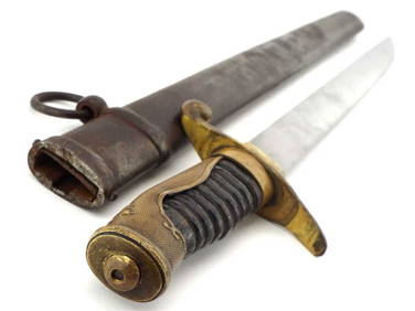
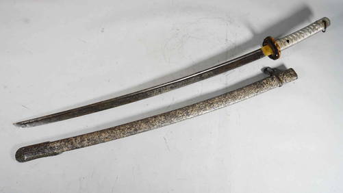
Japanese WWII ERA NCO Sword with Alloy Grip & Metal SheathNeo FineArts Inc4.4(13)See Sold PriceFeb 25, 2024
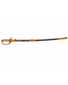
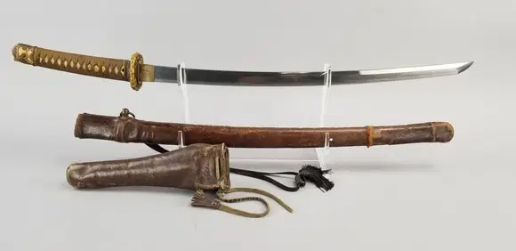
WWII Japanese Type 98 Shin-Gunto Katana SwordEpic Auctions and Estate Sales4.6(210)See Sold PriceMar 02, 2024
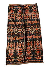
Collection of Allied Military Silk Printed Maps, WWII Era and LaterMaterial Culture4.6(778)See Sold PriceFeb 29, 2024
[ARCTIC]. BOWEN, Emanuel. A New & Accurate Map of the North...Potter & Potter Auctions4.6(545)See Sold PriceMar 07, 2024
[BUSINESS]. Travel Guide of Negro Hotels and Guest Houses. Published by Afro-American Newspapers ofFreeman's | Hindman4.4(1.6k)See Sold PriceFeb 27, 2024
1749 MAP CARTE DE LA TARTARIE ORIENTALE RUSSIA & CHINA antique EASTERN TARTARYJasper524.5(9.9k)See Sold PriceFeb 27, 2024
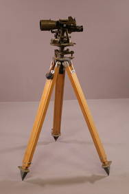
WWII JAPANESE THEODOLITE IN WOODEN CASE W/ TRIPODRedlands Antique Auction4.8(862)See Sold PriceFeb 24, 2024
Lot of WW2 WWII CBI China Burma India engraved Cigarette CasesEagles Corps International LLC4.5(107)See Sold PriceMar 10, 2024
Rare WW2 WWII Japanese Imperial Army M38 officers visor with boxEagles Corps International LLC4.5(107)See Sold PriceMar 10, 2024
Named WW2 WWII Japanese Yosegaki Battle FlagEagles Corps International LLC4.5(107)See Sold PriceMar 10, 2024
WWII RARE RAF Eagle Squadron ID'D UniformEagles Corps International LLC4.5(107)See Sold PriceMar 10, 2024
Chinese Clair-de-Lune Censer With Japanese Silver TopLion and Unicorn4.8(1.9k)See Sold PriceMar 12, 2024
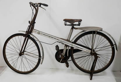
Occupied Japan Bicycle Salvaged Airplane PartsGrant Zahajko Auctions, LLC4.7(1k)See Sold PriceMar 06, 2024
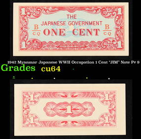
1942 Myanmar Japanese WWII Occupation 1 Cent "JIM" Note P# 9 Grades Choice CUKey Date Coins4.4(1.4k)See Sold PriceFeb 25, 2024
1942 Philippines (Japanese WWII Occupation) 10 Centavos "JIM" Note P# 104 Grades Choice CUKey Date Coins4.4(1.4k)See Sold PriceFeb 29, 2024


![[ARCTIC]. BOWEN, Emanuel. A New & Accurate Map of the North... (1 of 1)](https://p1.liveauctioneers.com/928/318880/171360917_1_x.jpg?height=282&quality=70&version=1707501302)
![[BUSINESS]. Travel Guide of Negro Hotels and Guest Houses. Published by Afro-American Newspapers of (1 of 4)](https://p1.liveauctioneers.com/197/319238/171467937_1_x.jpg?height=282&quality=70&version=1707520367)