ATLAS of ANTIENT GEOGRAPHY by SAMUEL BUTLER 1843John McInnis Auctioneers,LLC4.6(502)See Sold PriceFeb 24, 2024
18TH C. ANTIQUE MAP: FRENCH & INDIAN WAR, FRAMEDThomaston Place Auction Galleries4.4(386)See Sold PriceFeb 24, 2024
Rand McNally Railroad Map Cabinet w/ 21 Railroad MapsRail & Road Auctions4.6(165)See Sold PriceMar 08, 2024
Keith Haring - Ink on New York Map, Best Buddies, Inscribed, Signed, and DatedSapphire Auction Gallery4(67)See Sold PriceMar 02, 2024
LATE 17TH C. FRENCH MAP OF THE NEW WORLD BY ALEXIS-HUBERT JAILLOT (1632-1712)Thomaston Place Auction Galleries4.4(386)See Sold PriceFeb 24, 2024
Central Railroad of New Jersey Map of Sandy Hook Route-ca. 1903JM Hobby Supply and Railroad Artifact Auctions4.4(126)See Sold PriceFeb 24, 2024
Lot of Six Mixed Atlas Box Cars-HO Scale-New in BoxJM Hobby Supply and Railroad Artifact Auctions4.4(126)See Sold PriceFeb 25, 2024
Rand McNally/Santa Fe Railroad Map of Iowa-1912JM Hobby Supply and Railroad Artifact Auctions4.4(126)See Sold PriceFeb 24, 2024
NICOLAES VISSCHER (NETHERLANDS, 1618-1709) MAP OF THE NEW WORLDThomaston Place Auction Galleries4.4(386)See Sold PriceFeb 24, 2024
17TH C. WORLD MAP BY NICOLAES VISSCHER (NETHERLANDS, 1618-1709)Thomaston Place Auction Galleries4.4(386)See Sold PriceFeb 24, 2024
Lot of Six Mixed Atlas Cabooses-HO Scale-New in BoxJM Hobby Supply and Railroad Artifact Auctions4.4(126)See Sold PriceFeb 25, 2024
Hughes: Antique Map of Route of Xenophon, 1856Map: Route of Xenophon and the Ten Thousand Greeks Date: 1856 By William Hughes from Long's Classical Atlas. Includes: Troja, Thermopylae, Marathon, Plataea, Mantinea, Granicus, Leuctra, Issus, ArbelaSee Sold Price
Hughes: Antique Map of Sicilia, 1856Map: Sicilia Date: 1856 By William Hughes from Long's Classical Atlas Size: 10 x 6.5 inches Please note that this lot has a confidential reserve. When you leave a bid in advance of the auction, submitSee Sold Price
Hughes: Antique Map of Graecia & Macedonia, 1856Map: Graecia Including Epirus and thessalia with Part of Macedonia Date: 1856 By William Hughes from Long's Classical Atlas Size: 10 x 13 inches Please note that this lot has a confidential reserve. WSee Sold Price
SoldHughes: Antique Map of Asia Minor & Syria, 1856Map: Asia Minor and the Northern Part of Syria Date: 1856 By William Hughes from Long's Classical Atlas Size: 13 x 10 inches Please note that this lot has a confidential reserve. When you leave a bidSee Sold Price
Hughes: Antique Map of Agaean Sea Islands, 1856Map: The Coasts and Islands of The Agaean Sea Date: 1856 By William Hughes from Long's Classical Atlas Size: 10 x 13 inches Please note that this lot has a confidential reserve. When you leave a bid iSee Sold Price
Hughes: Antique Map of Palaestina & Part of Syria, 1856Map: Palaestina with Part of Syria Date: 1856 By William Hughes from Long's Classical Atlas Size: 10 x 13 inches Please note that this lot has a confidential reserve. When you leave a bid in advance oSee Sold Price
The World as known to the Ancients, by WILLIAM HUGHES 1856 old antique mapCAPTION PRINTED BELOW PICTURE: 'The World as known to the Ancients' DATE PRINTED: 1856 IMAGE SIZE: Approx 31.5 x 42.5cm, 12.5 x 16.75 inches (Large) TYPE: Antique atlas map with original hand colourinSee Sold Price
SoldAN ANTIQUE MAP, "Ensign, Bridgman & Fanning's RailroadAN ANTIQUE MAP, "Ensign, Bridgman & Fanning's Railroad Map of the United States, Showing the Depots and Stations," NEW YORK, 1856, hand-colored with pencil inscription of route including off railSee Sold Price
The World as known to the Ancients, by WILLIAM HUGHESTITLE/CONTENT OF MAP: 'The World as known to the Ancients' Date: 1856 IMAGE SIZE: Approx 31.5 x 42.5cm, 12.5 x 16.75 inches (Large) TYPE: Antique atlas map with original hand colouring / coloring CONDSee Sold Price
Countries embraced within the travels of St Paul. Mediterranean. HUGHES 1856 mapTITLE/CONTENT OF MAP: 'The countries embraced within the travels of St. Paul' DATE PRINTED: 1856 IMAGE SIZE: Approx 20.5 x 30.0cm, 8 x 11.75 inches (Medium) TYPE: Antique atlas map with original handSee Sold Price
Hughes: Map of China showing provinces & Great WallTITLE/CONTENT OF MAP: 'China' China showing provinces & Great Wall. 1842 Treaty Ports. DATE PRINTED: 1856 IMAGE SIZE: Approx 30.5 x 41.0cm, 12 x 16.25 inches (Large) TYPE: Antique atlas map with origiSee Sold Price
Countries embraced within the travels of St Paul. Mediterranean. HUGHES 1856 mapCAPTION PRINTED BELOW PICTURE: 'The countries embraced within the travels of St. Paul' DATE PRINTED: 1856 IMAGE SIZE: Approx 20.5 x 30.0cm, 8 x 11.75 inches (Medium) TYPE: Antique atlas map with origiSee Sold Price
SoldMap of Louisiana, 1856 by Charles Desilver[Antique Hand-Colored Map of Louisiana], 1856, "A New Map of Louisiana with its canals, roads, & distances from place to place, along the stage & steam boat routes", by Charles Desilver, Phila., sightSee Sold Price
Hughes: Antique Map of Ancient World Alps to PersepolisTITLE/CONTENT OF MAP: 'Map of the principal countries of the Ancient World extending from the Alps to the southern frontier of Egypt and from Carthage to Persepolis [Inset: the Roman Empire, the PersiSee Sold Price
SoldFRAMED 1856 MAP OF TEXASFramed antique map, Texas, 1856, prepared for Yoakum's History of Texas, inset maps of Galveston Bay and Sabine Lake, shows west Texas as "desolate and steirle" land, some foxing, sight: approx. 12.5"See Sold Price
SoldChapman SECTIONAL MAP OF WISCONSIN 1856 Antique MapDetails: CHAPMAN, Silas (1813-1899). Chapman's Sectional Map of Wisconsin with the most recent surveys. Milwaukee: S. Chapman, 1856 [lithographed by F. Mayer, New York]. Folding pocket map, full periSee Sold Price
SoldColton: Antique Map of Iowa, 1856Map: 1856 Colton Map of Iowa --Iowa Cartographer: J Colton Year / Place: 1856, New York Map Dimensions: 12.5 x 15.5 in. Condition: Very good. Nicely colored. Slight toning, mostly in margins. A very nSee Sold Price
Hall: Antique Map of Ireland, 1856TITLE/CONTENT OF MAP: 'Ireland' showing counties & railways DATE PRINTED: 1856 IMAGE SIZE: Approx 54.0 x 41.5cm, 21.25 x 16.25 inches (Large); Please note that this is a folding map. TYPE: Antique atlSee Sold Price
SoldHall: Antique Map of Asia, 1856TITLE/CONTENT OF MAP: 'Asia' Siam Birmah Cochin China Niphon Persia Arabia DATE PRINTED: 1856 IMAGE SIZE: Approx 28.5 x 40.5cm, 11.25 x 16 inches (Large) TYPE: Antique atlas map with original hand colSee Sold Price
SoldAN ANTIQUE POSTAL MAP, "Post Route Map of the State ofAN ANTIQUE POSTAL MAP, "Post Route Map of the State of Texas with adjacent parts of Louisiana, Arkansas, Indian Territory, and the Republic of Mexico," CIRCA 1878, hand colored lithograph on paper, "DSee Sold Price
SoldSidney Hall: Antique Map of Ireland, 1856Title/Content of Map: Ireland showing counties & railways Date Printed: 1856 Image Size: Approx 54.0 x 41.5cm, 21.25 x 16.25 inches (Large); Please note that this is a folding map. Type: Antique atlasSee Sold Price
SoldWorld's highest waterfalls & biggest lakes. HUGHES 1876 old antique map chartTITLE/CONTENT OF MAP: 'Waterfalls. Lakes' DATE PRINTED: 1876 IMAGE SIZE: Approx 25.0 x 30.5cm, 9.75 x 12 inches (Large) TYPE: Antique hand coloured engraved map CONDITION: Good; suitable for framing.See Sold Price
Sidney Hall: Antique Map of Europe, 1856TITLE/CONTENT OF MAP: 'Europe' Prussia Austria Turkey in Europe &c DATE PRINTED: 1856 IMAGE SIZE: Approx 28.0 x 40.5cm, 11 x 15.75 inches (Large) TYPE: Antique atlas map with original hand colouring /See Sold Price
Sidney Hall: Antique Map of Holland, 1856Title/Content of Map: 'Holland' Netherlands. Railways. old antique map plan chart Date Printed: 1856 Image Size: Approx 40.5 x 29.0cm, 15.75 x 11.25 inches (Large) Type: Antique atlas map with originaSee Sold Price
William Simpson's Sketches at the Seat of War - Two Volumes with 81 Hand-colored LithographsTrillium Antique Prints & Rare Books4.5(30)See Sold PriceFeb 24, 2024
Morocco, Algeria, Tunisia & Libya. North Africa. HUGHES 1876 old antique mapJasper524.5(9.8k)See Sold PriceFeb 28, 2024
NORTHERN AFRICA. Morocco Tunisia Algeria. Caravan routes. RAPKIN/TALLIS 1851 mapJasper524.5(9.8k)See Sold PriceFeb 28, 2024
WEST AFRICA Explorers' routes Senegal Ashanti. Mountains of Kong. SDUK 1857 mapJasper524.5(9.8k)See Sold PriceFeb 28, 2024
WEST AFRICA explorers' routes. Beaufort Gray Park Dochard Caillie. SDUK 1874 mapJasper524.5(9.8k)See Sold PriceFeb 28, 2024
Pre-colonial Africa. Mountains of Kong/Moon. Caravan routes. THOMSON 1817 mapJasper524.5(9.8k)See Sold PriceFeb 28, 2024
COLONIES FRANÇAISES AFRIQUE. Africa Sénégambie Madagascar. LEVASSEUR 1856 mapJasper524.5(9.8k)See Sold PriceFeb 28, 2024
AFRIQUE. Africa. Decorative antique map/carte by Victor LEVASSEUR 1856 oldJasper524.5(9.8k)See Sold PriceFeb 28, 2024
WEST AFRICA I Explorers' routes Senegal Ashanti Ivory Gold Coast. SDUK 1851 mapJasper524.5(9.8k)See Sold PriceFeb 28, 2024
Early colonial Africa. Inset Madeira & Aden. SIDNEY HALL 1856 old antique mapJasper524.5(9.8k)See Sold PriceFeb 28, 2024
NIGERIA explorers' routes. Lander Clapperton Oudney Denham Allen. SDUK 1874 mapJasper524.5(9.8k)See Sold PriceFeb 28, 2024
Northern & Southern Africa. Maghreb. Orange River Sovereignty. HALL 1856 mapJasper524.5(9.8k)See Sold PriceFeb 28, 2024
AFRICA. Shows Mountains of Kong/the Moon. Caravan routes. RAPKIN/TALLIS 1851 mapJasper524.5(9.8k)See Sold PriceFeb 28, 2024
NIGERIA early explorers' routes. Lake Chad. Yariba Houssa Borgou SDUK 1844 mapJasper524.5(9.8k)See Sold PriceFeb 28, 2024
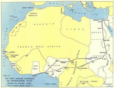
West Africa WW2 Nigeria Sudan Egypt. Takoradi air reinforcement route 1954 mapJasper524.5(9.8k)See Sold PriceFeb 28, 2024
NIGERIA w/ early explorers' routes. Lake Chad Yariba Houssa Borgou.SDUK 1844 mapJasper524.5(9.8k)See Sold PriceFeb 28, 2024
West Africa. Sahara caravan routes. Tribes Kingdoms Empires. LIZARS 1842 mapJasper524.5(9.8k)See Sold PriceFeb 28, 2024
WEST AFRICA showing early explorers' routes & Mountains of Kong. SDUK 1844 mapJasper524.5(9.8k)See Sold PriceFeb 28, 2024
NORTHERN AFRICA. Morocco Tunisia Algeria. Caravan routes. RAPKIN/TALLIS 1851 mapJasper524.5(9.8k)See Sold PriceFeb 28, 2024
Perry, Matthew C. 1856 Large Map. Shah Bay, Lew Chew I. JapanAlbion Auctions4.6(336)See Sold PriceMar 01, 2024