House of Commons.- A General Map of ScotlandHouse of Commons.- A General Map of Scotland,Appendix to the Report of the House of Commons respecting the Distilleries in Scotland, engraved map by James Basire, with extensive original hand-See Sold Price
SoldFirst Edition of Burgoyne's Expedition from CanadaA State of the Expedition from Canada, as laid before the House of Commons. General John Burgoyne (1722-1792). London: J. Almon, 1780. 4to (10 4/8 x 8 4/8 inches). 6 engraved folding maps by William FSee Sold Price
SoldArrowsmith (John) British Isles Railway mapArrowsmith (John) Map of England and Scotland, Shewing the Amalgamation of Railways, Returned to Orders of the House of Commons,outline map indicating railways, rivers and towns, title and colSee Sold Price
House of Commons.- Maps of IndiaHouse of Commons.- Benghal Papers relative to the Marhatta War in 1803,a group of 15 maps and battle plans, by or after Arrowsmith, Basire, Neele and others, including revenue, judicial, militSee Sold Price
SoldEight Railway Clearing House maps for Scotland,Eight Railway Clearing House maps for Scotland, Staffordshire District, London and its Environs, Yorkshire District - North, Yorkshire District - South, England and Wales - small edition, and anotherSee Sold Price
Speed (John) - England, Wales, Scotland and Ireland,engraved pictorial title and 62 engraved maps including one folding (lacking folding general map 'England, Scotland and Ireland'), folding map with two small closed tears along folds, map 43 with smalSee Sold Price
SoldDorret, JamesDorret, James A general map of Scotland and islands thereto belonging, from new surveys, the shires properly divided & subdivided, the forts lately erected & roads of communication or Military Ways…See Sold Price
SoldTAYLOR George & SKINNER AndrewTaylor & Skinner's survey and maps of the roads of North Britain or Scotland ... 1st edition, engraved fldg. titlepage, fldg. index leaf, fldg. general map of Scotland, with 61 engraved fldg. road mapSee Sold Price
SoldTAYLOR George & SKINNER AndrewTaylor & Skinner's survey and maps of the roads of North Britain or Scotland ... 1st edition, engraved fldg. titlepage, fldg. index leaf, fldg. general map of Scotland, with 61 engraved fldg. road mapSee Sold Price
Scotland.- Taylor (George) & Andrew Skinner. Taylor andScotland.- Taylor (George) & Andrew Skinner. Taylor and Skinner's Survey and Maps of the Roads of North Britain, or Scotland, title, 2 pp. of letterpress contents, folding general map of Scotland, andSee Sold Price
SoldSCOTLAND general map showing castles & kirks. Railways.TITLE/CONTENT OF MAP: 'SCOTLAND' The map shows some early railways The top image on the right hand side shows the entire map. To view a close up of the map showing the level of printed detail, pleaseSee Sold Price
SCOTLAND. General map showing castles & kirks. SDUKTITLE/CONTENT OF MAP: 'SCOTLAND' The top image on the right hand side shows the entire map. To view a close up of the map showing the level of printed detail, please click on the bottom image on the rSee Sold Price
SCOTLAND. General map showing castles & kirks.TITLE/CONTENT OF MAP: 'SCOTLAND' The map shows some early railways The top image on the right hand side shows the entire map. To view a close up of the map showing the level of printed detail, pleaseSee Sold Price
SCOTLAND. General map showing castles & kirks.Reserve Reduced! TITLE/CONTENT OF MAP: 'SCOTLAND' The map shows some early railways DATE PRINTED: 1845 IMAGE SIZE: Approx 41.5 x 34.0cm, 16.25 x 13.5 inches (Large) TYPE: Antique steel engraved map wiSee Sold Price
SCOTLAND. General map showing castles & kirks. SDUKTITLE/CONTENT OF MAP: 'SCOTLAND' DATE PRINTED: 1874 IMAGE SIZE: Approx 42.0 x 33.5cm, 16.5 x 13.25 inches (Large) TYPE: Antique steel engraved map with original outline hand colouring CONDITION: Good;See Sold Price
SoldBurgoyne, A State of the Expedition from Canada - Second EditionBURGOYNE, [John,] Lieutenant-General (1722-1792). A State of the Expedition from Canada, as laid before the House of Commons, by Lieutenant-General Burgoyne, and verified by evidence; with a collectioSee Sold Price
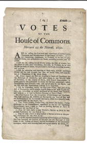
House Of Commons railway and canal mapsHouse Of Commons (publisher) A small, mixed group of plans for Reports of Commissioners or Select Committees on railways and inland navigation,including five from the Report of The CommissioneSee Sold Price
SoldKITCHIN ThomasGeographia Scotiae: being new and correct maps of all the counties and islands in the kingdom of Scotland ... with a general map of the whole kingdom from the latest observations ... With an engravedSee Sold Price
SoldAtlases.- British Isles.- Laurie (Richard H.) Laurie'sAtlases.- British Isles.- Laurie (Richard H., publisher) Laurie's New Traveller's Companion and Guide through the Roads of England and Wales, including Great part of Scotland; with a General Map, andSee Sold Price
SoldIreland.- Report from the Committee of SecrecyIreland.- Report from the Committee of Secrecy Appointed to take into Consideration the Treasonable Papers Presented to the House of Commons of Ireland, folding engraved map, John Stockdale, 1798 bounSee Sold Price
SoldCary (John) New Map of England and Wales, with parCary (John) New Map of England and Wales, with part of Scotland,engraved title, dedication, General Map (hand-coloured), explanation and scale sheets, and map on 76 sheets only, with originalSee Sold Price
SoldAmericas.- Burgoyne (John) A State of the ExpeditionAmericas.- Burgoyne (Lt.-Gen. John) A State of the Expedition from Canada, as laid before the House of Commons, first edition, folding engraved map and 5 folding engraved battle-plans with partial hanSee Sold Price
SoldEngland & Wales.- Cary (John) Cary's New Map of EnglandEngland & Wales.- Cary (John) Cary's New Map of England & Wales with Part of Scotland..., disbound with title, general map, dedication, and explanation leaf, and remaining map sheets 1-81, engravingsSee Sold Price
SoldBartholomew, John 1904 Lot of 4 Railway Maps UK IrelandRailways of Scotland, Ireland, England & Wales, and General Map of the British Isles with Railway & Steamship Routes. Lithograph Map Published 1904, London for "The Survey Gazetteer of the British IslSee Sold Price
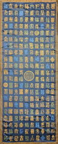
Cloud brocade, stone and green land with hundreds of blessingsHimalayan Auction House4.6(203)See Sold PriceFeb 25, 2024
LATE 16TH C. MAP OF SCOTLAND BY MERCATOR, FRAMEDThomaston Place Auction Galleries4.4(393)See Sold PriceFeb 24, 2024
The Holy Land Tours - Hamburg American Line - 1911Levy Auction House4.3(11)See Sold PriceFeb 27, 2024
Pair of Early Railroad Maps - 1874 Delaware, Lackawanna & Western and 1876 Pennsylvania RailroadRail & Road Auctions4.6(165)See Sold PriceMar 07, 2024
Map: A 17thC engraved and hand coloured map of Scotland titled Strath-Navernia / Strath Navern afterClaydon Auctioneers Ltd4.3(125)See Sold PriceFeb 26, 2024
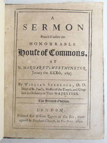
1692 SERMON before the HOUSE of COMMONS at WESTMINSTER antique in ENGLISHJasper524.5(9.9k)See Sold PriceFeb 27, 2024
Colonial Africa. British German French Spanish Portuguese Italian TIMES 1900 mapJasper524.5(9.9k)See Sold PriceFeb 28, 2024
Africa. Mauritius, Bourbon (Reunion) & Natal by Edward Weller 1860 old mapJasper524.5(9.9k)See Sold PriceFeb 28, 2024
AFRICA. Africa. General Map; Inset map of Population map 1907 old antiqueJasper524.5(9.9k)See Sold PriceFeb 28, 2024
Colonial Africa. British German French Spanish Portuguese Italian TIMES 1895 mapJasper524.5(9.9k)See Sold PriceFeb 28, 2024