ATLAS of ANTIENT GEOGRAPHY by SAMUEL BUTLER 1843John McInnis Auctioneers,LLC4.6(504)See Sold PriceFeb 24, 2024
18TH C. ANTIQUE MAP: FRENCH & INDIAN WAR, FRAMEDThomaston Place Auction Galleries4.4(389)See Sold PriceFeb 24, 2024
Rand McNally Railroad Map Cabinet w/ 21 Railroad MapsRail & Road Auctions4.6(165)See Sold PriceMar 08, 2024
Keith Haring - Ink on New York Map, Best Buddies, Inscribed, Signed, and DatedSapphire Auction Gallery4.1(67)See Sold PriceMar 02, 2024
LATE 17TH C. FRENCH MAP OF THE NEW WORLD BY ALEXIS-HUBERT JAILLOT (1632-1712)Thomaston Place Auction Galleries4.4(389)See Sold PriceFeb 24, 2024
Central Railroad of New Jersey Map of Sandy Hook Route-ca. 1903JM Hobby Supply and Railroad Artifact Auctions4.4(126)See Sold PriceFeb 24, 2024
Lot of Six Mixed Atlas Box Cars-HO Scale-New in BoxJM Hobby Supply and Railroad Artifact Auctions4.4(126)See Sold PriceFeb 25, 2024
Rand McNally/Santa Fe Railroad Map of Iowa-1912JM Hobby Supply and Railroad Artifact Auctions4.4(126)See Sold PriceFeb 24, 2024
NICOLAES VISSCHER (NETHERLANDS, 1618-1709) MAP OF THE NEW WORLDThomaston Place Auction Galleries4.4(389)See Sold PriceFeb 24, 2024
17TH C. WORLD MAP BY NICOLAES VISSCHER (NETHERLANDS, 1618-1709)Thomaston Place Auction Galleries4.4(389)See Sold PriceFeb 24, 2024
Lot of Six Mixed Atlas Cabooses-HO Scale-New in BoxJM Hobby Supply and Railroad Artifact Auctions4.4(126)See Sold PriceFeb 25, 2024
SoldHolme Map of PennsylvaniaHOLME, Thomas (1624-1695). A MAPP OF YE IMPROVED PART OF PENSILVANIA IN AMERICA, DIVIDE INTO COUNTYES TOWNSHIPS AND LOTTS. Engraving by John Harris with original hand color. London: 1687. 19 5/8" x 23See Sold Price
SoldA Mapp of Ye Improved Part of Pennsylvania in America,Thomas Holme (1624-1695). Engraved Map. London: Philip Lea, c. 1715. 18 1/2 x 21 1/2 inches. Cartographic scholar Philip D. Burden calls the first map of Pennsylvania “without question the finest prSee Sold Price
Sold(PENNSYLVANIA.) Holme, Thomas. A Mapp of ye Im(PENNSYLVANIA.) Holme, Thomas. A Mapp of ye Improved Part of Pensilvania in America, Divided into Countyes, Townships and Lotts. Double-page engraved map, 415x545 mm, wide margins; hand-colored in outSee Sold Price
SoldMAP, Pennsylvania, ReidPennsylvania. John Reid, The State of Pennsylvania. From the Latest Surveys, 1796 (published). Black & White. This map is the first state of Reid's early map of Pennsylvania which was based on ReadingSee Sold Price
SoldBarnes, R.L. - Railroad map Pennsylvania, NJ 1865Barnes, R.L. Barnes railroad, canal and county map of Pennsylvania, New Jersey and adjoining states, hand-col. Philadelphia: 1865Fifty mile scaleDimensions: 25" X 34 1/2"Inv.1See Sold Price
SoldCopy 1749 Map Pennsylvania, New Jersey, New YorkDESCRIPTION: Copy of 1749 Map of Pensilvania (sic), New Jersey, New-York and the Three Delaware Counties. Made by Lewis Evans. Colored borders, cities, townships, bodies of water, mountains labeled. DSee Sold Price
Sold1847 Mitchell's Map Pennsylvania1847 J H Young Mitchell's Map Tourist's Pocket Map of Pennsylvania in tooled leather cover. The map is hand colored and exhibits the coal regions and internal improvements including: roads distances,See Sold Price
Sold19th c. Map PennsylvaniaDated 1858 "Map Of Susquehanna Co. Pennsylvania.....Survey By G.M. Hopkins C.E. 1858".See Sold Price
SoldBarnes, R.L. Barnes railroad map Pennsylvania, 1865Barnes, R.L. Barnes railroad, canal and county map of Pennsylvania, New Jersey and adjoining states, hand-col. Philadelphia: 1865Fifty mile scaleDimensions: 25" X 34 1/2"Inv.1See Sold Price
Barnes, R.L. Barnes railroad map Pennsylvania, NewBarnes, R.L. Barnes railroad, canal and county map of Pennsylvania, New Jersey and adjoining states, hand-col. Philadelphia: 1865Fifty mile scaleDimensions: 25" X 34 1/2"Inv.4See Sold Price
Barnes, R.L. Barnes railroad map Pennsylvania, NewBarnes, R.L. Barnes railroad, canal and county map of Pennsylvania, New Jersey and adjoining states, hand-col. Philadelphia: 1865Fifty mile scaleDimensions: 25" X 34 1/2"Inv.4See Sold Price
Soil Map. Pennsylvania Chester County sheetTitle/Content of Map: Soil Map. Pennsylvania Chester County sheet Date: 1905 Cartographer: Henry J. Wilder, Thomas A. Caine, etc. Publisher: Dept. of Interior Bureau of Soils Size: 36Height - 33+.WidtSee Sold Price
Soil Map. Pennsylvania Montgomery County sheetTitle: Soil Map. Pennsylvania Montgomery County sheet Publication Date: 1905 Cartographer: Henry J. Wilder, A. T. Strahorn, W.J. Geib Publisher: Dept. of Interior. Bureau of Soils Size: 30.5Height - 3See Sold Price
Soil Map Pennsylvania Center County sheetTitle/Content of Map: Soil Map Pennsylvania Center County sheet Cartographer: HEARN, W. EDWARD/G. M. MAC NIDER Date: 1908 Publisher: U.S. Department of Agriculture Bureau of Soils; [NC] State Dept. ofSee Sold Price
Sold19Pcs Antique Maps PENNSYLVANIA MAPS ACCOMPANYING THEDetails: This lot consists of the “Pennsylvania Maps Accompanying the Report of the Secretary of Internal Affairs on the Boundaries of the Commonwealth, 1887â€. Nineteen large folding maps aSee Sold Price
TOPOGRAPHICA GEOLOGICAL & OIL MAPS PENNSYLVANIATen assorted geological and topographical maps. Most with color. Not all opened and examined. Some brittleness. Those opened dated 1880. Titles include, " Cameron County RR. Plate no III, Columnar SEcSee Sold Price
Sold2 OLD MAPS PENNSYLVANIA & THE WORLDPennsylvania 1882 engraved by George F. Cram. The World from Britania World Atlas copyright CS Hammond & Co. NY 1937. 22" X 14 1/2" $40 - $80 Please contact us for high resolutionSee Sold Price
SoldFramed Map Penna, NJ & NYFramed map, Pennsylvania, Nova Jersey at Nova York along the Delaware River, Tob. Conr. lotter, geographer, with Wm Penn scene (top left) and map index (bottom right), color sections and accents, framSee Sold Price
Pennsylvania by TannerTitle/Content of Map: Pennsylvania by Tanner Date Printed: 1843 Cartographer: Material/Medium: Paper Size: 14" x 17" Provenance: New York Published in Philadelphia Please note that this lot has a confSee Sold Price
Pennsylvania b MitchellTitle/Content of Map: Pennsylvania b Mitchell Date Printed: 1869 Cartographer: Augustus S. Mitchell Material/Medium: Paper Size: 14" x 16" Provenance: New York From Mitchell's 'New General Atlas'. HanSee Sold Price
Pennsylvania Railroad Routes and USA Wall Map --Title/Content of Map: Pennsylvania Railroad Routes and USA Wall Map -- Pennsylvania Railroad and Connections Date Printed: 1940s ca. Buffalo Cartographer: Clement Co. Size: 32 x 56 in. Mid 20th centurSee Sold Price
Tanner: Antique Map of Pennsylvania, 1843Title/Content of Map: Pennsylvania by Tanner Date Printed: 1843 Cartographer: H.C. Tanner Material/Medium: Paper Size: 17" x 14" Hand colored engraved Map based on the work of H.C. Tanner from the firSee Sold Price
SoldAntique Britannica War/Battle Map of Pennsylvania, 1903Title/Content of Map: 'Pennsylvania, Eastern part; Inset map of Philadelphia and Vicinity' The sites of important battles and their dates are marked on this map for the following conflicts: American RSee Sold Price
Ohio and Pennsylvania RR 1st Annual Report-1849JM Hobby Supply and Railroad Artifact Auctions4.4(126)See Sold PriceFeb 24, 2024
Ohio and Pennsylvania RR 2nd Annual Report-March 4, 1850JM Hobby Supply and Railroad Artifact Auctions4.4(126)See Sold PriceFeb 24, 2024
Ohio and Pennsylvania RR 2nd Annual Report-1850JM Hobby Supply and Railroad Artifact Auctions4.4(126)See Sold PriceFeb 24, 2024
Crams Township and Railroad Map of Pennsylvania-1898JM Hobby Supply and Railroad Artifact Auctions4.4(126)See Sold PriceFeb 24, 2024
Fort Wayne and Pennsylvania RR 1880 Public TimetableJM Hobby Supply and Railroad Artifact Auctions4.4(126)See Sold PriceFeb 24, 2024
Pennsylvania Central/Pittsburgh Ft Wayne and Chicago 1870 Public TimetableJM Hobby Supply and Railroad Artifact Auctions4.4(126)See Sold PriceFeb 24, 2024
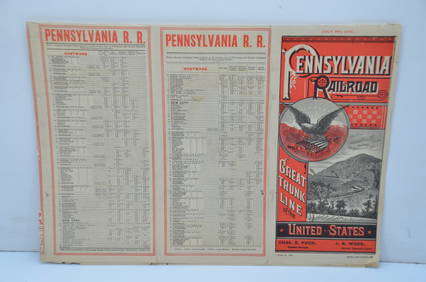
Pennsylvania Railroad July 8, 1885 Public TimetableJM Hobby Supply and Railroad Artifact Auctions4.4(126)See Sold PriceFeb 24, 2024
Pennsylvania Railroad May 29, 1904 Public TimetableJM Hobby Supply and Railroad Artifact Auctions4.4(126)See Sold PriceFeb 24, 2024
1888 Hand Book of the Pennsylvania Lines Containing Maps of Principal Cities - First EditionRail & Road Auctions4.6(165)See Sold PriceMar 07, 2024
1855 Guide for the Pennsylvania Railroad with an Extensive Map from the Pennsylvania RailroadRail & Road Auctions4.6(165)See Sold PriceMar 07, 2024
1876 The Centennial Exhibition Pennsylvania Railroad Worlds Fair Guide with Map and Trade CardRail & Road Auctions4.6(165)See Sold PriceMar 07, 2024
Early Pennsylvania Railroad Literature - 1881 New York and Chicago Limited Timetable Brochure andRail & Road Auctions4.6(165)See Sold PriceMar 07, 2024
1904 Pennsylvania Railroad Winter Excursions Book with Fold Out MapRail & Road Auctions4.6(165)See Sold PriceMar 07, 2024
Pair of Early Railroad Maps - 1874 Delaware, Lackawanna & Western and 1876 Pennsylvania RailroadRail & Road Auctions4.6(165)See Sold PriceMar 07, 2024
Pair of Early Railroad Maps - 1862 Pittsburgh, Ft. Wayne & Chicago Railway and 1873 PennsylvaniaRail & Road Auctions4.6(165)See Sold PriceMar 07, 2024
1764 MAP OF COUNTRIES THIRTY MILES ROUND LONDON antique 12.5 by 15"Jasper524.5(9.8k)See Sold PriceFeb 27, 2024
1822 MAP of LEEWARD ISLANDS GEOGRAPHICAL STATISTICAL HISTORICAL antique 17.5x22"Jasper524.5(9.8k)See Sold PriceFeb 27, 2024
1822 MAP of NORTH & SOUTH AMERICA GEOGRAPHICAL STATISTICAL HISTORICAL antiqueJasper524.5(9.8k)See Sold PriceFeb 27, 2024
George F. Cram - Historical Map of Pittsburgh Allegheny PennsylvaniaProverde Auctions4.3(3)See Sold PriceFeb 28, 2024
Vintage Street Map of Pittsburgh, Pennsylvania - Rand McNallyProverde Auctions4.3(3)See Sold PriceFeb 28, 2024
Monmouth, Illinois Vintage Topography MapRapid Estate Liquidators and Auction Gallery4.5(1.1k)See Sold PriceFeb 28, 2024
Antique Pennsylvania Map Fragment incl Wellersburg and New CentervilleCordier Auctions4.4(1.5k)See Sold PriceMar 02, 2024