ATLAS of ANTIENT GEOGRAPHY by SAMUEL BUTLER 1843John McInnis Auctioneers,LLC4.6(502)See Sold PriceFeb 24, 2024
18TH C. ANTIQUE MAP: FRENCH & INDIAN WAR, FRAMEDThomaston Place Auction Galleries4.4(386)See Sold PriceFeb 24, 2024
Rand McNally Railroad Map Cabinet w/ 21 Railroad MapsRail & Road Auctions4.6(165)See Sold PriceMar 08, 2024
Keith Haring - Ink on New York Map, Best Buddies, Inscribed, Signed, and DatedSapphire Auction Gallery4(67)See Sold PriceMar 02, 2024
LATE 17TH C. FRENCH MAP OF THE NEW WORLD BY ALEXIS-HUBERT JAILLOT (1632-1712)Thomaston Place Auction Galleries4.4(386)See Sold PriceFeb 24, 2024
Central Railroad of New Jersey Map of Sandy Hook Route-ca. 1903JM Hobby Supply and Railroad Artifact Auctions4.4(126)See Sold PriceFeb 24, 2024
Lot of Six Mixed Atlas Box Cars-HO Scale-New in BoxJM Hobby Supply and Railroad Artifact Auctions4.4(126)See Sold PriceFeb 25, 2024
Rand McNally/Santa Fe Railroad Map of Iowa-1912JM Hobby Supply and Railroad Artifact Auctions4.4(126)See Sold PriceFeb 24, 2024
NICOLAES VISSCHER (NETHERLANDS, 1618-1709) MAP OF THE NEW WORLDThomaston Place Auction Galleries4.4(386)See Sold PriceFeb 24, 2024
17TH C. WORLD MAP BY NICOLAES VISSCHER (NETHERLANDS, 1618-1709)Thomaston Place Auction Galleries4.4(386)See Sold PriceFeb 24, 2024
Lot of Six Mixed Atlas Cabooses-HO Scale-New in BoxJM Hobby Supply and Railroad Artifact Auctions4.4(126)See Sold PriceFeb 25, 2024
Hawaiian or Sandwich Islands North Pacific Ocean ADMIRALTY chart 1881 (1955) mapTitle: Hawaiian or Sandwich Islands North Pacific Ocean ADMIRALTY chart 1881 (1955) map Description: North Pacific Ocean - Hawaiian or Sandwich Islands' by From the United States Government charts toSee Sold Price
Southern Oahu. Hawaii. Pearl Harbor. ADMIRALTY sea chart 1929 (1954) old mapTitle: Southern Oahu. Hawaii. Pearl Harbor. ADMIRALTY sea chart 1929 (1954) old map Description: North Pacific Ocean - Hawaiian or Sandwich Islands - Southern Part of Oahu' by From the United States GSee Sold Price
Bermuda Islands, North Atlantic Ocean. ADMIRALTY sea chart 1946 (1950) old mapTitle: Bermuda Islands, North Atlantic Ocean. ADMIRALTY sea chart 1946 (1950) old map Description: North Atlantic Ocean - Bermuda Islands' by From Admiralty surveys to 1937 and United States GovernmenSee Sold Price
Fiji Islands – Pacific Ocean British Admiralty ChartTitle/Content of Map: Fiji Islands – Pacific Ocean British Admiralty Chart 1251, published 1866 Date: 1866 Cartographer: British Admiralty Material/Medium: thick paper Size: standard Very detailed,See Sold Price
Fiji Islands – Pacific Ocean British Admiralty ChartVery detailed, unused and authentic chart of Ngau Island and Mambulitha Reef in the Fiji or Viti Island Group. With beautiful view on the island. Authentic sea chart, no modern copy. On thick paper, fSee Sold Price
Fiji Islands – Pacific OceanBritish Admiralty ChartTitle/Content of Map: Fiji Islands – Pacific Ocean British Admiralty Chart 1251, published 1866 Date Printed: 1866 Cartographer: British Admiralty Material/Medium: thick paper Size: standard 71x104See Sold Price
North Pacific Ocean 1855 British Admiralty Nautical ChartScarce Original 1855 British Admiralty Nautical Chart: North Pacific Ocean: Provinces of Tlascala, Guaxaca, Tabasco, Guatemala, Salvador, Honduras, Costa Rica, Veragua, etc. London. Published accordinSee Sold Price
Pacific – Islands in the North Pacific BritishTitle/Content of Map: Pacific – Islands in the North Pacific British Admiralty Chart 1936, published 1849 Date: 1849 Cartographer: British Admiralty Material/Medium: thick paper Size: standard HardlSee Sold Price
Pacific Ocean – Phoenix Islands British Admiralty ChartTitle/Content of Map: Pacific Ocean – Phoenix Islands British Admiralty Chart 184, published 1950 Date: 1950 Cartographer: British Admiralty Material/Medium: thick paper Size: standard Unused and deSee Sold Price
Pacific Ocean – Phoenix Islands British Admiralty ChartUnused and detailed sea chart of the Phoenix Islands in the Pacific Ocean with Sydney and Phoenix Island and six other. Authentic, very detailed sea chart, no modern copy. On thick paper, folded as isSee Sold Price
Pacific Ocean – Caroline Islands British AdmiraltyTitle/Content of Map: Pacific Ocean – Caroline Islands British Admiralty Chart 977, published 1928 Date: 1928 Cartographer: British Admiralty Material/Medium: thick paper Size: standard Used and detSee Sold Price
Southern California Bight islands San Diego LA ADMIRALTY chart 1885 (1955) mapTitle: Southern California Bight islands San Diego LA ADMIRALTY chart 1885 (1955) map Description: North America - West Coast - California - San Diego Bay to Conception Point including Santa Cruz andSee Sold Price
Bermuda Great Sound. Hamilton Harbour ADMIRALTY sea chart 1941 (1956) old mapTitle: Bermuda Great Sound. Hamilton Harbour ADMIRALTY sea chart 1941 (1956) old map Description: North Atlantic Ocean - Bermuda Islands - Great Sound including Hamilton Harbour' by Surveyed by CaptaiSee Sold Price
SoldPOLYNESIA/PACIFIC ISLANDS. inc Sandwich/HawaiianTITLE/CONTENT OF MAP: 'Polynesia or Islands in the Pacific Ocean' Vignettes: Resolution Bay, Marquesas; Harbour of Dory, New Guinea; Otaheite [Tahiti]; Kalakakooa, Sandwich Islands [Hawaiian islands].See Sold Price
Pacific Ocean – Caroline Islands British AdmiraltyUsed and detailed sea chart of the Caroline Islands in the Pacific. Tidal information is mentioned for the most important islands. Authentic, very detailed sea chart, no modern copy. On thick paper, fSee Sold Price
New Hebrides - South Pacific Ocean British AdmiraltyTwo hardly used, detailed sea charts of the New Hebrides with Anetyum Island, Torres Island and many others islands, with a beautiful engraved view of the Bastion Rock on Maewo Island. The first surveSee Sold Price
SoldDufour/Dyonnet: Australia, Oceania with Island InsetsA superbly detailed nautical chart of the Pacific Ocean showing all of Australia, Indonesia, and Japan as well as most of North America and the west coast of South. Includes five insets: southeasternSee Sold Price
SoldPrint, A Woman of the Sandwich Islands, in the North"A Woman of the Sandwich Islands, in the North Pacific Ocean," etching on paper, titled lower center, overall (with frame): 21.5"h x 19.25"wSee Sold Price
SoldEarly Discoveries of the Hawaiian Islands 1880Title: Early Migrations. Early Discoveries of the Hawaiian Islands in the North Pacific Ocean: Evidences of Visits by Spanish Navigators During the XVI Century Author: Peirce, Henry A. Description: 8See Sold Price
SoldEarly Discoveries of the Hawaiian Islands 1880Title: Early Migrations. Early Discoveries of the Hawaiian Islands in the North Pacific Ocean: Evidences of Visits by Spanish Navigators During the XVI Century Author: Peirce, Henry A. Description: 8See Sold Price
Bahamas Cat Long Islands Great Exuma Eleuthera ADMIRALTY chart 1851 (1955) mapTITLE/CONTENT OF MAP: 'West Indies - The Bahama Islands - Old Bahama Channel to Exuma' DATE PRINTED: Surveyed 1836-1943. Published 1851. New edition 1891. Corrections to 1955 IMAGE SIZE: Approx 129.0See Sold Price
Bahamas Cat Long Islands Great Exuma Eleuthera ADMIRALTY chart 1851 (1955) mapTITLE/CONTENT OF MAP: 'West Indies - The Bahama Islands - Old Bahama Channel to Exuma' DATE PRINTED: Surveyed 1836-1943. Published 1851. New edition 1891. Corrections to 1955 IMAGE SIZE: Approx 129.0See Sold Price
SoldWeller: Map of Pacific, Hawaii Australia New ZealandTITLE/CONTENT OF MAP: 'The Pacific Ocean'. Sandwich Islands/Hawaii Australia New Zealand This map is folding hence the centrefold line may show on the image below DATE PRINTED: 1862 IMAGE SIZE: ApproxSee Sold Price
Weller: Antique Map of the Pacific Ocean, 1863Title/Content of Map: 'The Pacific Ocean' Sandwich Islands/Hawaii Australia New Zealand &c. Date Printed: 1863 Image Size: Approx 47.0 x 65.0cm, 18.5 x 25.75 inches (Large); Please note that this is aSee Sold Price
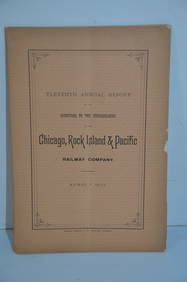
Chicago Rock Island and Pacific RR 11th Annual Report-April 1, 1891JM Hobby Supply and Railroad Artifact Auctions4.4(126)See Sold PriceFeb 24, 2024
Chicago Rock Island and Pacific RR Book Sunshine and Moonlight-1889JM Hobby Supply and Railroad Artifact Auctions4.4(126)See Sold PriceFeb 24, 2024
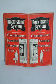
Rock Island RR Iowa and Minnesota Lakes Country Brochure-1926JM Hobby Supply and Railroad Artifact Auctions4.4(126)See Sold PriceFeb 24, 2024
Chicago Rock Island and Pacific RY August 1, 1882 Public TimetableJM Hobby Supply and Railroad Artifact Auctions4.4(126)See Sold PriceFeb 24, 2024
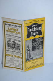
Chicago Rock Island and Pacific RY October 1896 Public TimetableJM Hobby Supply and Railroad Artifact Auctions4.4(126)See Sold PriceFeb 24, 2024
Chicago Rock Island and Pacific RY November 4, 1899 Public TimetableJM Hobby Supply and Railroad Artifact Auctions4.4(126)See Sold PriceFeb 24, 2024
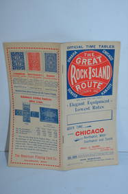
Chicago Rock Island and Pacific RY August 1903 Westbound Edition Public TimetableJM Hobby Supply and Railroad Artifact Auctions4.4(126)See Sold PriceFeb 24, 2024
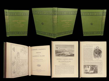
1874 HAWAII 1ed Northern California Oregon Pacific Island Travel Puget RedwoodsSchilb Antiquarian Rare Books4.8(421)See Sold PriceMar 10, 2024
EARLY 18TH C. DUTCH CHART OF PACIFIC OCEAN BY FREDERIK DE WIT (1629-1706) WITH CALIFORNIA AS ANThomaston Place Auction Galleries4.4(386)See Sold PriceFeb 24, 2024
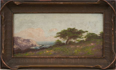
Antique California Coastal Beach Scene Pacific Ocean Framed American Impressionist Oil PaintingCurated Gallery Auctions4.6(120)See Sold PriceFeb 25, 2024
Portfolio of 15 County Maps by Robert Morden (English 1650-1703)Nadeau's Auction Gallery4.7(401)See Sold PriceFeb 24, 2024
Hiroshi Sugimoto - North Atlantic Ocean, Cape Breton IslandSapphire Auction Gallery4(67)See Sold PriceMar 02, 2024
Vaillant - Hawaii: Stranding in the Sandwich Islands (Echouage aux Iles Sandwich). 43Trillium Antique Prints & Rare Books4.5(30)See Sold PriceFeb 24, 2024
Vaillant - Kealakekua Bay, Hawaii (Village de Kearakekoua, Iles Sandwich). 44Trillium Antique Prints & Rare Books4.5(30)See Sold PriceFeb 24, 2024
Vaillant - Honolulu, Hawaii (Vue de Honolulu, Iles Sandwich). 45Trillium Antique Prints & Rare Books4.5(30)See Sold PriceFeb 24, 2024
Vaillant - Hawaiian Dance (Scene de Danse aux Iles Sandwich). 42Trillium Antique Prints & Rare Books4.5(30)See Sold PriceFeb 24, 2024
Map of United States of North America, 1785Antiques Online Auctions4.6(407)See Sold PriceMar 14, 2024