ATLAS of ANTIENT GEOGRAPHY by SAMUEL BUTLER 1843John McInnis Auctioneers,LLC4.6(504)See Sold PriceFeb 24, 2024
18TH C. ANTIQUE MAP: FRENCH & INDIAN WAR, FRAMEDThomaston Place Auction Galleries4.4(389)See Sold PriceFeb 24, 2024
Rand McNally Railroad Map Cabinet w/ 21 Railroad MapsRail & Road Auctions4.6(165)See Sold PriceMar 08, 2024
Keith Haring - Ink on New York Map, Best Buddies, Inscribed, Signed, and DatedSapphire Auction Gallery4.1(67)See Sold PriceMar 02, 2024
LATE 17TH C. FRENCH MAP OF THE NEW WORLD BY ALEXIS-HUBERT JAILLOT (1632-1712)Thomaston Place Auction Galleries4.4(389)See Sold PriceFeb 24, 2024
Central Railroad of New Jersey Map of Sandy Hook Route-ca. 1903JM Hobby Supply and Railroad Artifact Auctions4.4(126)See Sold PriceFeb 24, 2024
Lot of Six Mixed Atlas Box Cars-HO Scale-New in BoxJM Hobby Supply and Railroad Artifact Auctions4.4(126)See Sold PriceFeb 25, 2024
Rand McNally/Santa Fe Railroad Map of Iowa-1912JM Hobby Supply and Railroad Artifact Auctions4.4(126)See Sold PriceFeb 24, 2024
NICOLAES VISSCHER (NETHERLANDS, 1618-1709) MAP OF THE NEW WORLDThomaston Place Auction Galleries4.4(389)See Sold PriceFeb 24, 2024
17TH C. WORLD MAP BY NICOLAES VISSCHER (NETHERLANDS, 1618-1709)Thomaston Place Auction Galleries4.4(389)See Sold PriceFeb 24, 2024
Lot of Six Mixed Atlas Cabooses-HO Scale-New in BoxJM Hobby Supply and Railroad Artifact Auctions4.4(126)See Sold PriceFeb 25, 2024
SoldHarenburg/Homann Heirs: Holy Land, 12 Tribes, 1750Palaestina in XII tribus divisa. Homann's fascinating map of the Holy Land "divided into 12 tribes and it adjacent lands" was "revised and augmented by J.C. Harenburg" according to the French title trSee Sold Price
SoldHarenburg / Homann Heirs: Palestine & Cyprus, 1744Palaestina seu Terra olim Sancta J.C. Harenburg's map of the Holy Land "divided into 12 tribes and extended by Kings David and Solomon," is both highly dramatic and scholarly (Harenburg, clearly had iSee Sold Price
SoldHarenburg / Homann: Holy Land with Tribal Divisions,Palaestina in XII tribus divisa Homann's fascinating map of the Holy Land "divided into 12 tribes and it adjacent lands" was "revised and augmented by J.C. Harenburg" according to the French title traSee Sold Price
SoldMap of the holy landMap of the holy land the 12 tribes - Situs Terrae Promissionis . . . per Chr. Adrichom, Amsterdam 1652. 38X50 cm, good condition. Loar 24.See Sold Price
SoldCantelli (G) Terra Sancta sive PromissionisCantelli (Giacomo) Terra Sancta sive Promissionis, olim Palestina,Holy Land showing the 12 tribes of Israel, with decorative title cartouche, depicting a reclining Adam and Eve in the Garden oSee Sold Price
Map of The Holy Land. Robert de Vaugondy, Gilles,"Cart de la Terre des Hebreuxou Israelites partgeeselonl'ordre de Dieu aux douzetribus." Map of the Holy Land divided into 12 tribes pursuant to the Sanson map. Coastline from Sidon in the North to RaSee Sold Price
SoldMap of the Holy Land Divided Among the 12 TribesGeographiae: Sacrae ex Veteri, et Nova Testamento desumpta...... 15"h x 19"wSee Sold Price
SoldAntique Johnson and Ward "Holy Land" MapDESCRIPTION: map of the Holy Land, based upon the 12 tribes and contemporary (to mid-19th Century) borders. Insets of view of Damascus and town plan of Jerusalem. Shows towns, roads, rivers, lakes, moSee Sold Price
Map of the Holy Land. Print in 1850.Map of the Holy Land shared in the 12 Tribes. Print in 1850.Print of steel engraving titled „La Terre Sainte partagee en 12 Tribus .Author A. Houze.Engraved by unknown.From the „Atlas Universel HiSee Sold Price
SoldMap of the Holy Land. Nicolas Sanson. Amsterdam, 1738.Geographiae Sacrae, Tabula in qua Terra Promissa in suas Tribus Partesq. Distincta. Autore N. Sanson Abbavillaeo. Map of the Holy Land. Borders of the 12 tribes. By Nicolas Sanson. From: Sauzet, HenriSee Sold Price
SoldDas Heilig Landt mit ausztheilung der zwoelffThe Holy Land as divided among the 12 tribes: "Das Heilig Landt mit ausztheilung der zwoelff Geschlechter". German. Hand-colored woodcut. By Münster Sebastian, 1628 (?). On verso [Right page]: PalaSee Sold Price
Johnson’s 1866 hand colored map of PalestineNice map of the Holy Land, hand-colored based on the 12 tribes and contemporary borders. Insets of view of Damascus and town plan of Jerusalem. Shows towns, roads, rivers, lakes, mountains, coastal feSee Sold Price
SoldAveele (Jan vanden) 12 tribes of IsraelAveele (Jan vanden) Perigrinatie ofte Veertigh-Iarige Reyse der Kinderen Israëls,variant of the Holy Land map by Visscher and others, with a more elaborate vignette above, and revised title baSee Sold Price
Harenburg: Antique Map of the Holy Land, 1750Map: Palaestina in XII tribus divisa - Holy Land/Tribal Territories Cartographer: Harenburg/Homann Heirs Place & Date: Nurnberg / 1750 Size: 20 1/2" x 18 3/4" Condition: outline color (tribal areas inSee Sold Price
SoldMontanus (Benedictus Arias) Terrae IsraelMontanus (Benedictus Arias) Terrae Israel,the Holy Land, oriented with east at the top, with the divisions of the 12 tribes of Israel, decorative title cartouche, ships and sea monsters, engraSee Sold Price
SoldJohann Christoph Harenberg - Carte de la Terre Sainte.Johann Christoph Harenberg - Carte de la Terre Sainte, 1750. Map of the Holy Land divided by tribes. 49x53cm.See Sold Price
SoldMap, ''Carte de la Terre Sainte...''Antiquarian map, ''Carte de la Terre Sainte Divisee Selon les Douze Tribus D'Israel'', published by Homann Heirs, circa 1757, depicts the Holy Land with the territories of the Twelve Tribes of Israel,See Sold Price
SoldHarenburg/Homann: Holy Land with Tribal DivisionsMap Title: Palaestina in XII tribus divisa Cartographer: Harenburg/Homann Heirs Place/Date: Nurnberg / 1750 Size: 20 1/2" x 18 3/4" Condition: outline color (tribal areas in wash color and cartouchesSee Sold Price
"Le Dodeci Tribu d'Isdraele". Promised Land. 12 TribesTITLE/CONTENT OF MAP: 'Terra di Canaan ov Terra Promessa ad Abramo e a suoi posteri in cui vien disegnata la sortita del popolo d'Israele suor dell'Egitto e le sue 42 dinore nel Deserto / le Dodeci TrSee Sold Price
Sold(4) Maps of Palestine 19th c.Includes: A New Map of Palestine of the Holy Land. 12 3/8" x 15" folded, Mitchell 1867. Hocland von Juda 10 5/8" x 16 3/8" Andreas Atlas 1893 (p.109). Palestine 13 5/8" x 20 3/8" folded, Appleton 1891See Sold Price
SoldBiblical Holy Land 12-Coin CollectionBiblical Holy Land 12-Coin Collection **|**|** Biblical Holy Land 12-Coin Collection #IRS53289See Sold Price
Picture album with pressed flowers, English and PolishPicture album with pressed flowers, English and Polish text, Souvenir-The Holy Land 12 Artistic Pictures in Color, 1930s, hand painted postcardsSee Sold Price
SoldTyas (Robert) Flowers from the Holy LandTyas (Robert) Flowers from the Holy Land,12 hand-coloured plates, contemporary ink inscription on verso of front fly-leaf, 1851 § Osborn (Henry) Plants of the Holy Land with their Fruits and FSee Sold Price
SoldCard for contribution pledges for Rabbi Eliezer HaleviRabbi Elazar Halevi Rosenfeld, Av Beit Din of Uspitzin, son-in-law of Divrei Chaim from Sanz. A interesting card for material support when he made Aliyah to the Holy Land. 12 X 18 CmSee Sold Price
Matryoshka Doll - Israeli Ministers - Venice BiennaleLevy Auction House4.3(11)See Sold PriceFeb 27, 2024
12 Postcards Folder - Jewish - Woodcuts - S. JudowinLevy Auction House4.3(11)See Sold PriceFeb 27, 2024
12 Issues of Haprochim - Children Hebrew Weekly -1908Levy Auction House4.3(11)See Sold PriceFeb 27, 2024
Rumors, Conspiracies and Gossip - Antisemitic BookletLevy Auction House4.3(11)See Sold PriceFeb 27, 2024
17 Antisemitic Booklets - Jokes & Poems - 19th CenturyLevy Auction House4.3(11)See Sold PriceFeb 27, 2024
10th Holy Land/ Byzantine Glazed Pottery Oil LampArtemis Fine Arts4.8(1.4k)See Sold PriceFeb 26, 2024
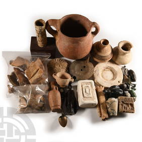
Ancient Holy Land Terracotta 2-Handled Vessel 8 1/2 inches heightGCB Estate Sales4.5(86)See Sold PriceMar 02, 2024
AN SILVER SAFED KIDDUSH CUP. Poland/Safed, c.1880. Engraved with three Holy Land scenes includingJ. Greenstein & Co., Inc.4.3(55)See Sold PriceApr 16, 2024