ATLAS of ANTIENT GEOGRAPHY by SAMUEL BUTLER 1843John McInnis Auctioneers,LLC4.6(504)See Sold PriceFeb 24, 2024
18TH C. ANTIQUE MAP: FRENCH & INDIAN WAR, FRAMEDThomaston Place Auction Galleries4.4(389)See Sold PriceFeb 24, 2024
Rand McNally Railroad Map Cabinet w/ 21 Railroad MapsRail & Road Auctions4.6(165)See Sold PriceMar 08, 2024
Keith Haring - Ink on New York Map, Best Buddies, Inscribed, Signed, and DatedSapphire Auction Gallery4.1(67)See Sold PriceMar 02, 2024
LATE 17TH C. FRENCH MAP OF THE NEW WORLD BY ALEXIS-HUBERT JAILLOT (1632-1712)Thomaston Place Auction Galleries4.4(389)See Sold PriceFeb 24, 2024
Central Railroad of New Jersey Map of Sandy Hook Route-ca. 1903JM Hobby Supply and Railroad Artifact Auctions4.4(126)See Sold PriceFeb 24, 2024
Lot of Six Mixed Atlas Box Cars-HO Scale-New in BoxJM Hobby Supply and Railroad Artifact Auctions4.4(126)See Sold PriceFeb 25, 2024
Rand McNally/Santa Fe Railroad Map of Iowa-1912JM Hobby Supply and Railroad Artifact Auctions4.4(126)See Sold PriceFeb 24, 2024
NICOLAES VISSCHER (NETHERLANDS, 1618-1709) MAP OF THE NEW WORLDThomaston Place Auction Galleries4.4(389)See Sold PriceFeb 24, 2024
17TH C. WORLD MAP BY NICOLAES VISSCHER (NETHERLANDS, 1618-1709)Thomaston Place Auction Galleries4.4(389)See Sold PriceFeb 24, 2024
Lot of Six Mixed Atlas Cabooses-HO Scale-New in BoxJM Hobby Supply and Railroad Artifact Auctions4.4(126)See Sold PriceFeb 25, 2024
SoldGrp: 6 Maps of SpainGroup of six maps of France and Spain. Includes Friedrich Wilhelm Streit (1772-1839) map of France "Charte von Frankreich nach den besten Hulfsmitteln," Nuremberg, 1815; Guillaume Delisle (1675-1726)See Sold Price
SoldGrp: 6 Maps of Italy 18th-19th c.Group of 18th and 19th century maps of Italy. This group includes one map of Italy, Sardinia, Corsica, and Sicily by Carolo Allard; one map of Sicily by Jan Jansson (1588-1664) with an insert detailinSee Sold Price
SoldGrp: 6 Maps of Europe by Braun & HogenbergGroup of six maps by Georg Braun (1541–1622) and Frans Hogenberg (1540–1590) including maps of Ghent, Odense in Denmark originally for the book "Civitates Orbis Terrarum", a map of ParisSee Sold Price
SoldGrp: 6 Maps of New York CityGroup of six maps of New York City. Includes five early 20th century Bromley hand colored maps of New York City, "Plate 30, 32, 34, 35, and 36, Part of Section 2"; with G. Hayward Map of "Plan of theSee Sold Price
SoldGrp: 6 Maps of AsiaGroup of six maps of Asia and the Near East, including maps of the Persian Empire, Eastern and South Eastern Asia, Asia Minor, and Asia. SKU: 03488See Sold Price
SoldGrp: 6 Maps of South AmericaGroup of six maps of South America. Includes two maps of the continent overall; three maps of the southern section of South America, including Argentina, Chile, Paraguay, Uruguay, Bolivia, and in oneSee Sold Price
SoldGrp: 6 Maps of the Middle East BiblicalGroup of six maps of the Middle East, many Biblical. Includes Nicolas Sanson (1600-1677)"Kaart can de Reis-Tochten en Verblyf-Plaat der Heilige Apostelen Petrus en Paulus," Amsterdam; "A Chart of theSee Sold Price
Sold(6) antique maps: Spain, Germany, Austria, etc.(6) antique maps: Spain, Germany, Austria, etc., 17th/18th century, largest: 21.5" x 26.5", unframedSee Sold Price
SoldGrp: 9 Maps of SpainGroup of nine maps of Spain. A large map of Granada. A colored map of Spain and part of North Africa with a detail insert of the Harbour of Port Mahon by Emmanuel Bowen. A large map of the coasts of SSee Sold Price
Spain & Portugal, RARE Swedish issue by A. AkermanTitle: Spain & Portugal, RARE Swedish issue by A. Akerman 1768-1774 Date/Period: 1768-1774 Materials: Copperplate engravedSize: 7 1/2 x 6”. Scarce map elegantly shows the provinces of Spain despiteSee Sold Price
SoldGrp: Maps of Iberia and FranceGroup of maps of the Iberian Peninsula and France, including many early maps of Spain and Portugal. Includes Joh. Bapt. Homannum "Regnum Portugalliae, divisum in Quinque Provincias majores & subdivisuSee Sold Price
SoldGrp 6 Early Science BooksGroup of six early science books. Includes "Suite du Recueil de Planches, sur les Sciences, les Arts Liberaux, et les Arts Mechaniques, avec leur Explication," Paris, 1777; "Miscellanea Curiosa," LondSee Sold Price
Grp 6 Books on European ExplorationGroup of six books about European exploration. Includes "The Memoirs and Travels of Sir John Reresby, Bart.," London, 1813; "Colomb dans les fers, a Ferdinand et Isabelle," London, 1782; "An AbridgmenSee Sold Price
Arrowsmith: Map of Spain & Portugal, 1842Map: Spain & Portugal Maker: John Arrowsmith Date: 1842 Size: Folio, 18.6 inches high x 23.75 inches wide From Famed Arrowsmith London Atlas John Arrowsmith (1780-1873) was an English geographer and mSee Sold Price
SoldCornwell & Dower 1849 Lot of 6 European MapsIncl Germany, Austria, Europe, Spain/Portugal, Prussia, and France. Steel Engraved Maps Published 1849, London for "A School Atlas" by James Cornwell. Maps by John Dower. Paper Size: 6.5 x 4 inch (16See Sold Price
SoldRapkin, John 1860 Lot of 6 European MapsIncl Greece, Turkey in Europe, Switzerland, Spain/Portugal, Sweden/Norway, and Russia in Europe. Steel Engraved Map Published 1860 by The London Printing & Published Company, London for "The Royal DicSee Sold Price
SoldMAP OF SPAIN AND PORTUGALThe map dedicated to Duke John L. Somers, 18th C. Plate Size: 25 x 36 1/2 in (63.5 x 92.7 cm). Paper Size: 27 x 37 1/2 in (68.6 x 95.3 cm).See Sold Price
Map of Spain & Portugal,Title: Map of Spain & Portugal, Publication Date: 1826-03-01 Cartographer: HALL, SIDNEY Publisher: JAMES DUNCAN Size: 6.6Height - 7.75Width engraved for the Modern Traveller. Detailed small map. LaterSee Sold Price
Geographical & Statistical Map of Spain & Portugal 1822Map: Geographical and Statistical Map of Spain and Portugal Maker: M. Carey, Gros, C./E. Paquenaud/J. Yeager Date: 1822 Size: Octavo, 10.6 inches high x 13 inches wide Restriking of a map by Gros, impSee Sold Price
SoldSilk Embroidered Map of Spain & Portugal. FramedSilk Embroidered Map of Spain & Portugal. Framed in Period Frame. Ferdinand Isabelle. -- Dimensions: Image Size: H: 6 inches: W: 7 inches --- US Shipping charge: $35See Sold Price
SoldTwiss (Richard) - Travels through Portugal and Spain infirst edition , large hand-coloured folding engraved map, 6 engraved plates, 2 double-page and folding, engraved tail-piece bearing the coat of arms of Spain, ink annotations to 3E4, 3F1, 3G2, 3G4 andSee Sold Price
1539 JULIUS CAESAR'S Commentarii ILLUSTRATED 16th centuryCaesar's Commentarii Basel: Nicholaum Brylingerum, 1539 Size: 4 1/2 by 6 1/4" with woodcut printer's device to title, illustrated with two double-page woodcut maps depicting Spain and Northern Europe,See Sold Price
SoldGRP OF ROAD MAPSGRP OF ROAD MAPS TO INC: (6) FRANCE 1940'S MAPS BY MICHELIN; (9) ESSO/IMPERIAL MAPS OF CANADA, ITALY, ENGLAND, FRANCE, SWITZERLAND, & WESTERN EUROPE; (8) CANADIAN 1952, 1973, 1990-91 MAPS.See Sold Price
1831 SDUK Map of Southern Spain -- Spain (Espana) IIITitle: 1831 SDUK Map of Southern Spain -- Spain (Espana) III Cartographer: SDUK Year/Place: 1831, London Dimensions: 11.6 X 14.6 in. Description: This is an excellent map of southern Spain. Key citiesSee Sold Price
MAP - Dufour, A. H. ( Malte / Brun ) :MAP - ESPAGNE PARTIE SUD DIVISEE EN PROVINCES ANCIENNES ( MAPLuis Porretta Fine Arts4.3(10)See Sold PriceMar 02, 2024
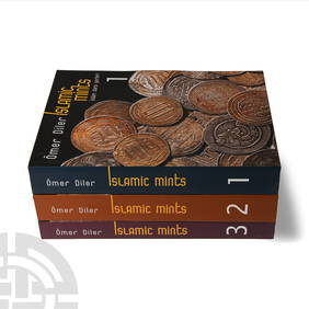
Numismatic Books - Diler - Islamic Mints Volumes 1-3TimeLine Auctions Ltd.4.6(182)See Sold PriceMar 09, 2024
1772 GREEK BIBLE NEW TESTAMENT antique BIBLIA LATIN text MAP NOVUM TESTAMENTUMJasper524.5(9.8k)See Sold PriceFeb 27, 2024
VARIOUS ARTISTS [BRITISH TRAVEL GUIDES]. Group of 6 map booklets and flyers. 1930s.Swann Auction Galleries4.4(69)See Sold PriceFeb 29, 2024
Fielding (Henry) The Works, with An Essay on His Life and Genius by Arthur Murphy, 10 vol., newForum Auctions4.3(53)See Sold PriceFeb 29, 2024
Rees & Macpherson 1820 Lot of 6 Ancient Geography MapsAlbion Auctions4.6(341)See Sold PriceMar 01, 2024
Guthrie, William 1812 Antique Map. Spain and PortugalAlbion Auctions4.6(341)See Sold PriceMar 01, 2024
Disney Magic Mediterranean Cruise 2007 Map W CoinsRapid Estate Liquidators and Auction Gallery4.5(1.1k)See Sold PriceMar 01, 2024
6 pcs Vintage Paper Maps. Vancouver Island, British Columbia. Upper Elk Creek Sheet. See pics.Crawford Family Auctions LLC4.5(119)See Sold PriceMay 25, 2024


![VARIOUS ARTISTS [BRITISH TRAVEL GUIDES]. Group of 6 map booklets and flyers. 1930s. (1 of 2)](https://p1.liveauctioneers.com/199/319703/171640571_1_x.jpg?height=282&quality=70&version=1707943705)


