ATLAS of ANTIENT GEOGRAPHY by SAMUEL BUTLER 1843John McInnis Auctioneers,LLC4.5(505)See Sold PriceFeb 24, 2024
18TH C. ANTIQUE MAP: FRENCH & INDIAN WAR, FRAMEDThomaston Place Auction Galleries4.4(393)See Sold PriceFeb 24, 2024
Rand McNally Railroad Map Cabinet w/ 21 Railroad MapsRail & Road Auctions4.6(165)See Sold PriceMar 08, 2024
Keith Haring - Ink on New York Map, Best Buddies, Inscribed, Signed, and DatedSapphire Auction Gallery4(67)See Sold PriceMar 02, 2024
LATE 17TH C. FRENCH MAP OF THE NEW WORLD BY ALEXIS-HUBERT JAILLOT (1632-1712)Thomaston Place Auction Galleries4.4(393)See Sold PriceFeb 24, 2024
Central Railroad of New Jersey Map of Sandy Hook Route-ca. 1903JM Hobby Supply and Railroad Artifact Auctions4.4(127)See Sold PriceFeb 24, 2024
Lot of Six Mixed Atlas Box Cars-HO Scale-New in BoxJM Hobby Supply and Railroad Artifact Auctions4.4(127)See Sold PriceFeb 25, 2024
Rand McNally/Santa Fe Railroad Map of Iowa-1912JM Hobby Supply and Railroad Artifact Auctions4.4(127)See Sold PriceFeb 24, 2024
NICOLAES VISSCHER (NETHERLANDS, 1618-1709) MAP OF THE NEW WORLDThomaston Place Auction Galleries4.4(393)See Sold PriceFeb 24, 2024
17TH C. WORLD MAP BY NICOLAES VISSCHER (NETHERLANDS, 1618-1709)Thomaston Place Auction Galleries4.4(393)See Sold PriceFeb 24, 2024
Lot of Six Mixed Atlas Cabooses-HO Scale-New in BoxJM Hobby Supply and Railroad Artifact Auctions4.4(127)See Sold PriceFeb 25, 2024
SoldGrp: 14 Maps of Europe and Book Pages 17th-19thGroup of fourteen European maps and book pages dating from the 17th-19th century. This group includes a celestial atlas published by Oxford University. A French longitudinal and latitudinal map. An ItSee Sold Price
SoldGrp: 13 Maps of Italy and from Munster's CosmograGroup of 17th-19th century maps. This lot includes four pages from Sebastian Munster's "Cosmographia" including a map of Elba, a map of Italian mainland cities, a map of Sicily, and a map of Africa. TSee Sold Price
SoldAtlas & Travel Books Title Pages 19th Cent Lot of 40Lot of approx 40 Title Pages to Atlases and Travel Books, mostly 19th Century. A couple Engraved, including one by Levasseur. British, French and German. Paper Size: Up to 20 x 14 inch (50 x 36cm) GooSee Sold Price
Atlas & Travel Books Title Pages 19th Cent Lot of 40Lot of approx 40 Title Pages to Atlases and Travel Books, mostly 19th Century. A couple Engraved, including one by Levasseur. British, French and German. Paper Size: Up to 20 x 14 inch (50 x 36cm) GooSee Sold Price
DECORATIVE COPY 17TH CENTURY MAP OF VENICEDECORATIVE COPY 17TH CENTURY MAP OF VENICE: Decorative late 19th / early 20th century reproduction of 17th century map of Venice, 4 pages from book. Map pre dates 1682 as the dome at the Church of SaiSee Sold Price
SoldJansson. Imperium Carolimagni map[Carolinian Empire]. Jansson. Imperium Carolimagni. Double-page engraved map of Europe at the time of Charlemagne. French text on verso. Amst: Ioannis Ianssonii, mid-17th century. 14 1/2 x 17 in. PublSee Sold Price
SoldGrp: 16th and 17th c. Maps of the World Hondius MLarge lot of 16th and 17th century maps of various parts of the world, many pages from books and atlases. By cartographers including Jodocus Hondius (1563-1612) and Herman Moll (ca. 1654-1732). SeveraSee Sold Price
Sold1848 Houze ATLAS Geography 101 MAPS Europe Africa1848 Houze ATLAS Geography 101 MAPS Europe Africa America Hand-Colored England A rare 19th-century atlas filled with over 100 full-page maps hand-traced in color. These maps by Antoine Philippe HouzeSee Sold Price
19thc Atlas Map, Georgia, South Carolina19th Century Rand, McNally & Co.'s New 11" X 14" Map of Georgia, copyright 1895 on one side, South Carolina map on the reverse. Pages 29 & 30 from an original atlas book.See Sold Price
19thc Atlas Map, Georgia, South Carolina19th Century Rand, McNally & Co.'s New 11" X 14" Map of Georgia, copyright 1895 on one side, South Carolina map on the reverse. Pages 29 & 30 from an original atlas book.See Sold Price
EUROPE. 'Europe Moderne'. Rivers countries. VeryTITLE OF THE MAP: 'Europe Moderne' Date: 1683 IMAGE SIZE: Approx Overall page size 13 x 21cm approximately (5 x 8 inches); image size 10.5 x 14.5cm approximately (4 x 5.5 inches) TYPE: Original 17th cSee Sold Price
Sold18th C. Engraved / Colored Map of Central AmericaNorthern Europe, United Kingdom or colonies, ca. 18th to early 19th century CE. An engraved page from a book showing a color map of "Mexico or New Spain" clearly labeled in English. "The Pacific or SoSee Sold Price
18th C. Engraved / Colored Map of Central AmericaNorthern Europe, United Kingdom or colonies, ca. 18th to early 19th century CE. An engraved page from a book showing a color map of "Mexico or New Spain" clearly labeled in English. "The Pacific or SoSee Sold Price
18th C. Engraved / Colored Map of Central America**Originally Listed At $300** Northern Europe, United Kingdom or colonies, ca. 18th to early 19th century CE. An engraved page from a book showing a color map of "Mexico or New Spain" clearly labeledSee Sold Price
SoldNAPOLEON I: (1769-1821)NAPOLEON I: (1769-1821) Emperor of France 1804-14, 1815. L.S., `Nap´, one page, 4to, Fontainebleau, 17th October 1810, to the Duc de Feltre, Minister of War, in French. Napoleon refers to Spanish pSee Sold Price
Sold(2) 17TH C. CONTINENTAL HAND-COLORED MAPSIL BELLUNESE Con il FELTRINO with page from its German book on reverse, noted as 1647 framed under glass, image 14.75” by 19.5”; the other LUSATIA SUPERIOR Ex Officina Davids Funck Norumbergae matSee Sold Price
SoldANNE: (1665-1714) Queen of England, Scotland & IrelandANNE: (1665-1714) Queen of England, Scotland & Ireland 1702-07 and Queen of the Kingdom of Great Britain 1707-14. D.S., Anne R, as Queen, at the head, one page, folio, Court at St. James's, 19th FebruSee Sold Price
Collection of [3] Geography Books, Many Engravings and* Holy Land with Glimpses of Europe and Egypt. New York, 1863. Includes many lithographs of the Land of Israel from the mid-19th century. 407. 18.5 cm. Gilt page cuts. Very fine condition. * Britain OSee Sold Price
Sold1 BookEarly 19th century engraved German atlas of Europe, Africa, Asia, and Australia (Neu Holland), with several city maps and a final plate showing early locomotives. 28 pp., with all pages tipped in oldSee Sold Price
SoldGrp: Maps and Book Pages HondiusLarge group of maps and book pages. Includes several maps by Hondius, as well as two intriguing pages from a Spanish book with detailed botanical illustrations. SKU: 03467See Sold Price
SoldAntique Japanese Wood block print book, 40 pages. 19thAntique Japanese Wood block print book, 40 pages. 19th C. 14" x 9 1/2" wideSee Sold Price
SoldAntique Japanese Wood block print book, 40 pages. 19thAntique Japanese Wood block print book, 40 pages. 19th C. 14" x 9 1/2" wideSee Sold Price
12 PC. 19TH CENTURY MAP COLLECTION12 PC. 19TH CENTURY MAP COLLECTION: Comprising; 12- Early 19th Century Book maps, of Europe, Asia, Africa, Australia, and a Hemispherical map.See Sold Price
Grp: 9 Books and Maps about Europe and FranceGroup of books and maps about Europe, particularly focusing on France. Includes A. Hugo, "France Pittoresque ou Description Pittoresque, Topographique et Statitique Des Departements et colonies De LaSee Sold Price
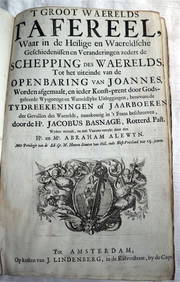
ACOBUS BASAGNE c1710 Theological History Numerous Engravings by De Hooghe Rare!Luis Porretta Fine Arts4.3(10)See Sold PriceMar 02, 2024
Rare 19thc German Handcolored Costume Plates, 17thc NobilityConnoisseur Auctions3.9(336)See Sold PriceMar 02, 2024
1872 Holy BIBLE & Hitchcock Analysis Gruden Concordance Theology MAPS Holy LandSchilb Antiquarian Rare Books4.8(428)See Sold PriceMar 31, 2024
17th century titled Dakaiko Al-Akhbaar by Sheikh Khalil bin MohamedOrientalist Art4.3(2)See Sold PriceFeb 29, 2024
A "Red Book" of the Greatest War of History 1914North American Artifact Auctions4.7(198)See Sold PriceApr 20, 2024
1816 MAP SOUTHERN PART OF RUSSIA or MUSCOVY in EUROPE copper engraving ANTIQUEJasper524.5(9.9k)See Sold PriceFeb 27, 2024
1816 MAP NORTHERN PART OF RUSSIA or MUSCOVY in EUROPE copper engraving ANTIQUEJasper524.5(9.9k)See Sold PriceFeb 27, 2024
1749 MAP CARTE DE LA TARTARIE ORIENTALE RUSSIA & CHINA antique EASTERN TARTARYJasper524.5(9.9k)See Sold PriceFeb 27, 2024
1704 DESCRIPTION OF ALL THE SEATS OF THE PRESENT WARS OF EUROPE antique w/ MAPSJasper524.5(9.9k)See Sold PriceFeb 27, 2024
18th century MAP of ARMENIA GEORGIA NATOLIA BLACK SEA ASIA MINOR antiqueJasper524.5(9.9k)See Sold PriceFeb 27, 2024
1738 RUSSIA SIBERIA & GREAT TARTARY Description illustrated ANTIQUE in ENGLISHJasper524.5(9.9k)See Sold PriceFeb 27, 2024
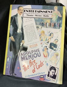
Retro Theatre Movie Radio Newspaper Anthology 1949The Benefit Shop Foundation Inc.4.3(2.9k)See Sold PriceMar 13, 2024
NUBIA. 'Nubie'. Nile Valley. Sudan Ethiopia Egypt. MALLET 1683 old antique mapJasper524.5(9.9k)See Sold PriceFeb 28, 2024
FRANCIS DE SALES: (1567-1622)International Autograph Auctions Europe S.L.4.5(52)See Sold PriceMar 13, 2024
ANTIQUE JOSEPHI MASCARDI LAW BOOK, 1607 BOUND TO FOLIO VELLUMNY Elizabeth 4.2(86)See Sold PriceMar 03, 2024
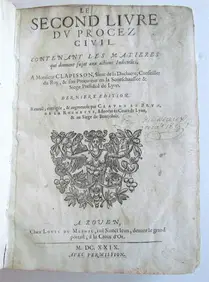
1629 CIVIL RIGHTS BOOK IN FRENCH, ANTIQUE VELLUM BOUND; SECOND LIFE OF THE CIVIL PROCESSNY Elizabeth 4.2(86)See Sold PriceMar 03, 2024
EDWARD VIII: (1894-1972) 'Conan Doyle's books are always so good'International Autograph Auctions Europe S.L.4.5(52)See Sold PriceMar 14, 2024
BALDWIN STANLEY: (1867-1947)International Autograph Auctions Europe S.L.4.5(52)See Sold PriceMar 14, 2024


![Collection of [3] Geography Books, Many Engravings and (1 of 7)](https://p1.liveauctioneers.com/2398/142670/72197311_1_x.jpg?height=282&quality=70&version=1558533951)