SoldA Mixed Group Of Loose British Isles MapsA Mixed Group Of Loose Maps Of The British Isles, including 9 Emanuel Bowen county maps of Lancashire, Herefordshire, Bedford, Hartfordshire, Shropshire, Cambridgshire and others, engraved mSee Sold Price
Sold5 Maps, British Isles, Misc. Publishers, c.1762-1805LOT. 5 maps relating to the British Isles, various publishers, c.1762-1805, includes: Kitchin. Ireland with the Roads, from the latest Surveys. 36.7x34 cm. (Some offsetting, 3" tear near centerfold.)See Sold Price
SoldBritish Isles.- Mixed group of mapsMixed group of maps of the British Isles,comprising c.65 sectional maps from Cary's New Map of England and Wales, 4to,1794, and c.130 strip road map sheets, most with maps printed both sides,See Sold Price
SoldRobert Morden (17th – 18th Century) British. ‘The SmallRobert Morden (17th – 18th Century) British. ‘The Smaller Islands in the British Isles’, Map circa 1722, 14.5” x 17”.See Sold Price
SoldOrdnance Survey.- A group of 70 folding mapsOrdnance Survey.- A group of 70 folding maps,with various counties and areas of the British Isles, lithographed maps, many printed in colour, v.s., all folding into contemporary paper covers,See Sold Price
SoldBartholomew, John 1889 Lot of 5 World, Europe MapsIncl Natural Productions, Chart of the World of showing Heights and Depths, Sketch Chart of the North Atlantic, Railway Map of Central Europe, and Railway Map of British Isles. Lithograph Maps PublishSee Sold Price
SoldGrp: Maps of the British IslesGroup of maps of the British isles, featuring several lovely regional maps of Scotland, one map of Ireland, and several maps of England and Wales. With one map of France, featuring the English ChannelSee Sold Price
Soldworld.- a small mixed group of mapsWorld.- a small mixed group of maps,including the British Isles, by Sebastian Munster, hand-coloured woodcut map, 80 x 130mm., mounted close, framed and glazed, c.1545 or later; 2 woodblock maSee Sold Price
SoldGrp: 11 Maps of the British Isles w/ 1 Map ParmaGroup of ten maps of various regions of the British Isles, primarily dating from the 19th century. Includes one Thomas Kitchin (1718–1784) map of Leith, Ireland; one map of the rivers and canalSee Sold Price
SoldMoule, Thomas C1850 British Map. Isle of ManSteel Engraved Map Published C1850 "A Complete and Universal English Dictionary" by the Rev. James Barclay et al. Maps by Thomas Moule. Paper Size: 10.5 x 8 inch (27 x 21cm) Good ConditionSee Sold Price
SoldMoule, Thomas C1838 British Map. Isle of ManSteel Engraved Map Published C1838 for "A Complete and Universal English Dictionary" by the Rev. James Barclay et al. Maps by Thomas Moule. Paper Size: 10.5 x 8 inch (27 x 21cm) Good ConditionSee Sold Price
SoldMoule, Thomas C1838 British Map. Isle of WightSteel Engraved Map Published C1838 for "A Complete and Universal English Dictionary" by the Rev. James Barclay et al. Maps by Thomas Moule. Paper Size: 10.5 x 8 inch (27 x 21cm) Tight top margin as boSee Sold Price
SoldMoule, Thomas C1838 British Map. Isle of ThanetSteel Engraved Map Published C1838 for "A Complete and Universal English Dictionary" by the Rev. James Barclay et al. Maps by Thomas Moule. Paper Size: 10.5 x 8 inch (27 x 21cm) Minor wrinkle present,See Sold Price
SoldMoule, Thomas C1835 British Map. Isle of ManSteel Engraved Map Published C1835, London for "A Complete and Universal English Dictionary" by the Rev. James Barclay et al. Maps by Thomas Moule. Paper Size: 11 x 8.5 inch (28 x 22cm) Minor toning,See Sold Price
SoldOrtelius, Abraham. Angliae, Scotiae et HiberniaeOrtelius, Abraham Angliae Scotiae et Hiberniae 1572 Copperplate engraving; old coloured Printed area: 50.3 x 34.5 cm; 19.8 x 13.5 in The British Isles are depicted from an unusual westerly orientatedSee Sold Price
SoldBritish Isles.Reserve Reduced! Title/Content of Map: British Isles.Date: 1840 Cartographer: GREENLEAF, JEREMIAH Material/Medium: JEREMIAH GREENLEAF Size: 12.5 x 10.75 inches Showing topography, many place names. MaSee Sold Price
Maps of Britain and IrelandTitle: Lot of 5 maps relating to the British Isles Author: ** Description: Includes: Kitchin. Ireland with the Roads, from the latest Surveys. 36.7x34 cm. (Some offsetting, 3" tear near centerfold.) cSee Sold Price
SoldMunster: Antique Ptolemaic Map of British Isles, 1570Title: Britannischen Insula. 1570 woodcut Ptolemaic map of the British Isles Map maker: Sebastian Münster Place and Year: Basel, 1570 Dimensions: 25.0 x 16.5 cm (9.8 x 6.5 in) Technique: Woodblock prSee Sold Price
SoldGerard Mercator, (2) 16th c. maps of British IslesGerard Mercator, (2) 16th c. maps of British Isles, Gerard Mercator (German, 1512-1594), half sheets of Scotland and England, c. 1580s, 19.5"h x 22.5"w (sheet), unframed Provenance: Property from a maSee Sold Price
Sold(MAP, SCOTLAND) BLEAU, J. A group of 2 hand-colore(MAP, SCOTLAND) BLEAU, J. A group of two hand-colored copper engraved maps of British Isles. (Amsterdam: J. Blaeu, 1654). Each with richly hand-colored borders, forests, mountain ranges and towns, decSee Sold Price
Sold(MAP, SCOTLAND) BLAEU, J. A group of three maps of(MAP, SCOTLAND) BLAEU, J. A group of three hand-colored copper engraved maps of British Isles. (Amsterdam: J. Blaeu, 1654). French text to verso of one, Latin text to verso of others. Each with richlySee Sold Price
SoldTOBIAS LOTTER MAP OF BRITISH ISLESOriginal hand-colored engraving. 18th century. Three different hand-colored heraldic devices. Dimensions: (Frame) H 30.5" x W 26.5", (Sight) H 23.75" x W 20" Condition: Some light foxing. Unexamined oSee Sold Price
Sold19th c. Schoolgirl map of British IslesSchool girl map of the British Isles titled "Britain by C H." Title surrounded by a ring of roses. Hand colored ink and water color on paper. 11 5/8" H x 9" W. 19th Century. Provenance: Estate of SallSee Sold Price
Sold160 maps Britain, Ireland, Europe, c.1800-1911.[British Isles/Europe]. About 167 maps, mostly in color (hand and printed). About 18 of Holland and Belgium; 32 other Continental maps (mostly general maps of Europe); 5 engraved hand-colored maps ofSee Sold Price
LATE 17TH C. FRENCH MAP OF THE NEW WORLD BY ALEXIS-HUBERT JAILLOT (1632-1712)Thomaston Place Auction Galleries4.4(386)See Sold PriceFeb 24, 2024
AN ANTIQUE FOLDING MAP OF THE BRITISH ISLES DATED 1873Hutchinson Scott Auctioneers4.4(39)See Sold PriceFeb 28, 2024
Chatelain - 3 Maps of the British Isles (England, Ireland, Scotland)Trillium Antique Prints & Rare Books4.5(30)See Sold PriceFeb 24, 2024
De Jode, Rare, pub. 1593 - Map of the British Isles [England, Scotland, Ireland] (Angliae Scotiae etTrillium Antique Prints & Rare Books4.5(30)See Sold PriceFeb 24, 2024
Donovan's The Natural History of British Shells - 5 Volumes in 3 Books with 180 EngravingsTrillium Antique Prints & Rare Books4.5(30)See Sold PriceFeb 24, 2024
Map: A 17thC engraved map of the British Isles titled A Generall Mapp of the Isles of GreatClaydon Auctioneers Ltd4.3(125)See Sold PriceFeb 26, 2024
Group of 5 1934 Sinclair Graphic Road MapsCheck the Oil Promotions, LLC4.6(275)See Sold PriceMar 03, 2024
VARIOUS ARTISTS [BRITISH TRAVEL GUIDES]. Group of 6 map booklets and flyers. 1930s.Swann Auction Galleries4.4(65)See Sold PriceFeb 29, 2024
CENTRAL EAST AFRICA French Belgian Congo British German Kenya Tanzania 1909 mapJasper524.5(9.8k)See Sold PriceFeb 28, 2024
Southern Africa Cape of Good Hope-Madagascar ADMIRALTY sea chart 1935 (1955) mapJasper524.5(9.8k)See Sold PriceFeb 28, 2024
Gulf of Guinea. Ghana Togo Benin Nigeria. ADMIRALTY sea chart 1928 (1954) mapJasper524.5(9.8k)See Sold PriceFeb 28, 2024
South Namibia coast. Walvis Bay-Orange River ADMIRALTY sea chart 1881 (1954) mapJasper524.5(9.8k)See Sold PriceFeb 28, 2024
Colonial West Africa. Nigeria Cameroon Congo. British German. TIMES 1900 mapJasper524.5(9.8k)See Sold PriceFeb 28, 2024
Colonial West Africa. Nigeria Cameroon Congo. British German. TIMES 1895 mapJasper524.5(9.8k)See Sold PriceFeb 28, 2024
Stanford, Edward 1901 Large Map. Geological Map of the British IslesAlbion Auctions4.6(336)See Sold PriceMar 01, 2024
Stanford, Edward 1901 Large Map. Hydrographical Map of the British IslesAlbion Auctions4.6(336)See Sold PriceMar 01, 2024
Stanford, Edward 1901 Large Map. Stereographical Map of The British IslesAlbion Auctions4.6(336)See Sold PriceMar 01, 2024
Paterson & Mogg 1822 Pair of British Road Maps. Isle of Thanet & WightAlbion Auctions4.6(336)See Sold PriceMar 01, 2024
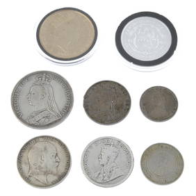
Group of 5 United Kingdom & Isle of Man, Elizabeth II base metal coins.Fellows4.3(159)See Sold PriceFeb 29, 2024


![De Jode, Rare, pub. 1593 - Map of the British Isles [England, Scotland, Ireland] (Angliae Scotiae et (1 of 2)](https://p1.liveauctioneers.com/6581/319571/171593327_1_x.jpg?height=282&quality=70&version=1707853304)


![VARIOUS ARTISTS [BRITISH TRAVEL GUIDES]. Group of 6 map booklets and flyers. 1930s. (1 of 2)](https://p1.liveauctioneers.com/199/319703/171640571_1_x.jpg?height=282&quality=70&version=1707943705)