ATLAS of ANTIENT GEOGRAPHY by SAMUEL BUTLER 1843John McInnis Auctioneers,LLC4.6(502)See Sold PriceFeb 24, 2024
18TH C. ANTIQUE MAP: FRENCH & INDIAN WAR, FRAMEDThomaston Place Auction Galleries4.4(386)See Sold PriceFeb 24, 2024
Rand McNally Railroad Map Cabinet w/ 21 Railroad MapsRail & Road Auctions4.6(165)See Sold PriceMar 08, 2024
Keith Haring - Ink on New York Map, Best Buddies, Inscribed, Signed, and DatedSapphire Auction Gallery4(67)See Sold PriceMar 02, 2024
LATE 17TH C. FRENCH MAP OF THE NEW WORLD BY ALEXIS-HUBERT JAILLOT (1632-1712)Thomaston Place Auction Galleries4.4(386)See Sold PriceFeb 24, 2024
Central Railroad of New Jersey Map of Sandy Hook Route-ca. 1903JM Hobby Supply and Railroad Artifact Auctions4.4(126)See Sold PriceFeb 24, 2024
Lot of Six Mixed Atlas Box Cars-HO Scale-New in BoxJM Hobby Supply and Railroad Artifact Auctions4.4(126)See Sold PriceFeb 25, 2024
Rand McNally/Santa Fe Railroad Map of Iowa-1912JM Hobby Supply and Railroad Artifact Auctions4.4(126)See Sold PriceFeb 24, 2024
NICOLAES VISSCHER (NETHERLANDS, 1618-1709) MAP OF THE NEW WORLDThomaston Place Auction Galleries4.4(386)See Sold PriceFeb 24, 2024
17TH C. WORLD MAP BY NICOLAES VISSCHER (NETHERLANDS, 1618-1709)Thomaston Place Auction Galleries4.4(386)See Sold PriceFeb 24, 2024
Lot of Six Mixed Atlas Cabooses-HO Scale-New in BoxJM Hobby Supply and Railroad Artifact Auctions4.4(126)See Sold PriceFeb 25, 2024
SoldGray's New Map of CincinnatiTitle: Gray's New Map of Cincinnati Publication Date: 1878 Cartographer: GRAY, FRANK A. Publisher: O.W. GRAY & SON Size: 11.8Height - 15Width Map showing street plan, districts (separately colored), mSee Sold Price
Gray's New Map of CincinnatiTitle: Gray's New Map of Cincinnati Publication Date: 1878 Cartographer: Frank A. Gray Publisher: O.W. Gray & Son Size: 12.3 X 14.7 City plan showing and naming streets, railroads, wards etc. Inset: OSee Sold Price
SoldGray's New Map of the U.S. by Frank A. Gray c1894Offered in this lot we have a map of the United States and shows the westward movement by way of population and drawn up by Frank A. Gray and originating from 1894. The map shows the image of the UnitSee Sold Price
Sold1880 Gray US Map -- Gray's New Map of the United StatesReserve Reduced! Title/Content of Map: 1880 Gray US Map -- Gray's New Map of the United States Date: 1880, Philadelphia Cartographer: F Gray Size: 15.5 x 26.7 in. A very nice large US map, showing greSee Sold Price
1875 Gray’s New Map of Texas – 1st ed.Large and impressive hand-colored map of Texas from Gray’s National Atlas. Full title: “Gray’s New Map of Texas and the Indian Territory.” Created by Frank Gray, the map has good margins and iSee Sold Price
Gray's New Map of Baltimore 1886Map: Gray's New Map of Baltimore | City of Washington | Gray's New Map Of Richmond | Maryland, Delaware And the District Of Columbia Maker: O. W. Gray Publishing: Philadelphia 1886 Size: 15.6 x 26.75See Sold Price
SoldGray's New Map of Utah [verso] Arizona and New MexicoTitle/Content of Map: Gray's New Map of Utah [verso] Arizona and New Mexico Date: 1886, Philadelphia Cartographer: F Gray Size: 11.5 x 15 in. This is a very nice map of Utah and on the reverse New MexSee Sold Price
Sold[MAP]. Gray’s New Map of Texas....601. [MAP]. GRAY, Frank A. (mapmaker) & O.W. Gray (publisher). Gray’s New Map of Texas and the Indian Territory... [above lower border] Copyright, 1876 by O.W. Gray & Son;[insets from toSee Sold Price
SoldGray's New Map of the United StatesTitle/Content of Map: Gray's New Map of the United States Cartographer: GRAY, FRANK A. Date: 1879 Publisher: O.W. GRAY & SON Size: 15.5Height - 26.9Width Insets: "Territorial District of Alaska formerSee Sold Price
1880 Gray's New Map Of The United States1880 Gray's New Map Of The United States Map by F Gray, 1880, Philadelphia, 15.5 x 26.7 in. Please note that this lot has a confidential reserve. When you leave a bid in advance of the auction, submitSee Sold Price
SoldGray's New Map of the Countries Surrounding the BlackTitle/Content of Map: Gray's New Map of the Countries Surrounding the Black Sea: Date: 1883 Cartographer: GRAY, FRANK A. Size: 16.3X26.8 "...comprising Turkey in Europe, and part of Turkey in Asia, GrSee Sold Price
Sold1880 Gray US Map -- Gray's New Map of the United StatesTitle/Content of Map: 1880 Gray US Map -- Gray's New Map of the United States Date: 1880, Philadelphia Cartographer: F Gray Size: 15.5 x 26.7 in. A very nice larger US map, showing great deal of topogSee Sold Price
Gray's New Map of Texas and the Indian TerritoryWith an Inset Map of Austin 301. [MAP]. GRAY, Frank A[rnold]. Gray’s New Map of Texas and the Indian TerritorySee Sold Price
SoldFramed 19th Century Gray's New Map Of LouisianaFramed 19th Century Gray's New Map Of Louisiana. Nice condition, nice mat and frame. A few small crinkles in map, map measures 18" x 27".See Sold Price
SoldGray's New Map of the Countries Surrounding the BlackTitle: Gray's New Map of the Countries Surrounding the Black Sea: Publication Date: c1879 Cartographer: GRAY, FRANK A. Publisher:O.W. GRAY & SON Size: 16.25Height - 26.75Width comprising Turkey in EurSee Sold Price
SoldGray, "New Map of Louisiana, With Insets of NewGray, "New Map of Louisiana, With Insets of New Orleans, and the Passes of the Mississippi," 1890, hand colored, H.- 17 in., W.- 28 in.See Sold Price
Gray's New Map of California, 1886Map: Gray's New Map of California Maker: O.W. Gray and Son, Frank A. Gray Date: 1886 Size: Folio - 26.75 x 16.75 inches Reverse: Washington and Oregon and Nevada From Gray's The National Atlas, SpeciaSee Sold Price
Gray's New Map of North Carolina and South CarolinaPublication Date: 1881 Title: Gray's New Map of North Carolina and South Carolina Cartographer: Gray, Frank A. Publisher: O.W. Gray & Son Height: 16 Width: 27 "by Frank A. Gray. ... Engraved on copperSee Sold Price
Gray's New Map of OhioReserve Reduced! Title: Gray's New Map of Ohio Publication Date: 1877 Cartographer: Gray, Frank A. Publisher: O.W. Gray & Son Size: 15.7 X 25.5 Map with insets of City of Columbus, Vicinity of Toledo,See Sold Price
1880 Gray US Map -- Gray's New Map of the United StatesReserve Reduced! Title/Content of Map: 1880 Gray US Map -- Gray's New Map of the United States Date: 1880, Philadelphia Cartographer: F Gray Size: 15.5 x 26.7 in. A very nice large US map, showing greSee Sold Price
Gray's New Map of Utah [verso] Arizona and New MexicoTitle/Content of Map: Gray's New Map of Utah [verso] Arizona and New Mexico Date: 1886, Philadelphia Cartographer: F Gray Size: 11.5 x 15 in. This is a very nice map of Utah and on the reverse New MexSee Sold Price
Sold1880 Gray US Map -- Gray's New Map of the United StatesTitle/Content of Map: 1880 Gray US Map -- Gray's New Map of the United States Date: 1880, Philadelphia Cartographer: F Gray Size: 15.5 x 26.7 in. A very nice large US map, showing great deal of topogrSee Sold Price
Gray's New Map of Kentucky and TennesseeTitle/Content of Map: Gray's New Map of Kentucky and Tennessee Date: 1883 Cartographer: GRAY, FRANK A. Publisher: STEDMAN & BROWN/O.W. GRAY & SON Size: 16Height - 25.8Width Dust soiling erased .DetailSee Sold Price
Gray's New Map of the Countries Surrounding the BlackTitle/Content of Map: Gray's New Map of the Countries Surrounding the Black Sea: Date: 1879 ca. Cartographer: GRAY, FRANK A. Size: 16.25x26.75 "comprising Turkey in Europe, and part of Turkey in Asia,See Sold Price
Cincinnati and Chicago Railroad 1st Annual Report-October 1854JM Hobby Supply and Railroad Artifact Auctions4.4(126)See Sold PriceFeb 24, 2024
Vintage County Map Of NY State Plate EngravingThe Benefit Shop Foundation Inc.4.3(2.9k)See Sold PriceFeb 28, 2024
Portfolio of 15 County Maps by Robert Morden (English 1650-1703)Nadeau's Auction Gallery4.7(401)See Sold PriceFeb 24, 2024
1849 THE NEW-ENGLAND MERCANTILE UNIONNorth American Artifact Auctions4.6(182)See Sold PriceApr 20, 2024
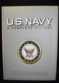
U.S. NAVY - A Complete History by Goodspeed, M. Hill 2003 MintNorth American Artifact Auctions4.6(182)See Sold PriceApr 20, 2024
Burberry BE4307 38314L Top Grey Transparent Women Sunglasses 50mmBidhaus4.3(747)See Sold PriceFeb 25, 2024
PERSOL PO3202V 1065 Grey Striped Beige Demo Lens Mens Eyeglasses 51 mmMynt Auctions4.6(680)See Sold PriceFeb 23, 2024
Map: A 19thC engraved and hand coloured map of Buckingham titled A New Map of BuckinghamshireClaydon Auctioneers Ltd4.3(125)See Sold PriceFeb 26, 2024
10 x 14 SLATE BLUE GRAY NEW Oushak Handmade Rug Natural Wool GEOMETRICMynt Auctions4.6(680)See Sold PriceMar 02, 2024
PERSOL PO3202V 1065 Grey Striped Beige Demo Lens Mens Eyeglasses 53 mmMynt Auctions4.6(680)See Sold PriceMar 01, 2024
MIU MIU SMU 55U 1BC-175 Dark Grey Flash Silver Womens Sunglasses 33mmMynt Auctions4.6(680)See Sold PriceMar 01, 2024
Herman Moll A New Map of Ye North Parts of AmericaWillow Auction House4.5(283)See Sold PriceMar 14, 2024


![Gray's New Map of Utah [verso] Arizona and New Mexico (1 of 2)](https://p1.liveauctioneers.com/5584/132630/67371636_1_x.jpg?height=282&quality=70&version=1544582541)
![[MAP]. Gray’s New Map of Texas.... (1 of 1)](https://p1.liveauctioneers.com/514/38482/16709422_1_x.jpg?height=282&quality=70&version=1363615005)


![Gray's New Map of Utah [verso] Arizona and New Mexico (1 of 2)](https://p1.liveauctioneers.com/5584/126410/64293315_1_x.jpg?height=282&quality=70&version=1534897229)