SoldGibson Laurie Whittle NEW MAP OF THE WHOLE CONTINENT OFDetails: [GIBSON, John] - LAURIE & WHITTLE, publishers. A New Map of the Whole Continent of America, divided into North and South America and West Indies, wherein are described the United States of NSee Sold Price
Gibson/Laurie & Whittle: Two-sheet Western HemisphereMap: A New Map of the Whole Continent of America Divided into North and South and West Indies wherein are exactly Described the United States of North America. Cartographer: Gibson / Laurie & WhittleSee Sold Price
Sold1 piece. Hand-Colored Engraved Map. Laurie, Rober1 piece. Hand-Colored Engraved Map. Laurie, Robert; Whittle, James. A New Map of The Whole Continent of America; Divided into North and South and West Indies, wherein are exactly The United States ofSee Sold Price
SoldLAURIE, ROBERT; and WHITTLE, JAMES. A New Map of theLAURIE, ROBERT; and WHITTLE, JAMES. A New Map of the Whole Continent of America, divided into North and South and West Indies, wherein are exactly described the United States of North America. Large eSee Sold Price
SoldA NEW MAP OF THE WHOLE CONTINENT OF AMERICA. EngravedA NEW MAP OF THE WHOLE CONTINENT OF AMERICA. Engraved and colored map. London, by Laurie & Whittle, May 1794. 101 x 118 cmSee Sold Price
Laurie & Whittle Map of the AmericasLAURIE & WHITTLE (Late 18th Century), after D'ANVILLE, Jean-Baptiste Bourguignon (1697-1782).A New Map of the Whole Continent of America Divided into North and South and West Indies...Engraved map witSee Sold Price
Large map of the Americas 1794Heading: Author: Laurie & Whittle Title: A New Map of the Whole Continent of America, Divided into North and South and West Indies. Wherein are Exactly Described the United States of North America, aSee Sold Price
SoldLarge map of the Americas 1794Heading: Author: Laurie & Whittle Title: A New Map of the Whole Continent of America, Divided into North and South and West Indies. Wherein are Exactly Described the United States of North America, aSee Sold Price
Gibson / Sayer: Antique Map of Western Hemisphere, 1786Map: A New Map of the Whole Continent of America Divided into North and South and West Indies wherein are exactly Described the United States of North America Cartographer: J. Gibson / R. Sayer PlaceSee Sold Price
Gibson/Sayer: Antique Map of Western Hemisphere, 1786Map: A New Map of the Whole Continent of America Divided into North and South and West Indies wherein are exactly Described the United States of North America Cartographer: J. Gibson / R. Sayer PlaceSee Sold Price
SoldLaurie & Whittle, "New Map of North America with theLaurie & Whittle, "New Map of North America with the West India Isles", 1794, map, sight: 20.5 x 46.5", frame: 32.75 x 58.25" Provenance: the Estate of Nancye MillerSee Sold Price
England.Laurie & Whittles, New Map of the InlandEngland.Laurie & Whittles, New Map of the Inland Navigation of England & Wales, With that of Scotland to the South...By Nath.l Coltman. 29-1/2 x 23-3/4 inches, outlined in color, in glass-fronted framSee Sold Price
Laurie & Whittle, "A New Map of the Electorate ofLaurie & Whittle, "A New Map of the Electorate of Bavaria Comprehending The Duchy of Bavaria," 1794, H. - 21 1/4 in., W. - 29 in.See Sold Price
SoldLaurie and Whittle's new map of Surrey and Sussex,Laurie and Whittle's new map of Surrey and Sussex, 1807, a C19th Ronkin map of England and Wales, a map of Ireland, and another of Buckinghamshire, largest 28" x 22 1/2"See Sold Price
19th century Laurie and Whittles new map of all the19th century Laurie and Whittles new map of all the coach roads of England and Wales by Nathaniel Coltman, published London 1820 by Richard Holmes Laurie of Fleet Street, 80cm x 65cmSee Sold Price
SoldLaurie & Whittle Map of the Kingdom of PolandLaurie & Whittle A new map of the Kingdom of Poland, with its dismembered provinces and the Kingdm. of Prussia,from A New Universal Atlas, with title cartouche, upper left, engraved map, withSee Sold Price
SoldJigsaw Puzzle Map of Americas 1813Heading: (Games & Puzzles) Author: Laurie & Whittle Title: Laurie & Whittle's New General Map of America Compiled from the most Authentic Materials London Published Sepr. 16th, 1813, by Laurie & WhittSee Sold Price
SoldMap of America, Laurie and Whittle 1813Antique Map of America, "Laurie & Whittle's New General Map of America, Compiled from the Most Authentic Materials", London, Laurie and Whittle, 1813, hand-colored engraved map, 19 in. x 23 in., frameSee Sold Price
Sold3 maps of Germany. 18th century.[Germany] 3 maps. (1) Homann Heirs. “Der Rhein die Maass und Mosel.” Nuremberg, 1783. Engraved map. 19” x 23 1/2”. (2) Laurie/Whittle. “A new Map of Germany divided intoSee Sold Price
Sold(ARABIA.) Group of 3 large double-page engrave(ARABIA.) Group of 3 large double-page engraved maps. Various sizes, wide margins; coloring and condition as described. London or Edinburgh, vd Laurie & Whittle. A New Map of Arabia. 485x620 mm; hand-See Sold Price
SoldA NEW MAP OF THE WHOLE CONTINENT OF AMERICA (SOUTHERNRobert Sayer - A New Map Of The Whole Continent Of America (southern Section), 1786 - 40 X 17 3/4 In. - This Giclée Print Is Gallery Stretched And Ready To HangSee Sold Price
SoldIndia.- Laurie & Whittle (publishers) A New Map of theIndia.- Laurie & Whittle (publishers) A New Map of the Jaghir Lands, on the Coast of Coromandel, The Territory Belonging To The East India Company Round Madras From An Actual Survey In The PossessionSee Sold Price
Scandinavia.- Laurie & Whittle (publishers) A New MapScandinavia.- Laurie & Whittle (publishers) A New Map of the Northern States containing the Kingdoms of Sweden, Denmark, and Norway; with The Western Parts of Russia, Livonia, Courland &ca., engravedSee Sold Price
SoldSayer (Robert) - A New Map of the Whole Continent ofNorth and South America, with inset map of the Baffin and Hudson Bays, large decorative title cartouche, engraved map with original outline hand-colouring, cartouche uncoloured, 1040 x 1180mm., verticSee Sold Price
Central Railroad of New Jersey Map of Sandy Hook Route-ca. 1903JM Hobby Supply and Railroad Artifact Auctions4.4(127)See Sold PriceFeb 24, 2024
Erie Railway Tourist Book/Magazine-1874JM Hobby Supply and Railroad Artifact Auctions4.4(127)See Sold PriceFeb 24, 2024
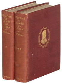
Union Pacific RR Across The Continent West From Omaha, NE Book-April 2, 1868JM Hobby Supply and Railroad Artifact Auctions4.4(127)See Sold PriceFeb 24, 2024
1885 CIVIL WAR 1ed Famous Memoirs US Grant Sheridan Sherman 6v RARE LOT MapsSchilb Antiquarian Rare Books4.8(428)See Sold PriceMar 10, 2024
LARGE LATE 17TH C. DUTCH CHART OF CANADA, GREAT LAKES, NEW FRANCE, LABRADOR, HUDSON BAY, BY PIERREThomaston Place Auction Galleries4.4(393)See Sold PriceFeb 24, 2024
LATE 17TH C. FRENCH MAP OF THE NEW WORLD BY ALEXIS-HUBERT JAILLOT (1632-1712)Thomaston Place Auction Galleries4.4(393)See Sold PriceFeb 24, 2024
NICOLAES VISSCHER (NETHERLANDS, 1618-1709) MAP OF THE NEW WORLDThomaston Place Auction Galleries4.4(393)See Sold PriceFeb 24, 2024
Ib Kofod Larsen Danish Modern Four-Drawer ChestAuctions at Showplace4.6(740)See Sold PriceMar 03, 2024
Portfolio of 15 County Maps by Robert Morden (English 1650-1703)Nadeau's Auction Gallery4.7(409)See Sold PriceFeb 24, 2024
1872 Holy BIBLE & Hitchcock Analysis Gruden Concordance Theology MAPS Holy LandSchilb Antiquarian Rare Books4.8(428)See Sold PriceMar 31, 2024
Pair of The Gateway to a Continent Books - Grand Central Zone and 1939 World's FairRail & Road Auctions4.6(165)See Sold PriceMar 07, 2024
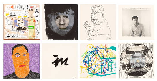
Keith Haring - Ink on New York Map, Best Buddies, Inscribed, Signed, and DatedSapphire Auction Gallery4(67)See Sold PriceMar 02, 2024
Willem Blaeu, Etc. 17th C. Antiquarian Maps, 2Auctions at Showplace4.6(740)See Sold PriceMar 17, 2024
Audubon - 8 Quadruped LithographsTrillium Antique Prints & Rare Books4.5(32)See Sold PriceFeb 24, 2024
Audubon, NYSE Best Watercolor Ed - Pair: Brown Pelican & Reddish EgretTrillium Antique Prints & Rare Books4.5(32)See Sold PriceFeb 24, 2024
Buffon, Vaugody & Bell 1785 America - Map of the New ContinentAlbion Auctions4.6(341)See Sold PriceMar 01, 2024