ATLAS of ANTIENT GEOGRAPHY by SAMUEL BUTLER 1843John McInnis Auctioneers,LLC4.6(502)See Sold PriceFeb 24, 2024
18TH C. ANTIQUE MAP: FRENCH & INDIAN WAR, FRAMEDThomaston Place Auction Galleries4.4(386)See Sold PriceFeb 24, 2024
Rand McNally Railroad Map Cabinet w/ 21 Railroad MapsRail & Road Auctions4.6(165)See Sold PriceMar 08, 2024
Keith Haring - Ink on New York Map, Best Buddies, Inscribed, Signed, and DatedSapphire Auction Gallery4(67)See Sold PriceMar 02, 2024
LATE 17TH C. FRENCH MAP OF THE NEW WORLD BY ALEXIS-HUBERT JAILLOT (1632-1712)Thomaston Place Auction Galleries4.4(386)See Sold PriceFeb 24, 2024
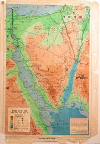
Central Railroad of New Jersey Map of Sandy Hook Route-ca. 1903JM Hobby Supply and Railroad Artifact Auctions4.4(126)See Sold PriceFeb 24, 2024
Lot of Six Mixed Atlas Box Cars-HO Scale-New in BoxJM Hobby Supply and Railroad Artifact Auctions4.4(126)See Sold PriceFeb 25, 2024
Rand McNally/Santa Fe Railroad Map of Iowa-1912JM Hobby Supply and Railroad Artifact Auctions4.4(126)See Sold PriceFeb 24, 2024
NICOLAES VISSCHER (NETHERLANDS, 1618-1709) MAP OF THE NEW WORLDThomaston Place Auction Galleries4.4(386)See Sold PriceFeb 24, 2024
17TH C. WORLD MAP BY NICOLAES VISSCHER (NETHERLANDS, 1618-1709)Thomaston Place Auction Galleries4.4(386)See Sold PriceFeb 24, 2024
Lot of Six Mixed Atlas Cabooses-HO Scale-New in BoxJM Hobby Supply and Railroad Artifact Auctions4.4(126)See Sold PriceFeb 25, 2024
SoldGerard Mercator Map of the Artic and AreaGerard Mercator (1512 - 1594) map of the Artic and surrounding area as seen from the Artic. Circa 1606 or later. Measures 14.5" x 15.5" plate szie. Artic area is depicted as a land with four rivers. MSee Sold Price
SoldGerard Mercator map of Artic and CanadaCartographer: Gerard Mercator Title: Septentrionalium Terrarum descriptio Subject: Arctic, Canada Published: Amsterdam Date: 1595 Description: The first separate, printed map of the Arctic and Canada,See Sold Price
SoldThevet, Andre. Table dThevet, Andre Table d'Afrique 1575 Woodcut; uncoloured Printed area: 44.7 x 34.5 cm; 17.5 x 13.5 in Largely modelled on the Africa section of Gerard Mercator's famous world map of 1569, Thevet's map oSee Sold Price
SoldMercator (Gerard) and Jodocus Hondius GraeciaMercator (Gerard) and Jodocus Hondius Graecia,map of Greece, decorative cartouche, lower left, engraving, 370 x 470mm., French text verso, central vertical fold, small area of surface loss, miSee Sold Price
Mercator, Gerard. Accurata Prussiae DescriptioMercator, Gerard Accurata Prussiae 1595 Copperplate engraving; area coloured Printed area: 48.2 x 36.6 cm; 18.9 x 14.4 in A very rare version of Mercator's map of Prussia - a map which has been issuedSee Sold Price
Mercator. Tabulae Geographicae (atlas)Mercator, Gerard Tabulae Geographica (atlas) 1585 & 1589 Copperplate engraving; old coloured Printed area: 41.5 x 29.8 cm; 16.3 x 11.7 in Outstanding first edition of a work by Gerard Mercator, publisSee Sold Price
Mercator, Gerard. Universalis Tabula juxta PtolemaeumMercator, Gerard Universalis Tabula juxta Ptolemaeum 1578 Copperplate engraving; uncoloured Printed area: 58.8 x 49 cm; 23.1 x 19.2 in This early Renaissance map was personally engraved by Gerhard MerSee Sold Price
Mercator, Gerard. Turcici Imperii ImagoMercator, Gerard Turcici Imperii Imago 1606 Copperplate engraving; outline coloured Printed area: 48 x 37.7 cm; 18.9 x 14.8 An attractive map of the Turkish Empire; Arabia is shown in detail. The bottSee Sold Price
Mercator, Gerard. ArgowMercator, Gerard Argow 1638 Copperplate engraving; outline coloured Printed area: 46.7 x 36 cm; 18 x 14 in A map of Central Switzerland with Lake Zurich, Lake Lucern, Lake Thun and the surrounding regSee Sold Price
Mercator; Hondius; Janssonius. Sclavonia Croatia BosniaMercator, Gerard; Hondius, Jodocus; Janssonius, Johannes Sclavonia, Croatia, Bosnia cum Dalmatiae Parte 1645 Copperplate engraving; outline coloured Printed area: 46 x 35.7 cm; 18.1 x 14 in A map of tSee Sold Price
Mercator, G; Hondius, J. Insulae Indiae Orientalis...Mercator, Gerard; Hondius, Jodocus Insaule Indiae Orientalis praecipuae in quibis Moluccae celeberrimae sunt 1630 Copperplate engraving; old coloured Printed area: 47.0 x 34.2 cm; 18.5 x 13.4 in SplenSee Sold Price
Mercator, G.; Hondius, J. Asia ex magna orbis terreMercator, Gerard; Hondius, Jodocus Asia ex magna orbis terre descriptione Gerardi Mercatoris... C. 1611 Copperplate engraving; area coloured Printed area: 47.5 x 38 cm; 18.7 x 14.9 in Originally publiSee Sold Price
van den Keere, C. Gerardus Mercator É Iudocus HondiusKeere, Colette van den Gerardus Mercator É Iudocus Hondius 1613 Copperplate engraving; coloured Printed area: 44.4 x 38.2 cm; 17.4 x 15 in A double portrait of legendary cartographers Gerard MercatorSee Sold Price
SoldGERARD MERCATOR MAP OF DEVON,CORNWALL, SOMERSETFROM THE MERCATOR ATLAS OF 1611, 18"W, 14.5"TALL. PLUS 5"FRAME AND MATTSee Sold Price
SoldGerard Mercator Map of Spain from PortfolioLegionis, Biscaiae Et Guipiscoae Typus Cartographer: Gerard Mercator Hand Colored Published in Mercator/Hondius, Amsterdam. Verso are two large portfolio pages from chapterSee Sold Price
SoldG. Mercator map of Virginia and Florida, 1609Gerard Mercator map of Virginia and Florida. Titled "Virginia et Florida" depicting Southern Virginia to what is now known as Northern Georgia, with German text en verso. 7 3/8" H x 9 3/8" W. Germany,See Sold Price
SoldEUROPAE. [Ortelius, Ca. 1584-1612.] Map.[Ortelius, Abraham] EUROPAE. [C. 1584-1612.] Engraved map by Ortelius based on Jenkinson’s Russia map and Gastaldi’s maps of Africa and Asia, Gerard Mercator’s 1564 map of Britain, a map of ScanSee Sold Price
SoldEUROPAE. [Ortelius, Ca. 1584-1612.] Map.[Ortelius, Abraham] EUROPAE. [C. 1584-1612.] Engraved map by Ortelius based on Jenkinson’s Russia map and Gastaldi’s maps of Africa and Asia, Gerard Mercator’s 1564 map of Britain, a map of ScanSee Sold Price
SoldMercator's Map of AfricaAfrica Ex magna orbis terre descriptione... Gerard Mercator (Grandson), after Gerard Mercator. Engraved map with original hand color in part. Duisburg / 1595. 16 3/4 x 20 1/4 inches sheet A fine old cSee Sold Price
MAP - Europe. OrteliusEurope. Abraham Ortelius, Europae, 1571 (published). Hand Color. This handsome map was based on Gerard Mercator's 1554 map of Europe and incorporates Magnus' information on Scandinavia and Jenkinson'sSee Sold Price
SoldTwo Mercator / Hondius Maps2 (Gerard) Mercator atlas maps, 1619 French Edition, handcolored copperplate engravings on paper. 1st item: America "L'Amerique" by Joducus Hondius, Western Hemisphere - North and South America. ShowsSee Sold Price
SoldGerard Mercator, Alsatia Superior MapGerard Mercator hand colored map of "Alsatia Superior cu Suntgoia & Brisgoia" depicting the Upper Alsace Region. Map from Mercator's atlas published at the end of the 16th century. Map is oriented witSee Sold Price
SoldMap, Gerard MercatorGerard Mercator (Belgian, 1512-1594), "Irlandiae Regnum," copper engraved map with hand coloring, text (Royaume d'Irlande) in French verso, sheet (unframed): 17.5"h x 21"wSee Sold Price
SoldMap, Mercator, Gerard, Amsterdam 1595-[??]MAP. Mercator, Gerard, Westmorlandia, Lancastria, Cestria, Caernarvan, Denbigh, Flint, Merionidh, Montgomery, Salopia cum Insulis Mania et Anglesey Amsterdam 1595-[??] Copper-engraved map, hand-coloreSee Sold Price
New York Central RR The Adirondacks Brochure 1916-1917JM Hobby Supply and Railroad Artifact Auctions4.4(126)See Sold PriceFeb 24, 2024
Map UNITED COUNTIES LEEDS & GRENVILLE by Walling 1861 Rare Canada Map 5ft x 5ftLuis Porretta Fine Arts4.3(10)See Sold PriceMar 02, 2024
De Passe. Portraits. To include: Gerard Mercator, Nicolaus Paschasius, John More, Philip Herbert,Tremont Auctions4.6(293)See Sold PriceFeb 25, 2024
De Jode, Rare, pub. 1593 - Map of Africa (Africae Vera Forma, et Situs)Trillium Antique Prints & Rare Books4.5(30)See Sold PriceFeb 24, 2024
1764 Bellin Map of Fort Louis Area of Guadeloupe -- Environs du Fort Louis de la GuadeloupeJasper524.5(9.8k)See Sold PriceFeb 27, 2024
Operation Torch Nov 1942-May 1943. World War 2. Western Mediterranean 1966 mapJasper524.5(9.8k)See Sold PriceFeb 28, 2024
Blackie (Pub) 1882 Folio Map. World on Mercators ProjectionAlbion Auctions4.6(336)See Sold PriceMar 01, 2024


![EUROPAE. [Ortelius, Ca. 1584-1612.] Map. (1 of 3)](https://p1.liveauctioneers.com/179/82189/42599765_1_x.jpg?height=282&quality=70&version=1447864785)
![EUROPAE. [Ortelius, Ca. 1584-1612.] Map. (1 of 3)](https://p1.liveauctioneers.com/179/85723/44107985_1_x.jpg?height=282&quality=70&version=1456876561)


![Map, Mercator, Gerard, Amsterdam 1595-[??] (1 of 2)](https://p1.liveauctioneers.com/130/16182/5354501_1_x.jpg?height=282&quality=70&version=1213128912)