Marc Chagall-Limited Edition -Paris Opera Ceiling after ChagallArt Legacy Auctions4.5(223)See Sold PriceFeb 24, 2024
Salvador Dali Pantagruel Limited Edition Lithograph Hand signed and numberedArt Legacy Auctions4.5(223)See Sold PriceFeb 24, 2024
Pablo Picasso Bouquet of Peace Collection Domaine Picasso Limited Edition on paper.Art Legacy Auctions4.5(223)See Sold PriceFeb 24, 2024
A RARE MAXFIELD PARRISH JACK AND THE BEANSTALK PRINTSoulis Auctions4.8(953)See Sold PriceFeb 24, 2024
LARGE MECHANICAL PRINT 'STARS' AFTER MAXFIELD PARRISHSoulis Auctions4.8(953)See Sold PriceFeb 24, 2024
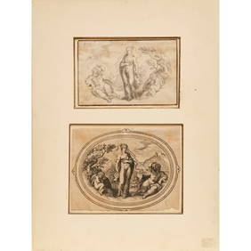
Heinrich Aldegrever, etc. 15 old master prints. 16th-17th centuries. Aldegrever works include "ManTremont Auctions4.5(297)See Sold PriceFeb 25, 2024
SoldGeographical or Travel Engravings of the 18th CTwo 18th Century geographical or travel engravings to include: One "The Kraals of the Hottentots” with "The Hottentots Manner of Attacking Wild Beats" Engraved for Drake's Voyages; measures approximSee Sold Price
Geographical or Travel Engravings of the 18th CTwo 18th Century geographical or travel engravings to include: One "The Kraals of the Hottentots” with "The Hottentots Manner of Attacking Wild Beats" Engraved for Drake's Voyages; measures approximSee Sold Price
Bernard Picart Copperplate Engraving Pair C. 1700sTwo (2) 18th Century geographical or travel engravings to include: (1) "The Kraals of the Hottentots” with "The Hottentots Manner of Attacking Wild Beats" Engraved for Drake's Voyages; measures apprSee Sold Price
Picart Copperplate Engraving Pair C. 1700sTwo (2) 18th Century geographical or travel engravings to include: (1) "The Kraals of the Hottentots" with "The Hottentots Manner of Attacking Wild Beasts" Engraved for Drake's Voyages; measures approSee Sold Price
SoldGEOGRAPHICAL ENGRAVING. 18th c. Black line engrGEOGRAPHICAL ENGRAVING. 18th c. Black line engraving. Engraved by Page after a painting by Robinson. Engraved page from ''Millar's New Complete & Universal System of Geography'' and shows a view of thSee Sold Price
SoldGEOGRAPHICAL ENGRAVING. 18th c. Black line engrGEOGRAPHICAL ENGRAVING. 18th c. Black line engraving. Engraved by ''Grainger'' this is a page from ''Millar's New Complete & Universal System of Geography'' and shows vegetable products cultivated AsiSee Sold Price
18th C Engravings from Captain Cook's TravelsTitle: 18th C Engravings from Captain Cook's Travels Date/Period: 1780 Dimension: 12.5" by 10.5" framed Provenance:California Woman and Man Shipping: Domestic: Flat-rate of $30.00 to anywhere within tSee Sold Price
SoldAntique Map Alps Central EuropeAntique physical geography topography map. Central Europe. Alps mountains. River gods in cartouche. Hand colored engraving, 18th C. 22" x 23".See Sold Price
SoldA Tobias Conrad Lotter handcoloured map of theA Tobias Conrad Lotter handcoloured map of the Seventeen Provinces of the Low Countries copper engraving, 18thC and period, 46,5 x 48,5 cmSee Sold Price
Sold18th C. Engraving of a Woman From Cook's Travels18th C. Engraving of a Woman of Sandwich Island from Cook's Travels in the Pacific, engraved by J. Webber. Sight size measures approx. 11" inches by 9" inches. Overall size is 21" inches by 14" inchesSee Sold Price
Sold4 copper engraving maps4 copper engraving maps, 18th C., 1x Rheinverlauf of F. de Wit, cartouche and borders colored, bow folds, approx. 22.5x103cm; Palatinatus Rheni of Janssonius, partially colored, approx. 38x48cm; LineSee Sold Price
Collection of 18th c. Engravings, Biblical ScenesGroup of 6 engraved plates depicting various Biblical scenes. All early to mid 1700s, on folio leaves approx. 14.5" x 8.5". One with marginal repair. Some mild toning or soiling. Likely taken from a fSee Sold Price
Collection of 18th c. Engravings, Biblical ScenesGroup of 6 engraved plates depicting various Biblical scenes. All early to mid 1700s, on folio leaves approx. 14.5" x 8.5". Some mild toning, foxing, or soiling. Likely taken from a folio edition of BSee Sold Price
Sold18th C. Engraving of Sandwich Island Man from Cook18th C. Engraving of Sandwich Island Man from Cook's Travels engraved by J Webber. In good condition. Sight size is 11" inches wide by 9" inches tall. Overall size is 21" inches by 14" inches. MattedSee Sold Price
SoldTHREE 18TH C. TERRITORY ENGRAVINGS, AMOS DOOLITTLEThree 18th C. maps of America comprising Amos Doolittle (American, 1754-1832). Map of Pennsylvania territory - circa 1795, mapped by Cyrus Harris engraved by Amos Doolittle, copperplate engraving on pSee Sold Price
THREE 18TH C. TERRITORY ENGRAVINGS, AMOS DOOLITTLEThree 18th C. maps of America comprising Amos Doolittle (American, 1754-1832). Map of Pennsylvania territory - circa 1795, mapped by Cyrus Harris engraved by Amos Doolittle, copperplate engraving on pSee Sold Price
SoldEngravings. Inc: Drake's Voyages. 18th c.[Exploration] Group of 18th century engravings. Includes: (1) “Dress of the Female Inhabitants of Whidah on the Gold Coast.” From Charles Theodore Middleton's A Complete System of Geography. (2) �See Sold Price
SoldAntique Mid 18th C Herrliberger Zurich EngravingAntique 18th Century David Herrliberger (Swiss, 1697-1777) "Plans Du Lac De Zurich" Engraving. From Herrliberger's book "Topographie der Eydgnossschaft. Map shows view of Lake Zurich with surroundingSee Sold Price
18thc Copper Plate Engraving, Road Map of KentOriginal, antique, copper-plate engraved, double sided Road Map of Kent, England, compiled by John Owen and engraved by Emmanuel Bowen in the 1720 edition of Britannia Depicta or Ogilby Improved. FramSee Sold Price
SoldCopper engraving map, Joh. Baptist Homann NurembergCopper engraving map, Joh. Baptist Homann Nuremberg, 18th C., Judaea and Palaestina, partly colored, two cartouches, upper with representation of Moses, who receives the Ten Commandments, smoothed creSee Sold Price
Korea, 18th c. - Shihei Hayashi (1738-1793)Ancient history book of Korea dating from 1768 containing geographical and political information, including maps of the ancient territories. Rare map of the Dokdo Islands drawn by the Japanese geograpSee Sold Price
THREE ANTIQUE 18TH C FRAMED MAPS: SPAIN, ENGLANDLot of three antique 18th century hand colored map engravings. Includes Balearic Islands, Spain, 1778, Antonio Zatta; Buckinghamshire, 1787, J. Cary; and Oxfordshire, 1787, J. Cary. The two smaller EnSee Sold Price
18th C Lot of Russia Maps Morden De FerThree engravings including one entitle Moscovie or Russie attributed to Robert Mordern early 18th century, "Grande Tartarie", by N De Fer, , and handcolored plan of the fortress of Tobolsk. All smalleSee Sold Price
18th C. Maps, Kent, Surrey, by Emanuel BowenEmanuel Bowen's 18th Century maps of Kent and Surrey are original engravings printed upon eighteenth century, hand-made, laid paper and with full margins as published in London by W. Owen in 1756 forSee Sold Price
18TH C. ANTIQUE MAP: FRENCH & INDIAN WAR, FRAMEDThomaston Place Auction Galleries4.4(393)See Sold PriceFeb 24, 2024
18th C. Francois N Martinet Colored Engraving of BirdsArtemis Fine Arts4.8(1.4k)See Sold PriceFeb 26, 2024
French Flintlock Double Barrel Fowler, Olive of Marsaille, Ca. Late 18th C., 24 Ga. (.570 Cal.) LDuMouchelles4.6(830)See Sold PriceMar 14, 2024