ATLAS of ANTIENT GEOGRAPHY by SAMUEL BUTLER 1843John McInnis Auctioneers,LLC4.5(505)See Sold PriceFeb 24, 2024
18TH C. ANTIQUE MAP: FRENCH & INDIAN WAR, FRAMEDThomaston Place Auction Galleries4.4(393)See Sold PriceFeb 24, 2024
Rand McNally Railroad Map Cabinet w/ 21 Railroad MapsRail & Road Auctions4.6(165)See Sold PriceMar 08, 2024
Keith Haring - Ink on New York Map, Best Buddies, Inscribed, Signed, and DatedSapphire Auction Gallery4.1(67)See Sold PriceMar 02, 2024
LATE 17TH C. FRENCH MAP OF THE NEW WORLD BY ALEXIS-HUBERT JAILLOT (1632-1712)Thomaston Place Auction Galleries4.4(393)See Sold PriceFeb 24, 2024
Central Railroad of New Jersey Map of Sandy Hook Route-ca. 1903JM Hobby Supply and Railroad Artifact Auctions4.4(127)See Sold PriceFeb 24, 2024
Lot of Six Mixed Atlas Box Cars-HO Scale-New in BoxJM Hobby Supply and Railroad Artifact Auctions4.4(127)See Sold PriceFeb 25, 2024
Rand McNally/Santa Fe Railroad Map of Iowa-1912JM Hobby Supply and Railroad Artifact Auctions4.4(127)See Sold PriceFeb 24, 2024
NICOLAES VISSCHER (NETHERLANDS, 1618-1709) MAP OF THE NEW WORLDThomaston Place Auction Galleries4.4(393)See Sold PriceFeb 24, 2024
17TH C. WORLD MAP BY NICOLAES VISSCHER (NETHERLANDS, 1618-1709)Thomaston Place Auction Galleries4.4(393)See Sold PriceFeb 24, 2024
Lot of Six Mixed Atlas Cabooses-HO Scale-New in BoxJM Hobby Supply and Railroad Artifact Auctions4.4(127)See Sold PriceFeb 25, 2024
General Topographical Map. Sheet XIIPublication Date: 1893 Title: General Topographical Map. Sheet XII Cartographer: U.S. ARMY. CORPS OF ENGINEERS Publisher: WAR DEPARTMENT Height: 16.3 Width: 27.3 Plate CXLVII from the Atlas to AccompaSee Sold Price
General Topographical Map. Sheet XIITitle/Content of Map: General Topographical Map. Sheet XII Publication Date: 1893 Cartographer: U.S. ARMY. CORPS OF ENGINEERS Publisher: WAR DEPARTMENT Description: Plate CXLVII from the Atlas to AccoSee Sold Price
General Topographical Map. Sheet XIIPublication Date: 1893 Title: General Topographical Map. Sheet XII Cartographer: U.S. ARMY. CORPS OF ENGINEERS Publisher: WAR DEPARTMETN Height: 16.3 Width: 27.3 Plate CXLVII from the Atlas to AccompaSee Sold Price
SoldAN ANTIQUE MAP, "General Topographical Map, SheetAN ANTIQUE MAP, "General Topographical Map, Sheet XXII," WASHINGTON D.C., 1891-1895, lithograph on paper, from Atlas to Accompany the Official Records of the Union and Confederate Armies, plate CLVII,See Sold Price
General Topographical Map. Sheet XWAR DEPARTMENT, U.S. ARMY. CORPS OF ENGINEERS, 1893, Folio – 16.50 H x 27.30 W Inches, Plate CXLV from the Atlas to Accompany the Official Records of the Union and Confederate Armies. 1861-1865. TheSee Sold Price
General Topographical Map. Sheet XV.WAR DEPARTMENT, U.S. ARMY. CORPS OF ENGINEERS., 1893, Folio – 18.50 H x 29.50 W Inches, Plate CL from the Atlas to accompany the Official Records of the Union and Confederate armies, 1861-1865. CentSee Sold Price
General Topographical Map Sheet XXIIIWAR DEPARTMENT, U.S. ARMY. CORPS OF ENGINEERS., 1892, Double Folio – 16.00 H x 27.50 W Inches, From the Atlas to accompany the Official Records of the Union and Confederate armies, 1861-1865. Map shSee Sold Price
General Topographical Map. Sheet Ix.Title/Content of Map: General Topographical Map. Sheet Ix. Cartographer: U.S. ARMY. CORPS OF ENGINEERS Date: 1893 Publisher: WAR DEPARTMENT Size: 16.5Height - 27.3Width Plate CXLIV from the Atlas to ASee Sold Price
General Topographical Map Sheet XXIII.Publication Date: 1893 Title: General Topographical Map Sheet XXIII. Cartographer: U.S. ARMY. CORPS OF ENGINEERS. Publisher: WAR DEPARTMENT Height: 16.5 Width: 27.5 Plate CLVIII from the Atlas to AccoSee Sold Price
General Topographical Map. Sheet XXV.Publication Date: 1893 Title: General Topographical Map. Sheet XXV. Cartographer: U.S. ARMY. CORPS OF ENGINEERS. Publisher: WAR DEPARTMENT Height: 18.5 Width: 29 Plate CLX from the Atlas to accompanySee Sold Price
General Topographical Map. Sheet XVIIITitle: General Topographical Map. Sheet XVIII Cartographer: U.S. ARMY. CORPS OF ENGINEERS Publisher: WAR DEPARTMENT Size: 16.5 X 27.5 Plate CLIII from the Atlas to Accompany the Official Records of thSee Sold Price
General Topographical Map. Sheet XIII.Title: General Topographical Map. Sheet XIII. Cartographer:U.S. ARMY. CORPS OF ENGINEERS Publisher: WAR DEPARTMENT Height: 16.5 Width: 27.3 Plate CXLVIII from the Atlas to Accompany the Official RecorSee Sold Price
General Topographical Map. Sheet XIXTitle: General Topographical Map. Sheet XIX Cartographer: U.S. ARMY. CORPS OF ENGINEERS Date: 1893 Publisher: WAR DEPARTMENT Size: 16.5Height - 27.3Width Additional Info: Plate CLIV from the Atlas toSee Sold Price
Sold1894 Cowles Civil War Map of Virginia and Parts of WestTitle/Content of Map: 1894 Cowles Civil War Map of Virginia and Parts of West Virginia and Maryland -- General Topographical Map, Sheet II [Plate CXXXVII] Cartographer: C Cowles (compiled by) Year/PlaSee Sold Price
SoldTexas 1893Map: General Topographical Map. Sheet XXII, Texas Publishing: War Department, US Army Corps of Engineers: Washington DC Date: 1893 Size: 16.5 x 27.5 inches Plate CLVII from the Atlas to Accompany theSee Sold Price
SoldGeneral Topographical Map 1893Map Title: General Topographical Map. Sheet XXIV Date: 1893 Publisher: War Department: Washington DC Size: 18.3 x 29 inches This is the Union Army's detailed mapping of southeast Indian Territory, souSee Sold Price
Sold1894 Cowles Civil War Map of South Carolina and PartsTitle/Content of Map: 1894 Cowles Civil War Map of South Carolina and Parts of North Carolina -- General Topographical Map, Sheet IV [Plate CXXXIX] Date: 1894, Washington Cartographer: C Cowles (compiSee Sold Price
1894 Cowles Civil War Map of North Carolina andTitle: 1894 Cowles Civil War Map of North Carolina and Southern Virginia -- General Topographical Map, Sheet III [Plate CXXXVIII] Cartographer: C Cowles (compiled by) Year / Place: 1894, Washington MaSee Sold Price
1894 Cowles Civil War Map of Virginia and Parts of WestTitle/Content of Map: 1894 Cowles Civil War Map of Virginia and Parts of West Virginia and Maryland -- General Topographical Map, Sheet II [Plate CXXXVII] Date: 1894, Washington Cartographer: C CowlesSee Sold Price
1894 Cowles Civil War Map of Northern Virginia,Title: 1894 Cowles Civil War Map of Northern Virginia, Maryland, Delaware and Parts of West Virginia and Pennsylvania -- General Topographical Map, Sheet I [Plate CXXXVI] Cartographer: C Cowles (compiSee Sold Price
1894 Cowles Civil War Map of North Carolina andTitle/Content of Map: 1894 Cowles Civil War Map of North Carolina and Southern Virginia -- General Topographical Map, Sheet III [Plate CXXXVIII] Cartographer: C Cowles (compiled by) Year/Place: 1894,See Sold Price
1894 Cowles Civil War Map of Northern Virginia,Title/Content of Map: 1894 Cowles Civil War Map of Northern Virginia, Maryland, Delaware and Parts of West Virginia and Pennsylvania -- General Topographical Map, Sheet I [Plate CXXXVI] Cartographer:See Sold Price
1894 Cowles Civil War Map of Ohio, West Virginia andTitle/Content of Map: 1894 Cowles Civil War Map of Ohio, West Virginia and Parts of Pennsylvania and Kentucky -- General Topographical Map, Sheet V [Plate CXL] Cartographer: C Cowles (compiled by) YeaSee Sold Price
1894 Cowles Civil War Map of North Carolina andTitle/Content of Map: 1894 Cowles Civil War Map of North Carolina and Southern Virginia -- General Topographical Map, Sheet III [Plate CXXXVIII] Cartographer: C Cowles (compiled by) Year/Place: 1894,See Sold Price
Pair of Early Railroad Maps - 1874 Delaware, Lackawanna & Western and 1876 Pennsylvania RailroadRail & Road Auctions4.6(165)See Sold PriceMar 07, 2024
Group of 15 Printed or Lithographed Items, including: litho...Potter & Potter Auctions4.6(545)See Sold PriceMar 07, 2024
West Indies Islands. Guadaloupe. | Mariegalante &C. | Antigua.Jasper524.5(9.9k)See Sold PriceFeb 27, 2024
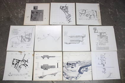
Set of 11 Mid Century Modern Architectural Plans & Site Map RenderingsPUBLIC SALE4.7(226)See Sold PriceMar 02, 2024
Colonial Africa. British German French Spanish Portuguese Italian TIMES 1900 mapJasper524.5(9.9k)See Sold PriceFeb 28, 2024
Africa. Mauritius, Bourbon (Reunion) & Natal by Edward Weller 1860 old mapJasper524.5(9.9k)See Sold PriceFeb 28, 2024
AFRICA. Africa. General Map; Inset map of Population map 1907 old antiqueJasper524.5(9.9k)See Sold PriceFeb 28, 2024
Colonial Africa. British German French Spanish Portuguese Italian TIMES 1895 mapJasper524.5(9.9k)See Sold PriceFeb 28, 2024
SOUTHERN AFRICA.Inset Ascension Is.; European colonies 1914;St Helena 1920 mapJasper524.5(9.9k)See Sold PriceFeb 28, 2024
[Constructivism]. The general plan of reconstruction of Moscow. - Moscow: Moscow Worker, 1936. -ARTMAXIMUM4.3(4)See Sold PriceMar 14, 2024


![[Constructivism]. The general plan of reconstruction of Moscow. - Moscow: Moscow Worker, 1936. - (1 of 6)](https://p1.liveauctioneers.com/6171/320219/172084257_1_x.jpg?height=282&quality=70&version=1708525949)


