ATLAS of ANTIENT GEOGRAPHY by SAMUEL BUTLER 1843John McInnis Auctioneers,LLC4.6(502)See Sold PriceFeb 24, 2024
18TH C. ANTIQUE MAP: FRENCH & INDIAN WAR, FRAMEDThomaston Place Auction Galleries4.4(386)See Sold PriceFeb 24, 2024
Rand McNally Railroad Map Cabinet w/ 21 Railroad MapsRail & Road Auctions4.6(165)See Sold PriceMar 08, 2024
Keith Haring - Ink on New York Map, Best Buddies, Inscribed, Signed, and DatedSapphire Auction Gallery4(67)See Sold PriceMar 02, 2024
LATE 17TH C. FRENCH MAP OF THE NEW WORLD BY ALEXIS-HUBERT JAILLOT (1632-1712)Thomaston Place Auction Galleries4.4(386)See Sold PriceFeb 24, 2024
Central Railroad of New Jersey Map of Sandy Hook Route-ca. 1903JM Hobby Supply and Railroad Artifact Auctions4.4(126)See Sold PriceFeb 24, 2024
Lot of Six Mixed Atlas Box Cars-HO Scale-New in BoxJM Hobby Supply and Railroad Artifact Auctions4.4(126)See Sold PriceFeb 25, 2024
Rand McNally/Santa Fe Railroad Map of Iowa-1912JM Hobby Supply and Railroad Artifact Auctions4.4(126)See Sold PriceFeb 24, 2024
NICOLAES VISSCHER (NETHERLANDS, 1618-1709) MAP OF THE NEW WORLDThomaston Place Auction Galleries4.4(386)See Sold PriceFeb 24, 2024
17TH C. WORLD MAP BY NICOLAES VISSCHER (NETHERLANDS, 1618-1709)Thomaston Place Auction Galleries4.4(386)See Sold PriceFeb 24, 2024
Lot of Six Mixed Atlas Cabooses-HO Scale-New in BoxJM Hobby Supply and Railroad Artifact Auctions4.4(126)See Sold PriceFeb 25, 2024
Fries: Antique Ptolemaic Map of Central Asia, 1541Title: [Title on Verso] Tabula Septima Asiae Complectitur Margianam, Bactrianam, Sogdianam, Sacas, & Scythiam, Intra Imaum Montem. 1541 Ptolemaic map of Central Asia Map maker: Laurent Fries, ClaudiiSee Sold Price
1541 Ptolemaic map of Central AsiaTitle: [Title on Verso] Tabula Septima Asiae Complectitur Margianam, Bactrianam, Sogdianam, Sacas, & Scythiam, Intra Imaum Montem Map maker: Laurent Fries, Claudii Ptolemaei Alexandrini Geographicae��See Sold Price
SoldPtolemaic map of central Asia 1541Heading: Author: Ptolemy, Claudius / Lorenz Fries Title: Tabula Septima Asiae Complectitur Margianam, Bactriniam, Sogdianam, Sacas, & Scythiam intra Imaum montem - title from reverse Place Published:See Sold Price
SoldFries: Antique Ptolemaic Map of Sicily, 1541Title: Tabula Nova Siciliae, Sardiniae & Corsicae Map maker: Laurent Fries, Claudii Ptolemaei Alexandrini Geographicae… Place and Year: Vienne, 1541 Dimensions: 40.2 x 27.7 cm (15.8 x 10.9 in) TechnSee Sold Price
Fries: Antique Ptolemaic Map of Greece, 1541Title/Content of Map: 1541 Fries Map of Greece -- Europae Tabula Decima Continet Macedoniam, Epyrum, Achaiam, Peloponesum, & Cretam Insulam Date Printed: 1541, Vienna Cartographer: T Fries Size: 12.8See Sold Price
Fries: Antique Ptolemaic Map of Greece, 1541Map: Europae Tabula Decima Continet Macedoniam, Epyrum, Achaiam, Peloponesum, & Cretam Insulam Cartographer: T Fries Year / Place: 1541, Vienna Map Dimensions: 12.8 x 17.9 in. Condition: Very Good. ClSee Sold Price
SoldFries: Antique Ptolemaic Map of Sri Lanka, 1541Title: [Title on Verso] Tabula Duodecima Asiae Continet Taprobanam Insulam Map maker: Lorenz Fries, Claudii Ptolemaei Alexandrini Geographicae… Place and Year: Vienne, 1541 Dimensions: 45.8 x 28.2 cSee Sold Price
SoldAsia.- Caspian Sea.- Fries (Lorenz) Tabula VII Asiae,Asia.- Caspian Sea.- Fries (Lorenz) Tabula VII Asiae, Ptolemaic map of Central Asia, woodcut on laid paper with watermark of an encircled anchor with heart [cf. Briquet 585, datable to 1530s and earliSee Sold Price
SoldFries (Laurent) - Tabu. Nova Asiae Mi.ptolemaic map of Asia Minor and Cyprus, title banderole in upper margin, woodcut map with original hand-colouring, 300 x 385mm., Latin text verso within ornate woodcut borders, central vertical fold,See Sold Price
-. Fries (Laurent) - Tabu. Nova Asiae Mi.ptolemaic map of Asia Minor and Cyprus, title banderole in upper margin, woodcut map with original hand-colouring, 300 x 385mm., Latin text verso within ornate woodcut borders, central vertical fold,See Sold Price
Fries (Laurent) - Asia Tabula Quinta,ptolemaic map of Persia and Mesopotamia, woodcut map, 305 x 500mm., Latin text verso with title, central vertical fold, minor handling creases, mostly marginal, [Strasbourg], 1522-41.See Sold Price
SoldBellin: Antique Maps of Central Asia / Silk Road, 1749Map: 1. Carte de Karazm, Turkestan et Grande Bukarie. 2. Carte de la Petite Bukharie et Pays Voisin Cartographer: Jacques Nicolas Bellin Place & Date: Paris / 1749/1760 Size: 12" x 8 1/2" (each) CondiSee Sold Price
SoldSDUK: Antique Map of Central Asia & Siberia, 1846Title/Content of Map: 'WESTERN SIBERIA, INDEPENDENT TARTARY, KHIVA, BOKHARA &c' Date Printed: 1846 Image Size: Approx 42.0 x 34.5cm, 16.5 x 13.75 inches (Large) Type: Antique steel engraved map with oSee Sold Price
Homann Heirs: Antique Map of Central Asia, 1739Map: Imperii Rusici Et Tartariae Universae... Opera Ioh. Mathiae Hasu, Math. P.P. ... Publication Date: 1739 Cartographer: DORN, SEBASTIAN Publisher: HOMANN HEIRS Size: Folio – 21.00 H x 24.00 W IncSee Sold Price
Stanford: Antique Map Of Central Asia, 1896TITLE/CONTENT OF MAP: 'Central Asia' Trans-Caspian Aral Sea Khiva Bokhara Sirdaria DATE PRINTED: 1896 IMAGE SIZE: Approx 36.0 x 50.0cm, 14 x 19.75 inches (Large); Please note that this is a folding maSee Sold Price
Bonne: Antique Map of Central Asia, 1780TITLE/CONTENT OF MAP: 'Carte de la Perse, de la Géorgie, et de la Tartarie Indépendante' A map of Central and southwest Asia; "Independent Tartary", Tibet, Persia, the Caspian Sea, Persia, Iraq, theSee Sold Price
Stanford: Antique Map of Central Asia, 1896Title/Content of Map: 'Central Asia' Trans-Caspian Aral Sea Khiva Bokhara Sirdaria Date Printed: 1896 Image Size: Approx 36.0 x 50.0cm, 14 x 19.75 inches (Large); Please note that this is a folding maSee Sold Price
Johnston: Antique Map of Central Asia, 1912Title/Content of Map: 'Central Asia' Aral Sea Turkestan Khiva Bukhara Samarkand. Date Printed: 1912 Image Size: Approx 35.0 x 43.5cm, 13.75 x 17.25 inches (Large); Please note that this is a folding mSee Sold Price
Antique Original Map - Central Asia - Tibet - India - Pakistan - AfghanistanDiscover the Timeless Beauty of "Indien & Inner-Asien, Nordliches Bl": An Exquisite Cartographic Gem. This exquisite cartographic masterpiece invites you on a journey through the enchanting lands of ISee Sold Price
SoldAntique MapLot consists of an antique map of central Asia. Manufactured by George F. Cram.See Sold Price
Asia.- Pakistan, Afghanistan & Western India.- MercatorAsia.- Pakistan, Afghanistan & Western India.- Mercator (Gerard) Asiae IX Tab:, Ptolemaic map of Central Asia, centered on the Indus River, decorative title cartouche in the lower right, engraving onSee Sold Price
SoldFries: Antique Map of Greece, 1541Title/Content of Map: 1541 Fries Map of Greece -- Europae Tabula Decima Continet Macedoniam, Epyrum, Achaiam, Peloponesum, & Cretam Insulam Date Printed: 1541, Vienna Cartographer: T Fries Size: 12.8See Sold Price
SoldBradford: Antique Map of Siberia & Central Asia, 1835Map: Siberia & Central Asia Date Printed: 1835 Cartographer: T.G. Bradford Material/Medium: Paper Size: 13" x 9 1/2" Condition: Very Good. Some foxing on edges. Does not affect Map. Hand colored outliSee Sold Price
Bonne: Antique Map of Central & Southwest Asia, 1780Title/Content of Map: 'Carte de la Perse, de la Géorgie, et de la Tartarie Indépendante' A map of Central and southwest Asia; "Independent Tartary", Tibet, Persia, the Caspian Sea, Persia, Iraq, theSee Sold Price
De Jode, Rare, pub. 1593 - Map of the Middle East, Eastern Asia (Primae Partis Asiae accurataTrillium Antique Prints & Rare Books4.5(30)See Sold PriceFeb 24, 2024
19th CENTURY POETRY in CHAGATAI TURKIC LANGUAGE ISLAMIC MANUSCRIPT antiqueJasper524.5(9.8k)See Sold PriceFeb 27, 2024
CENTRAL EAST AFRICA French Belgian Congo British German Kenya Tanzania 1909 mapJasper524.5(9.8k)See Sold PriceFeb 28, 2024
AFRICA. European Possessions in Central; map of Zanzibar 1907 old antiqueJasper524.5(9.8k)See Sold PriceFeb 28, 2024
WEST CENTRAL AFRICA. Congo Angola Gabon Cameroon Sao Tome. MALLET 1683 old mapJasper524.5(9.8k)See Sold PriceFeb 28, 2024
Buffon, Vaugody & Bell 1785 Map of the Old Continent. Africa, AsiaAlbion Auctions4.6(336)See Sold PriceMar 01, 2024
Blackie (Pub) 1882 Folio Map. West India Islands & Central AmericaAlbion Auctions4.6(336)See Sold PriceMar 01, 2024
Antique Map - Views on the coast of Asia. J. Webber del. Engraved after J. Webber and W. Bligh.Proverde Auctions4.3(3)See Sold PriceFeb 28, 2024
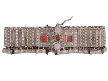
TURKMEN CENTRAL ASIA SILVER CARNELIAN TRIBAL BELTAntique Arena Inc.4.5(852)See Sold PriceJun 15, 2024
TURKMEN CENTRAL ASIA SILVER CARNELIAN TRIBAL BELTAntique Arena Inc.4.5(852)See Sold PriceJun 15, 2024
TURKMEN CENTRAL ASIA SILVER CARNELIAN TRIBAL HEADDRESSAntique Arena Inc.4.5(852)See Sold PriceJun 15, 2024
ISLAMIC SAMANID NUH I IBN NASR LARGE SILVER DIRHAM COINAntique Arena Inc.4.5(852)See Sold PriceJun 15, 2024