ATLAS of ANTIENT GEOGRAPHY by SAMUEL BUTLER 1843John McInnis Auctioneers,LLC4.6(502)See Sold PriceFeb 24, 2024
18TH C. ANTIQUE MAP: FRENCH & INDIAN WAR, FRAMEDThomaston Place Auction Galleries4.4(386)See Sold PriceFeb 24, 2024
Rand McNally Railroad Map Cabinet w/ 21 Railroad MapsRail & Road Auctions4.6(165)See Sold PriceMar 08, 2024
Keith Haring - Ink on New York Map, Best Buddies, Inscribed, Signed, and DatedSapphire Auction Gallery4(67)See Sold PriceMar 02, 2024
LATE 17TH C. FRENCH MAP OF THE NEW WORLD BY ALEXIS-HUBERT JAILLOT (1632-1712)Thomaston Place Auction Galleries4.4(386)See Sold PriceFeb 24, 2024
Central Railroad of New Jersey Map of Sandy Hook Route-ca. 1903JM Hobby Supply and Railroad Artifact Auctions4.4(126)See Sold PriceFeb 24, 2024
Lot of Six Mixed Atlas Box Cars-HO Scale-New in BoxJM Hobby Supply and Railroad Artifact Auctions4.4(126)See Sold PriceFeb 25, 2024
Rand McNally/Santa Fe Railroad Map of Iowa-1912JM Hobby Supply and Railroad Artifact Auctions4.4(126)See Sold PriceFeb 24, 2024
NICOLAES VISSCHER (NETHERLANDS, 1618-1709) MAP OF THE NEW WORLDThomaston Place Auction Galleries4.4(386)See Sold PriceFeb 24, 2024
17TH C. WORLD MAP BY NICOLAES VISSCHER (NETHERLANDS, 1618-1709)Thomaston Place Auction Galleries4.4(386)See Sold PriceFeb 24, 2024
Lot of Six Mixed Atlas Cabooses-HO Scale-New in BoxJM Hobby Supply and Railroad Artifact Auctions4.4(126)See Sold PriceFeb 25, 2024
SoldFrench Map of the Gulf of Mexico, 1843[French Map of the Gulf of Mexico], "Carte du Golfe du Mexique dresse par Mr. Keller", Paris, Depot General de la Marine, 1843, hand-colored copper-engraved chart, 23 1/2 in. x 35 in., framedSee Sold Price
French Map of the Gulf of MexicoCarte Reduite Du Golphe du Mexique et Des Isles de L'Amerique pour servir au Vaisseux du Roy...Annee 1749. Nicholas Bellin (1703-1772). Copperplate engraving with original hand color. Paris, 1749. 23See Sold Price
SoldFrench Map of the Gulf of Mexico 1843[French Map of the Gulf of Mexico], "Carte du Golfe du Mexique dresse par Mr. Keller", Paris, Depot General de la Marine, 1843, hand-colored copper-engraved chart, 23 1/2 in. x 35 in., framedSee Sold Price
Sold1821 French map of the Gulf of Mexico1821 Carte Du Golfe Du Mexique par Ambroise Tardieu, French map of the Gulf of Mexico, framed, image size 16" x 22"See Sold Price
Soldlate 18thC hand colored French map of the Gulf oflate 18thC hand colored French map of the Gulf of Mexico - 17"x22"See Sold Price
A French Map, Height 11 x width 15 inches.A French Map, depicting the Gulf of Mexico, framed with a print of a 19th century Turkish caique. Height 11 x width 15 inches.See Sold Price
SoldAntique French Buache map of the Carribean and GulfAntique French JN Buache map of the Gulf of Mexico, Caribbean, Antilles and West Indies. Sight size 19 3/4"h x 36 3/4" w Framed size 28"h x 45"wSee Sold Price
SoldJACQUES NICOLAS BELLIN (FRENCH, 1703-1772) MAP OFJACQUES NICOLAS BELLIN (FRENCH, 1703-1772) MAP OF LOUISIANA AND THE GULF OF MEXICO engraving on laid paper, "Carte De La Louisiane et Pays Voisins Pour servir a l'Historie Generale des Voyages", publiSee Sold Price
SoldJacques Nicolas Bellin Map. Gulf of MexicoJacques Nicolas Bellin (French, 1703-1772). A colored engraved map. Golphe Du Mexico, Isle Of America. Depicting the Gulf of Mexico with Florida, Louisiana, Mexico, Cuba, etc. 14-1/2 in x 9-7/8 in. PrSee Sold Price
Robiquet: Antique Map Gulf of Mexico & Caribbean, 1853Title: Carte Generale des Iles Antilles et du Golfe du Mexique Dressee d'Apres les Travaux Anglais et Espagnols. Large French sea chart of the Gulf of Mexico and Caribbean, centered on Cuba Map maker:See Sold Price
SoldBuache Map of Gulf of Mexico, 1783BAUCHE, Philippe (1700-1773). Carte du Mexique et des Etats Unis D'Amerique, Partie Meridionale... Engraving with original color in outline. Paris, 1783. (5th State) 21 3/4" x 30 1/2" sheet. Carl WheaSee Sold Price
SoldBellin Map of the Gulf of MexicoCarte Reduite du Golphe du Mexique... Nicolas Bellin (1703-1772). Engraved Map. Paris, 1749. 22 x 33 1/2 inches visible, 39 x 50 inches framed.See Sold Price
Sold3 Items: Partie des Etats_Unis + 2 Maps.[Carribean/Bermuda/Gulf of Mexico]. 3 Items. Early hand-colored outline. ++ Partie Des Etats_Unis. Consists of 2 columns of French text, with a small lithographed map of northeastern North Carolina atSee Sold Price
SoldBellin: Gulf of Mexico / West Indies, 1771Carte du Golphe de Mexique et des Isles de l'Amerique/Kaart van de Golf van Mexico The prolific French cartographer Bellin's West Indies and Gulf Coast map for Prévost's influential Histoire GénéraSee Sold Price
SoldPopple (Henry) British Empire in AmericaPopple (Henry) A Map of the British Empire in America with the French, Spanish and Hollandish Settlements adjacent thereto,showing the southern states of America, and the Gulf of Mexico to theSee Sold Price
SoldBellin: Antique Map Gulf of Mexico & West Indies, 1754Title/Content of Map: Carte du Golphe de Mexique et des Isles de l'Amerique Cartographer: Jacques Bellin Place & Date: Paris / 1754/1760 Size: 14 3/4" x 10 3/4" Condition: b&w; old folds as published;See Sold Price
SoldKitchin: Antique Map Gulf of Mexico / West Indies, 1778Map: Kaart van de Golf van Mexico, de Eilanden en de Aangrenzende Landschappen Cartographer: Thomas Kitchin Place & Date: Amsterdam / 1778 Size: 19 1/8" x 12 1/4" Condition: b&w; a beautifully preservSee Sold Price
Sold1754 Bellin Map Gulf of Mexico West IndiesMap of Jacques Bellin circa 1754 entitled "Cartes Du Golphe Du Mexique Et Des Isles De L'Amerique", printed at Paris. Very Good, folds and light tatter, measures 16.5 x 13.5". Reserve: $70.00 ShippingSee Sold Price
SoldFrench map of Mexico 1825Title: Carte Generale des Etats-Unis Mexicains et des Provinces Unies de l'Amerique Centrale Author: Brué, Adrien Hubert Description: Copper-engraved map, hand-colored in outline. 51x36 cm. (20x14").See Sold Price
SoldPhil Buache antique map Gulf Of MexicoArtist: Popple, Ms. with several corrections and augmentations by Phil Buache Title: Carte d'une Partie de A'merique pour la Navigation des Isles et du Golfe du Mexique avec Interieur des Terres. DateSee Sold Price
SoldFRENCH MAP OF MEXICO AND FLORIDA. - 26 in. x 19 inFRENCH MAP OF MEXICO AND FLORIDA. Engraving - 26 in. x 19 in., sight size.See Sold Price
Soldmap, Gulf of Mexico, CaribbeanFramed engraved map, ''Carte du Golfe de Mexique et des Isles & Pays Contigus,'' 19th century, sight: 7.5''h x 11.75''w, overall: 19.25''h x 23.25''wSee Sold Price
MAP - Gulf of Mexico & Caribbean. BlaeuGulf of Mexico & Caribbean. Willem Blaeu, Insulae Americanae in Oceano Septentrionali, cum Terris Adiacentibus, 1642 (circa). Hand Color. This fine map centered on the West Indies reflects the firsthaSee Sold Price
LARGE GULF SERVICE STATION MAP COLLECTION WITH DISPLAY STAND.Dan Morphy Auctions4.2(1.3k)See Sold PriceFeb 24, 2024
LATE 17TH C. FRENCH MAP OF THE NEW WORLD BY ALEXIS-HUBERT JAILLOT (1632-1712)Thomaston Place Auction Galleries4.4(386)See Sold PriceFeb 24, 2024
18TH C. ANTIQUE MAP: FRENCH & INDIAN WAR, FRAMEDThomaston Place Auction Galleries4.4(386)See Sold PriceFeb 24, 2024
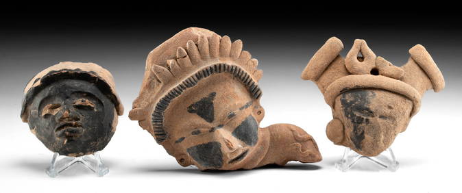
VERACRUZ CULTURE, GULF COAST MEXICO, C. 550-950 AD, FLUTEThomaston Place Auction Galleries4.4(386)See Sold PriceFeb 24, 2024
Map of Mexico, Central America, New Grenada, Venzuela and the West IndiesJasper524.5(9.8k)See Sold PriceFeb 27, 2024
New and Correct Map of North America With the West India Islands,Jasper524.5(9.8k)See Sold PriceFeb 27, 2024


![Untitled. [Eastern U.S., Gulf of Mexico and Caribbean] (1 of 5)](https://p1.liveauctioneers.com/5584/319958/171812128_1_x.jpg?height=282&quality=70&version=1708466739)