SoldFramed map Danubius Fluvius Maximus, A Fontibus AdFramed map Danubius Fluvius Maximus, A Fontibus Ad Ostia, c. 1636-1642, map maker J. Jansson, depicts the Course of the Danube River from its sources in the Alps to the Black Sea, hand colored, most lSee Sold Price
An antique map of 'Danubius' 'Fluvius Europae Maximus aAn antique map of 'Danubius' 'Fluvius Europae Maximus a Fontibus ad Ostia, cum Omnibus Flumnibus ab Utroque Latere, in Illum Defluentibus' depicting the river Danube and its surrounding countries, colSee Sold Price
SoldBlaeu Map of the DanubeBLAEU Family (Late 16th-17th Century). Danubius, Fluvius Europae Maximus, a Fontibus ad Ostia, cum Omnibus Fluminibus, ab Utroque Latere, in Illum Defluentibus. Engraved map with original hand color iSee Sold Price
Sold-. Blaeu (Johannes) Danubius, Fluvius Europae Maxi-. Blaeu (Johannes) Danubius, Fluvius Europae Maximus, a Fontibus ad Ostia ...,extended map sheet, from Switzerland to the Black Sea, tracing the course of the Danube and its many tributaries,See Sold Price
SoldDanubius, Fluvius Europae Maximus, a Fontibus ad Ostia.Danubius, Fluvius Europae Maximus, a Fontibus ad Ostia. Grenzkolorierte Kupferstichkarte von 2 Platten gedruckt. Blaeu, um 1644. Plattenmaße ca. 41,5 x 95 cm (53,5 x 98,5 cm).Donau Danubius, FluvSee Sold Price
SoldDonau-Lauf: Danubius fluvius EuropaeDonaulauf. Danubius, fluvius Europae maximus, a fontibus ad ostia, cum omnibus fluminibus, ab utroque latere, in illum defluentibus. Kupferstich mit großer figürlicher Kartusche und großer allegoriSee Sold Price
SoldTwo historical maps -- Holstein, ''HTwo historical maps -- Holstein, ''Holsatiae Ducatus'', border col. Engraving by Mercator circa 1620, and Elbe River map ''Albis Fluvius Germaniae celebris a Fontibus ad Ostia. Cum fluminibus ab utroqSee Sold Price
Sold17th Century European Map of The Elbe.17th Century map titled "Albis Fluvius Germaniae celebris. A Fontibus Ad Ostia". Published by Moses Pitt for inclusion in the 2 volume "Pitt's English Atlas" (1680-1683). Map measures 15" x 19" and isSee Sold Price
SoldDanubius, Fluvius Europae Maximus..., [ca 1630-70[Europe/Danube]. Danubius, Fluvius Europae Maximus... Engraved map on 2 sheets joined, the Danube River, from Germany and Italy in the west to the Danube's delta in the east, where it empties into theSee Sold Price
SoldBlaeu (Willem) DanubiusBlaeu (Willem) Danubius, Fluvius Europæ Maximus,extended map sheet, from Switzerland to the Black Sea, tracing the course of the Danube and its many tributaries, these represented by the waterSee Sold Price
SoldPost Medieval Map of ArabiaPublished 1732 AD. Framed map of Arabia by Christophe Cellarius, author of Geographia Antiqua, first published 1686; this edition published Leipzig by Gledisch, 1732; depicting the region of Arabia toSee Sold Price
SoldMatted, framed map U.S. Coast Survey A.D. Bache,Matted, framed map U.S. Coast Survey A.D. Bache, Superintendent, Reconnaissance of the Western Coast of the United States, Middle Sheet, from San Francisco to Umpquah River by the Hydrographic Party uSee Sold Price
SoldAlbis Fluvius Germaniae celebris a Fontibus ad Ostia.Albis Fluvius Germaniae celebris a Fontibus ad Ostia. Cum fluminibus ab utroque latere in illum fluentibus, descriptus. Kol. Kupferstichkarte. Amsterdam, Jansson, um 1640. Plattengröße ca. 40 x 50,5See Sold Price
Elbe-Lauf (Janss. Waesb./Pitt/Swart): Albis FluviusElbe-Lauf (Janss. Waesb./Pitt/Swart) - Albis Fluvius, Germaniae celebris, a Fontibus ad Ostia cum fluminibus ab utroque latere in illum fluentibus, descriptus. Kupferstich mit alt kolorierter figürliSee Sold Price
SoldFramed Map "Hemispher IV Aeqvinoctiali Linea adCircvlv Poli, after cornelius de judeis, Speculum Orbis Terra, 1593, 38cm x 54cmSee Sold Price
SoldJohn Smith, Deer Island M.E. MapFramed copy of a map. "U.S. Coast Survey, A.D. Bache Supt. Eastern End of Deer Island Surveyed in June 1863". [37" x 39 1/4" H]. Creased and wear.See Sold Price
SoldFour, Framed Maps of the WorldFour vintage color lithographs, maps of the world including global hemisphere map of 17th century by N. Visscher; The Holy Land from Abraham Ortelius, orig 1570 A.D; Canada and the Great Lakes, by GuiSee Sold Price
ANTIQUE MAP L'ASIE BY PIERRE VAN DER AD 1696 BRUSSLEFROM ATLAS",NOUVEAU ET CURIEUX," PENCIL SIGNED..READS FROM ATLAS NOUVEAU ET CURIEX BY PIERRE VAN DER AD BRUSSLES 1696 DIMENSIONS 24 X 20 FRAMED MAP 15 X 12See Sold Price
L'ASIE MAP BY PIERRE VAN DER ,AD 1696 BRUSSLEFROM ATLAS",NOUVEAU ET CURIEUX," PENCIL SIGNED..READS FROM ATLAS NOUVEAU ET CURIEX BY PIERRE VAN DER AD BRUSSLES 1696 DIMENSIONS 24 X 20 FRAMED MAP 15 X 12See Sold Price
SoldPair of framed maps, CA Orbem Spiralis Lutio PetrumPair of framed maps, CA Orbem Spiralis Lutio Petrum Schenk Gerardum Valk, ad Sceno Systematis Patole, sight size 17" x 20 1/2"See Sold Price
Two Framed MapsTwo antique style Mediterranean maps: Contado di Molise et Principato Vltra, Palatinatvs ad Rhenvm Each framed, height 19 in. (49cm) x width 24 in. (61cm)See Sold Price
Guillaume de l’Isle, ‘Atlas Novus […]’ & 5 Framed Maps,Guillaume de l’Isle (1675-1726) – French Cartograph ‘Atlas Novus ad Usum Serenissimi Burgundiae Ducis’ Published by Covens & Mortier, Amsterdam, 1730 Engraved copper title by Romeyn de HoogheSee Sold Price
SoldLot of 2 Antique Maps Of The Danube In Matching Frames:Lot of 2 Antique Maps Of The Danube River In Matching Frames: 1 - Il Danubio - 20" x 14" & 1 - Danubius Fluvius - 18"x 15"See Sold Price
SoldNicholaum Visscher (1649-1702), "Insulae AmericanaNicholaum Visscher (1649-1702), "Insulae Americanae in Oceano Septentrionali ac Regiones Adiacentes a C. de May usque ad Lineaum Aequinoctialen," 17th c., colored map, framed, H.- 18 1/2 in., W.- 22 1See Sold Price
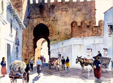
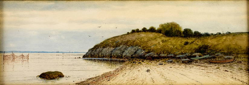
John Lavalle (MA,NY,1896-1971) watercolor paintingBroward Auction Gallery4.7(292)See Sold PriceMar 10, 2024
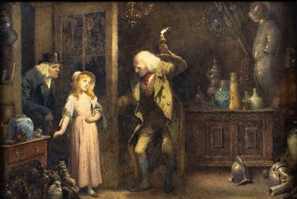
ATTR Charles Green (UK,1840-1898) watercolor painting antiqueBroward Auction Gallery4.7(292)See Sold PriceMar 10, 2024
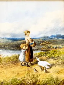
Myles Birket Foster (UK,1825-1899) watercolor painting antiqueBroward Auction Gallery4.7(292)See Sold PriceMar 10, 2024
Charles Sarka (NY,IL,1879-1960) watercolor paintingBroward Auction Gallery4.7(292)See Sold PriceMar 10, 2024
Samuel Chaffee (MA,RI,1850-1913) watercolor painting antiqueBroward Auction Gallery4.7(292)See Sold PriceMar 17, 2024
Raymond Perry (NY,IL,1876-1960) gouache paintingBroward Auction Gallery4.7(292)See Sold PriceMar 17, 2024
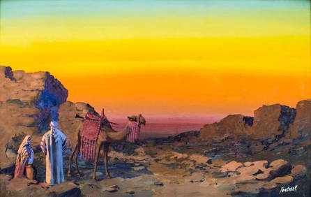
Thomas Eason (US,early 20C) gouache painting antiqueBroward Auction Gallery4.7(292)See Sold PriceMar 17, 2024
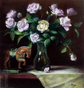
Richard Pionk (NY,MN,1936-2007) pastel paintingBroward Auction Gallery4.7(292)See Sold PriceMar 17, 2024
Scot Howden (UK,Australia,20C) watercolor paintingBroward Auction Gallery4.7(292)See Sold PriceMar 31, 2024
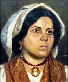
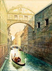
Giulio Vittini (Italy,1888-1968) watercolor paintingBroward Auction Gallery4.7(292)See Sold PriceMar 31, 2024
Victor Prezio (NY,PA,1924-1976) gouache paintingBroward Auction Gallery4.7(292)See Sold PriceMar 31, 2024
17TH C. MAP OF THE BERKSHIRES BY JOHN SPEED, FRAMEDThomaston Place Auction Galleries4.4(393)See Sold PriceFeb 24, 2024
18TH C. ANTIQUE MAP: FRENCH & INDIAN WAR, FRAMEDThomaston Place Auction Galleries4.4(393)See Sold PriceFeb 24, 2024
ABRAHAM ORTELIUS (1527-1598) MAP OF ROMAN GAUL (FRANCE)Thomaston Place Auction Galleries4.4(393)See Sold PriceFeb 24, 2024
Malcolm Parcell (PA,1896-1987) pastel paintingBroward Auction Gallery4.7(292)See Sold PriceApr 14, 2024
Vintage Full Color World Map LithographThe Benefit Shop Foundation Inc.4.3(2.9k)See Sold PriceFeb 28, 2024
Nova Totius Full Color Geographical World MapThe Benefit Shop Foundation Inc.4.3(2.9k)See Sold PriceFeb 28, 2024
Vintage Chinese Porcelain Items, Two Total, Table Screen and Figurines on StandNorthgate Gallery, Inc.4.5(36)See Sold PriceMar 02, 2024


![Guillaume de l’Isle, ‘Atlas Novus […]’ & 5 Framed Maps, (1 of 10)](https://p1.liveauctioneers.com/1670/80631/41928129_1_x.jpg?height=282&quality=70&version=1445256227)