ATLAS of ANTIENT GEOGRAPHY by SAMUEL BUTLER 1843John McInnis Auctioneers,LLC4.6(502)See Sold PriceFeb 24, 2024
18TH C. ANTIQUE MAP: FRENCH & INDIAN WAR, FRAMEDThomaston Place Auction Galleries4.4(386)See Sold PriceFeb 24, 2024
Rand McNally Railroad Map Cabinet w/ 21 Railroad MapsRail & Road Auctions4.6(165)See Sold PriceMar 08, 2024
Keith Haring - Ink on New York Map, Best Buddies, Inscribed, Signed, and DatedSapphire Auction Gallery4(67)See Sold PriceMar 02, 2024
LATE 17TH C. FRENCH MAP OF THE NEW WORLD BY ALEXIS-HUBERT JAILLOT (1632-1712)Thomaston Place Auction Galleries4.4(386)See Sold PriceFeb 24, 2024
Central Railroad of New Jersey Map of Sandy Hook Route-ca. 1903JM Hobby Supply and Railroad Artifact Auctions4.4(126)See Sold PriceFeb 24, 2024
Lot of Six Mixed Atlas Box Cars-HO Scale-New in BoxJM Hobby Supply and Railroad Artifact Auctions4.4(126)See Sold PriceFeb 25, 2024
Rand McNally/Santa Fe Railroad Map of Iowa-1912JM Hobby Supply and Railroad Artifact Auctions4.4(126)See Sold PriceFeb 24, 2024
NICOLAES VISSCHER (NETHERLANDS, 1618-1709) MAP OF THE NEW WORLDThomaston Place Auction Galleries4.4(386)See Sold PriceFeb 24, 2024
17TH C. WORLD MAP BY NICOLAES VISSCHER (NETHERLANDS, 1618-1709)Thomaston Place Auction Galleries4.4(386)See Sold PriceFeb 24, 2024
Lot of Six Mixed Atlas Cabooses-HO Scale-New in BoxJM Hobby Supply and Railroad Artifact Auctions4.4(126)See Sold PriceFeb 25, 2024
Fine antique framed map of Tartary or north centralTitle/Content of Map: Fine antique framed map of Tartary or north central Asia Date Printed: 1713 Cartographer: Aa, Pieter van der Size (in): 11 x 8 Attractive, framed copper-engraved antique map of TSee Sold Price
SoldAntique Map of Central East United StatesFramed and matted Antique Map of Delaware, Illinois, Indiana, Iowa, Kentucky, Maryland, Missouri, New Jersey, North Carolina, Ohio, Pennsylvania, Tennessee, and West Virginia. Map is in very good condSee Sold Price
Bellin: Antique Map of Central Mexico, 1754Title/Content of Map: Carte du Mexique Pour l'Histoire Generale des Voyages 1754 Date Printed: 1754 Cartographer: Bellin, Jacques Nicolas Size (inches): 11 x 8 Framed. Original mid 18th-century FrenchSee Sold Price
SoldMitchell: Antique Map of North & Central America, 1852Title/Content of Map: 1852 Mitchell Map of North and Central America -- Map of North America Date Printed: 1852, Philadelphia Cartographer: S Mitchell Size: 10.6 x 8 in. A very nice map of North AmeriSee Sold Price
Mitchell: Antique Map of North & Central America, 1852Title/Content of Map: 1852 Mitchell Map of North and Central America -- Map of North America Date Printed: 1852, Philadelphia Cartographer: S Mitchell Size: 10.6 x 8 in. A very nice map of North AmeriSee Sold Price
Mitchell: Antique Map of North & Central America, 1852Title/Content of Map: 1852 Mitchell Map of North and Central America -- Map of North America Date Printed: 1852, Philadelphia Cartographer: S Mitchell Size: 10.6 x 8 in. A very nice map of North AmeriSee Sold Price
SoldAntique Framed Map of North America / USAAntique Framed Map of North America / USA. Measures 21.5 x 17 inches.See Sold Price
Sold1779 French Engraved Framed Map Americas NR1779 French engraved framed map of North & Central America (probably printed about 100 years later) (Center fold with small, minor tears & holes; nice old appearance; frame much later; Old Print ShopSee Sold Price
Fine Antique Speculative Map of North AmericaTitle/Content of Map: Fine Antique Speculative Map of North America Date Printed: 1778 Cartographer: Vaugondy, Robert de Size (in): 11 x 9 Fine example of Robert de Vaugondy's 1778 map of North AmericSee Sold Price
SoldAntique Map P.S. Duval North and Central AmericaAntique Map of boundary between the Untied States and British Possessions. Measures 15.875 in. x 14.625 in. Split at fold lower left, angular crease lower left and very light toning. Unframed, loose aSee Sold Price
SoldAntique Diagrammatic Road Map of Central EuropeAntique Framed Diagrammatic Road Map of Central Europe by Wood McMurtry. Measures 22 inches high by 28 inches wide.See Sold Price
Antique Diagrammatic Road Map of Central EuropeAntique Framed Diagrammatic Road Map of Central Europe by Wood McMurtry. Measures 22 inches high by 28 inches wide.See Sold Price
SoldAntique Framed map of east coast of North AmericaAntique Framed map of east coast of North America, dated 1783, 23" x 20"See Sold Price
SoldEarly Hand Colored Map North America by T ConderAntique framed hand colored early map of North America. Top left image of Native man and foliage, reads "North America agreeable to the most approved Maps and Charts, by Thomas Condor" Frame: 14 3/4 iSee Sold Price
Bonne: Antique Map of the Moluccas, 1780Title/Content of Map: Fine antique map of the Moluccas and North Australia. Carte des Isles de la Sonde et des Isles Moluques par M. Bonne, Inginieur Hydrographe de la Marine Date Printed: 1780 CartogSee Sold Price
SoldNORTH AMERICA COLORED MAP, C. 1763, POSTLETHWAYTFramed antique map c. 1770, "North America, Plate 1" from the publication "Dictionary of Trade and Commerce" by Malachy Postlethwayt (British, 1707-1767), hand colored, also reading "North America, PeSee Sold Price
SoldNORTH AMERICA COLORED MAP, C. 1763, POSTLETHWAYTFramed antique map c. 1770, "North America, Plate III" and "Part of North America, Plate IV", from the publication "Dictionary of Trade and Commerce" by Malachy Postlethwayt (British, 1707-1767), handSee Sold Price
SoldFramed antique North American mapIn French. Frame size 14.5 x 13. Map 9.5 x 8 inchesSee Sold Price
SoldTwo Mid 19th Century United States Framed Maps1. Hand colored map "United States of North America / North Central Sheet", depicting Midwest with Minnesota Territory pre-Dakota, c. 1863, drawn and engraved by T. Ettling, Weekly Dispatch Atlas; matSee Sold Price
SoldLot/3 Antique Maps of United States, Albany New YorkLot of three antique maps. A large hanging map of North America and Central America. United States Ornamental map with Presidents around the border. Hanging map of Albany New York by Jay Gould. All wiSee Sold Price
Antique Persian Mohtasham Kashan,Size4'6" x 6'4"Fine Antique Persian Mohtasham Kashan Hand Knotted Circa 1890Antique Kashan carpets are among the finest Persian rugs. They are woven in workshops of the city of Kashan, in north central Iran. KashanSee Sold Price
SoldWoodbridge: Antique Map of North America & West IndiesWOODBRIDGE, W.C. . London: Whittaker, 1821. From "Modern Atlas". Approximately 8-1/2 x 10-1/2, in plastic sleeve. Right margin a little close trimmed (no loss of image), else fine. Depicts the North ASee Sold Price
SoldLaurie & Whittle Map of North & Central ItalyLaurie & Whittle Map of North & Central Italy. Engraved map of North & Central Italy by D'Anville, published by Laurie & Whittle. Professionally matted and framed. Frame measures 38.5 inches x 31 inchSee Sold Price
SoldMontanus / Ogilby: Antique Map of Central America, 1671The detailed map of southeastern Mexico and Central America from Ogilby's English edition of Montanus' influential history of America. The map encompasses the Mexican heartland, the Yucatan peninsula,See Sold Price
Thangka, Fine Authentic Striking Antique Vivid Himalayan Tantric Colorful-Personal FavoriteThe Buddha Gallery4.4(29)See Sold PriceMar 13, 2024
ANTIQUE BRITISH FEMALE PAINTING BY FRED ALBERT SLOCOMBEAntique Arena Inc.4.5(852)See Sold PriceFeb 24, 2024
Carey, pub. 1796 - Map of the Tennassee State formerly part of North Carolina (Tennessee)Trillium Antique Prints & Rare Books4.5(30)See Sold PriceFeb 24, 2024
OP ART POLISH SCREENPRINT BY JULIAN STANCZAK W COAAntique Arena Inc.4.5(852)See Sold PriceMar 02, 2024
ANTIQUE MICROMOSAIC MALACHITE AND 18K GOLD BROOCHAntique Arena Inc.4.5(852)See Sold PriceMar 02, 2024
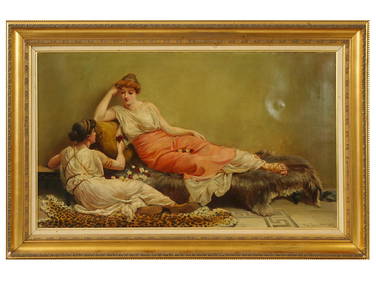
Hazy Sun on the Mountains, Scottish Glen 'Glen Coe' Signed Oil c.1920sJasper524.5(9.8k)See Sold PriceFeb 28, 2024