ATLAS of ANTIENT GEOGRAPHY by SAMUEL BUTLER 1843John McInnis Auctioneers,LLC4.6(502)See Sold PriceFeb 24, 2024
18TH C. ANTIQUE MAP: FRENCH & INDIAN WAR, FRAMEDThomaston Place Auction Galleries4.4(386)See Sold PriceFeb 24, 2024
Rand McNally Railroad Map Cabinet w/ 21 Railroad MapsRail & Road Auctions4.6(165)See Sold PriceMar 08, 2024
Keith Haring - Ink on New York Map, Best Buddies, Inscribed, Signed, and DatedSapphire Auction Gallery4(67)See Sold PriceMar 02, 2024
LATE 17TH C. FRENCH MAP OF THE NEW WORLD BY ALEXIS-HUBERT JAILLOT (1632-1712)Thomaston Place Auction Galleries4.4(386)See Sold PriceFeb 24, 2024
Central Railroad of New Jersey Map of Sandy Hook Route-ca. 1903JM Hobby Supply and Railroad Artifact Auctions4.4(126)See Sold PriceFeb 24, 2024
Lot of Six Mixed Atlas Box Cars-HO Scale-New in BoxJM Hobby Supply and Railroad Artifact Auctions4.4(126)See Sold PriceFeb 25, 2024
Rand McNally/Santa Fe Railroad Map of Iowa-1912JM Hobby Supply and Railroad Artifact Auctions4.4(126)See Sold PriceFeb 24, 2024
NICOLAES VISSCHER (NETHERLANDS, 1618-1709) MAP OF THE NEW WORLDThomaston Place Auction Galleries4.4(386)See Sold PriceFeb 24, 2024
17TH C. WORLD MAP BY NICOLAES VISSCHER (NETHERLANDS, 1618-1709)Thomaston Place Auction Galleries4.4(386)See Sold PriceFeb 24, 2024
Lot of Six Mixed Atlas Cabooses-HO Scale-New in BoxJM Hobby Supply and Railroad Artifact Auctions4.4(126)See Sold PriceFeb 25, 2024
Exactissima Regni Scotiae TabulaPublication Date: c1677 Title: Exactissima Regni Scotiae Tabula Cartographer: VISSCHER, NICOLAUS Publisher: VISSCHER Height: 22 Width: 18.6 "tam in septentrionalem et meridionalem quam in minores earuSee Sold Price
Exactissima Regni Scotiae TabulaPublication Date: c1677 Title: Exactissima Regni Scotiae Tabula Cartographer: VISSCHER, NICOLAUS Publisher: VISSCHER Height: 22 Width: 18.6 "tam in septentrionalem et meridionalem quam in minores earuSee Sold Price
Exactissima Regni Scotiae TabulaTitle: Exactissima Regni Scotiae Tabula Publication Date: c1677 Publisher: VISSCHER Size: 22 x 18.6 "tam in septentrionalem et meridionalem quam in minores earumdem provincias, insulasq, ei undique prSee Sold Price
Exactissima Regni Scotiae TabulaTitle: Exactissima Regni Scotiae Tabula Publication Date: 1677 ca. Cartographer: VISSCHER, NICOLAUS Material/Medium: VISSCHER Size: H22-18.6W una cum adjacentibus regionibus addita rusticarum tribuu dSee Sold Price
SoldVisscher, Nicolaus. Exactissima Regni Scotiae TabulaVisscher, Nicolaus. Exactissima Regni Scotiae Tabula tam in Septentrionalem et Meridionalem quam in minores earumdem Provincias. Infulasq, ei undique praetenfas accurate divisa per Nicolaum Visscher ASee Sold Price
Exactissima Regni Scotiae TabulaTitle/Content of Map: Exactissima Regni Scotiae Tabula Cartographer: VISSCHER, NICOLAUS Date: c1677 Publisher: VISSCHER Size: 22Height - 18.6Width "tam in septentrionalem et meridionalem quam in minorSee Sold Price
Sold17th Century Map of Scotland["Exactissima Regni Scotiae Tabula…,"] by Nicholaum Visscher, after Blaeu, published 1680 by Visscher, showing Scotland and portions of England and Ireland, ornate cartouches depicting god-like figuSee Sold Price
Visscher (Nicolas) Exactissima Regni Scotiae TabulVisscher (Nicolas) Exactissima Regni Scotiae Tabula tam in Septentrionalem et Meridionale...,map of Scotland, including the Orkney Islands, decorative title cartouche upper left, engraving, wiSee Sold Price
SoldSchottland (Allard): Regni Scotiae ... tabulaSchottland. Novissima Regni Scotiae Septentrionalis et Meridionalis Tabula ... Zeitgenöss. grenzkolorierter Kupferstich mit einer kleinen Nebenkarte und drei ebenfalls zeitgenöss. kolorierteSee Sold Price
SoldSchenk, PetrusSchenk, Petrus Novissima Regni Scotiae septentrionalis at meridionalis tabula. Amsterdam, c.1705, approx 58cm by 49cm, hand coloured, decorative cartouche, previous fold, some offsettingSee Sold Price
SoldAbraham Ortelius Scotiae tabula, map of Scotland, 15thAbraham Ortelius Scotiae tabula, map of Scotland, 15th - 16th C., hand-colored engraving, plate size 14" x 18 3/4". Provenance: Estate of Mark W. Izard MD, Cider Brook Road, Avon, CT.See Sold Price
SoldAbraham Ortelius Scotiae Tabula [Scotland Map]Abraham Ortelius (Antwerp, Belgium 1527 - 1598), cartographer and geographer, Scotiae Tabula (map of Scotland) with north oriented to the right of page. (Late 15th, early 16th century, exact date of mSee Sold Price
SoldEngraved map of Scotiae Tabula, 14'' x 18 1/2''.Engraved map of Scotiae Tabula, 14'' x 18 1/2''.See Sold Price
SoldRespublica, sive status regni ScotiaeRespublica, sive status regni Scotiae et Hiberniae,engraved title, slightly browned, engraved bookplate of Colonel Clarke on front pastedown, contemporary vellum, coat of arms on upper cover,See Sold Price
Sold[Ortelius (Abraham)] Scotiae Tabula[Ortelius (Abraham)] Scotiae TabulaScotland and surrounding islands, large ornamental cartouche, engraved map with some original hand-colouring, 360 x 480mm., Latin text on verso, later colourSee Sold Price
Nova et accurata totius Regni Scotiae...Georg Matthäus Seutter, Nova et accurata totius Regni Scotiae..., engraving (hand colored), ca. 1729, 19.5x 23 19.5x 23See Sold Price
Sold-. Oretelius (Abraham) - Scotiae Tabula,map of Scotland, large title cartouche upper right, from Ortelius' Theatrum Orbis Terrarum ' , engraved map with hand-colouring, orientated with West at the top of the map, 355 x 480 mm. (14 x 18 7/8See Sold Price
SoldScotland.- Ortelius (Abraham) Scotiae Tabula, [Antwerp,Scotland.- Ortelius (Abraham) Scotiae Tabula, map of Scotland, oriented with north to the right, with large strap-work title cartouche in the upper right corner, sea monster and ship, engraving on laiSee Sold Price
Scotland.- Ortelius (Abraham) Scotiae Tabula, [Antwerp,Scotland.- Ortelius (Abraham) Scotiae Tabula, map of Scotland, oriented with north to the right, with large strap-work title cartouche in the upper right corner, sea monster and ship, engraving on laiSee Sold Price
SoldAA.VV. Respublica, sive status regni Scotiae etAA.VV. Respublica, sive status regni Scotiae et Hiberniae. Leiden, Ex officina Elzeviriana, 1627 (In fine: 1630) In 16mo; 110x503 mm; Leg. coeva in pergamena rigida, tagli rossi a spruzzo, titolo manoSee Sold Price
Respublica, sive status regni Scotiae et Hiberniae.Scotland and Ireland. AA.VV. Respublica, sive status regni Scotiae et Hiberniae. Leiden, Ex officina Elzeviriana, 1627 (In fine: 1630) In 16mo; 110x503 mm; Leg. coeva in pergamena rigida, tagli rossSee Sold Price
SoldElzevir.- Respublica, sive Status Regni Scotiae etElzevir.- Respublica, sive Status Regni Scotiae et Hiberniae,device on title, little marking, covers loose, Amsterdam, L. Elzevir, 1650 § Respublica, sive Status Regni Scotiae et Hiberniae, enSee Sold Price
[WALES] AA.VV. Respublica, sive status regni Scotiae[WALES] AA.VV. Respublica, sive status regni Scotiae et Hiberniae. Leiden, Ex officina Elzeviriana, 1627 [In fine: 1630]In 16mo; Leg. coeva in pergamena rigida, tagli rossi a spruzzo; pp. 282, compr.See Sold Price
SoldOrtelius map of ScotlandHeading: (Scotland) Author: Ortelius, Abraham Title: Scotiae Tabula Place Published: Antwerp Publisher: Date Published: 1573- Description: Copper-engraved map, hand-colored.See Sold Price
17TH C. WORLD MAP BY NICOLAES VISSCHER (NETHERLANDS, 1618-1709)Thomaston Place Auction Galleries4.4(386)See Sold PriceFeb 24, 2024
NICOLAES VISSCHER (NETHERLANDS, 1618-1709) MAP OF THE NEW WORLDThomaston Place Auction Galleries4.4(386)See Sold PriceFeb 24, 2024
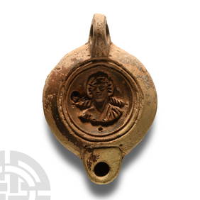
Roman Terracotta Lamp with Fighting GladiatorsTimeLine Auctions Ltd.4.5(183)See Sold PriceMar 05, 2024
English Milled Coins - William and Mary - 1689 - AR HalfcrownTimeLine Auctions Ltd.4.5(183)See Sold PriceMar 09, 2024
English Milled Coins - Mixed Victorian Coin and Medal Group [6]TimeLine Auctions Ltd.4.5(183)See Sold PriceMar 09, 2024
Nova Totius Full Color Geographical World MapThe Benefit Shop Foundation Inc.4.3(2.9k)See Sold PriceFeb 28, 2024
De Jode, Rare, pub. 1593 - Map of the British Isles [England, Scotland, Ireland] (Angliae Scotiae etTrillium Antique Prints & Rare Books4.5(30)See Sold PriceFeb 24, 2024
De Jode, Rare, pub. 1593 - Map of Italy (Italiae Totius Orbis olim Domatricis Nova ExactissTrillium Antique Prints & Rare Books4.5(30)See Sold PriceFeb 24, 2024
1736 LARGE MAP OF SILESIA POLAND OPPAVIENSIS antique 25 by 34 3/4"Jasper524.5(9.8k)See Sold PriceFeb 27, 2024
1640s ANTIQUE BLINDSTAMP PIGSKIN FOLIO ANTONINI DIANA Resolutionum MoraliumJasper524.5(9.8k)See Sold PriceFeb 27, 2024
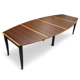
Tabula Magna Dining Table by Oscar Tosquets Blanca for Driade Aleph (1991)Jasper524.5(9.8k)See Sold PriceFeb 27, 2024
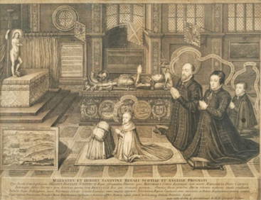
George VERTUE (1684 - 1756) BritishPridham's Auctions & Appraisals4.7(223)See Sold PriceMar 02, 2024
EPICTETUS ENCHIRIDIUS'S ANCIENT VELLUM TREATISE ON VEGETARIANISM, PUBLISHED IN 1655NY Elizabeth 4.3(84)See Sold PriceMar 03, 2024
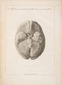
SOEMMERING, SAMUEL THOMAS.1755-1830. Tabula baseos encephali. Frankfurt: by the author, 1799.Bonhams4.1(305)See Sold PriceJun 18, 2024


![Abraham Ortelius Scotiae Tabula [Scotland Map] (1 of 7)](https://p1.liveauctioneers.com/5755/154409/77936383_1_x.jpg?height=282&quality=70&version=1573094011)

![[Ortelius (Abraham)] Scotiae Tabula (1 of 1)](https://p1.liveauctioneers.com/410/8611/1592494_1_x.jpg?height=282&quality=70)


![[WALES] AA.VV. Respublica, sive status regni Scotiae (1 of 2)](https://p1.liveauctioneers.com/3336/110291/56956372_1_x.jpg?height=282&quality=70&version=1511544421)


![English Milled Coins - Mixed Victorian Coin and Medal Group [6] (1 of 1)](https://p1.liveauctioneers.com/1191/317894/170617481_1_x.jpg?height=282&quality=70&version=1706620797)


![De Jode, Rare, pub. 1593 - Map of the British Isles [England, Scotland, Ireland] (Angliae Scotiae et (1 of 2)](https://p1.liveauctioneers.com/6581/319571/171593327_1_x.jpg?height=282&quality=70&version=1707853304)