ATLAS of ANTIENT GEOGRAPHY by SAMUEL BUTLER 1843John McInnis Auctioneers,LLC4.6(502)See Sold PriceFeb 24, 2024
18TH C. ANTIQUE MAP: FRENCH & INDIAN WAR, FRAMEDThomaston Place Auction Galleries4.4(386)See Sold PriceFeb 24, 2024
Rand McNally Railroad Map Cabinet w/ 21 Railroad MapsRail & Road Auctions4.6(165)See Sold PriceMar 08, 2024
Keith Haring - Ink on New York Map, Best Buddies, Inscribed, Signed, and DatedSapphire Auction Gallery4(67)See Sold PriceMar 02, 2024
LATE 17TH C. FRENCH MAP OF THE NEW WORLD BY ALEXIS-HUBERT JAILLOT (1632-1712)Thomaston Place Auction Galleries4.4(386)See Sold PriceFeb 24, 2024
Central Railroad of New Jersey Map of Sandy Hook Route-ca. 1903JM Hobby Supply and Railroad Artifact Auctions4.4(126)See Sold PriceFeb 24, 2024
Lot of Six Mixed Atlas Box Cars-HO Scale-New in BoxJM Hobby Supply and Railroad Artifact Auctions4.4(126)See Sold PriceFeb 25, 2024
Rand McNally/Santa Fe Railroad Map of Iowa-1912JM Hobby Supply and Railroad Artifact Auctions4.4(126)See Sold PriceFeb 24, 2024
NICOLAES VISSCHER (NETHERLANDS, 1618-1709) MAP OF THE NEW WORLDThomaston Place Auction Galleries4.4(386)See Sold PriceFeb 24, 2024
17TH C. WORLD MAP BY NICOLAES VISSCHER (NETHERLANDS, 1618-1709)Thomaston Place Auction Galleries4.4(386)See Sold PriceFeb 24, 2024
Lot of Six Mixed Atlas Cabooses-HO Scale-New in BoxJM Hobby Supply and Railroad Artifact Auctions4.4(126)See Sold PriceFeb 25, 2024
SoldEurope.- De Bouge (J. B.) Carte d'Europe, suivant lesEurope.- De Bouge (J. B.) Carte d'Europe, suivant les derniers Traites, engraved map with outline hand-colouring, 94 x 123 cm (37 x 48 in.), dissected and linen-backed, original marbled slipcase withSee Sold Price
SoldCarte de l'Europe"Carte de l'Europe Suivant Les Plus Nouvelles Observations de Messieurs de L'Academic des Sciences Et des Princi...", hand-colored engraved map of Europe from Henri Chatelain, Atlas Historique, LondonSee Sold Price
1783 Bellin Map Tracing Explorers Marco Polo and Jenkinson and Showing Asia and Europe -- Carte pourTitle: 1783 Bellin Map Tracing Explorers Marco Polo and Jenkinson and Showing Asia and Europe -- Carte pour les Voyages de Rubruquis, Marco Polo, Jen-kin-son, &c. Cartographer: J Bellin Year / Place:See Sold Price
1783 Bellin Map Tracing Explorers Marco Polo and Jenkinson and Showing Asia and Europe -- Carte pourTitle: 1783 Bellin Map Tracing Explorers Marco Polo and Jenkinson and Showing Asia and Europe -- Carte pour les Voyages de Rubruquis, Marco Polo, Jen-kin-son, &c. Cartographer: J Bellin Year / Place:See Sold Price
1783 Bellin Map Tracing Explorers Marco Polo and Jenkinson and Showing Asia and Europe -- Carte pourTitle: 1783 Bellin Map Tracing Explorers Marco Polo and Jenkinson and Showing Asia and Europe -- Carte pour les Voyages de Rubruquis, Marco Polo, Jen-kin-son, &c. Cartographer: J Bellin Year / Place:See Sold Price
1783 Bellin Map Tracing Explorers Marco Polo and Jenkinson and Showing Asia and Europe -- Carte pourTitle: 1783 Bellin Map Tracing Explorers Marco Polo and Jenkinson and Showing Asia and Europe -- Carte pour les Voyages de Rubruquis, Marco Polo, Jen-kin-son, &c. Cartographer: J Bellin Year / Place:See Sold Price
Carte Géologique de L'Europe. Geological map of Europe.TITLE/CONTENT OF MAP: 'Carte Géologique de l'Europe dressée Par M J J N Huot d'après les travaux De M.M.A.Boué , d'Omalius, d'Halloy, De Buch et autres Géologistes [Geological map of Europe drawnSee Sold Price
Sold Carte de l'Europe suivant les plus Nouvelles ObservatCarte de l'Europe suivant les plus Nouvelles Observations de Messieurs de l'Academie des Sciences et des Principaux Geographes avec des Tables et de Nouvelles Instructions ... Kupferstichkarte aus ChaSee Sold Price
SoldChatelain (Henri Abraham) Carte De L'Europe SuivanChatelain (Henri Abraham) Carte de l'Europe suivant les plus nouvelles Observationsde Messieurs de L'Academie des Sciences..., hand-coloured engraved map, 480 x 600mm, [c.1720] § Bowen (EmanueSee Sold Price
BOUGE, J. B. de - Carte chorographique du royaumeBOUGE, J. B. de - Carte chorographique du royaume des Pays-Bas. Comprenant la division territoriale en provinces et arrondissemens. En divisions judiciaire, militaire et religieuse et tableaux, statisSee Sold Price
180 BOUGE, J. B. de - Nouvelle carte chorographique deBOUGE, J. B. de - Nouvelle carte chorographique des Pays-Bas autrichiens. Bruxelles, 1786. 4 grandes cartes entoilées et en couleur sous étui. Hauteur totale: 132 cm; longueur: 169 cm.See Sold Price
Sold18TH C. JEAN-BAPTISTE NOLIN, MAP OF THE AMERICASJean-Baptiste Nolin (French, c.1657–1708). "l'Amerique Suivant les Dernier Memoires de J B Nolin Geographe du Roi (Map of North and South America)", hand colored engraving. Elaborately framed. ApSee Sold Price
Two hemisphere maps by Melchior TevernierTitle: Carte de l'Amerique nouvellement dressee suivant les nouvelles decouvertes et mise en fransois [and] Carte nouvelle de l'Europe, Asie, Afrique, nouvellement dressee et mise en fransois Author:See Sold Price
SoldMAP - Russia in Europe. De FerRussia in Europe. Nicholas de Fer, Estats du Grand Duc de Moscovie Suivant les Derniere Relations, 1705 (circa). Hand Color. Handsome, smaller map covering European Russia with part of Finland, showinSee Sold Price
Le Rouge: Map of Europe, 1747L'europe Suivant Les Nouvelles Observations De Mr. De Cassini Et De Mr. Haas, a Paris. By Le Rouge 1747, Size with Margin 69 x 52.5 cm Please note that this lot has a confidential reserve. When you leSee Sold Price
SoldJ. B. de Bouge Engraved Map of BelgiumNouvelle Carte Chorographique des Pays Bas Autrichiens dédiée à... J.B. de Bouge (1757–1833). Engraved map with original hand color in 24 parts. laid on canvas. Brussels, 1786. 26 1/2 x 34 inchesSee Sold Price
SoldChabert, J.-B. de: Voyage fait par ordre du roi enChabert, (J.-B.) de. Voyage fait par ordre du roi en 1750 et 1751, dans l'Amerique septentrionale, pour rectifier les cartes des côtes de l'Acadie, de l'Isle Royale & de l'Isle de TerSee Sold Price
D'Anville. Seconde Partie de la Carte d'EuropeD'Anville (J.B.B.) Seconde Partie de la Carte d'Europe,contenant Le Danemark et La Norwege, La Suède et La Russie, large title and dedication cartouche to Louis Philippe d'Orléans, upper rightSee Sold Price
SoldFEUR D'Anville (J.B.B.) Seconde Partie de la CarteFEUR D'Anville (J.B.B.) Seconde Partie de la Carte d'Europe,contenant Le Danemark et La Norwege, La Suède et La Russie, large title and dedication cartouche to Louis Philippe d'Orl&eacuSee Sold Price
D'anville: Premiere partie de la carte d'Europe, 1756Title/Content of Map: 'Prémière partie de la carte d'Europe contenant La France, L'Alemagne, L'Italie, L'Espagne, & les Isles Britanniq.s. Publiée sous les auspices de Monseigneur Louis Philippe d'See Sold Price
Prémière partie de la carte d'Europe'. D'ANVILLE. Western Europe 1756 old mapTITLE/CONTENT OF MAP: 'Prémière partie de la carte d'Europe contenant La France, L'Alemagne, L'Italie, L'Espagne, & les Isles Britanniq.s. Publiée sous les auspices de Monseigneur LouisSee Sold Price
Prémière partie de la carte d'Europe'. D'ANVILLE.TITLE/CONTENT OF MAP: 'Prémière partie de la carte d'Europe contenant La France, L'Alemagne, L'Italie, L'Espagne, & les Isles Britanniq.s. Publiée sous les auspices de Monseigneur Louis Philippe d'See Sold Price
Prémière partie de la carte d'Europe'. D'ANVILLE.TITLE/CONTENT OF MAP: 'Prémière partie de la carte d'Europe contenant La France, L'Alemagne, L'Italie, L'Espagne, & les Isles Britanniq.s. Publiée sous les auspices de Monseigneur Louis Philippe d'See Sold Price
Prémière partie de la carte d'Europe'. D'ANVILLE.Reserve Reduced! TITLE/CONTENT OF MAP: 'Prémière partie de la carte d'Europe contenant La France, L'Alemagne, L'Italie, L'Espagne, & les Isles Britanniq.s. Publiée sous les auspices de MonseigneurSee Sold Price
Group Antique Milton, Prescott, Morris + BooksThe Benefit Shop Foundation Inc.4.3(2.9k)See Sold PriceFeb 28, 2024
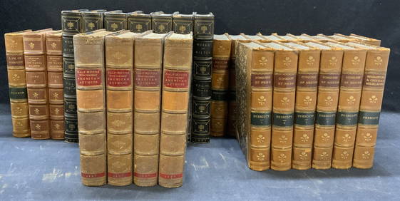
[DYE COLOR SAMPLE BOOKS]. A Group of Six Dye Color Sample B...Potter & Potter Auctions4.6(539)See Sold PriceMar 07, 2024
Two (2) Antique 18th C. Copper Engraved Framed Maps - America & EuropeMagnusson Art Group4.5(46)See Sold PriceMar 14, 2024
1758 MAP PARTIE DE LA MER GLACIALE contenants La Nouvelle Zemble RUSSIA antiqueJasper524.5(9.8k)See Sold PriceFeb 27, 2024
VARIOUS ARTISTS LES MAITRES DE L’AFFICHE. Bound volumes 2-5. 1897-1900.Swann Auction Galleries4.4(65)See Sold PriceFeb 29, 2024
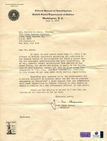
Railways & Transport.- [Prospectus] The Dorking, Brighton, and Arundel Atmospheric Railway, byForum Auctions4.3(52)See Sold PriceFeb 29, 2024
DUVIVIER JULIEN: (1896-1967)International Autograph Auctions Europe S.L.4.5(52)See Sold PriceMar 13, 2024
CARPEAUX JEAN-BAPTISTE: (1827-1875)International Autograph Auctions Europe S.L.4.5(52)See Sold PriceMar 14, 2024
DERAIN ANDRE: (1880-1954)International Autograph Auctions Europe S.L.4.5(52)See Sold PriceMar 14, 2024
KANDINSKY WASSILY: (1866-1944)International Autograph Auctions Europe S.L.4.5(52)See Sold PriceMar 14, 2024
TOLSTOY LEO: (1828-1910)International Autograph Auctions Europe S.L.4.5(52)See Sold PriceMar 14, 2024
BEAUVOIR SIMONE DE: (1908-1986)International Autograph Auctions Europe S.L.4.5(52)See Sold PriceMar 14, 2024
BERTRAND JOSEPH: (1822-1900)International Autograph Auctions Europe S.L.4.5(52)See Sold PriceMar 14, 2024
WELLINGTON DUKE OF: (1769-1852)International Autograph Auctions Europe S.L.4.5(52)See Sold PriceMar 14, 2024
NAPOLEON III: (1808-1873)International Autograph Auctions Europe S.L.4.5(52)See Sold PriceMar 14, 2024
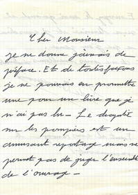
[Johann Baptist Lampi Jr.] Von Lampi de Jungere, J.B. Young woman in a headscarf. - 1800s. Canvas,ARTMAXIMUM4.3(4)See Sold PriceMar 14, 2024


![[DYE COLOR SAMPLE BOOKS]. A Group of Six Dye Color Sample B... (1 of 2)](https://p1.liveauctioneers.com/928/318880/171361536_1_x.jpg?height=282&quality=70&version=1707501302)


![Railways & Transport.- [Prospectus] The Dorking, Brighton, and Arundel Atmospheric Railway, by (1 of 1)](https://p1.liveauctioneers.com/5458/319736/171654703_1_x.jpg?height=282&quality=70&version=1708010439)


![[PRIZE OF WAR] : (1 of 6)](https://p1.liveauctioneers.com/1458/320148/172030900_1_x.jpg?height=282&quality=70&version=1708367366)

![[Johann Baptist Lampi Jr.] Von Lampi de Jungere, J.B. Young woman in a headscarf. - 1800s. Canvas, (1 of 3)](https://p1.liveauctioneers.com/6171/320219/172084152_1_x.jpg?height=282&quality=70&version=1708525949)


