SoldEngraving, Map "France in Departments"Published by John Thomson & Edinburgh. 9 1/2"h x 11 1/2"wSee Sold Price
Engraving, Map "France in Departments"Published by John Thomson & Edinburgh. 9 1/2"h x 11 1/2"wSee Sold Price
Victor Lavasseur. Map of France in Department. 1830.Print of hand colored steel engraving titled France en Department“.Author Victor Lavasseur.Engraved by unknown.From Atlas classique universel de Geographie anciene et moderne“ by Victor Levasseur.See Sold Price
Victor Lavasseur. Map of France in department. 1830.Print of hand colored steel engraving titled France par departemens“.Author Victor Lavasseur.Engraved by unknown.From Atlas classique universel de Geographie anciene et moderne“ by Victor LevasseuSee Sold Price
France in Departments Antique Map 1826Antique Map of France in Departments. Size: 11 X 8.5 inches approx. Unframed. Printed 1826.See Sold Price
France in Departments Antique Map 1826Antique Map of France in Departments. Size: 11 X 8.5 inches approx. Unframed. Printed 1826.See Sold Price
SoldJohn Cary New Map of France Engraving 1799John Cary (ca. 1754–1835), "A New Map of France, Divided into Departments, as decreed by the National Assembly, MDCCXC," 1799. Hand colored engraved map of France. Dimensions: Sight; height: inSee Sold Price
Map of France in 86 departments. Europe. 1835.Print of hand colored steel engraving titled „France en 86 departmens“.Author C. V. Monin.Engraved by unknown.From the „Atlas Universel de Geography“ by C. V. Monin. Parsi. 1835.France is a soSee Sold Price
Map of France in 86 departments. Europe. 1835.Print of hand colored steel engraving titled France en 86 departmens“.Author C. V. Monin.Engraved by unknown.From the Atlas Universel de Geography“ by C. V. Monin. Parsi. 1835.France is a sovereigSee Sold Price
SoldA New Map of France Divided into 83 Departments......as approved by the Constitutional Committee of that Kingdom, and Dedicated to the National Assembly (London: John Wallis, 1791), copperplate engraving with color. Unframed, loose behind mat. DOA 25See Sold Price
SoldBowles, France, English Channel (2) HC EngravingsTitle: Map of France Divided Into 83 Departments According to the Decree of the National Assembly & English Channel with Its Environs - two, Pub: Bowles & Carver, Date: C.1800, Medium: Copperplate engSee Sold Price
Map of France, Holland & Belgium, 1862Map: France, Holland & Belgium, 1862 Original engraving by Johnson and Ward. Divided into two separate maps. The left hand map focuses on France and is color coded according to department, includes inSee Sold Price
Sold19TH CENTURY HAND COLORED DEPT. DE LA CÔTE D'OR MAP FRANCE1857 map of French department of cote d'or France. Part of France's burgundy or bourgogne wine region. decorative engravings around map. published by Victor Levasseur. Atlas National IllustreSee Sold Price
SoldWall Map of France Post-RevolutionA New Map of France divided into Metropolitan Circles and Departments agreeable to the decree of the National Assembly in 1790. John Fairburn (fl. 1789 - 1840). Engraving with original hand color in oSee Sold Price
Authentic Antique 19th C. Maps-Provinces ofAuthentic Antique 19th C. Maps-Provinces of France-Engravings-Set Of 6 Set of six (6) imperial folio sized engraved pictorial maps from mid-19th century of departments (counties/provinces) of France aSee Sold Price
SoldMAP, Northern France, Paris, MercatorNorthern France, Paris. Mercator/Hondius, L'Isle de Frace Parisiensis Ager, 1609 (circa). Hand Color. Charming little map of the department with Paris at bottom center, fully engraved with dozens of tSee Sold Price
SoldFRENCH DEPARTMENT MAPS, STEEL ENGRAVINGS PAIRFRENCH DEPARTMENT MAPS, STEEL ENGRAVINGS PAIR, 12" X 17" Maps of various provences of France. Published by A. Combette. Circa 1885. Each framed, 23" x 27".See Sold Price
France: Dept. Du Loiret by Levasseur, 1845Original engraving of the Loiret department of France from "Atlas National Illustre" by Victor Levasseur and engraving by A. Combette, Paris, 1845. Victor Levasseur (1800-1870) was a French surveyor aSee Sold Price
SoldFrance Divided Into Circles and DepartmentsLavoisne?/ Carey?, France Divided Into Circles and Departments, engraving (hand colored), ca. 1820?, 15 x 13 15 x 13See Sold Price
France.- Levasseur (Victor) 21 maps from: AtlasFrance.- Levasseur (Victor) 21 maps from: Atlas National Illustré des 86 Départments et des Possessions, engravings on wove paper, some outline hand-colouring, each sheet approx. 365 x 530 mSee Sold Price
Sold6 hand-colored engravings maps France LemercierSet of six hand-colored engravings of maps of France by Lemercier. [Paris, 1852]. Plate size 18 x 11 1/2 in. Framed, matted, under glass. This is a live auction at our physical auction gallery, that ySee Sold Price
Sold1834 Malte-Brun Map of France's Departments -- FranceTitle/Content of Map: 1834 Malte-Brun Map of France's Departments -- France Divided into Departments Date Printed: 1834, Boston Cartographer: M. Malte-Brun / S. Walker Size: 9.3 x 7.5 in. An attractivSee Sold Price
1834 Malte-Brun Map of France's Departments -- FranceTitle/Content of Map: 1834 Malte-Brun Map of France's Departments -- France Divided into Departments Date: 1834, Boston Cartographer: M. Malte-Brun / S. Walker Size: 9.3 x 7.5 in. An attractive and hiSee Sold Price
Malte-Brun: Antique Map of France's Departments, 1834Title/Content of Map: 1834 Malte-Brun Map of France's Departments -- France Divided into Departments Date Printed: 1834, Boston Cartographer: M. Malte-Brun / S. Walker Size: 9.3 x 7.5 in. An attractivSee Sold Price
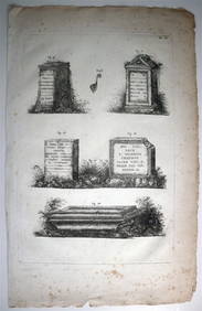
ORGIAZZI 14 x Folio Sized Engravings Roman Road Signs etc. c1802 Aix FranceLuis Porretta Fine Arts4.3(10)See Sold PriceMar 02, 2024
Framed Hand Colored Antique Map of the Department of Nord, FranceDonny Malone Auctions4.4(1.8k)See Sold PriceMar 04, 2024