ATLAS of ANTIENT GEOGRAPHY by SAMUEL BUTLER 1843John McInnis Auctioneers,LLC4.5(505)See Sold PriceFeb 24, 2024
18TH C. ANTIQUE MAP: FRENCH & INDIAN WAR, FRAMEDThomaston Place Auction Galleries4.4(393)See Sold PriceFeb 24, 2024
Rand McNally Railroad Map Cabinet w/ 21 Railroad MapsRail & Road Auctions4.6(165)See Sold PriceMar 08, 2024
Keith Haring - Ink on New York Map, Best Buddies, Inscribed, Signed, and DatedSapphire Auction Gallery4.1(67)See Sold PriceMar 02, 2024
LATE 17TH C. FRENCH MAP OF THE NEW WORLD BY ALEXIS-HUBERT JAILLOT (1632-1712)Thomaston Place Auction Galleries4.4(393)See Sold PriceFeb 24, 2024
Central Railroad of New Jersey Map of Sandy Hook Route-ca. 1903JM Hobby Supply and Railroad Artifact Auctions4.4(127)See Sold PriceFeb 24, 2024
Lot of Six Mixed Atlas Box Cars-HO Scale-New in BoxJM Hobby Supply and Railroad Artifact Auctions4.4(127)See Sold PriceFeb 25, 2024
Rand McNally/Santa Fe Railroad Map of Iowa-1912JM Hobby Supply and Railroad Artifact Auctions4.4(127)See Sold PriceFeb 24, 2024
NICOLAES VISSCHER (NETHERLANDS, 1618-1709) MAP OF THE NEW WORLDThomaston Place Auction Galleries4.4(393)See Sold PriceFeb 24, 2024
17TH C. WORLD MAP BY NICOLAES VISSCHER (NETHERLANDS, 1618-1709)Thomaston Place Auction Galleries4.4(393)See Sold PriceFeb 24, 2024
Lot of Six Mixed Atlas Cabooses-HO Scale-New in BoxJM Hobby Supply and Railroad Artifact Auctions4.4(127)See Sold PriceFeb 25, 2024
SoldEnglish issue of Wilkes map of Oregon TerritoryMap of the Oregon Territory by the U.S. Ex. Ex. Charles Wilkes, Esqr. Commander 1841, engraved map, sectioned for folding, 58.5x89 cm. (23x35 inches), folding English version of the map originally appSee Sold Price
SoldEnglish issue of Wilkes map of Oregon TerritoryTitle: Map of the Oregon Territory by the U.S. Ex. Ex. Charles Wilkes, Esqr. Commander 1841 Author: Wilkes, Charles Description: Engraved map, hand-colored in outline; sectioned for folding, backed wiSee Sold Price
SoldWilkes Map of Oregon territoryWILKES, Charles (1798-1877). Map of the Oregon Territory by the U. S. Ex. Ex. Charles Wilkes, Esqr Commander, 1841. Lithographed Map. Philadelphia, 1841. 24" x 38" sheet.See Sold Price
SoldWilkes map of Oregon Territory 1841-5Title: Map of the Oregon Territory by the U.S. Ex. Ex. Charles Wilkes, Exqr. Commander 1841 Author: Wilkes, Charles Description: Lithographed map. 57.8x89 cm. (22¾x35").Important map of the NorthwestSee Sold Price
SoldWilkes map of Oregon Territory 1841-5Title: Map of the Oregon Territory by the U.S. Ex. Ex. Charles Wilkes, Exqr. Commander 1841 Author: Wilkes, Charles Description: Lithographed map. 57.8x89 cm. (22¾x35").Important map of the NorthwestSee Sold Price
SoldWilkes map of Oregon Territory 1841-5Title: Map of the Oregon Territory by the U.S. Ex. Ex. Charles Wilkes, Exqr. Commander 1841 Author: Wilkes, Charles Description: Engraved map. 57.8x89 cm. (22¾x35").Important map of the Northwest, frSee Sold Price
Sold[Americana] The Oregon Territory, 1841Charles Wilkes, "Map of the Oregon Territory by the U. S. Ex. Ex. … 1841" (Phila.: Lea & Blanchard, lithographed by Young, Sherman & Smith, New York, 1844) 22 1/2 X 35 in., plus margins, mountedSee Sold Price
Sold1 piece. Lithograph Map. (Wilkes, Charles.) Map1 piece. Lithograph Map. (Wilkes, Charles.) Map of the Oregon Territory by The U.S. Ex. Ex.... 1841." 25 1/2 x 38 inches; 647 x 965 mm. Occasional discoloration, a few perforations along folds. [FromSee Sold Price
SoldWyld publication of Wilkes' OregonHeading: Author: Wilkes, Charles Title: Map of the Oregon Territory by the U. S. Ex. Ex. Charles Wilkes, Esqr Commander, 1841. Re-Published by James Wyld... Place Published: London Publisher:James WySee Sold Price
1841 Wilkes Map of the Pacific Northwest -- Map of the Oregon Territory by the U.S. Ex. Ex.Title: 1841 Wilkes Map of the Pacific Northwest -- Map of the Oregon Territory by the U.S. Ex. Ex. Cartographer: C Wilkes Year / Place: 1841 Map Dimension (in.): 22.8 X 33.8 in. This is a superb, impoSee Sold Price
SoldEarly Oregon Trail Map - , ORc1841 This is a 38" x 24" black and white "Map/ Of The/ Oregon Territory/ By The/ U.S. E.X. E.X./ Charles Wilkes Esqr./ Commander/ 1841". The printer`s mark on the lower right corner of the map is mosSee Sold Price
Rare separate issue of Colton map of West 1849Heading: Author: Colton, Joseph Hutchins Title: Map of California, Oregon, Texas, and the Territories adjoining with Routes &c Place Published: New York Publisher:J.H.Colton Date Published:See Sold Price
SoldRare separate issue of Colton map of West 1849Heading: Author: Colton, Joseph Hutchins Title: Map of California, Oregon, Texas, and the Territories adjoining with Routes &c Place Published: New York Publisher:J.H.Colton Date Published:See Sold Price
TWO 19TH C MAPS OF AMERICAN LANDSCAPEOregon Territory, 1856. From the 1841 Charles Wilkes expedition. Size: 13 3/4 x 18 1/2 in (35 x 47 cm). North Western America, 1870 Cede by Russia To The United States. Published by William M. BradleySee Sold Price
SoldIllman & Pilbrow Map of Oregon Territory, 1833David H. Burr (American, 1803-1875), "Oregon Territory", engraved by Illman & Pilbrow, 1833. Publisher - New York: D.S. Stone. Printed by Cammeyer & Clark, New York. According to the statement below tSee Sold Price
SoldSamuel Parker. MAP OF OREGON TERRITORY. 1838.[West] MAP OF OREGON TERRITORY. By Samuel Parker. 1838. Margin at lower right: “Engd. By M. M. Peabody, Utica, N. Y.” From “Journal of an Exploring Tour Beyond the Rocky Mountains, under the DirSee Sold Price
SoldHood's map of Oregon Territory 1838Title: Map of the United States Territory of Oregon West of the Rocky Mountains. Exhibiting the various Trading Depots or Forts occupied by the British Hudson Bay Company, connected with the Western aSee Sold Price
SoldMap of Oregon Territory c.1845Title: Oregon Territory Author: Greenleaf, Jeremiah Description: Engraved map, hand-colored. 27x32 cm. (10½x12½"), framed under glass.The Pacific Northwest north of California, with the boundary betSee Sold Price
SoldMap of Oregon Territory West of the Cascade MountainsMap of Oregon Territory west of the Cascade Mountains, hand-col. Baltimore: Lithograph by A. Hoen and Co., 1855.Dimensions: 13 3/4" X 9"Note: Senate Executive Document No 1, 34th Cogress, 1st Session.See Sold Price
SoldHood's map of Oregon Territory 1838Heading: Author: Hood, Washington, editor Title: Map of the United States Territory of Oregon West of the Rocky Mountains: Exhibiting the Various Trading Depots or Forts Occupied by the British HudsoSee Sold Price
Sold1849 Map of Oregon TerritoryHeading: (Oregon Territory) Author: Title: Map of the Oregon Territory From the Best Authorities. 1849. Place Published: Publisher: Date Published: Description: Folding lithogSee Sold Price
Map of Oregon Territory West of the Cascade MountainsMap of Oregon Territory west of the Cascade Mountains, hand-col. Baltimore: Lithograph by A. Hoen and Co., 1855.Dimensions: 13 3/4" X 9"Note: Senate Executive Document No 1, 34th Cogress, 1st Session.See Sold Price
SoldHood's map of Oregon Territory 1838Title: Map of the United States Territory of Oregon West of the Rocky Mountains. Exhibiting the various Trading Depots or Forts occupied by the British Hudson Bay Company, connected with the Western aSee Sold Price
SoldHood's map of Oregon Territory 1838Title: Map of the United States Territory of Oregon West of the Rocky Mountains. Exhibiting the various Trading Depots or Forts occupied by the British Hudson Bay Company, connected with the Western aSee Sold Price
19 century Ormolu Commemorative mantle clock Charles V of FranceSan Diego Art Auction4.3(9)See Sold PriceFeb 24, 2024
Southern Pacific RR Oregon Outdoors Brochure-May 1916JM Hobby Supply and Railroad Artifact Auctions4.4(127)See Sold PriceFeb 24, 2024
Oregon Short Line RR April 1899 Public TimetableJM Hobby Supply and Railroad Artifact Auctions4.4(127)See Sold PriceFeb 24, 2024
RARE 1638 HONDIUS MAP OF BERMUDA, FRAMEDThomaston Place Auction Galleries4.4(393)See Sold PriceFeb 24, 2024
17TH C. ENGLISH LINEAR MAP BY OGILBY, FRAMEDThomaston Place Auction Galleries4.4(393)See Sold PriceFeb 24, 2024
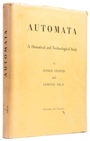
CHAPUIS, Alfred (1880-1958) and DROZ, Edmond. Automata. A H...Potter & Potter Auctions4.6(545)See Sold PriceFeb 24, 2024
Portfolio of 15 County Maps by Robert Morden (English 1650-1703)Nadeau's Auction Gallery4.7(409)See Sold PriceFeb 24, 2024
Arrowsmith & Lewis - Map of the United StatesTrillium Antique Prints & Rare Books4.5(32)See Sold PriceFeb 24, 2024
GEORGE ANDREW CORLEY (DATES UNKNOWN) U.S. TEAM SKI TRYOUTS / MT. HOOD OREGON. 1939.Swann Auction Galleries4.4(70)See Sold PriceFeb 29, 2024
John Senex Map of Louisiana & Mississippi RiverWillow Auction House4.5(289)See Sold PriceMar 14, 2024


![[Americana] The Oregon Territory, 1841 (1 of 6)](https://p1.liveauctioneers.com/523/81971/42494508_1_x.jpg?height=282&quality=70&version=1447274451)