ATLAS of ANTIENT GEOGRAPHY by SAMUEL BUTLER 1843John McInnis Auctioneers,LLC4.6(502)See Sold PriceFeb 24, 2024
18TH C. ANTIQUE MAP: FRENCH & INDIAN WAR, FRAMEDThomaston Place Auction Galleries4.4(386)See Sold PriceFeb 24, 2024
Rand McNally Railroad Map Cabinet w/ 21 Railroad MapsRail & Road Auctions4.6(165)See Sold PriceMar 08, 2024
Keith Haring - Ink on New York Map, Best Buddies, Inscribed, Signed, and DatedSapphire Auction Gallery4(67)See Sold PriceMar 02, 2024
LATE 17TH C. FRENCH MAP OF THE NEW WORLD BY ALEXIS-HUBERT JAILLOT (1632-1712)Thomaston Place Auction Galleries4.4(386)See Sold PriceFeb 24, 2024
Central Railroad of New Jersey Map of Sandy Hook Route-ca. 1903JM Hobby Supply and Railroad Artifact Auctions4.4(126)See Sold PriceFeb 24, 2024
Lot of Six Mixed Atlas Box Cars-HO Scale-New in BoxJM Hobby Supply and Railroad Artifact Auctions4.4(126)See Sold PriceFeb 25, 2024
Rand McNally/Santa Fe Railroad Map of Iowa-1912JM Hobby Supply and Railroad Artifact Auctions4.4(126)See Sold PriceFeb 24, 2024
NICOLAES VISSCHER (NETHERLANDS, 1618-1709) MAP OF THE NEW WORLDThomaston Place Auction Galleries4.4(386)See Sold PriceFeb 24, 2024
17TH C. WORLD MAP BY NICOLAES VISSCHER (NETHERLANDS, 1618-1709)Thomaston Place Auction Galleries4.4(386)See Sold PriceFeb 24, 2024
Lot of Six Mixed Atlas Cabooses-HO Scale-New in BoxJM Hobby Supply and Railroad Artifact Auctions4.4(126)See Sold PriceFeb 25, 2024
England & Wales.- Betts (John) Betts's new Map ofEngland & Wales.- Betts (John) Betts's new Map of England & Wales compiled from the latest parliamentary documents, engraving with outline hand-colouring, 800 x 685 mm (31 1/2 x 27 in), dissected andSee Sold Price
Betts: Antique Map of England & Wales, 1842Map: Bett's New Itinerant and Commercial Map of England And Wales, Publication Date: 1842 Cartographer: BETTS, JOHN Publisher: JOHN BETTS Size: Elephant Folio – 36.00 H x 29.50 W Inches one which thSee Sold Price
SoldBetts (John) - Betts's Tour through England & Wales,game map of the counties, tracing a course through 91 points, diagram of the relative heights of mountains in England and Wales compared to St Paul's Cathedral, lower right, engraved map with extensivSee Sold Price
SoldBetts (John) - Betts's Tour through England & Wales,later issue of the game map of the counties, tracing a course through 91 points, diagram of the relative heights of mountains in England and Wales compared to St Paul's Cathedral, lower right, engraveSee Sold Price
SoldEngland & Wales.- Cary (John) Cary's New Map of EnglandEngland & Wales.- Cary (John) Cary's New Map of England & Wales with Part of Scotland..., unsual format with map presented as loose plates in slipcase, including title, general map, and sheets 1-80, lSee Sold Price
SoldEngland & Wales.- Cary (John) Cary's New Map of EnglandEngland & Wales.- Cary (John) Cary's New Map of England & Wales with Part of Scotland..., disbound with title, general map, dedication, and explanation leaf, and remaining map sheets 1-81, engravingsSee Sold Price
SoldAtlases.- Cary (John) - New Map of England and Walesengraved title, dedication and explanation f. and and map in 78 sections numbered 1-81, mostly hand-coloured in outline, some offsetting, a few small marginal stains, occasional spotting, last page ofSee Sold Price
SoldCary (John) New Map of England and Wales, with parCary (John) New Map of England and Wales, with part of Scotland,engraved title, dedication, General Map (hand-coloured), explanation and scale sheets, and map on 76 sheets only, with originalSee Sold Price
SoldCary (John) New Map of England and WalesCary (John) New Map of England and Wales, with part of Scotland, rolling travel atlas, 81 maps sheets, including title and dedication, interspersed with Memorandums sheets, engraved maps in orSee Sold Price
SoldCary (John) New Map of England and Wales,Cary (John) New Map of England and Wales, With Part of Scotland,On which are carefully laid down All the Direct and Principal Cross Roads, the Course of the Rivers and Navigable Canals, CitiesSee Sold Price
SoldCary (John) New Map of England and WalesCary (John) New Map of England and Wales, with part of Scotland,On which are carefully laid down-All the Direct and Principal Crofs Roads, the Course of the Rivers and Navigable Canals, CitiesSee Sold Price
SoldCary (John) New Map of England and WalesCary (John) New Map of England and Wales, with part of Scotland,On which are carefully laid down-All the Direct and Principal Crofs Roads, the Course of the Rivers and Navigable Canals, CitiesSee Sold Price
-.Cary (John) - New Map of England and Wales with Partengraved title, dedication and explanation f. and and map in 78 sections numbered 1-81, mostly hand-coloured in outline, some offsetting, a few small marginal stains, occasional spotting, last page ofSee Sold Price
SoldCary (John) Cary's New Map of England and Wales, wCary (John) Cary's New Map of England and Wales, with part of Scotland,engraved title with single-page dedication, General Map, and 76 single-page maps, all with outline hand-colouring, some oSee Sold Price
Sold1 vol. Cary, John. Cary's New Map of England and1 vol. Cary, John. Cary's New Map of England and Wales with Parts of Scotland,... all the Direct and Principal Cross Roads,... Rivers... Canals, Cities, Market and Borough Towns, Parishes,... ConsiderSee Sold Price
SoldCary, New Map of England and WalesCary (John) Cary's New Map of England and Wales with Part of Scotland,engraved title, dedication & page of Explanations, hand-coloured general map, 77 map sheets (numbered to 81 as usual), hanSee Sold Price
Cary, John Cary's New Map of England and Wales withCary, John Cary's New Map of England and Wales with part of Scotland London: J. Cary, 1794. 4to, hand-coloured single-page map of England and Wales, diagram to illustrate scale and 76 map sections, haSee Sold Price
SoldCary's New Map of England and WalesCary (John) Cary's New Map of England and Wales, With Part of Scotland,On which are carefully laid down-All the Direct and Principal Crofs Roads, the Course of the Rivers and Navigable Canals,See Sold Price
SoldBBRI Cary (John) Cary's New Map of England and WalBBRI Cary (John) Cary's New Map of England and Wales, With Part of Scotland,On which are carefully laid down-All the Direct and Principal Crofs Roads, the Course of the Rivers and Navigable CaSee Sold Price
Cary (John) Cary's New Map of England and Wales wiCary (John) Cary's New Map of England and Wales with Part of Scotland,engraved title, dedication & page of Explanations, hand-coloured general map, 76 map sheets (numbered to 81, omitting 62/See Sold Price
SoldCary's New Map of England and WalesCary (John) Cary's New Map of England and Wales, With Part of Scotland,On which are carefully laid down All the Direct and Principal Crofs Roads, the Course of the Rivers and Navigable Canals,See Sold Price
SoldBritain.- Cary (John) Cary's New Map of England andBritain.- Cary (John) Cary's New Map of England and Wales with Part of Scotland, engraved title, hand-coloured general map and 76 sheets (numbered 1-81), mostly engraved maps hand-coloured in outlineSee Sold Price
SoldBritain.- Cary (John) Cary's New Map of England andBritain.- Cary (John, publisher) Cary's New Map of England and Wales with Part of Scotland, engraved title, hand-coloured general map and 79 sheets (numbered 1-81), mostly maps hand-coloured in outlinSee Sold Price
SoldBritain.- Cary (John) Cary's New Map of England andBritain.- Cary (John) Cary's New Map of England and Wales with part of Scotland, engraved title, hand-coloured general map and 76 sheets (numbered 1-81), mostly engraved maps hand-coloured in outlineSee Sold Price
Numismatic Books - Boyne - Tokens Issued in the Seventeenth Century in England, Wales, and IrelandTimeLine Auctions Ltd.4.5(183)See Sold PriceMar 09, 2024
Portfolio of 15 County Maps by Robert Morden (English 1650-1703)Nadeau's Auction Gallery4.7(401)See Sold PriceFeb 24, 2024
1849 THE NEW-ENGLAND MERCANTILE UNIONNorth American Artifact Auctions4.6(182)See Sold PriceApr 20, 2024
[MAP]. [ALBRIZZI, Giambatista, 1698-1777]. Carta Geografica...Potter & Potter Auctions4.6(539)See Sold PriceMar 07, 2024
Map: A 19thC engraved and hand coloured map of Buckingham titled A New Map of BuckinghamshireClaydon Auctioneers Ltd4.3(125)See Sold PriceFeb 26, 2024
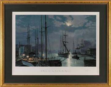
JOHN STOBART (Massachusetts/Florida/England, 1929-2023), "Chicago The Barkentine 'Naiad' Towing PastEldred's4.7(409)See Sold PriceMar 07, 2024
Late 18th century map of England and Wales sampler and two printsFellows4.3(159)See Sold PriceMar 05, 2024
Herman Moll A New Map of Ye North Parts of AmericaWillow Auction House4.5(283)See Sold PriceMar 14, 2024


![[MAP]. [ALBRIZZI, Giambatista, 1698-1777]. Carta Geografica... (1 of 1)](https://p1.liveauctioneers.com/928/318880/171361280_1_x.jpg?height=282&quality=70&version=1707501302)