2 Illuminated Books of Hours LeavesSchmidt's Antiques Inc. Since 19114.8(431)See Sold PriceMar 02, 2024
Illuminated Manuscript Leaf of The CrucifixionSchmidt's Antiques Inc. Since 19114.8(431)See Sold PriceMar 02, 2024
RARE 1930s AUTOGRAPH BOOK FEATURING RUTH & GEHRIGJohn McInnis Auctioneers,LLC4.6(502)See Sold PriceFeb 25, 2024
Timetable, Paper and Ephemera Lot-Eastern USA RailroadsJM Hobby Supply and Railroad Artifact Auctions4.4(126)See Sold PriceFeb 24, 2024
SCARCE 1971 Kim Il Sung Signed Book "ON THE WORK OF THE WOMAN'S UNION"Rbfinearts4.4(571)See Sold PriceFeb 24, 2024
1885 CIVIL WAR 1ed Famous Memoirs US Grant Sheridan Sherman 6v RARE LOT MapsSchilb Antiquarian Rare Books4.8(421)See Sold PriceMar 10, 2024
"WINTER AND SUMMER IN MAINE" 1904 PHOTO ALBUMJohn McInnis Auctioneers,LLC4.6(502)See Sold PriceFeb 25, 2024
1821 THE (3) VOYAGES of CAPT JAMES COOK VOL. I-VIIJohn McInnis Auctioneers,LLC4.6(502)See Sold PriceFeb 24, 2024
[BASEBALL]. [SHEET MUSIC]. KALBFLEISCH, J. H. The Live Oak ...Potter & Potter Auctions4.6(539)See Sold PriceMar 07, 2024
Illuminated Manuscript Leaf of The VisitationSchmidt's Antiques Inc. Since 19114.8(431)See Sold PriceMar 02, 2024
Illuminated Manuscript Leaf of GethsemaneSchmidt's Antiques Inc. Since 19114.8(431)See Sold PriceMar 02, 2024
c1700s RARE Arabic Handwritten Manuscript Middle East Persia Journal ARABIASchilb Antiquarian Rare Books4.8(421)See Sold PriceMar 10, 2024
Emmons Manuscipt Map of SaucelitoEmmons, George Foster (1811-1884). Exterior Boundary of the Town of Saucelito. Graphite, pen and ink on paper. 1868. 18 1/4" x 24 1/4" sheet, 28" x 34" framed. Provenance: Spring Valley Water Company,See Sold Price
Moll: Antique Map of Peypses or Pepys Island, 1699Title/Content of Map: First printed map of Peypses or Pepys Island Date Printed: 1699 Cartographer: Moll, Herman Size (inches): 5 x 6 Four scarce views on one sheet based on a manuscipt maps drawn bySee Sold Price
SoldPlano topografico descriptivo de la gran batalla...Plano topografico descriptivo de la gran batalla Ganada... Andres Santa Cruz & Antonio de Meucci. Lima, October 1835. 32 4/8 x 21 4/8 inches. Manuscipt Map in Brown Ink on Paper with full watercolor.See Sold Price
SoldAlaska, Klondike, map, Gold RushHeading: (Alaska – 1898 Klondike Gold Rush Map) Author: Title: 1898 Alaska Klondike Gold Rush Map Place Published: Publisher: Date Published: Description: [Emmons, S.F.]See Sold Price
SoldManuscipt land sale map Sonoma County 1870Heading: Author: Freeman, James E. Title: Map of Knight's Valley Comprising Part of Rancho Mallacomes or Moristal Y Plan de Agua Caliente in Sonoma County, California, Subdivided for Josiah HasbrookSee Sold Price
SoldMap of Alaska with text 1898Heading: (Alaska) Author: [Emmons, S.F.] Title: Map Of Alaska Showing Known Gold-Bearing Rocks with Descriptive Text Containing Sketches of the Geography, Geology, and Gold Deposits and Routes to theSee Sold Price
SoldLand auc tion map for Sausalito 1873Heading: Author: Goddard, George H. Title: Map of the Old Saucelito Land and Dry Dock Cos. Lands Showing the Property for Sale at Auction by Maurice Dore & Co. Auctioneers Tuesday, July 22nd 1873, atSee Sold Price
SoldGeology and Ore Deposits of the Leadville MiningGeology and Ore Deposits of the Leadville Mining District by Emmons et al. All maps seem to be present. Adequate treatment of so large and so extensively developed a district as that of Leadville neceSee Sold Price
Leadville Books: Geology and Ore Deposits of the1) Geology and Ore Deposits of the Leadville Mining District by Emmons et al. All maps seem to be present. Adequate treatment of so large and so extensively developed a district as that of Leadville nSee Sold Price
SoldUS Geological Survey Leadville Mining Industry AtlasExtremely large 20"x17" volume, by Samuel Franklin Emmons. Both B&W and color top maps of the mining areas, also has section cuts with shafts, depths ,etc. There is a page on the geology of the area.See Sold Price
SoldVOLUME-NATURAL HISTORY OF NEW YORK (AGRICULTURE)VOLUME-NATURAL HISTORY OF NEW YORK (AGRICULTURE), EMMONS VOLUME 1, 1846 (WITH PLATES AND MAPSSee Sold Price
SoldAtlas of Leadville, ColoradoTitle: Atlas to Accompany a Monograph on the Geology and Mining Industry of Leadville, Colorado Author: Emmons, Samuel Franklin Description: With 31 lithographed maps, sections & profiles, most in colSee Sold Price
SoldEmmons. Geological Guide BookEmmons, Samuel Franklin. Geological Guide Book for an Excursion to the Rocky Mountains. NY: 1894. 4 TO. 480 pp. Illus. w/map & engravings (binding poor). Together with: Lindgren, Waldemar. The GeologySee Sold Price
SoldMap of Alaska showing known gold bearing rocks withMap of Alaska showing known gold-bearing rocks with descriptive text containing sketches of the geography, geology, and gold depositis and routes to the gold fields., comp. by Samuel Franklin Emmons.See Sold Price
SoldNorth Dakota land sale map 1904Heading: (North Dakota) Author: Boynton, Carlos N. Title: Map of South Central North Dakota showing selected lands owned and for sale by Carlos N. Boynton, in Burleigh, Kidder, Stutsman, Emmons, LoganSee Sold Price
SoldEmmons' Atlas of Leadville Colorado 1883Heading: Author: Emmons, Samuel Franklin Title: Atlas to Accompany a Monograph on the Geology and Mining Industry of Leadville, Colorado Place Published: Washington, D.C. Publisher: Date PublishSee Sold Price
Emmons, Samuel Franklin Sondersammlung Geologie -Emmons Samuel Franklin Sondersammlung Geologie - Metallurgie. - Atlas to Accompany a Monograph on the Geology and Mining Industry of Leadville Colorado . - Mit 31 meist farbigen oft doppelblattgroSee Sold Price
SoldEmmons' Atlas of Leadville ColoradoHeading: Author: Emmons, Samuel Franklin Title: Atlas to Accompany a Monograph on the Geology and Mining Industry of Leadville, Colorado Place Published: Washington, D.C. Publisher: Date PublishSee Sold Price
SoldAlaska Ephemera Lot #12Alaska Ephemera Lot #12: Map of Alaska Showing Known Gold-Bearing Rocks with Descriptive Text Containing Sketches of Geography, Geology, and Routes to the Gold Fields, U.S. Geological Survey, Emmons SSee Sold Price
SoldGeology and Ore Deposits of Goldfield, NevadaExceptionally important work on early Goldfield. Contains photos and maps. Geology and Ore Deposits of Goldfield, Nevada by Frederick Leslie James assisted in the field by W. H. Emmons and G. H. GarreSee Sold Price
SoldTHE GREAT AMERICAN REBELLION VOLUME 1 1863 WITH MAP ANDTHE GREAT AMERICAN REBELLION VOLUME 1 1863 WITH MAP AND ILLUSTRATIONS 800 PAGESSee Sold Price
SoldANTIQUE OAK SIX DRAWER MAP CASEWith wood pulls, paneled sides and back. Measures 26.5 x 53.5 x 34.5 inches. Case only, no contents.See Sold Price
SoldANTIQUE OAK MAP CASECase only - NO BOOKS. With paneled sides, two stacked sections and 10 drawers. Measures 33.5 x 35 x 46 inches.See Sold Price
Sold1739 Astronomy Galileo Telescope Illustrated Zodiac MAP1739 Astronomy Galileo Telescope Illustrated Zodiac MAPS Optics Pluche Noël-Antoine Pluche was an early 18th-century French priest and historian who is most remembered today for his landmark work ofSee Sold Price
Central Railroad of New Jersey Map of Sandy Hook Route-ca. 1903JM Hobby Supply and Railroad Artifact Auctions4.4(126)See Sold PriceFeb 24, 2024
Cincinnati Hamilton and Dayton RR Map -USGC 1889JM Hobby Supply and Railroad Artifact Auctions4.4(126)See Sold PriceFeb 24, 2024
Northern Pacific RR Washington and Northern Idaho Map Folder-1941JM Hobby Supply and Railroad Artifact Auctions4.4(126)See Sold PriceFeb 24, 2024
Rand McNally/Santa Fe Railroad Map of Iowa-1912JM Hobby Supply and Railroad Artifact Auctions4.4(126)See Sold PriceFeb 24, 2024
17TH C. WORLD MAP BY NICOLAES VISSCHER (NETHERLANDS, 1618-1709)Thomaston Place Auction Galleries4.4(386)See Sold PriceFeb 24, 2024
LATE 17TH C. FRENCH MAP OF THE NEW WORLD BY ALEXIS-HUBERT JAILLOT (1632-1712)Thomaston Place Auction Galleries4.4(386)See Sold PriceFeb 24, 2024
18TH C. ANTIQUE MAP: FRENCH & INDIAN WAR, FRAMEDThomaston Place Auction Galleries4.4(386)See Sold PriceFeb 24, 2024
NICOLAES VISSCHER (NETHERLANDS, 1618-1709) MAP OF THE NEW WORLDThomaston Place Auction Galleries4.4(386)See Sold PriceFeb 24, 2024
Nova Totius Full Color Geographical World MapThe Benefit Shop Foundation Inc.4.3(2.9k)See Sold PriceFeb 28, 2024
Civil War Map, Positions of the Army of the Ohio Front oh Dalton GA Dated 1864 34"L x 24"TSwisher Bros. Auction LLC4.4(241)See Sold PriceFeb 24, 2024
Keith Haring - Ink on New York Map, Best Buddies, Inscribed, Signed, and DatedSapphire Auction Gallery4(67)See Sold PriceMar 02, 2024
Rand McNally Railroad Map Cabinet w/ 21 Railroad MapsRail & Road Auctions4.6(165)See Sold PriceMar 08, 2024
Willem Blaeu, Etc. 17th C. Antiquarian Maps, 2Auctions at Showplace4.5(726)See Sold PriceMar 17, 2024
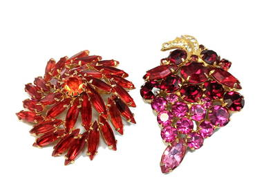
SUPERB VINTAGE LOT OF 2 SIGNED BROOCHES WEISS EMMONS PRONG SETNoble House Collection Gallery4.5(114)See Sold PriceFeb 28, 2024
Putnam - First Map of the State of Ohio by Rufus PutnamTrillium Antique Prints & Rare Books4.5(30)See Sold PriceFeb 24, 2024
De Jode, Rare, pub. 1593 - Map of Africa (Africae Vera Forma, et Situs)Trillium Antique Prints & Rare Books4.5(30)See Sold PriceFeb 24, 2024
BOSTON LINEN PRESS ATTRIB. TO EMMONS & ARCHIBALD BOSTON, ORIGINAL BRASS (93" TALL X 50" WIDE X 20"Carlsen Gallery, Inc.4.6(163)See Sold PriceMar 03, 2024
Antique Pennsylvania Map Fragment incl Wellersburg and New CentervilleCordier Auctions4.4(1.5k)See Sold PriceMar 02, 2024


![[BASEBALL]. [SHEET MUSIC]. KALBFLEISCH, J. H. The Live Oak ... (1 of 5)](https://p1.liveauctioneers.com/928/318880/171361400_1_x.jpg?height=282&quality=70&version=1707501302)