ATLAS of ANTIENT GEOGRAPHY by SAMUEL BUTLER 1843John McInnis Auctioneers,LLC4.5(505)See Sold PriceFeb 24, 2024
18TH C. ANTIQUE MAP: FRENCH & INDIAN WAR, FRAMEDThomaston Place Auction Galleries4.4(394)See Sold PriceFeb 24, 2024
Rand McNally Railroad Map Cabinet w/ 21 Railroad MapsRail & Road Auctions4.6(165)See Sold PriceMar 08, 2024
Keith Haring - Ink on New York Map, Best Buddies, Inscribed, Signed, and DatedSapphire Auction Gallery4.1(67)See Sold PriceMar 02, 2024
LATE 17TH C. FRENCH MAP OF THE NEW WORLD BY ALEXIS-HUBERT JAILLOT (1632-1712)Thomaston Place Auction Galleries4.4(394)See Sold PriceFeb 24, 2024
Central Railroad of New Jersey Map of Sandy Hook Route-ca. 1903JM Hobby Supply and Railroad Artifact Auctions4.4(127)See Sold PriceFeb 24, 2024
Lot of Six Mixed Atlas Box Cars-HO Scale-New in BoxJM Hobby Supply and Railroad Artifact Auctions4.4(127)See Sold PriceFeb 25, 2024
Rand McNally/Santa Fe Railroad Map of Iowa-1912JM Hobby Supply and Railroad Artifact Auctions4.4(127)See Sold PriceFeb 24, 2024
NICOLAES VISSCHER (NETHERLANDS, 1618-1709) MAP OF THE NEW WORLDThomaston Place Auction Galleries4.4(394)See Sold PriceFeb 24, 2024
17TH C. WORLD MAP BY NICOLAES VISSCHER (NETHERLANDS, 1618-1709)Thomaston Place Auction Galleries4.4(394)See Sold PriceFeb 24, 2024
Lot of Six Mixed Atlas Cabooses-HO Scale-New in BoxJM Hobby Supply and Railroad Artifact Auctions4.4(127)See Sold PriceFeb 25, 2024
EASTERN HEMISPHERE.Shows mail routes to British colonies. RAPKIN/TALLIS 1851 mapCAPTION PRINTED BELOW PICTURE: 'Eastern Hemisphere' The steamship mail route from Britain to Asia is indicated in blue. Marked on the map are the Mountains of Kong and the Mountains of the Moon, non-eSee Sold Price
EASTERN HEMISPHERE.Shows mail routes to British colonies. RAPKIN/TALLIS 1851 mapCAPTION PRINTED BELOW PICTURE: 'Eastern Hemisphere' The steamship mail route from Britain to Asia is indicated in blue. Marked on the map are the Mountains of Kong and the Mountains of the Moon, non-eSee Sold Price
WORLD MERCATOR showing mail routes to British colonies. RAPKIN/TALLIS 1851 mapTITLE/CONTENT OF MAP: 'The World on Mercator's Projection' Vignettes: Vesuvius; Gibraltar; London; Constantinople; Niagara; The Pyramids of Ghizeh; Pont Neuf, Paris. The steam ship routes to the colonSee Sold Price
EASTERN HEMISPHERE. Mail route to British colonies. Asia.TALLIS/RAPKIN 1849 mapTITLE/CONTENT OF MAP: 'Eastern Hemisphere' The steamship mail route from Britain to Asia is indicated in blue DATE PRINTED: 1849 IMAGE SIZE: Approx 26.5 x 34.5cm, 10.5 x 13.5 inches (Large); Please noSee Sold Price
E. Hemisphere Mail Route to British Colonies 1849 MapEastern Hemisphere. Mail Route to British Colonies. Asia.tallis/rapkin, 1849 Map. Title/content of Map: 'eastern Hemisphere' the Steamship Mail Route from Britain to Asia Is Indicated in Blue This MapSee Sold Price
SoldEASTERN HEMISPHERE.Shows mail routes to BritishReserve Reduced! TITLE/CONTENT OF MAP: 'Eastern Hemisphere' The steamship mail route from Britain to Asia is indicated in blue. Marked on the map are the Mountains of Kong and the Mountains of the MooSee Sold Price
WORLD MERCATOR showing mail routes to British colonies.TITLE/CONTENT OF MAP: 'The World on Mercator's Projection' Vignettes: Vesuvius; Gibraltar; London; Constantinople; Niagara; The Pyramids of Ghizeh; Pont Neuf, Paris. The steam ship routes to the colonSee Sold Price
WORLD MERCATOR showing mail routes to British colonies.TITLE/CONTENT OF MAP: 'The World on Mercator's Projection' Vignettes: Vesuvius; Gibraltar; London; Constantinople; Niagara; The Pyramids of Ghizeh; Pont Neuf, Paris. The steam ship routes to the colonSee Sold Price
WORLD MERCATOR showing mail routes to British colonies.TITLE/CONTENT OF MAP: 'The World on Mercator's Projection' Vignettes: Vesuvius; Gibraltar; London; Constantinople; Niagara; The Pyramids of Ghizeh; Pont Neuf, Paris. The steam ship routes to the colonSee Sold Price
WORLD MERCATOR showing mail routes to British colonies.TITLE/CONTENT OF MAP: 'The World on Mercator's Projection' Vignettes: Vesuvius; Gibraltar; London; Constantinople; Niagara; The Pyramids of Ghizeh; Pont Neuf, Paris. The steam ship routes to the colonSee Sold Price
BRITISH EMPIRE. Shows steam routes to the colonies.World. RAPKIN/TALLIS 1851 mapCAPTION PRINTED BELOW PICTURE: 'The World on Mercator's Projection' Vignettes: Vesuvius; Gibraltar; London; Constantinople; Niagara; The Pyramids of Ghizeh; Pont Neuf, Paris. The steam ship routes toSee Sold Price
BRITISH EMPIRE. Shows steam routes to the colonies.World. RAPKIN/TALLIS 1851 mapCAPTION PRINTED BELOW PICTURE: 'The World on Mercator's Projection' Vignettes: Vesuvius; Gibraltar; London; Constantinople; Niagara; The Pyramids of Ghizeh; Pont Neuf, Paris. The steam ship routes toSee Sold Price
WESTERN HEMISPHERE. Shows Russian America, Gran Colombia. RAPKIN/TALLIS 1851 mapCAPTION PRINTED BELOW PICTURE: 'Western Hemisphere' Alaska is indicated as "Russian America" as it was prior to its sale to the United States in 1867. The border between British North America (now CanSee Sold Price
SoldVan der Aa map showing route to British coloniesTitle: 't Noorder Gedeelte van Virginie door Bartholomeus Gosnol en Martin Pringe uyt Engeland Bevaaren Author: Van der Aa, Pieter Description: Copper-engraved map. 15x23 cm. (6x9").North Atlantic andSee Sold Price
SoldLAURIE & WHITTLE 1794 BRITISH COLONIES MAPLAURIE & WHITTLE 1794 BRITISH COLONIES MAP: Full title ''A New and Correct Map of the British Colonies in North America Comprehending Eastern Canada, with the Province of Quebec, New Brunswick, Nova SSee Sold Price
EASTERN HEMISPHERE. Falls rivers mountains. No Everest. TALLIS & RAPKIN 1851 mapTITLE/CONTENT OF MAP: 'A comparative view of the principal waterfalls, islands, lakes, rivers and mountains in the Eastern Hemisphere' Shows the snow lines, and the greatest heights reached by balloonSee Sold Price
EASTERN HEMISPHERE. Falls rivers mountains. No Everest. TALLIS/RAPKIN 1851 mapCAPTION PRINTED BELOW PICTURE: 'A comparative view of the principal waterfalls, islands, lakes, rivers and mountains in the Eastern Hemisphere' Shows the snow lines, and the greatest heights reached bSee Sold Price
EASTERN HEMISPHERE. Falls rivers mountains. No Everest. TALLIS & RAPKIN 1851 mapCAPTION PRINTED BELOW PICTURE: 'A comparative view of the principal waterfalls, islands, lakes, rivers and mountains in the Eastern Hemisphere' Shows the snow lines, and the greatest heights reached bSee Sold Price
Transport Map of Central Europe. Railways mail routes. LARGE 1952 oldTITLE/CONTENT OF MAP: British Isles - Railways [inset Glasgow District; Edinburgh District; Leeds District; Liverpool & Manchester District; Birmingham District; Nottingham District; Potteries DistricSee Sold Price
Australia/New Zealand Ports MapEastern Australia/new Zealand Ports Chart Lighthouses Mail Route Large C1914 Map. Size: Approx 49.0 x 68.5cm, 19.25 x 27 inches (Large); Please note that this is a folding map. Antique colour maritimeSee Sold Price
AMERICAS. British colonies trade routes; European Colonization 1907 old mapTITLE/CONTENT OF MAP: 'The New World showing British Possessions and trade routes; European Colonization about 1800; The Colonial Empires at the present time' DATE PRINTED: 1907 IMAGE SIZE: Approx 53.See Sold Price
OVERLAND ROUTE TO INDIA. Ship France Germany Euphrates. TALLIS & RAPKIN 1851 mapCAPTION PRINTED BELOW PICTURE: 'Overland Route to India' Vignettes: Post office, London; Gibraltar; Malta; Aden; Bombay; Madras; Suez. The key shows the Mail Steam Packet Route (orange); Marseilles OvSee Sold Price
Eastern Europe sea chart Ports Lighthouses mail route Black Sea Baltic 1918 mapTITLE/CONTENT OF MAP: 'Eastern European Ports and Waterways' DATE PRINTED: 1918 IMAGE SIZE: Approx 49.0 x 34.0cm, 19.25 x 13.5 inches (Large) TYPE: Antique colour maritime map chart; Scale 1:20,000,00See Sold Price
Eastern Europe sea chart Ports Lighthouses mail route Black Sea Baltic 1916 mapTITLE/CONTENT OF MAP: 'Eastern European Ports and Waterways' DATE PRINTED: 1916 IMAGE SIZE: Approx 49.0 x 34.0cm, 19.25 x 13.5 inches (Large) TYPE: Antique colour maritime map chart; Scale 1:20,000,00See Sold Price
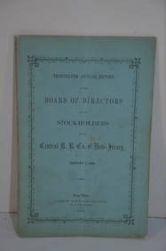
Central Railroad of New Jersey 13th Annual Report-January 1, 1860JM Hobby Supply and Railroad Artifact Auctions4.4(127)See Sold PriceFeb 24, 2024
Chicago and Eastern Illinois RR Annual Reports-1878 to 1887JM Hobby Supply and Railroad Artifact Auctions4.4(127)See Sold PriceFeb 24, 2024
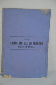
Chicago Danville and Vincennes RR Gold Bond Prospectus Book-1872JM Hobby Supply and Railroad Artifact Auctions4.4(127)See Sold PriceFeb 24, 2024
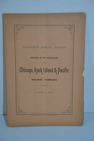
Chicago Rock Island and Pacific RR 11th Annual Report-April 1, 1891JM Hobby Supply and Railroad Artifact Auctions4.4(127)See Sold PriceFeb 24, 2024
Michigan Southern and Northern Indiana RR 14th Annual Report-February 28, 1869JM Hobby Supply and Railroad Artifact Auctions4.4(127)See Sold PriceFeb 24, 2024
Ohio and Pennsylvania RR 1st Annual Report-1849JM Hobby Supply and Railroad Artifact Auctions4.4(127)See Sold PriceFeb 24, 2024
Chicago Rock Island and Pacific RR Book Sunshine and Moonlight-1889JM Hobby Supply and Railroad Artifact Auctions4.4(127)See Sold PriceFeb 24, 2024
Delaware and Hudson RR International Holidays Book-1912JM Hobby Supply and Railroad Artifact Auctions4.4(127)See Sold PriceFeb 24, 2024
Eastern RR Summer Book of Tours-1884JM Hobby Supply and Railroad Artifact Auctions4.4(127)See Sold PriceFeb 24, 2024
Grand Trunk Railroad Across the Continent Through Canada Book-1917JM Hobby Supply and Railroad Artifact Auctions4.4(127)See Sold PriceFeb 24, 2024
Santa Fe RR Summer in Southern California Book-1895JM Hobby Supply and Railroad Artifact Auctions4.4(127)See Sold PriceFeb 24, 2024
Wabash RR A Vacation For Everybody Book-1920JM Hobby Supply and Railroad Artifact Auctions4.4(127)See Sold PriceFeb 24, 2024
Lehigh Valley RR 1891 PassJM Hobby Supply and Railroad Artifact Auctions4.4(127)See Sold PriceFeb 24, 2024
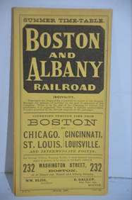
Boston and Albany RR March 17, 1881 Public TimetableJM Hobby Supply and Railroad Artifact Auctions4.4(127)See Sold PriceFeb 24, 2024
Chicago Burlington and Quincy RR Spring 1890 Public TimetableJM Hobby Supply and Railroad Artifact Auctions4.4(127)See Sold PriceFeb 24, 2024
Illinois Central RR July 24, 1906 Western Lines Public TimetableJM Hobby Supply and Railroad Artifact Auctions4.4(127)See Sold PriceFeb 24, 2024
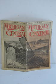
Michigan Central RR May 18, 1884 Public TimetableJM Hobby Supply and Railroad Artifact Auctions4.4(127)See Sold PriceFeb 24, 2024
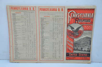
Pennsylvania Railroad July 8, 1885 Public TimetableJM Hobby Supply and Railroad Artifact Auctions4.4(127)See Sold PriceFeb 24, 2024
VARIOUS ARTISTS [BRITISH TRAVEL GUIDES]. Group of 6 map booklets and flyers. 1930s.Swann Auction Galleries4.4(71)See Sold PriceFeb 29, 2024
Map of Part of the West Indies, Etc., Showing the Exact Position Of The U.S. War Steamer SanJasper524.5(9.9k)See Sold PriceFeb 27, 2024
NORTHERN AFRICA. Morocco Tunisia Algeria. Caravan routes. RAPKIN/TALLIS 1851 mapJasper524.5(9.9k)See Sold PriceFeb 28, 2024
AFRICA. Shows Mountains of Kong/the Moon. Caravan routes. RAPKIN/TALLIS 1851 mapJasper524.5(9.9k)See Sold PriceFeb 28, 2024
NORTHERN AFRICA. Morocco Tunisia Algeria. Caravan routes. RAPKIN/TALLIS 1851 mapJasper524.5(9.9k)See Sold PriceFeb 28, 2024


![VARIOUS ARTISTS [BRITISH TRAVEL GUIDES]. Group of 6 map booklets and flyers. 1930s. (1 of 2)](https://p1.liveauctioneers.com/199/319703/171640571_1_x.jpg?height=282&quality=70&version=1707943705)


