ATLAS of ANTIENT GEOGRAPHY by SAMUEL BUTLER 1843John McInnis Auctioneers,LLC4.5(505)See Sold PriceFeb 24, 2024
18TH C. ANTIQUE MAP: FRENCH & INDIAN WAR, FRAMEDThomaston Place Auction Galleries4.4(394)See Sold PriceFeb 24, 2024
Rand McNally Railroad Map Cabinet w/ 21 Railroad MapsRail & Road Auctions4.6(165)See Sold PriceMar 08, 2024
Keith Haring - Ink on New York Map, Best Buddies, Inscribed, Signed, and DatedSapphire Auction Gallery4.1(67)See Sold PriceMar 02, 2024
LATE 17TH C. FRENCH MAP OF THE NEW WORLD BY ALEXIS-HUBERT JAILLOT (1632-1712)Thomaston Place Auction Galleries4.4(394)See Sold PriceFeb 24, 2024
Central Railroad of New Jersey Map of Sandy Hook Route-ca. 1903JM Hobby Supply and Railroad Artifact Auctions4.4(127)See Sold PriceFeb 24, 2024
Lot of Six Mixed Atlas Box Cars-HO Scale-New in BoxJM Hobby Supply and Railroad Artifact Auctions4.4(127)See Sold PriceFeb 25, 2024
Rand McNally/Santa Fe Railroad Map of Iowa-1912JM Hobby Supply and Railroad Artifact Auctions4.4(127)See Sold PriceFeb 24, 2024
NICOLAES VISSCHER (NETHERLANDS, 1618-1709) MAP OF THE NEW WORLDThomaston Place Auction Galleries4.4(394)See Sold PriceFeb 24, 2024
17TH C. WORLD MAP BY NICOLAES VISSCHER (NETHERLANDS, 1618-1709)Thomaston Place Auction Galleries4.4(394)See Sold PriceFeb 24, 2024
Lot of Six Mixed Atlas Cabooses-HO Scale-New in BoxJM Hobby Supply and Railroad Artifact Auctions4.4(127)See Sold PriceFeb 25, 2024
E. Bowen. New & correct map of Southwest of GermanyBowen, Emanuel A new and correct map of South West part of Germany C. 1745 Copperplate engraving; uncoloured Printed area: 34.5 x 42 cm; 13.5 x 16.5 in This map, drawn with the utmost sense of precisiSee Sold Price
Four Maps of Germanyde Pretot’s Chorographie du Cercle de Basse Saxe, 1787, 10 x 15 in. (sight); Bowen’s “A New and Correct Map of the South West Part of Germany”, originally published in 1736, circa 1812, 15-1?2See Sold Price
A correct map of the southern part of GermanyReserve Reduced! New to Jasper52 Item: A correct map of the southern part of Germany Origin: Bowen, E., A Complete System of Geography. Being a description of all the countries, islands, cities, chiefSee Sold Price
SoldDeutschland new and correct map: A new and correctDeutschland new and correct map - A New and Correct Map of the South West part of Germany ... Kupferstich mit zeitgenöss. kolorierter Waffen-Kartusche, kleiner Windrose und Meilenmesser sowie mit zeiSee Sold Price
Bowen (E A New Map of the NetherlandsBowen (Emanuel) A New & Correct Map of the Netherlands, or Low Countries engraved map of the Netherlands, pictorial cartouche, with hand-colouring, 350 x 430mm., [1750] ? Sanson (Nicolas) MasoSee Sold Price
Deutschland/Österreich: verschiedene KartenDeutschland. A correct Map of the North West / of the South West part of Germany. 2 Kupferstiche, jeweils mit dekorativer Kartusche und Windrose. Je ca 35 x 43 cm. By Eman(uel) Bowen. Um 1740. AusgezeSee Sold Price
SoldDeutschland/Österreich: verschiedene Karten- A correct Map of the North West / of the South West part of Germany. 2 Kupferstiche, jeweils mit dekorativer Kartusche und Windrose. Je ca 35 x 43 cm. By Eman(uel) Bowen. Um 1740.Ausgezeichnete DrucSee Sold Price
A correct map of the southern part of GermanyReserve Reduced! New to Jasper52 Item: A correct map of the southern part of Germany Origin: London Date: c 1745 Materials: Copper engraving Size: Approx. 42x34-1/2 cm. 1745 Bowen Map of Bohemia and SSee Sold Price
E. Bowen: A New & Accurate Map of Brasil, 1770Map: A New & Accurate Map of Brasil Maker: Emanuel Bowen Published: London, 1770 Size: Folio - 13.75 H x 16.75 W Inches "Divided into its Captainships drawn from the most approved modern maps & chartsSee Sold Price
SoldE. Bowen, A New & Accurate Map of China. 1747Emanuel Bowen, 'A New & Accurate Map of China Drawn from Surveys made by Jesuit Missionaries'. London, 1747. Impression measures 14x17'' on 16x18.25'' sheet. Slight discoloration of paper around lowerSee Sold Price
Bowen & Gibson, New and Correct Map of AmericaTitle: A New and Correct Map of North America, with the West India Islands. Divided According to the last Treaty of Peace... Paris, 10th Feby. 1763, wherein are particularly Distinguished The SeveralSee Sold Price
SoldA small, mixed group of prints and mapsA small, mixed group of prints, views and maps, including views of Bristol, Gloucester and Portsmouth, Hogarth's The Bench, two birds after Lear, E. Bowen's New and Accurate Map of SwitzerlanSee Sold Price
West India Islands, Florida, Texas & Central AmericaBowen, Emanuel (1694–1767). New and Correct Map of North America... Engraved map. Robert Sayer, c. 1763. 20 x 45 ½" sheet. "...divided according to the last treaty of peace at Paris 10th FebSee Sold Price
1784 Bowen Map of Greater London -- A New & Correct MapTitle/ Content of Map: 1784 Bowen Map of Greater London -- A New & Correct Map of the Counties upwards of Twenty Miles Round London, Drawn from Modern Surveys and Engrav'd for Thornton's History of LoSee Sold Price
1784 Bowen Map of Greater London -- A New & Correct MapTitle: 1784 Bowen Map of Greater London -- A New & Correct Map of the Counties upwards of Twenty Miles Round London, Drawn from Modern Surveys and Engrav'd for Thornton's History of London &c. Date: 1See Sold Price
1784 Bowen Map of Greater London -- A New & Correct MapTitle/Content of Map: 1784 Bowen Map of Greater London -- A New & Correct Map of the Counties upwards of Twenty Miles Round London, Drawn from Modern Surveys and Engrav'd for Thornton's History of LonSee Sold Price
1784 Bowen Map of Greater London -- A New & Correct MapTitle/Content of Map: 1784 Bowen Map of Greater London -- A New & Correct Map of the Counties upwards of Twenty Miles Round London, Drawn from Modern Surveys and Engrav'd for Thornton's History of LonSee Sold Price
1784 Bowen Map of Greater London -- A New & Correct MapTitle: 1784 Bowen Map of Greater London -- A New & Correct Map of the Counties upwards of Twenty Miles Round London, Drawn from Modern Surveys and Engrav'd for Thornton's History of London &c. Date: 1See Sold Price
1784 Bowen Map of Greater London -- A New & Correct MapTitle: 1784 Bowen Map of Greater London -- A New & Correct Map of the Counties upwards of Twenty Miles Round London, Drawn from Modern Surveys and Engrav'd for Thornton's History of London &c. Date: 1See Sold Price
1784 Bowen Map of Greater London -- A New & Correct MapTitle: 1784 Bowen Map of Greater London -- A New & Correct Map of the Counties upwards of Twenty Miles Round London, Drawn from Modern Surveys and Engrav'd for Thornton's History of London &c. CartogrSee Sold Price
1784 Bowen Map of Greater London -- A New & Correct MapTitle/Content of Map: 1784 Bowen Map of Greater London -- A New & Correct Map of the Counties upwards of Twenty Miles Round London, Drawn from Modern Surveys and Engrav'd for Thornton's History of LonSee Sold Price
SoldBowen: Antique Map of France, 1768Title/Content of Map: 1768 Bowen Map of France -- A New and Correct Map of France Drawn from the latest Authorities Date Printed: 1768 c. Cartographer: T Bowen Size: 14.3 x 9.3 in. Condition: Fair. NiSee Sold Price
Sold1751 Original Engraved Map of The Netherlands by BowenAn original copper engraved hand-colored map of The Netherlands engraved by Emanuel Bowen (1694-1767) and titled "A New and Correct Map of The Seven United Provinces". Emanuel Bowen worked for GeorgeSee Sold Price
SoldEMANUEL BOWEN, MAP PRINT "A NEW & CORRECT CHART"EMANUEL BOWEN, MAP PRINT, H 15", W 18", "A NEW & CORRECT CHART OF ALL THE KNOWN WORLD": Complete title "A New And Correct Chart of all the Known Word Laid down according to Mercator's Projection ExhibSee Sold Price
Elgin Joliet and Eastern RR Dressel Switch LampJM Hobby Supply and Railroad Artifact Auctions4.4(127)See Sold PriceFeb 24, 2024
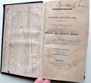
Charles Butler Ancient & Modern Music 1824 1st Edition Scarce MusicLuis Porretta Fine Arts4.3(10)See Sold PriceMar 02, 2024
OGILVY & BOWEN c1736 Original Map of Oxfordshire Berkshire Etc.Luis Porretta Fine Arts4.3(10)See Sold PriceMar 02, 2024
Portfolio of 15 County Maps by Robert Morden (English 1650-1703)Nadeau's Auction Gallery4.7(410)See Sold PriceFeb 24, 2024
17th Century Hand Colored Engraved Map of GermanyGlobal Auctions Company4.3(36)See Sold PriceMar 03, 2024
[ARCTIC]. BOWEN, Emanuel. A New & Accurate Map of the North...Potter & Potter Auctions4.6(550)See Sold PriceMar 07, 2024
Johann Homann Hand-Colored Map Engraving, c. 1730Auctions at Showplace4.6(744)See Sold PriceMar 17, 2024
1855 NOTES ON CENTRAL AMERICA by E. G. Squier antique w/ MAPSJasper524.5(9.9k)See Sold PriceFeb 27, 2024
Kent & Sussex.- Moss (W.G.) The History and Antiquities of the Town and Port of Hastings, 1824; andForum Auctions4.4(54)See Sold PriceFeb 29, 2024
1750 Bowen Map of Bermuda and St. Kitts -- A New & Accurate Map of Bermudas or Sommer's Islands...Jasper524.5(9.9k)See Sold PriceFeb 27, 2024
New and Correct Map of North America With the West India Islands,Jasper524.5(9.9k)See Sold PriceFeb 27, 2024
MONTBLANC LE PETIT PRINCE & AVIATOR STAINLESS STEEL CUFFLINKS GERMANY 123795 NEWGolden Air Auctions4.3(267)See Sold PriceFeb 27, 2024
MONTBLANC UW STAINLESS STEEL & TITANIUM RECTANGULAR NECKLACE 107905 NEW GERMANYGolden Air Auctions4.3(267)See Sold PriceFeb 27, 2024


![[ARCTIC]. BOWEN, Emanuel. A New & Accurate Map of the North... (1 of 1)](https://p1.liveauctioneers.com/928/318880/171360917_1_x.jpg?height=282&quality=70&version=1707501302)