ATLAS of ANTIENT GEOGRAPHY by SAMUEL BUTLER 1843John McInnis Auctioneers,LLC4.6(504)See Sold PriceFeb 24, 2024
18TH C. ANTIQUE MAP: FRENCH & INDIAN WAR, FRAMEDThomaston Place Auction Galleries4.4(389)See Sold PriceFeb 24, 2024
Rand McNally Railroad Map Cabinet w/ 21 Railroad MapsRail & Road Auctions4.6(165)See Sold PriceMar 08, 2024
Keith Haring - Ink on New York Map, Best Buddies, Inscribed, Signed, and DatedSapphire Auction Gallery4.1(67)See Sold PriceMar 02, 2024
LATE 17TH C. FRENCH MAP OF THE NEW WORLD BY ALEXIS-HUBERT JAILLOT (1632-1712)Thomaston Place Auction Galleries4.4(389)See Sold PriceFeb 24, 2024
Central Railroad of New Jersey Map of Sandy Hook Route-ca. 1903JM Hobby Supply and Railroad Artifact Auctions4.4(126)See Sold PriceFeb 24, 2024
Lot of Six Mixed Atlas Box Cars-HO Scale-New in BoxJM Hobby Supply and Railroad Artifact Auctions4.4(126)See Sold PriceFeb 25, 2024
Rand McNally/Santa Fe Railroad Map of Iowa-1912JM Hobby Supply and Railroad Artifact Auctions4.4(126)See Sold PriceFeb 24, 2024
NICOLAES VISSCHER (NETHERLANDS, 1618-1709) MAP OF THE NEW WORLDThomaston Place Auction Galleries4.4(389)See Sold PriceFeb 24, 2024
17TH C. WORLD MAP BY NICOLAES VISSCHER (NETHERLANDS, 1618-1709)Thomaston Place Auction Galleries4.4(389)See Sold PriceFeb 24, 2024
Lot of Six Mixed Atlas Cabooses-HO Scale-New in BoxJM Hobby Supply and Railroad Artifact Auctions4.4(126)See Sold PriceFeb 25, 2024
SoldDe Wit. Nova Totius Hungariae. c.1680.[Europe/ Balkans] de Wit, Frederick. “Nova totius Hungariae, Transilvaniae, Serviae, Romaniae, Bulgariae, Walachiae, Moldaviae, Sclavoniae, Croatiae, Bosniae, Dalmatiae, maximaeq[ue] partis DanuSee Sold Price
SoldFrederick de Wit (1629/1630-1706), NOVA TOTIUSFrederick de Wit (1629/1630-1706)NOVA TOTIUS HUNGARIAE, TRANSILVANIAE, SERVIAE, ROMANIAE, BULGARIAE, WALACHIAE, MOLDAVIAE, SCHLAVONIAE, DALMATIAE, MAXIMAEQ PARTIS DANUBII FLUMINIS DESCRIPTIOhand colouSee Sold Price
SoldAmerika (de Wit): Nova totius Americae descriptioAmerika (de Wit) - Nova totius Americae descriptio. Zeitgenöss. grenzkolorierter Kupferstich mit ebenso zeitgenöss. kolorierter figürlicher Kartusche, einer kleinen Allegorie von Meeresgöttern, 6See Sold Price
SoldAmerika (de Wit): Nova totius Americae descriptioAmerika (de Wit) - Nova totius Americae descriptio. Grenzkolorierter Kupferstich mit ebenso kolorierter figürlicher Kartusche, einer kleinen Allegorie von Meeresgöttern, 6 kleinen Gesamtansichten voSee Sold Price
SoldDE WIT, Frederick. Nova Totius Terrarum Orbis TabuDE WIT, Frederick. Nova Totius Terrarum Orbis Tabula.Amsterdam: c. 1680. Hand-colored double-page engraved map (505 x 580 mm). Condition: browned with old restoration at centerfold. Map of thSee Sold Price
SoldMap of the Americas with Californa an islandHeading: Author: De Wit, Frederick Title: Nova Totius Americæ Descriptio Place Published: Amsterdam Publisher: Date Published: 1660-[1666] Description: Copper-engraved map,See Sold Price
SoldDe Wit (Frederick) - Nova et Accurata Totius Europæthe continent from Iceland to Asia Minor", title banderole held by putti, upper left, Europa riding a bull below, with compass rose, ships and sea monster, engraved map with hand-colouring, 590 x 580mSee Sold Price
SoldWit (F de) Nova Totius Angliæ, ScotiæWit (Frederick de) Nova Totius Angliæ, Scotiæ, et Hiberniæ Tab.,British Isles, with title in banner form supported by sea creatures, upper right, engraved map with original hand-colouring in oSee Sold Price
SoldDe Wit map of World California an IslandTitle: Nova Totius Terrarum Orbis Tabla, ex officina F. de Wit Author: De Wit, Frederick Description: Copper-engraved map, slightly hand-colored in outline, with surrounding allegorical etchings partiSee Sold Price
SoldFrederick de wit World mapCartographer: Frederick de Wit Title: [Map 1] Nova Orbis Tabula, in Lucem Edita [in a set with Map 2] Nova Totius Europae [and Map 3] Nova Totius Asiae [and Map 4] Nova Totius Africa [and Map 5] NovaSee Sold Price
Nova Totius Americæ DescriptioAuthor: De Wit, Frederick Description: Copper-engraved map, hand-colored (later?). 43.4x53.9 cm. (17x21½") including vignette images at top and sides. Uncommon, separately published, and quite attracSee Sold Price
SoldWestfalen (de Wit): Westphaliae descriptioWestfalen. Nova totius Westphaliae descriptio. Kupferstich mit zwei kleinen Rollwerk-Kartuschen, einer Windrose sowie mit zeitgenöss. Grenzkolorit. 47 x 53,9 cm. Gedruckt tot Amsterdam by Frederick dSee Sold Price
Nova totius Westphaliae descriptio. Kupferstichkarte."Nova totius Westphaliae descriptio. Kupferstichkarte. Amsterdam de Wit um 1690. Plattenmae ca. 475 x 545 cm. Mit kol. Titel- u. Meilenzeigerkartusche. - Gegltteter teils hinterlegter Mittelfalz alteSee Sold Price
Sold1680 Nova Totius Angliae, Scotiae, and Hiberniae- map1680 Nova Totius Angliae, Scotiae, and Hiberniae- map of England, Scotland, and Ireland by Frederico deWit, hand colored two sheet map, 20 by 23.5 inchesSee Sold Price
SoldAmericas map by de Wit, c.1680[Americas]. Frederik de Wit. Novissima Et Eaccuratissima Totius Americae Descriptio. Double-page engraved map. Amst: [1680]. 21 x 22 in. Revised edition of de Wit's issue of map by Nicolas Visscher, aSee Sold Price
Soldde Wit map, Magnae Tartariae, c.1680[China/Eastern Asia]. Frederick de Wit. Magnae Tartariae, Magni Mogolis Imperii Japoniae Et Chinae, Nova Descriptio Ex Tabula Ampliss: Viri D.N. Witsen Pro Majori Parte... Double-page engraved map ofSee Sold Price
SoldFrederick De Wit, Totius Americae Descriptio, 1680Frederick De Wit, Totius Americae Descriptio, 1680, Frederick De Wit (Dutch, 1629-1706), "Novissima et Accuratissima totius Americae Descriptio", hand-colored map engraving of North and South AmericaSee Sold Price
SoldDe Wit. Nova et Accurata...Europae. c.1690.[Europe] de Wit, Frederick. “Nova et Accurata Divisa in Regna et Regiones Praecipuas Europae Descriptio.” Amsterdam, c.1690. Engraved map. 22 3/4” x 19 3/4”. Hand-colored. CartSee Sold Price
SoldWeltkarte (de Wit): Nova Orbis TabulaWeltkarte (de Wit) - Nova Orbis Tabula ... Abbildung der beiden Hemisphären, dazwischen zwei kleine Polkarten, in den Ecken allegorische Darstellungen der vier Jahreszeiten. Kupferstich mit schönemSee Sold Price
MAP, Europe, Renard/De WitDecorative Sea Chart of Europe with Greenland. Europe. Renard/De Wit, Totius Europae Littora Novissime Edita. Pascaert Vertoonende Alle de See-Custen van Europa, from Atlas de la Navigation et du CommSee Sold Price
SoldDe Wit. Accuratissima Totius Asiae... ca1670s-80s.[Asia] Accuratissima Totius Asiae Tabula Recens Emendata Per Fredericum de Wit Amstelodami. C. 1670s-1680s. Map is in the state that has a 7-line cartouche ending with “Amstelodami,” without a priSee Sold Price
SoldDe Wit. Accuratissima totius Asiae Tabula. Map.[Far East/Asia]. ACCURATISSIMA TOTIUS ASIAE TABULA RECENS EMENDATA Per Fredericum de Wit Amstelodami. [C. 1670’s to 1680’s.] The cartouche is in a state with 7 lines of text, ending at the word ��See Sold Price
SoldJoannem de Ram, Nova Totius Asiae Tabula c1690[Asia]. Joannem de Ram. Nova Totius Asiae Tabula. Double-page engraved map, with privilege. [Amst: c.1690]. 17 5/8 x 22 1/4 in. Map includes Japan and northwestern Australia (Nova Hollandia), variousSee Sold Price
de Wit, F. Totius Europae Littora novissime editaWit, Frederik de Totius Europae Littora novissime edita C. 1675 Copperplate engraving; coloured Printed area: 89 x 49.5 cm; 35 x 19.4 in Westerly-orientated sea chart of Europe, richly embellished witSee Sold Price
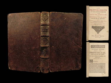
1666 EARLY Blaise PASCAL Provincial Letters Witchcraft Sorcery JESUIT PhilosophySchilb Antiquarian Rare Books4.8(422)See Sold PriceMar 10, 2024
EARLY 18TH C. DUTCH CHART OF PACIFIC OCEAN BY FREDERIK DE WIT (1629-1706) WITH CALIFORNIA AS ANThomaston Place Auction Galleries4.4(389)See Sold PriceFeb 24, 2024
MAP - PIETER SCHENK / VALK / JANSSEN Hand Colored superb Map Central Italy c1702Luis Porretta Fine Arts4.3(10)See Sold PriceMar 02, 2024
PIETER SCHENK / VALK / JANSSEN Hand Colored Map of Rhodes Greece ca1702 vgcLuis Porretta Fine Arts4.3(10)See Sold PriceMar 02, 2024
Nova Totius Full Color Geographical World MapThe Benefit Shop Foundation Inc.4.3(2.9k)See Sold PriceFeb 28, 2024
De Jode, Rare, pub. 1593 - Map of Italy (Italiae Totius Orbis olim Domatricis Nova ExactissTrillium Antique Prints & Rare Books4.5(30)See Sold PriceFeb 24, 2024
Map: A 17thC engraved and hand coloured map after Frederik de Wit (1630-1706) titled Nova Persiae,Claydon Auctioneers Ltd4.3(125)See Sold PriceFeb 26, 2024
3 Vintage The World Lithographs, By JanssonThe Benefit Shop Foundation Inc.4.3(2.9k)See Sold PriceMar 13, 2024
1602 OLD TESTAMENT SERMONES DE SANCTIS BY JACOBUS DE VORAGINE PIGSKINNY Elizabeth 4.3(85)See Sold PriceMar 03, 2024
JONATHAN DE PAS (1932-1991), DONATO D'URBINO (1935) & PAOLO LOMAZZI (1936) Two-seater Onda sofa forCapitoliumart s.r.l.4(82)See Sold PriceMar 07, 2024